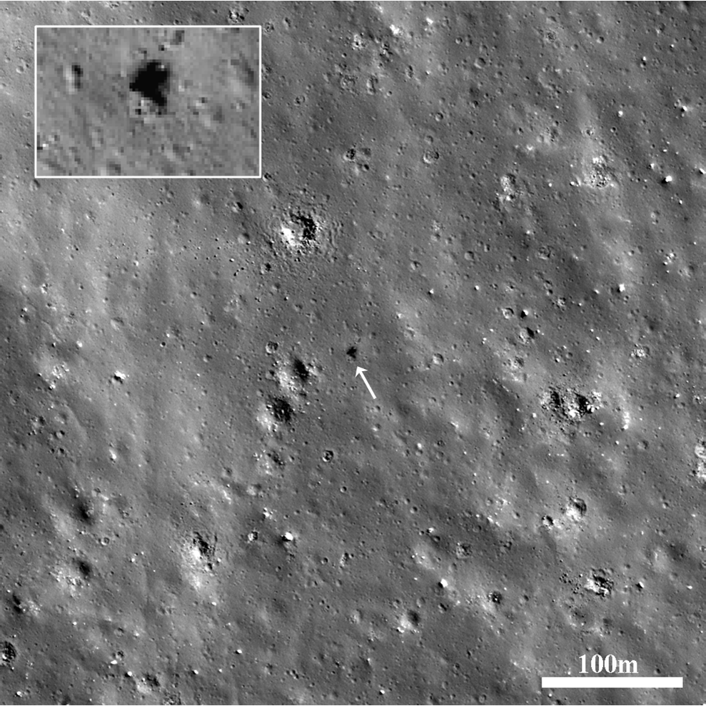
Surveyor 7 landed in the lunar highlands (40.980°S, 348.486°E) on 10 January 1968, on an impact-melt coated ejecta blanket 46.6 km (29 miles) north of the rim of Tycho Crater. The last spacecraft of the Surveyor series, it was sent to an area far from the mare in the southern highlands, in order to sample and analyze materials different from those of the other Surveyor missions. Surveyor 7 was the only Surveyor spacecraft to be sent to a region solely for scientific interest, rather than to obtain more data for the upcoming Apollo program, since program managers had decided that the previous Surveyor missions had already provided sufficient data to enable a safe Apollo landing. Results from the spacecraft’s alpha scattering detector showed that the highland crust is poorer in iron than the maria analyzed by the other Surveyors.
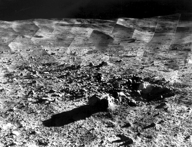
A total of 21,091 pictures were transmitted to Earth by Surveyor 7. One of the most stunning image sets is a photomosaic panorama of the landing site, which shows the rim of the 82-km diameter Tycho Crater on the horizon. On the surface of the Moon, as on Earth and elsewhere, impact craters are typically hidden from sight until you are standing right up on the rim. The Apollo 14 astronauts encountered this problem as well, when taking samples during a radial traverse of Cone crater. They lost sight of the crater rim during their traverse and eventually had to turn back before catching a glimpse of the interior of the crater in order to save enough oxygen for the journey back to the Lunar Module. LROC images (February 4, 2011, August 19, 2009) later confirmed that the crew came within 30 yards of the crater rim.
Surveyor 7 could only just make out the rim of Tycho Crater from its landing site. However, from an orbit of 50 km above the surface the panoramic view of the stunningly well preserved impact crater and its majestic central peaks is spectacular.
The Surveyor missions not only provided critical engineering data that helped enable the safe Apollo landings that followed, but also showed that powered descent to the lunar surface was feasible and straightforward. Robotic precursor missions (such as automated sample return missions and in-situ resource utilization demonstrations) will undoubtedly play a similarly important role as we prepare for the seventh human lunar landing and beyond.
Be sure to explore the entire NAC frame (M175355093L) covering the Surveyor 7 site, and check out the central peaks of Tycho in the June 29, 2011 and May 21, 2012 Featured Images!

Related posts:
New View of Apollo 14 Trail of Discovery at Fra Mauro
Tycho Central Peak Spectacular!
View From The Other Side Surveyor 1
Published by Ryan Watkins on 7 September 2012