Featured Images
 New!
New!
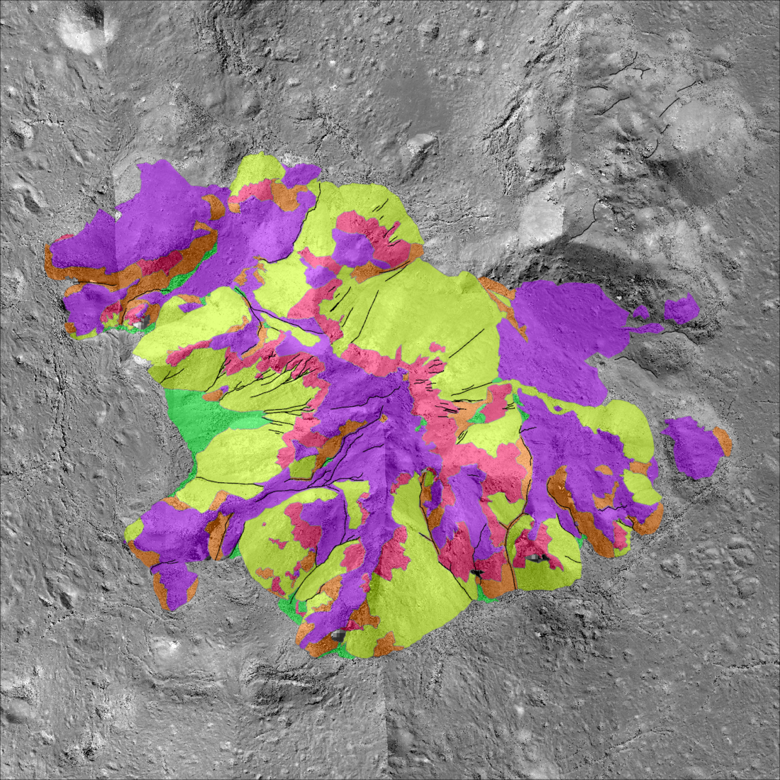
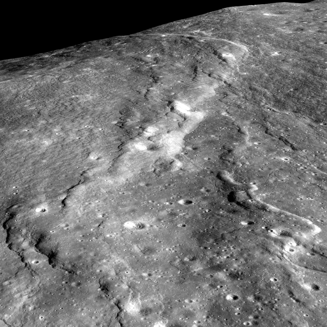
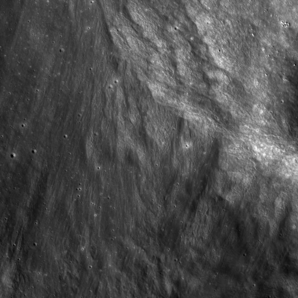
Tycho Central Peak: A Deeper Look!
A morphologic map highlighting the variety of landforms that make up the central peak of Tycho crater, a young ~70 kilometer diameter crater on the southern nearside (-43.48, 348.67) {NASA/ASU/Arizona State University].
Published on 03 May 2025
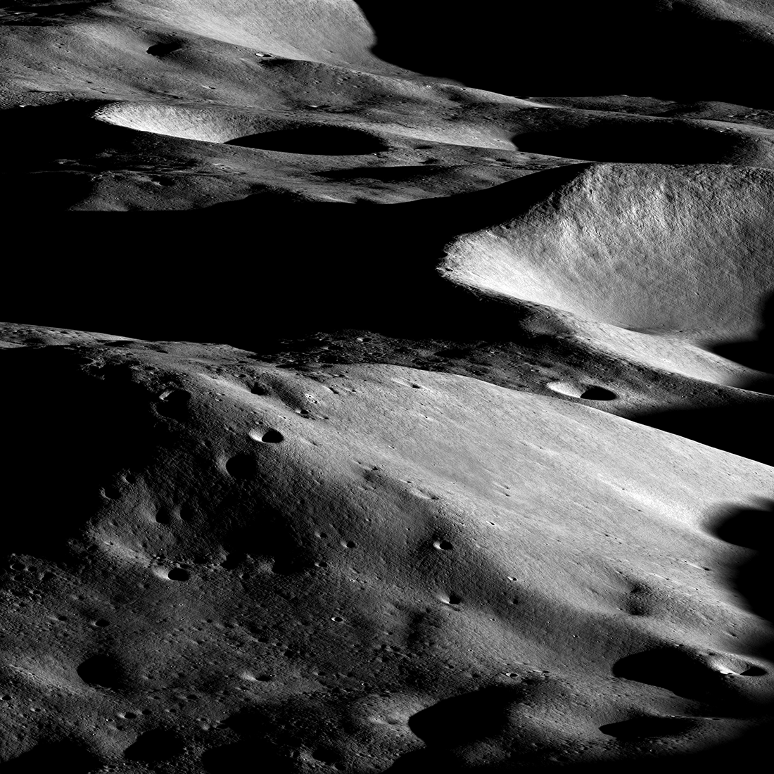
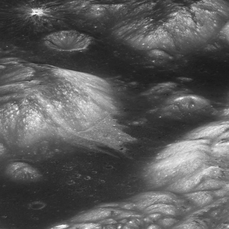
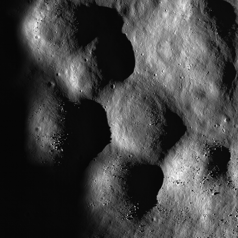
Malapert Massif
Malapert massif (informal name) is thought to be a remnant of the South Pole - Aitken basin rim, which formed more than 4 billion years ago. More recently, this magnificent peak (lower left) was selected as an Artemis 3 candidate...
Published on 14 Mar 2023
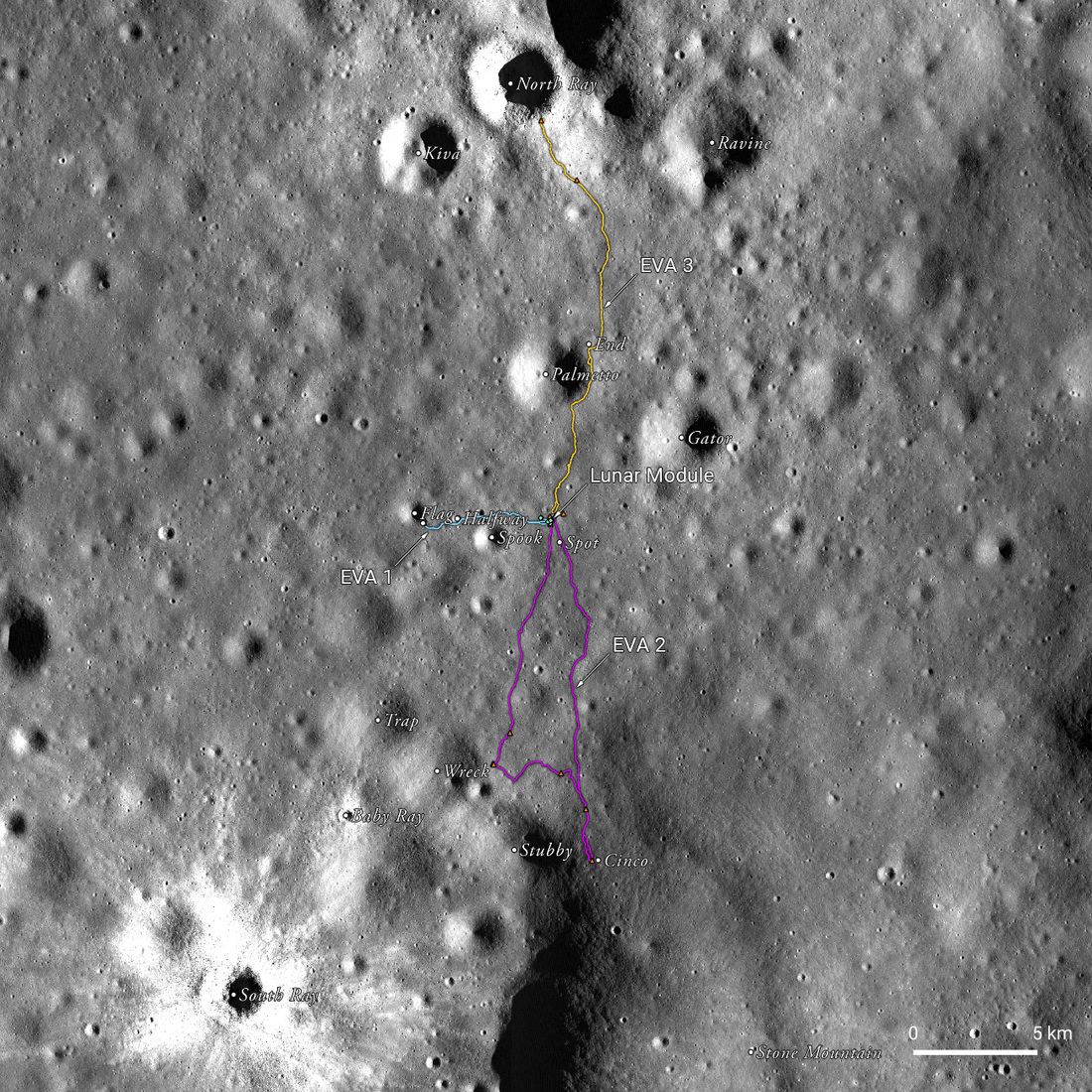
Apollo 16 50th Anniversary: A New Landscape
A spectacular, labeled view of the Apollo 16 landing site between North Ray and South Ray craters in the Descartes Highlands, a new landscape for the crew and an exciting set of LROC team products to help celebrate the 50th anniversary...
Published on 20 Apr 2022
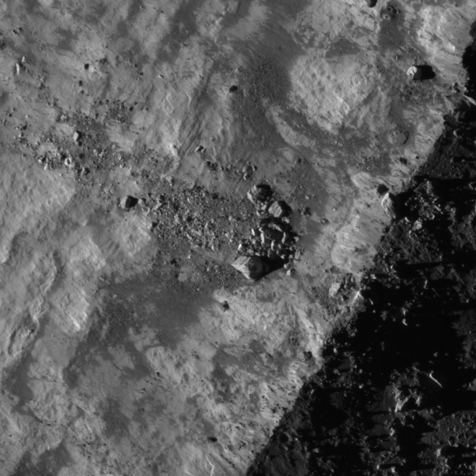
A Rain of Rock
A rain of rock carved these craters west of Vavilov crater. The ground here, which is elevated relative to the surrounding terrain, intersected with rock and other ejected debris excavated during the formation of Vavilov crater. The...
Published on 28 May 2020
Feature Mosaics: Behind the Seams
A seamless mosaic of a portion of Karpinsky crater (91 km diameter, 72.61° N, 166.80°E) seamless mosaic. Scene is 55 km across, NAC images M1309496597L/R, M1309503618L/R, M1309510644L/R, M1309517669L/R, and M1309524696L/R...
Published on 16 Mar 2020
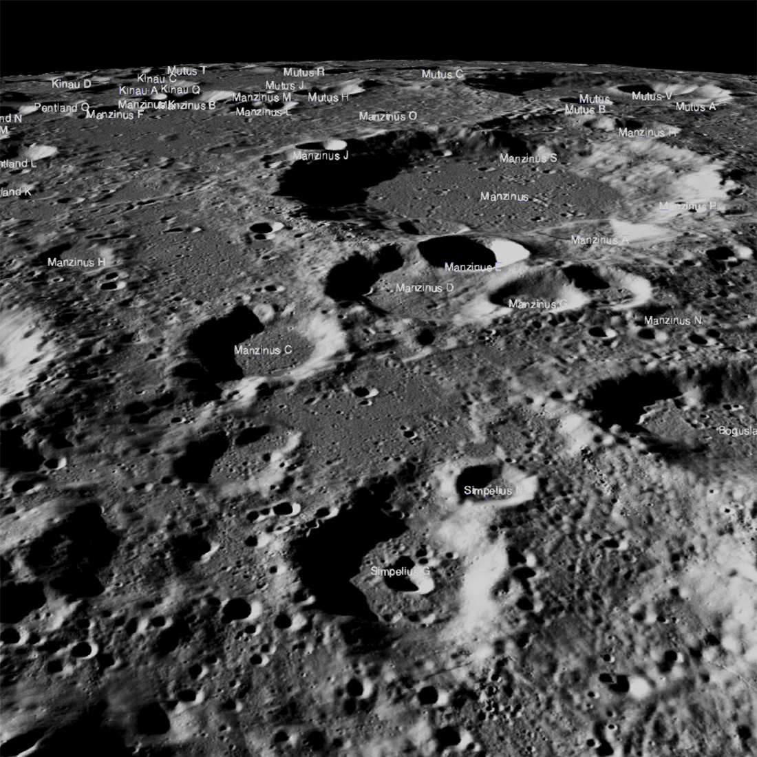
Obscured in the Lunar Highlands?
The Chandrayaan-2 lander, Vikram, attempted a landing September 7th Indian time (Friday the 6th in the United States), on a small patch of lunar highland smooth plains between Simpelius N and Manzinus C craters. Unfortunately the...
Published on 26 Sep 2019
Almost a Hole-in-One
A geologic story in Antoniadi crater on the Moon's far side. North is toward the top. Image width 1.54 kilometers, NAC M1311837924LR [NASA/GSFC/Arizona State University].
Published on 26 Jul 2019

Mysteries of Compton Crater
The oblique view of part of the north-central floor of Compton crater (center lat 55.9°, center lon 104.1°) shows floor fractures, the north slopes of its central peaks (center right), thousands of impact craters (some less than a meter...
Published on 10 Apr 2019
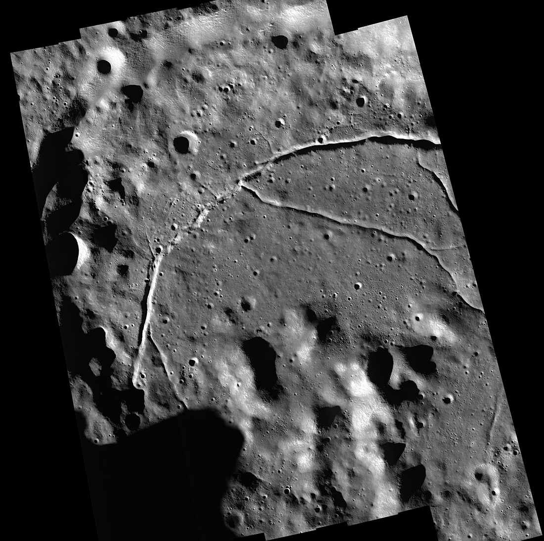
The West Side of Plato Crater
Western Plato crater (at right) and the geologically complex region west of its rim — part of a controlled and corrected mosaic made up of Lunar Reconnaissance Orbiter Camera (LROC) Narrow Angle Camera (NAC) images. The late afternoon...
Published on 18 Jan 2019
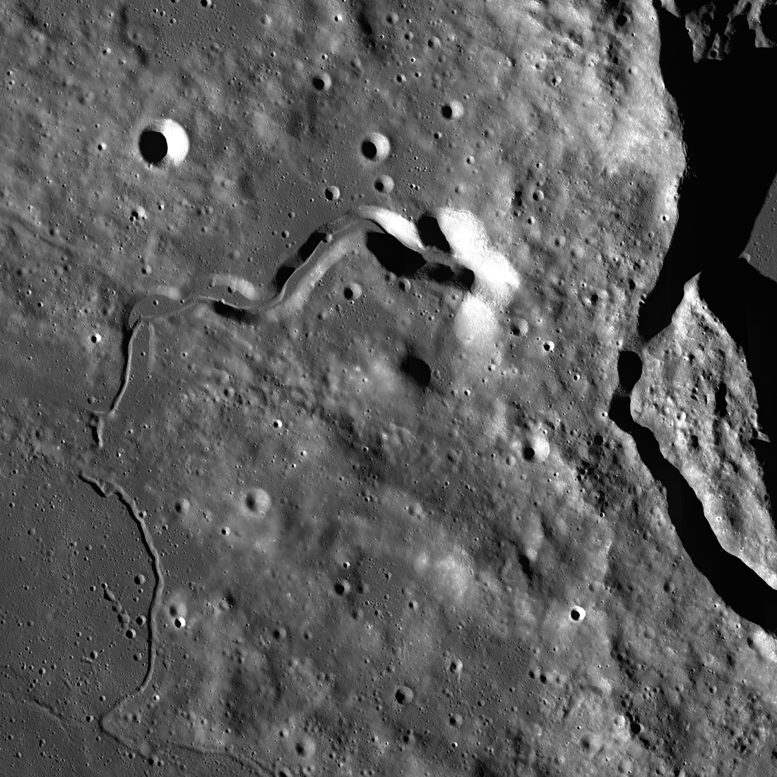
Lobate Scarps: The Movie
Lobate scarps - like those shown here on the floor of the farside crater d'Alembert - are not large, but they tell us much about how hot the Moon was when it was born and its ongoing thermal evolution. Image width is about four...
Published on 31 Oct 2018
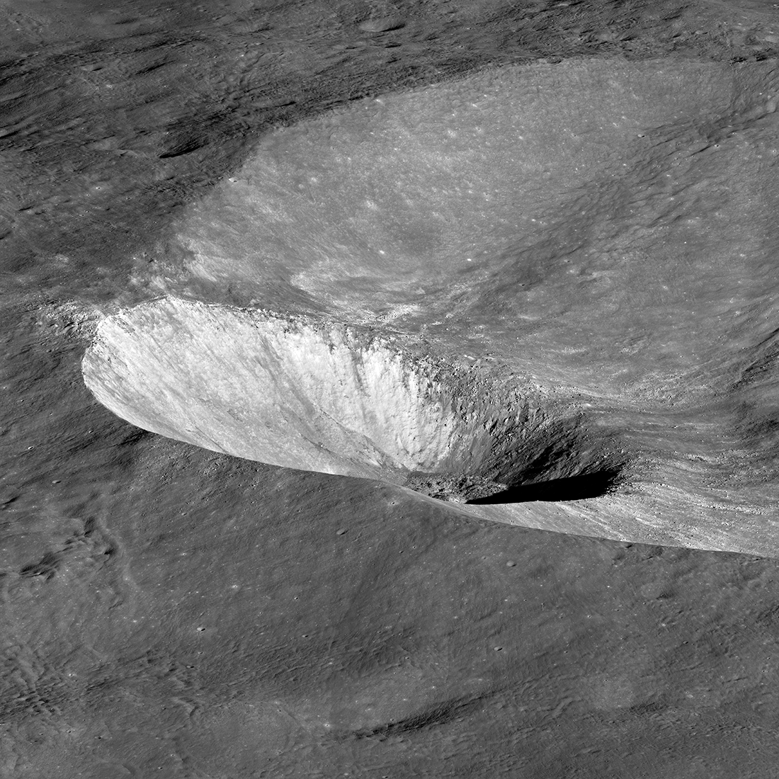
John Young at South Ray Crater
Overhead view of South Ray crater, the most prominent feature at the Apollo 16 Descartes landing site in the central lunar highlands. Astronaut John Young landed Lunar Module Orion north of the crater on 21 April 1972 (UTC)....
Published on 05 Jul 2018
Hawke Crater
Hawke crater, 13.2 km wide, is noticeably tilted because the impactor - an asteroid or a comet - that excavated it struck the sloping inner wall of Grotrian crater. Visible are light-colored rays that attest to the crater's youth, as...
Published on 03 May 2018
Curiously Fast Degradation of Small Lunar Craters
Taurus-Littrow valley, geologic exploration target for Apollo 17 and the Lunar Reconnaissance Orbiter Camera study team led by Dr. Prasun Mahanti. Center latitude 20.15°N, center longitude 30.98°E, image 18 km wide, image...
Published on 24 Apr 2018
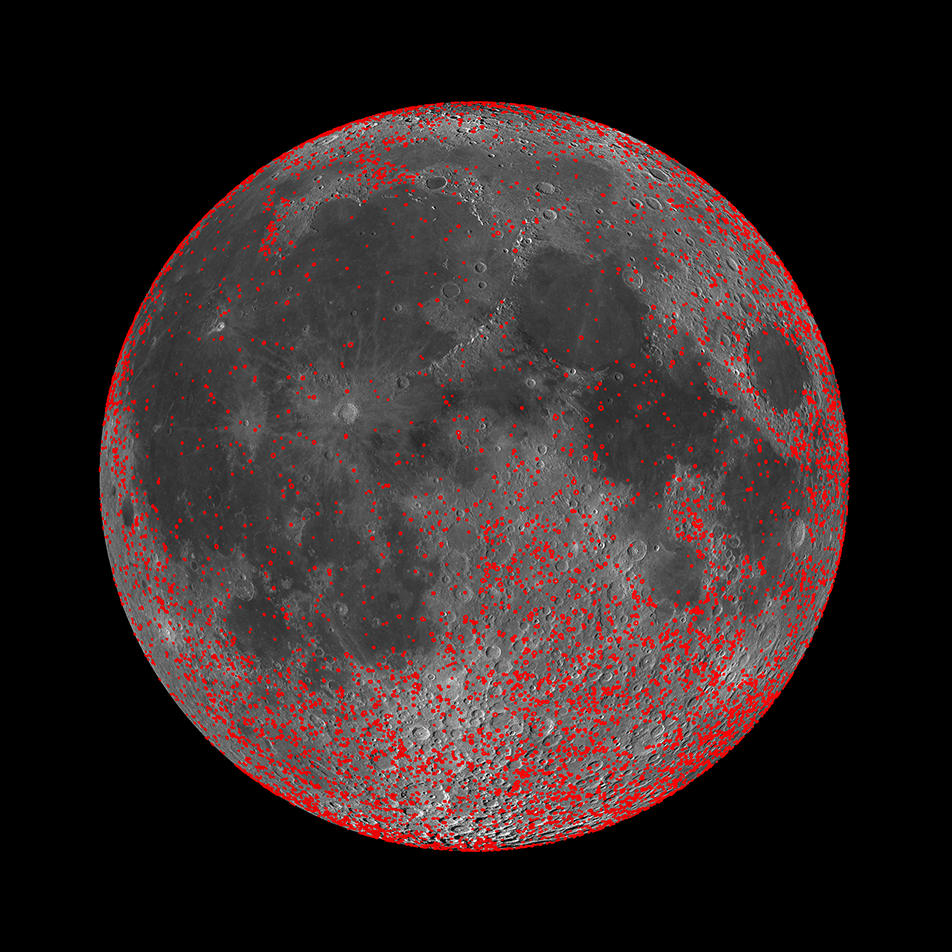
Every Crater on the Moon (Larger than 5 km)
New work from the LROC team resulted in a map of all detectable craters on the Moon between 5 and 20 km in diameter (red circles). When combined with an existing map of craters larger than 20 km in diameter, the differences in the...
Published on 13 Nov 2017
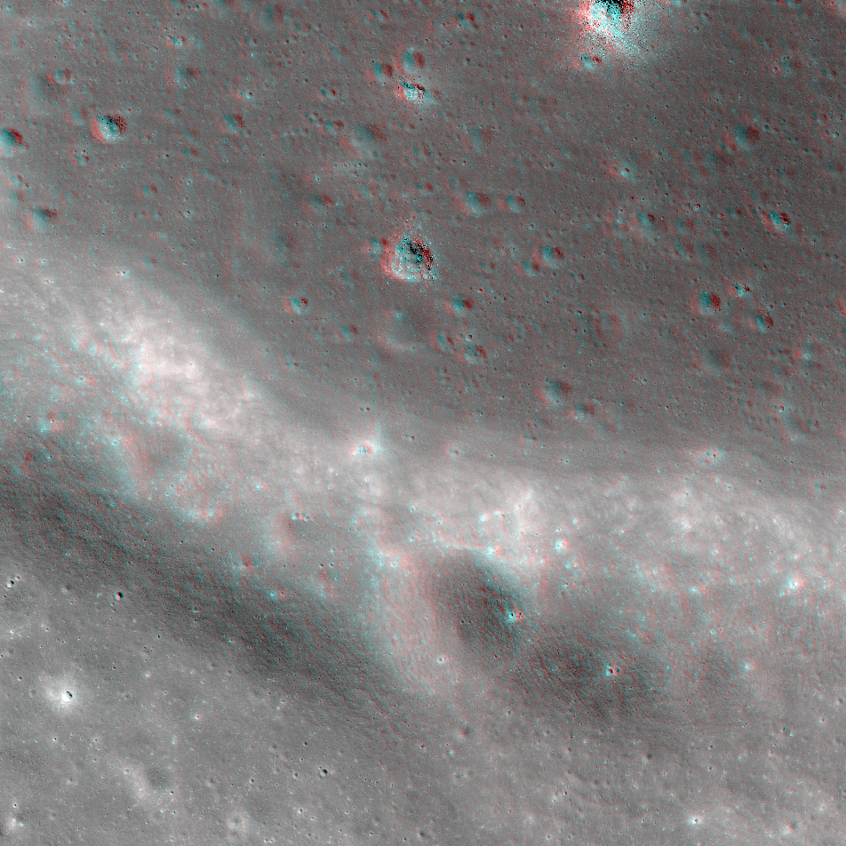
NAC Anaglyph: Mare Shoreline in Apollo Basin
A portion of the southwestern mare "shoreline" in the Apollo basin on the farside. This contact between ancient lava plains and a remnant crater rim shows the lunar surface as a land of contrasts -- of expansive plains and jutting...
Published on 30 Jun 2017
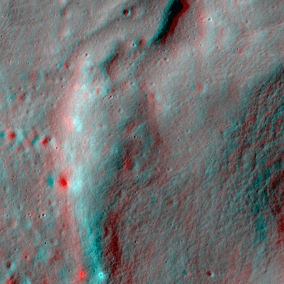
NAC Anaglyph: Buffon Flow Front
This lobate flow, found to the south of Buffon crater, likely formed as fluidized basin ejecta moved across the surface [NASA/GSFC/Arizona State University].
Published on 06 Jan 2017
LROC NAC Anaglyph: Highlands Ridge
A ridge that formed in ejecta deposits from the Orientale basin [NASA/GSFC/Arizona State University].
Published on 13 Feb 2015
Frozen Motion
The scoured floor of Harkhebi J crater, near the young crater Giordano Bruno (22 km diameter). Ejecta from Giordano Bruno flowed across the surface, leaving a record for us to see today. LROC NAC image M1128791817L; north is up and the...
Published on 20 Aug 2014
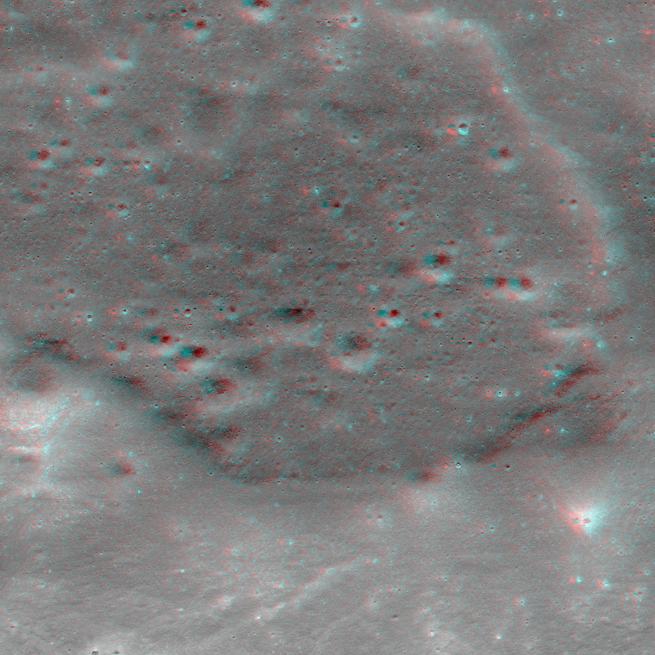
Donut Holes
LROC NAC image M180430508R showing central mounds, ~1 km diameter each, on the floor of Harriot B crater. Image width is ~3 km and North points up [NASA/GSFC/Arizona State University].
Published on 10 Jul 2014
Breaking Down Walls
Gravity is winning as boulders tumble down from the rim of Moore F (~24 km in diameter) in this LROC NAC mosaic (M1156517189) [NASA/GSFC/Arizona State University].
Published on 24 Jun 2014