Featured Images
First to See the Farside
First photograph (BW) taken of the famous Apollo 8 Earthrise sequence, the following images were acquired with color film [AS08-13-2329, NASA].
Published on 24 Dec 2024

Apollo 17 Remains Unchallenged After Fifty Years
Fifty years ago, the Apollo 17 crew concluded a series of human exploration missions that remain, like their footsteps, some of the greatest achievements in human history. Apollo 17 handheld image (AS17-134-20382) of astronaut Harrison...
Published on 10 Dec 2022
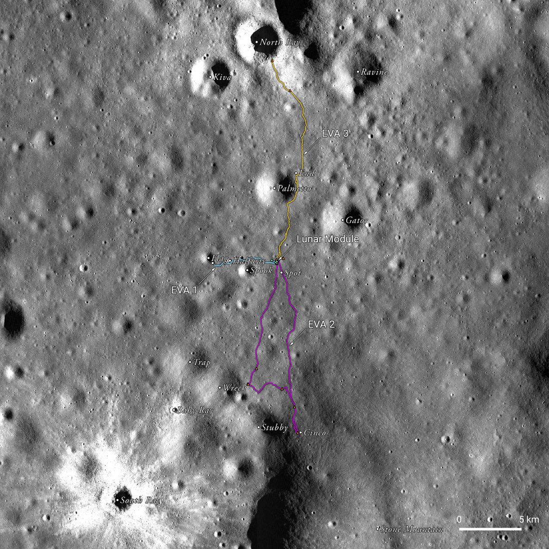
Apollo 16 50th Anniversary: A New Landscape
A spectacular, labeled view of the Apollo 16 landing site between North Ray and South Ray craters in the Descartes Highlands, a new landscape for the crew and an exciting set of LROC team products to help celebrate the 50th anniversary...
Published on 20 Apr 2022
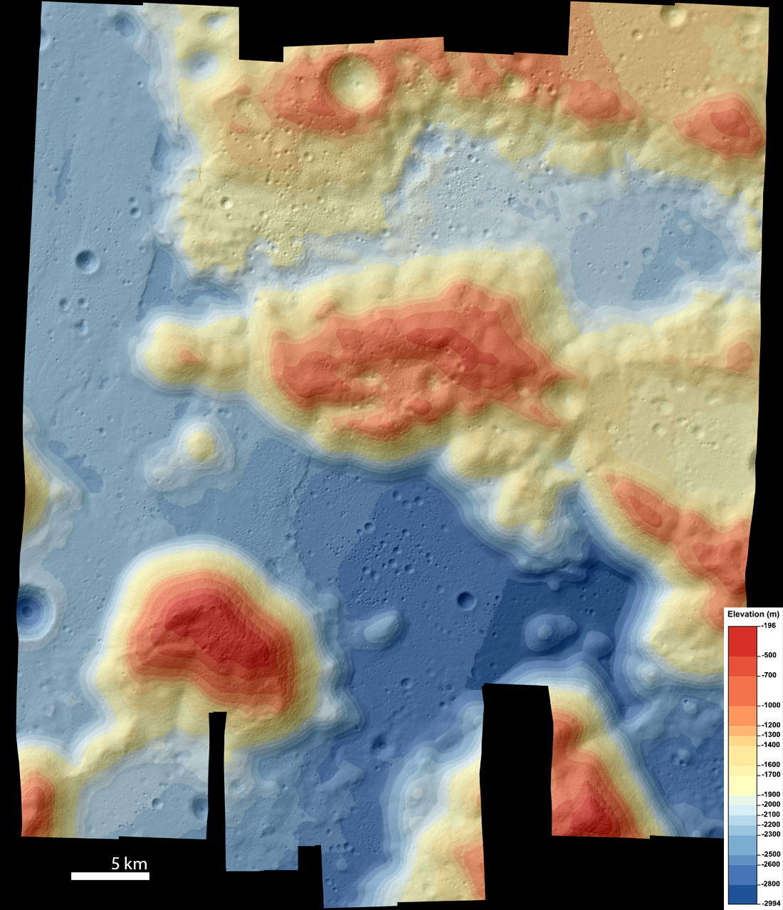
Topography of the Taurus-Littrow Valley
Color-shaded relief map of the Taurus-Littrow Valley (APOLLO17 DTM mosaic) made from eleven NAC stereo pairs [NASA/GSFC/Arizona State University].
Published on 11 Feb 2022
Apollo 15: A Mission of Many Firsts
Highlights of the Apollo 15 landing site, as seen in LROC NAC image M175252641R. This image has a resolution of 27 cm/px, and shows an area of 262 m by 186 m. The Lunar Module is clearly visible, as are many tracks from the Lunar Roving...
Published on 30 Jul 2021
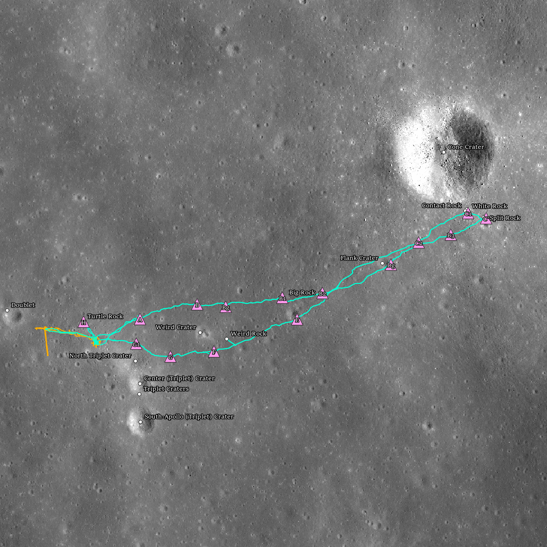
Apollo 14 Fiftieth Anniversary!
Apollo 14 landing site (4.646°S, 342.528°E) showing the two extra-vehicular activities (EVAs; orange = EVA1 and teal = EVA2) with stations (pink triangles), and geologic features (white dots).
Published on 05 Feb 2021
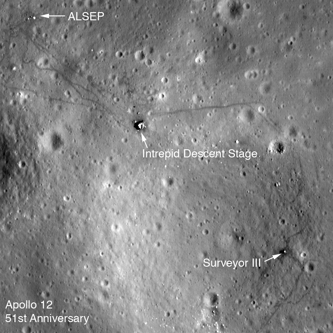
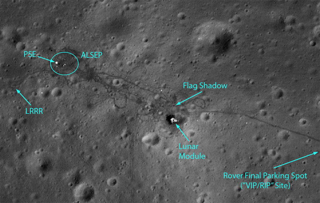
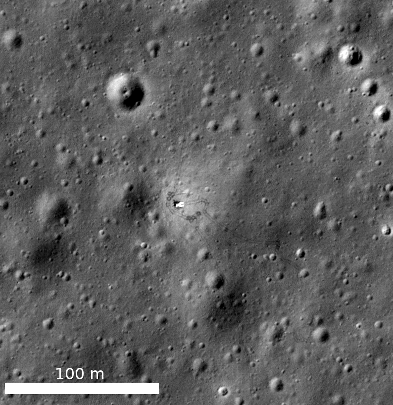
Apollo 12 Fifty-first Anniversary
LROC low-altitude image of the Apollo 12 landing site. The Lunar Module descent stage, Apollo Lunar Science Experiment Package (ALSEP), and Surveyor III spacecraft are all visible along with astronaut tracks. Image is 275 meters wide,...
Published on 13 Nov 2020
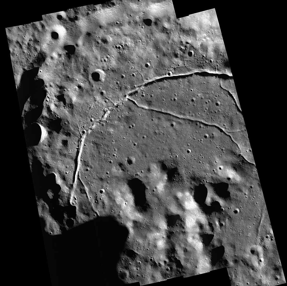
Feature Mosaics: Behind the Seams
A seamless mosaic of a portion of Karpinsky crater (91 km diameter, 72.61° N, 166.80°E) seamless mosaic. Scene is 55 km across, NAC images M1309496597L/R, M1309503618L/R, M1309510644L/R, M1309517669L/R, and M1309524696L/R...
Published on 16 Mar 2020
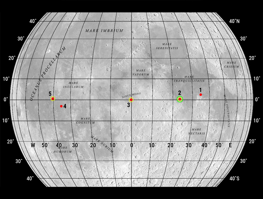
"Oceanus Procellarum Base Here - The Eagle Has Landed"
In 1969, NASA published a map showing candidate Apollo 11 and Apollo 12 landing sites. The map was based on photographs taken using large Earth-based telescopes. The map above, based on an LROC global image mosaic, is a near-copy of...
Published on 09 Aug 2019
What Armstrong Saw
Simulated view of what Armstrong saw as the Lunar Module Eagle approached the aim point on the northeast flank of West crater (190 meters diameter). The odd shape of the image area is due to the small windows in the Eagle. North is to...
Published on 16 Jul 2019
The Moon in Arizona
This 3.48-kilometer-wide part of the Sea of Tranquility is very special, though no one has ever landed or walked here. NAC image M1123426954LR [NASA/GSFC/Arizona State University].
Published on 02 Jul 2019
Mount Marilyn: A Lunar Love Story
Mount Marilyn, with its distinctive triangular shape, served as an important navigation landmark for the Apollo 11 astronauts. Portion of LROC Wide Angle Camera mosaic, 138 km wide [NASA/GSFC/Arizona State University].
Published on 21 Dec 2018
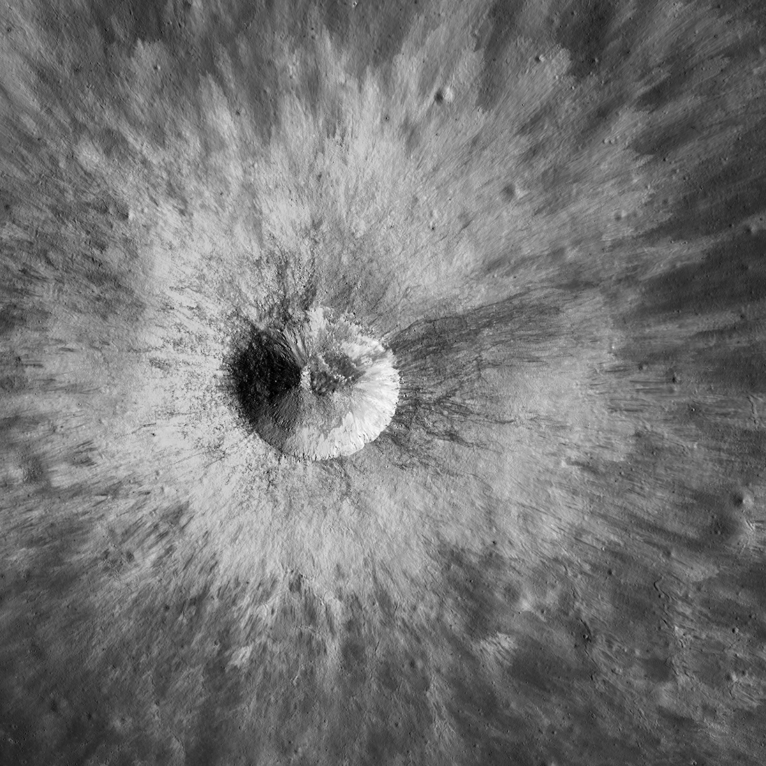
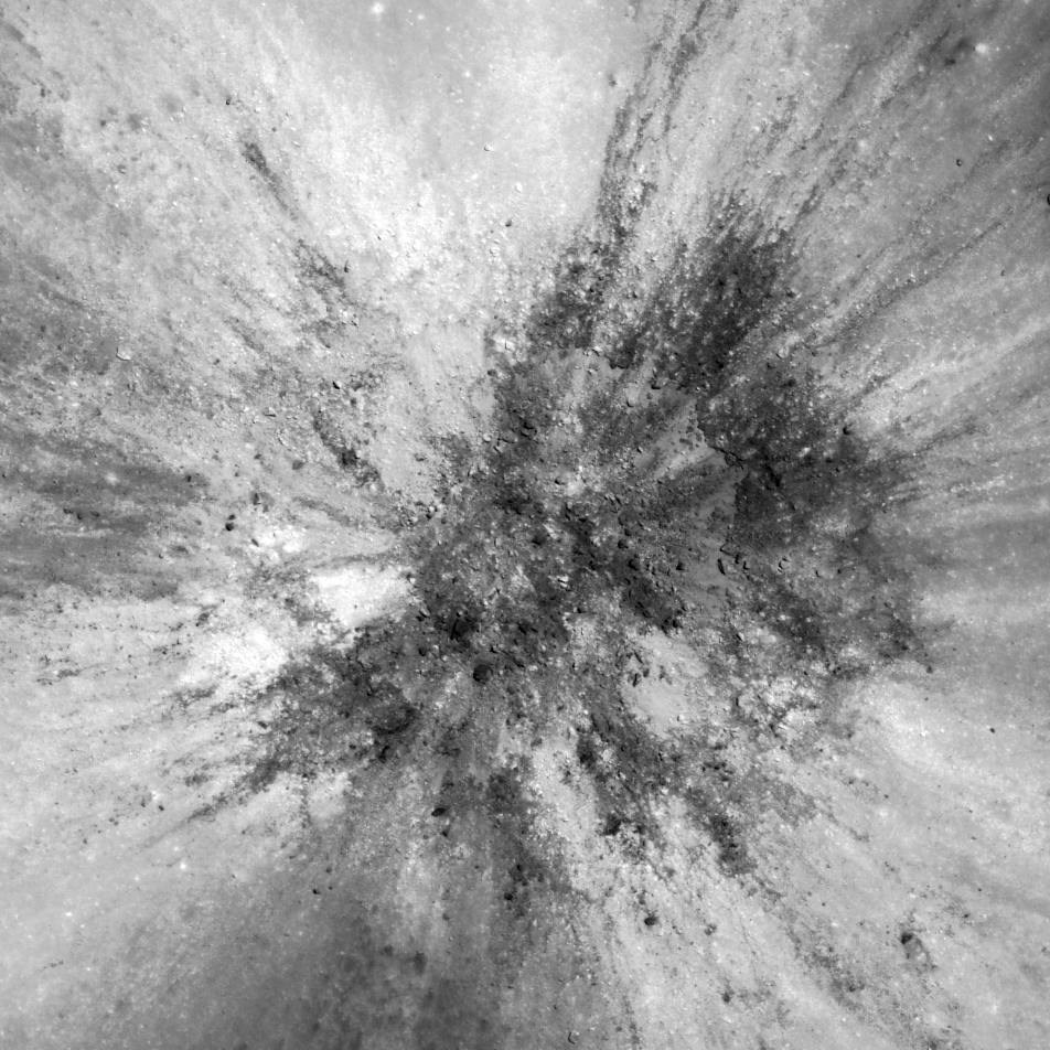
Lunar Beauty
The Lunar Reconnaissance Orbiter Camera imaged this bright young ray crater (3.13˚N, 281.07˚E) on 3 November 2018 — just three weeks ago. The Sun shone from the west (left, 48˚ incidence angle). This image covers an area 8.1 kilometers...
Published on 21 Nov 2018
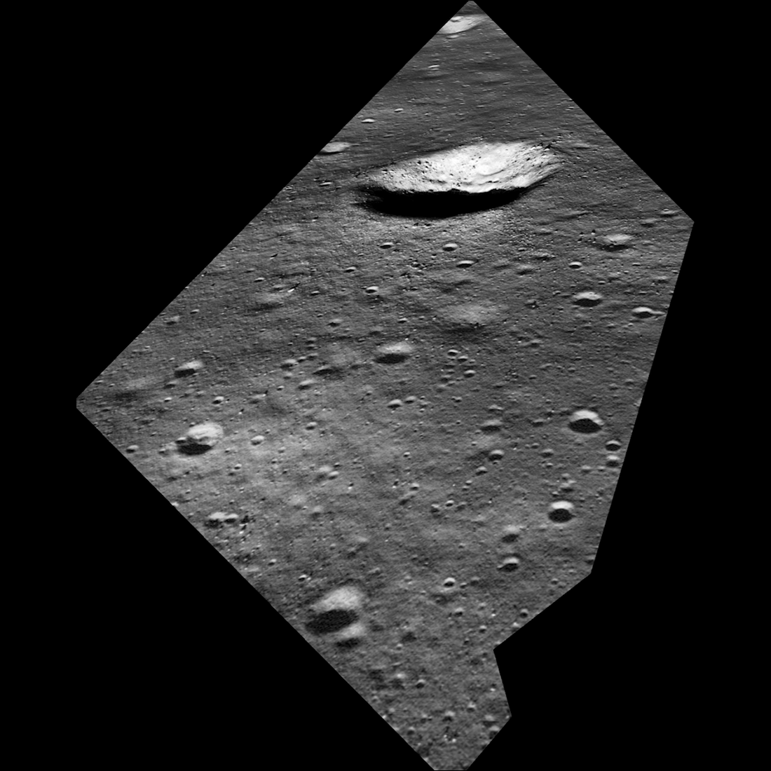
John Young at South Ray Crater
Overhead view of South Ray crater, the most prominent feature at the Apollo 16 Descartes landing site in the central lunar highlands. Astronaut John Young landed Lunar Module Orion north of the crater on 21 April 1972 (UTC)....
Published on 05 Jul 2018
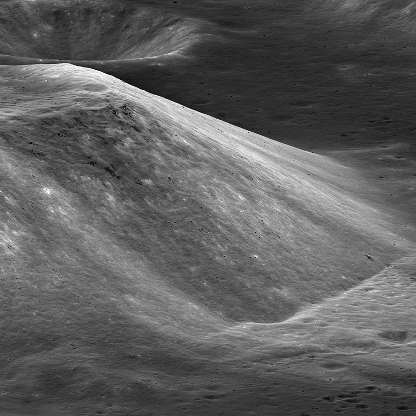
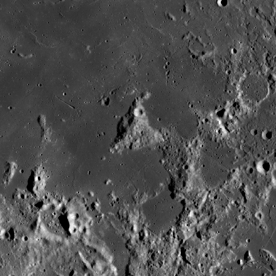
South Massif Landslide
By lunar standards South Massif is a relatively modest mountain, but with a rich history (geologic and exploration). The massif is about 7000 meters across at the base and 2300 meters tall; M1266925685LR, incidence angle 33°, slew angle...
Published on 09 Jun 2018
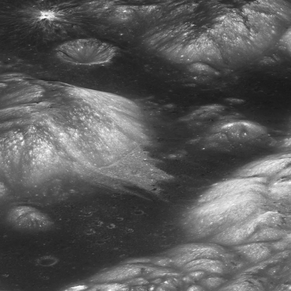
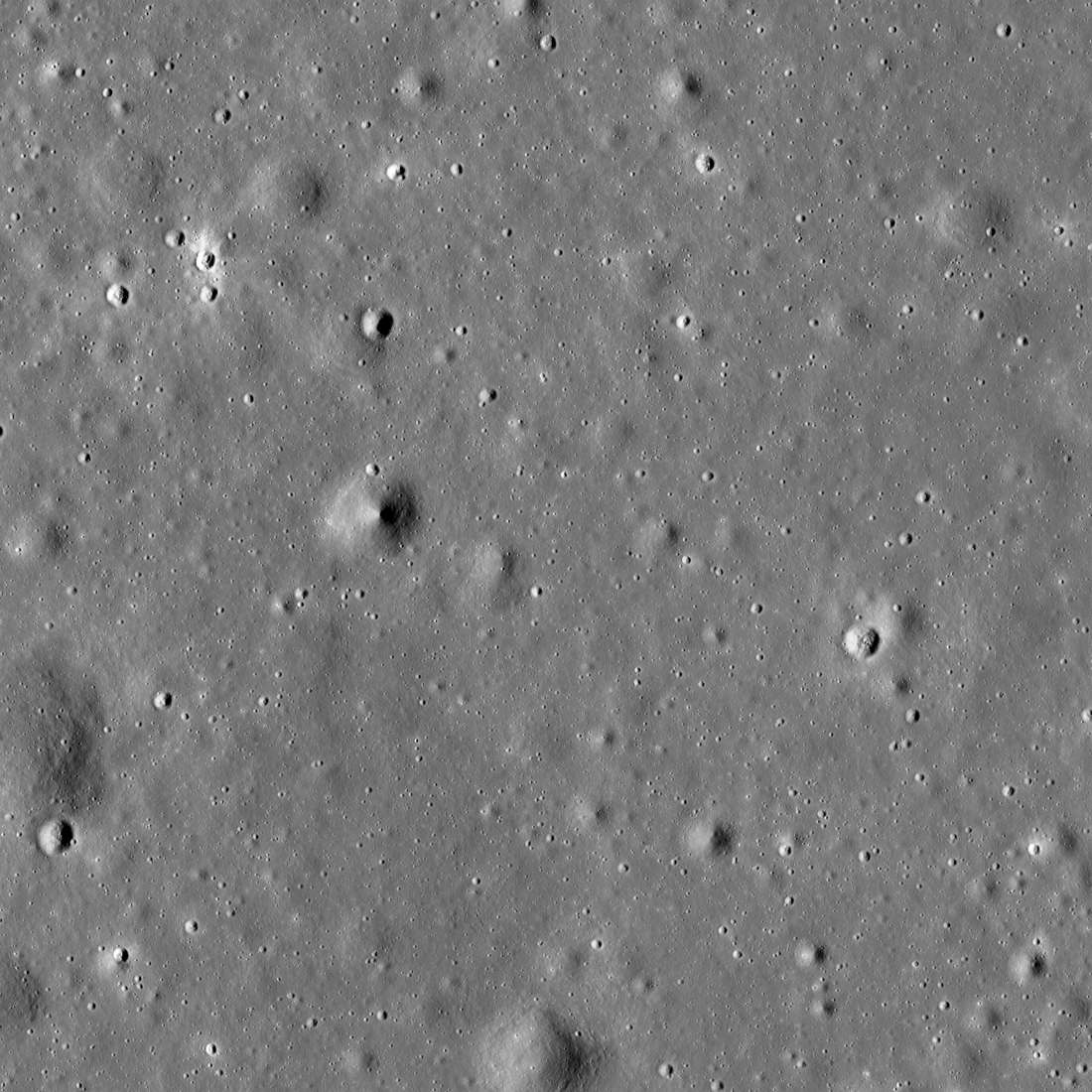
Curiously Fast Degradation of Small Lunar Craters
Taurus-Littrow valley, geologic exploration target for Apollo 17 and the Lunar Reconnaissance Orbiter Camera study team led by Dr. Prasun Mahanti. Center latitude 20.15°N, center longitude 30.98°E, image 18 km wide, image...
Published on 24 Apr 2018
Lunar Light Plains: The Movie
The Orientale Basin, about 950 kilometers wide, is the striking multi-ringed impact feature at lower right. New research suggests that the impact event that formed Orientale may have emplaced light plains deposits - visible here...
Published on 20 Apr 2018
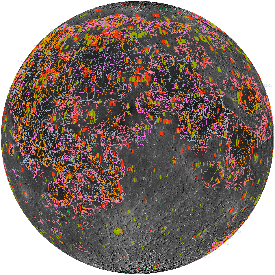
'Shaping' Lunar Science with Vector Data
Twenty new shapefiles created by the LROC Team are now available! A few of the shapefiles shown here include mare age units, footprints of digital terrain models (DTMs), and the locations of small geologic features such as...
Published on 18 Jul 2017
Spacecraft Related Coordinates - 2016 Update
Luna 17, the intrepid lander that carried the Lunokhod 1 rover to the surface. You can make out the rover's tracks around the lander, the tight circles were formed as the Earth-bound drivers tested out the maneuverability of their just...
Published on 25 Nov 2016
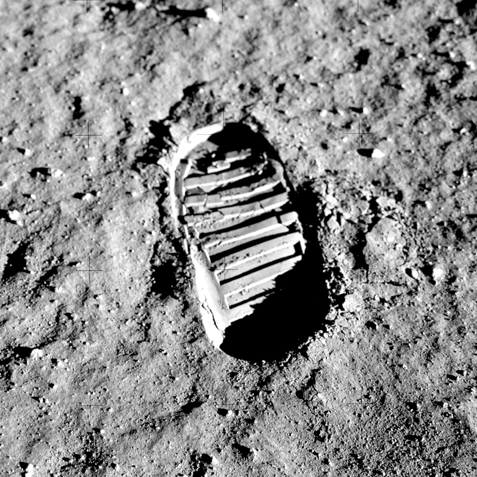
Regolith Porosity from Orbit
Apollo 11 photograph of boot-print in the lunar regolith (cropped version of AS11-40-5878).
Published on 08 Jun 2016