Every three months, LROC releases new RDRs, data products that were expressly created to facilitate exploration and science analysis. Creating RDRs involves joining multiple images into a single product and/or applying extra processing. Two of the most common types of RDR products included in each release (much like the products in this release) are high-resolution NAC ROI mosaics and NAC Digital Terrain Models (DTMs).
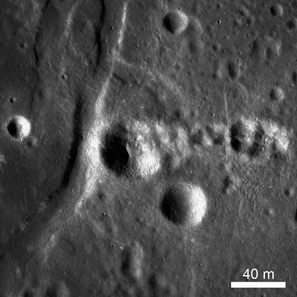
NAC ROI mosaics cover key sites using images that were taken with near-identical lighting (on adjacent orbits) and are carefully tied together using a control network. Corrected spacecraft and camera pointing create a seamless mosaic that offers coverage greater than a single NAC image. For instance, the NAC ROI pictured above (NAC_ROI_CATENA__LOA) consists of 4 NAC images and covers ~853 km2. This means that scientists can examine the entire area without offsets between images or lighting differences interfering with their analysis. For a better understanding of how a NAC ROI might be used, check out this post on the diversity of basaltic lunar volcanism.
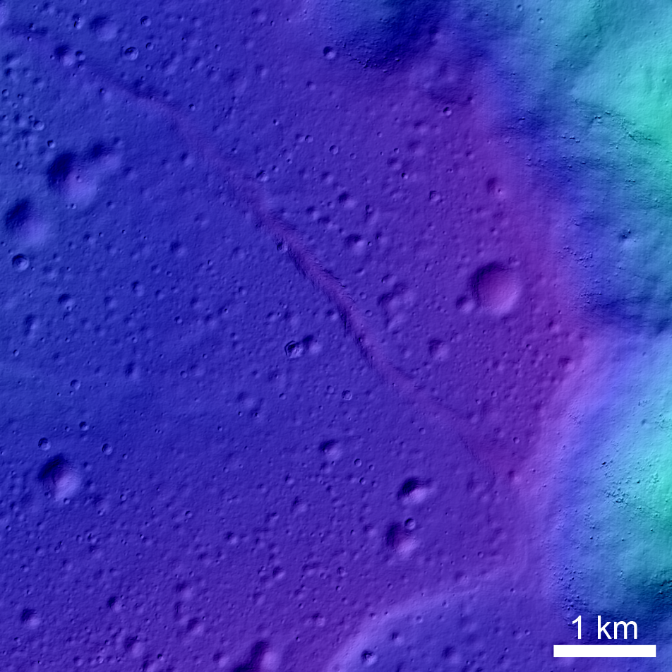
NAC DTMs are topographic products in which each pixel value represents the elevation of the surface at that point. Orthophotos, a colorshaded relief map, a shaded relief map, and a slope map are released alongside the DTM to provide additional visualization of the terrain. NAC DTMs are an extremely useful dataset, allowing precise measurements such as height, depth, volume, and slope. To learn how NAC DTMs are created from a set of stereo images, read our other posts on the topic: Digital Elevation Models (DEM), Barnstorming Linné Crater, and Crater in 3D!. For some examples of how a NAC DTM might be used, check out this post on ejecta from Orientale and this post on mare pit topography. Details of the DTM process appeared in Icarus, Journal of Solar System Studies (Henriksen et al 2016).
In addition to the new NAC ROIs and NAC DTMs, new README text files were added to all the existing RDRs in order to provide more documentation on what each RDR is and how it was created.
New RDRs include the following DTMs:
and the following ROIs:
- Aristillus crater (low Sun)
- Australe farside volcanism (low Sun)
- Catena Littrow (low Sun)
- Copernicus NW rim (low Sun)
- Copernicus SE rim (low Sun)
- Orientale Sculptured terrain (low Sun)
- Riccioli crater (low Sun)
- Serenitatis large wrinkle ridge (low Sun)
- Wolf Crater (low-Sun)
Additionally, the following shapefiles have been updated to include newly released images and DTMs:
Check out the full NAC ROI mosaic of Catena Littrow (down-sampled for web browsing):
Check out the full colorshaded relief of the rim of Tsiolkovskiy Crater NAC DTM:
Related Posts:
LROC PDS Release Number 5 - the first time we released RDRs!
'Shaping' Lunar Science with Vector Data
Diversity of Basaltic Lunar Volcanism
Precise 3D Measurements of Objects at Apollo 14 Landing Site from LROC NAC Stereo Images
Digital Elevation Models (DEM)
Published by Megan Henriksen on 31 October 2017