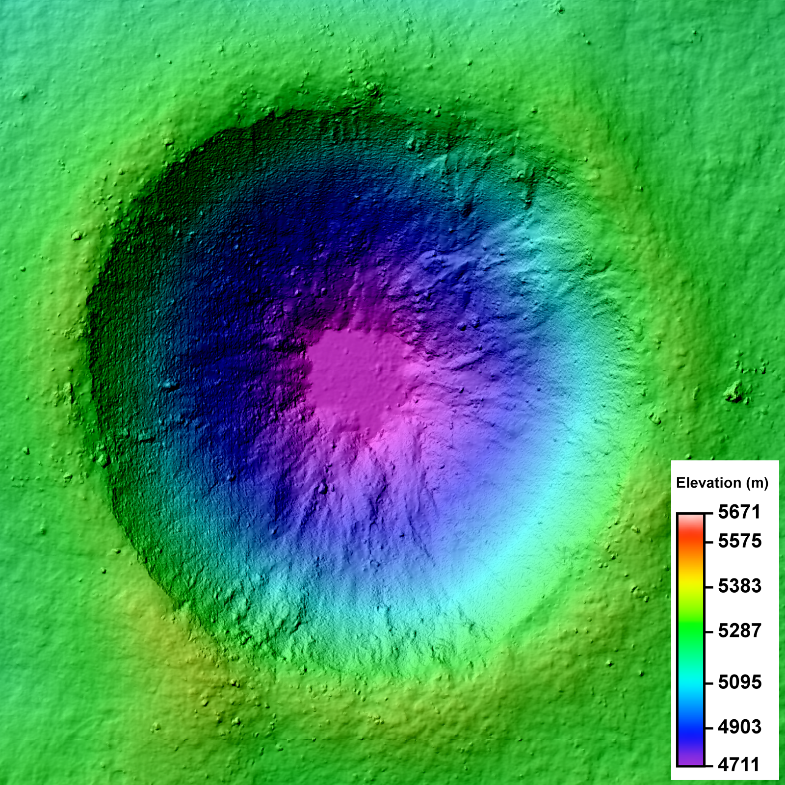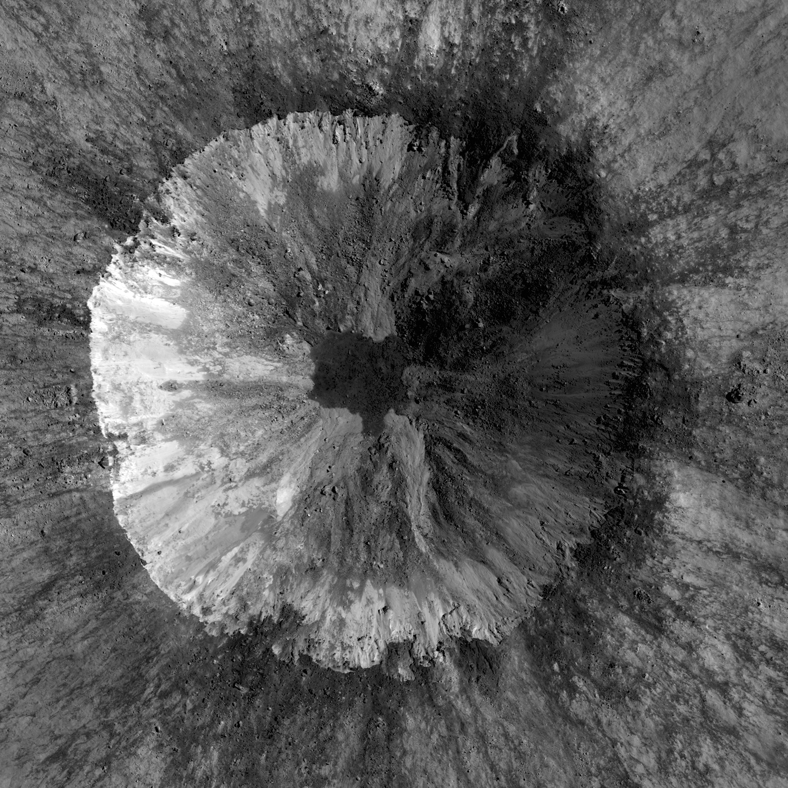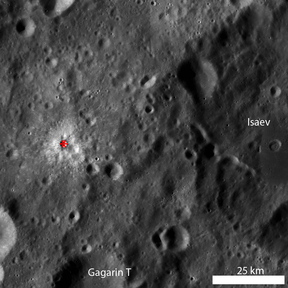
LROC Featured Images show off the incredible variety of stunning lunar geology imaged by the LROC NACs. While these beautiful images allow scientists to study the surface of the Moon with respect to morphologic detail and albedo variations at 0.5 meters per pixel, repeat - or stereo - images of the same location on the surface at similar illuminations but different viewing geometries provide scientists the chance to create a 3D topographic model. Why all the fuss? Well, these Digital Terrain Models, or DTMs, are critical to scientific investigations where topographic information about the lunar surface aids is necessary. Today's Featured Image is a DTM of a 2.3 km diameter unnamed impact crater (17.682°S, 144.408°E) west of Isaev crater. This impact crater is very young, evidenced by its high-reflectance ejecta blanket, and is of scientific interest because the interior crater morphology is complex (see image below).
The NAC mosaic above probably looks somewhat familiar because most Copernican-aged craters have crisp crater rims, prominent ejecta blankets, mass-wasting observed on the crater walls, and often times impact melt in pools on the crater floor or dark streamers superposed on the ejecta blanket. Over time, material from the rim and crater walls slumped toward the crater floor. Some of these slumps are composed of rockier, blockier material, while others do not have entrained rubble. There is a low-reflectance impact melt deposit on the crater floor with irregular contacts with the crater wall materials. Impact melt ponds often exhibit a relatively smooth surface because as the liquid melt cools, it seeks an equipotential surface, which is flat. But how does a scientist quantify "smooth"? Looking at the NAC, there are some debris entrained in the melt, but overall the surface looks flat. However, simply because something "looks" a certain way does not mean it is!
DTMs derived from LROC NAC stereo images are extremely useful because DTMs provide quantitative measures to complement qualitative descriptions. For the case of determining the smoothness of the impact melt pond, the slope of the crater walls and floor deposit can be calculated using the DTM. At the scale shown above, 2 m/pixel, the impact melt deposit surface is all at the same elevation and can thus be considered to be smooth. Furthermore, DTMs sometimes reveal unexpected observations! In the full frame of the LROC NAC DTM, there is a region of lower elevation to the north of the unnamed crater and a region of higher elevation to the south; these regions are not easily discerned in the LROC NAC mosaic.
Take a look at the following full LROC mosaics and see how the morphology you observe in the NAC image is linked with the elevation you see in the DTM!
DTM
NAC
Discover the Moon using DTMs in the DTM RDR Archive!
Direct link to today's Featured Image DTM in the RDR Archive.
Related Posts:
Barnstorming Linné crater
A Digital Terrain Model of the Orientale Basin
Precise 3D Measurements of Objects at Apollo 14 Landing Site from LROC NAC Stereo Images
Published by Lillian Ostrach on 2 May 2012

