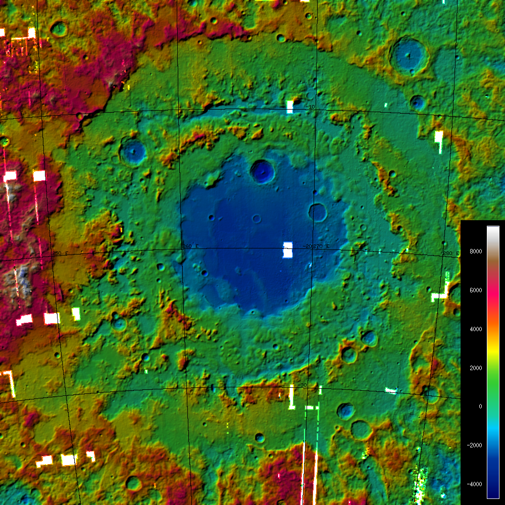
How was the Terrain Model created? LROC's wide angle camera (WAC) has a ground resolution of approximately 100 m/pixel from LRO's nominal orbit altitude of 65 km and is taking image swaths 70 km wide along LRO's ground-track. Therefore, images from adjacent orbits show substantial overlap and strong stereo effects in the overlapping images. Image overlap amounts to approximately 50% near the equator. Using sophisticated so-called "photogrammetric" techniques and computer software, a terrain model can be computed. Several hundred WAC images were combined to form this model. It is a subset of an almost global model, which is currently under construction and which will consist of more than 10,000 WAC images. This particular terrain model was produced using a software system that was originally developed by the German Aerospace Center (DLR; English version) for the High Resolution Stereo Camera (HRSC) on the European Mars Express Mission.
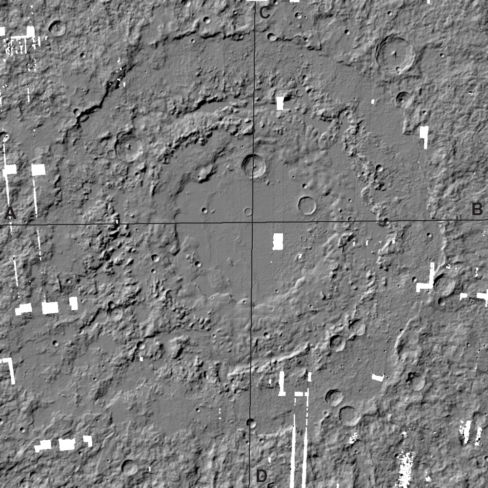
The DTM is presented in grey scale, and was artificially shaded to highlight morphological detail. Note how the concentric basin rings stand out. The vertical and horizontal black lines indicate locations of topographic profiles shown below.
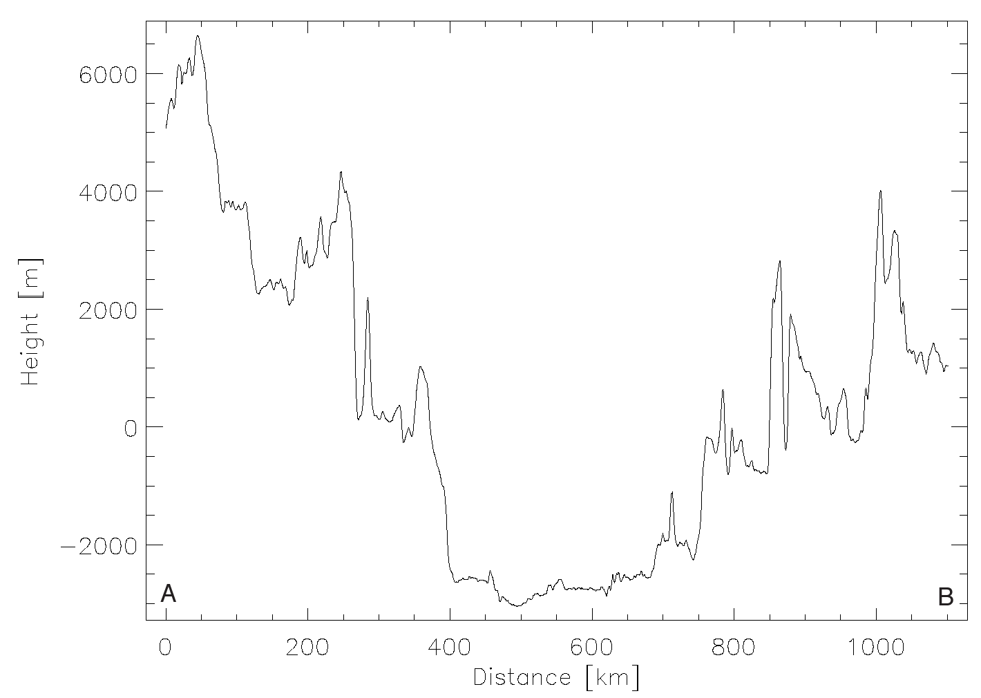 Topographic profile across the Orientale basin extending from West to East (A->B). The profile indicates that the outermost rings rise to as much as 6,500 m above the Lunar mean elevation level (R=1737.4 km). The basin center is approximately 2,500 - 3,000 m below this mean level.
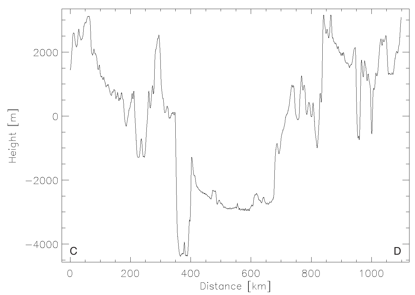 North to south (C->D) topographic profile across the Orientale basin. The profile data attest to the enormous dynamic height range of the Orientale basin.
Published by Juergen Oberst on 20 January 2010