The two LROC Narrow Angle Cameras (NACs) capture pairs of side-by-side images simultaneously in long, approximately north-to-south strips. To build up contiguous west-to-east coverage, multiple image pairs are collected on sequential orbits, and they form the basis of Feature Mosaics (FMs) that are constructed and released by the LROC team. These beautiful mosaics are seamless: no offsets from image-to-image are visible, and the location of each pixel's position on the Moon is known to very high accuracy, making them extremely useful for scientific analyses or landing site planning. So how do we get from raw images to seamless Feature Mosaics?
The images arrive as raw data in the form of Experiment Data Records (EDRs). We calibrate the EDRs, a process which removes noise and non-uniformities, converts digital numbers to physically meaningful values of reflected light, and adds SPICE data for initial spacecraft positioning information, resulting in Calibrated Data Records (CDRs). The NAC calibration routine has been developed and refined over the years, and is included in the software tool kit from the U.S. Geological Survey called Integrated Software for Imagers and Spectrometers 3 (ISIS3).
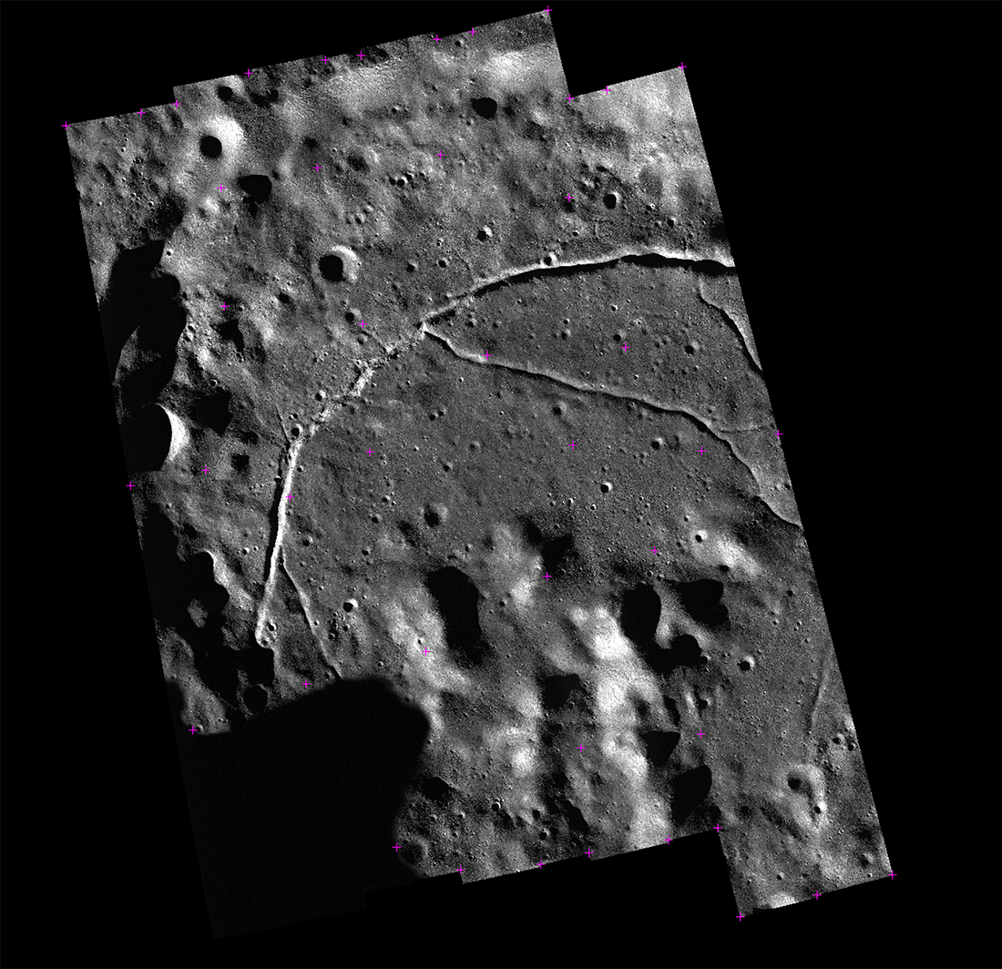
Mosaics are comprised of two or more NAC image pairs. Once the calibrated images are in hand, we create a "control network" made up of ground points, which tie images to the lunar surface, and control points, which tie images to each other. Ground points link specific locations in an image (line and sample, or x and y) to actual geographic locations on the Moon (latitudes and longitudes) that are known from other images or digital terrain models (GLD100 and DTM Orthophotos) that have already been accurately positioned on the Moon. Tie points are automatically created by finding the same feature in two images within a mosaic. Typically, a control network includes about 2000 points.
We then run a bundle adjustment on the images using jigsaw, an ISIS3 program. The adjustment defines the spacecraft orientation and position information based on the control network points to ensure minimal mismatches between the images and the location of the observed site, thus creating a seamless mosaic. The images are then map projected to the GLD100, a 100 meter scale global digital terrain model tied with LOLA data, as a final step.
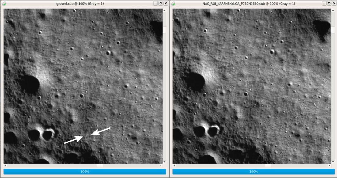
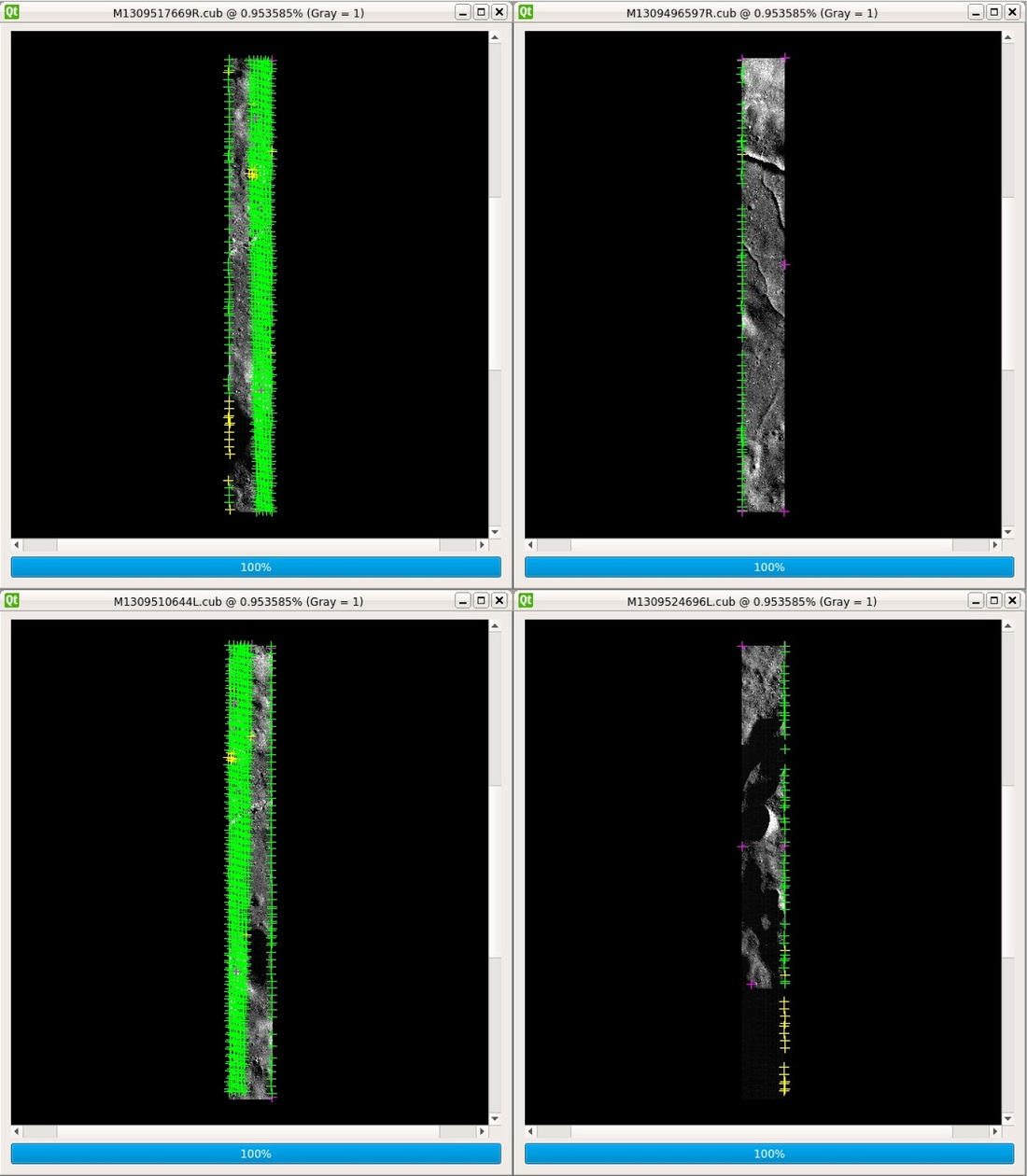
To ensure that our Feature Mosaic controlled correctly, we need to examine the seams between NAC pairs. At 100 percent resolution of the NAC images, if the seam is less than eight meters, the Feature Mosaic can move forward to becoming released. However, with any offset greater than eight meters, we have to go back to add more control points and run our jigsaw bundle adjustment again. The control process reduces locational uncertainty for controlled mosaics that come from the DTM, spacecraft posistion and orientation (SPICE), dramatic terrain (i.e. crater walls or mountains), in addition to removing image-to-image offsets.
At a pixel scale of 50 cm, a NAC image is roughly 2.5 km by 26 km (1.5 miles by 16 miles) which means they contain a lot of detail and need a fair amount of processing time. Putting together a typical NAC FM can take an experienced technician up to a week of solid work. Because they work on several mosaics at once to account for processing time, they can complete up to four or more mosaics within a month.
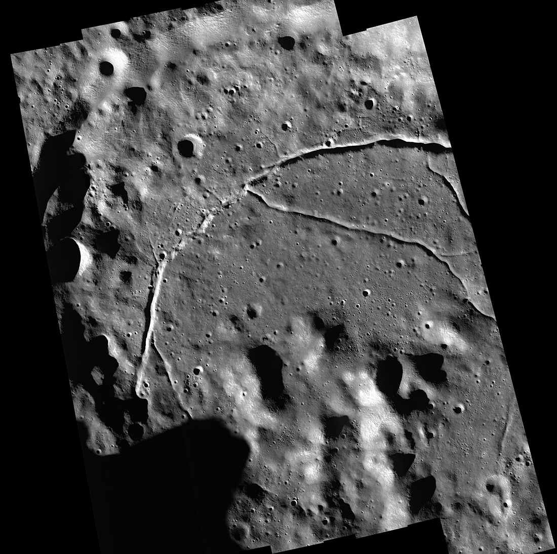
Karpinsky controlled mosaic features a farside floor-fractured crater. Here we can see the fractures really clearly!
Controlled Feature Mosaics help scientists to better understand lunar surface features by providing both details and the context in which they occur. Feature Mosaics are ideal for detailed studies of landforms larger than 5 m, geologic mapping, hazard analysis, crater counting, video visualization, and many other applications.
Download some awesome Feature Mosaics for yourself:
Messier Crater
Alphonsus Eastern Vents
Vallis Schröteri-Cobra Head
Aristarchus Crater
Mare Moscoviense
Related Featured Images:
Diversity of Basaltic Lunar Volcanism
Copernicus Seen Lookins Straight Down
The West Side of Plato Crater
High Resolution Maps of the Moon
Stay Tuned for more posts featuring Feature Mosaics finished here at Arizona State University!
Published by Anna Martin on 16 March 2020