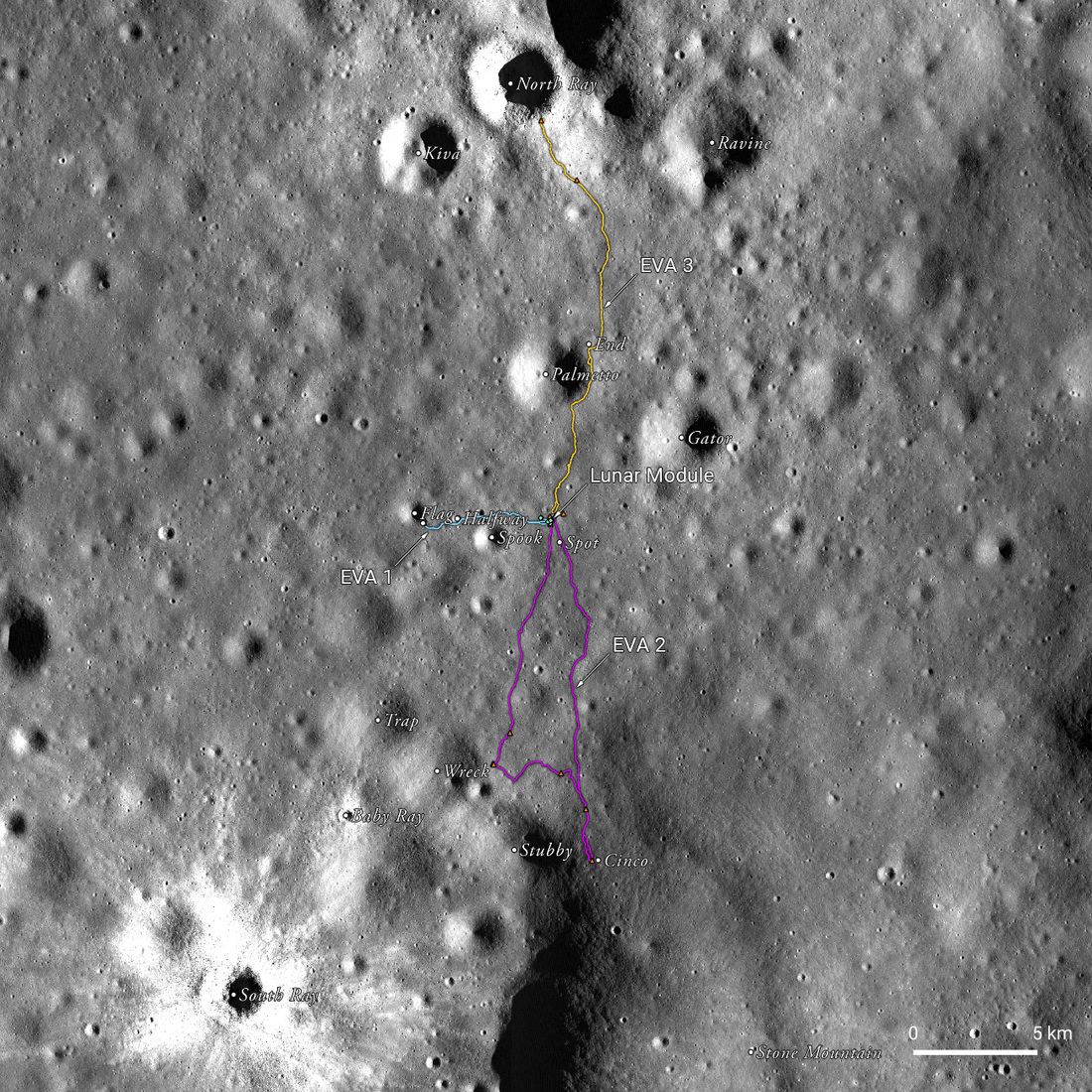
Fifty years ago today, on 20 April 1972, Apollo 16 astronauts John W. Young and Charles M. Duke Jr. became the ninth and tenth humans to walk on the Moon after setting down the Lunar Module (LM) Orion into unexplored lunar territory. While all but one of the previous Apollo missions landed on flat, dark plains of a lower elevation, called the lunar maria, this was the first mission to land in the lunar highlands, which make up about 83 percent of the lunar surface. Here, NASA hoped to find evidence of a different, much older type of volcanism than that which formed the maria. Additionally, the astronauts and their rover were put through a serious workout as they traversed some of the roughest landscapes yet encountered by lunar explorers.
Soon after Orion undocked from the Command Module Casper, Command Module Pilot (CMP) Thomas Mattingly II, LM Pilot (LMP) Charlie Duke, and Commander (CDR) John Young faced a potentially devastating issue. Duke and Young were already aboard Orion, ready to descend to the lunar surface, when Mattingly, alone in the command module, realized that something was amiss with the Service Module Propulsion System (SPS); the SPS vibrated alarmingly when Mattingly tested its gimbaling action. The astronauts relied on the SPS to boost them out of lunar orbit and would be marooned in orbit if it failed. For hours, mission control deliberated while Orion and Casper flew together in formation around the Moon. Finally, the decision came in: surface operations were a go for the following mission day, but with significant changes to the planned time frame to account for the lost time and to provide a buffer in case of further problems. The next day, Young and Duke descended to the surface in the LM from a higher altitude than in previous missions due to the technical delays. Nevertheless, the astronauts arrived at a point just 270 m north and 60 m west of their planned landing site between two young impact craters, North Ray and South Ray craters.
Surface operations began the next day with the setup of the scientific equipment before the astronauts turned the rover west. As they headed out on their first EVA, Young and Duke quickly began to suspect that the surface they were traversing was not, in fact, ancient volcanic material. The astronauts underwent significant geologic field training, much of it in volcanic landscapes. Fortunately, though, they also trained in non-volcanic sites. The geology team at ground control trusted the astronauts' judgment when they identified virtually every sample as not volcanic but instead impact breccia (a kind of rock made of soil and rock fragments welded together by impacts). The dominance of breccias in the landscape showed that the site derived from impact cratering rather than volcanism.
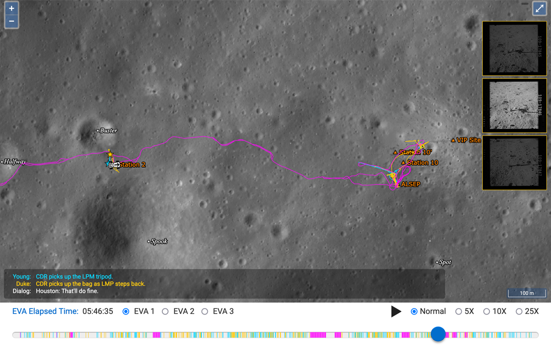
Follow along with Young and Duke on their exploration using the LROC team's new spatiotemporal map of Apollo 16!

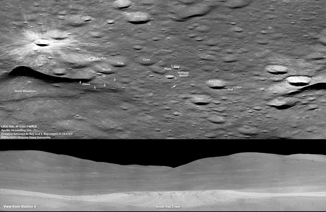
EVA2 took the astronauts to the highest vantage point that any human has yet reached on the lunar surface. As Young and Duke ascended the steep slopes of Stone Mountain, they looked southwest over a "spectacular" landscape dominated by South Ray, a blocky young crater with bright rays of ejecta stretching out in all directions. Because the astronauts hoped to sample material from the Descartes formation, they wanted to find samples that did not originate from the South Ray event. Again, however, they found a landscape dominated by breccias as they traveled between Stone Mountain, Wreck crater, and back north to the LM.

EVA3, on the final day, took them on a northern route to the rim of North Ray crater. This traverse was their last chance to find ancient volcanic material, and North Ray, as a relatively large, young crater, was a promising candidate. Satellite photos showed huge boulders scattered over its rim and slopes excavated from deep within the underlying rocks by the crater-forming impact. However, Young and Duke would have to hurry to get their samples: the time allotted to EVA3 had been truncated to just five hours to make up for the earlier mission delays.
As the rover approached the crater rim, the surface was smooth except for scattered boulders up to 5 meters in diameter. The astronauts eventually parked near the crest of North Ray crater and got out to collect samples and take images. They were hoping to see layering from lava flows in the crater walls, but instead, they found more impact breccias. North Ray crater is 240 m deep with steep (30-34°) walls – so steep that the astronauts were not able to see the crater floor from their position at the rim. This depth exposed long buried material (including some from the Descartes Formation), and samples from this site led scientists to eventually conclude that the dominant geologic units excavated by North Ray were formed from basin ejecta rather than volcanism.
As Young and Duke took samples and imagery from the rim of North Ray, they could see a very large black boulder called House Rock about 200 meters from the crater rim. Since they couldn’t see the bottom of the crater, sampling this rock was their best chance to bring back a piece of this deep material. House Rock ended up being about 12 m tall and 16 by 20 meters across, or the height of a three story building! While House Rock was dark like basalt, it was quickly identified as being yet another breccia.
![Handheld image taken by Duke showing Young near the smaller attached boulder "outhouse" rock and "House" rock on the right. Apollo image AS16-106-17354 [NASA]](/ckeditor_assets/pictures/1166/content_AS16-106-17354HR.jpg)
The samples taken from House Rock provided a final piece of evidence that this landscape was not the result of volcanic activity.
Although Apollo 16 did not retrieve the ancient volcanic rocks that NASA geologists hoped for, this unexpected result was potentially even more valuable. The breccias retrieved by Young and Duke showed that geologists had underestimated the role of meteorite impacts in the highlands’ evolution, while volcanic processes were much less prevalent than expected in these areas. The Apollo 16 results demonstrated the key role that humans can play in lunar exploration. The interpretations of satellite data, while based on multiple lines of evidence, were simply incorrect. The science return was enabled by visiting the surface, looking, and returning home with samples.
Young and Duke lifted off to rejoin Mattingly in the Command Module after about 71 hours on the Moon’s surface. They retrieved over 95 kg of lunar samples and data from various scientific experiments. Scientists still use these samples to untangle the complicated processes that formed the lunar highlands.
For more Apollo 16, check out this video from the LROC team!
Explore the other temporal traverses here:
Apollo 11
Apollo 12
Apollo 14
Apollo 15
Learn more about Apollo 16 with these related featured image posts:
Astronaut's Eye View of Apollo 16 Site
Orion, Up Close
How Young is Young?
Apollo 16, Footsteps Under High Sun
John Young at South Ray Crater
Found! Apollo 16 S-IVB Impact Crater
Published by Madeleine Manheim on 20 April 2022