Featured Images
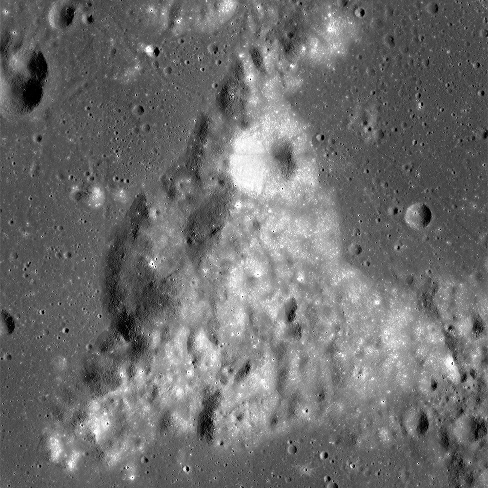
Mt. Marilyn: Navigating to the Surface
NAC mosaic of Mt. Marilyn, a key navigation landmark during the Apollo 11 Moon landing, scene is 30 km wide.
Published on 04 Jan 2016
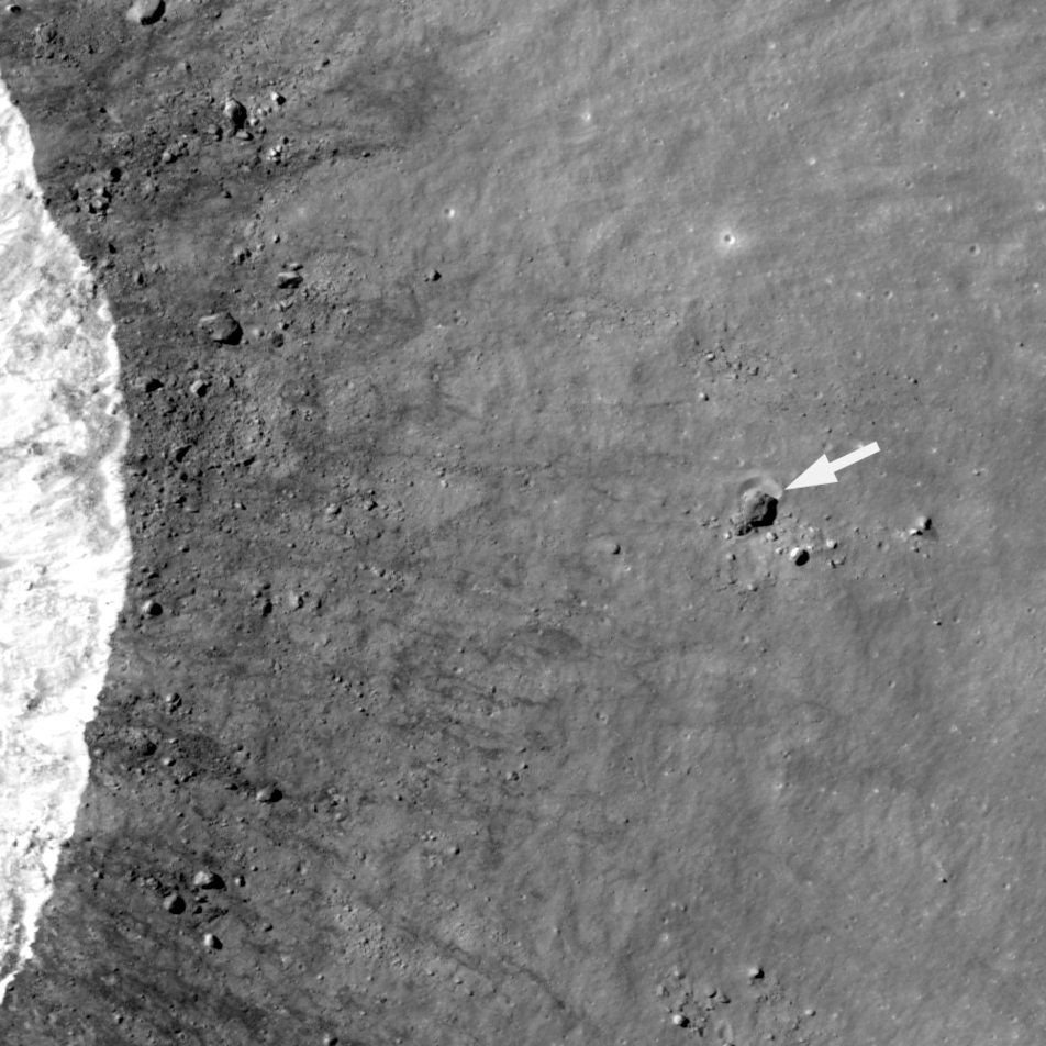
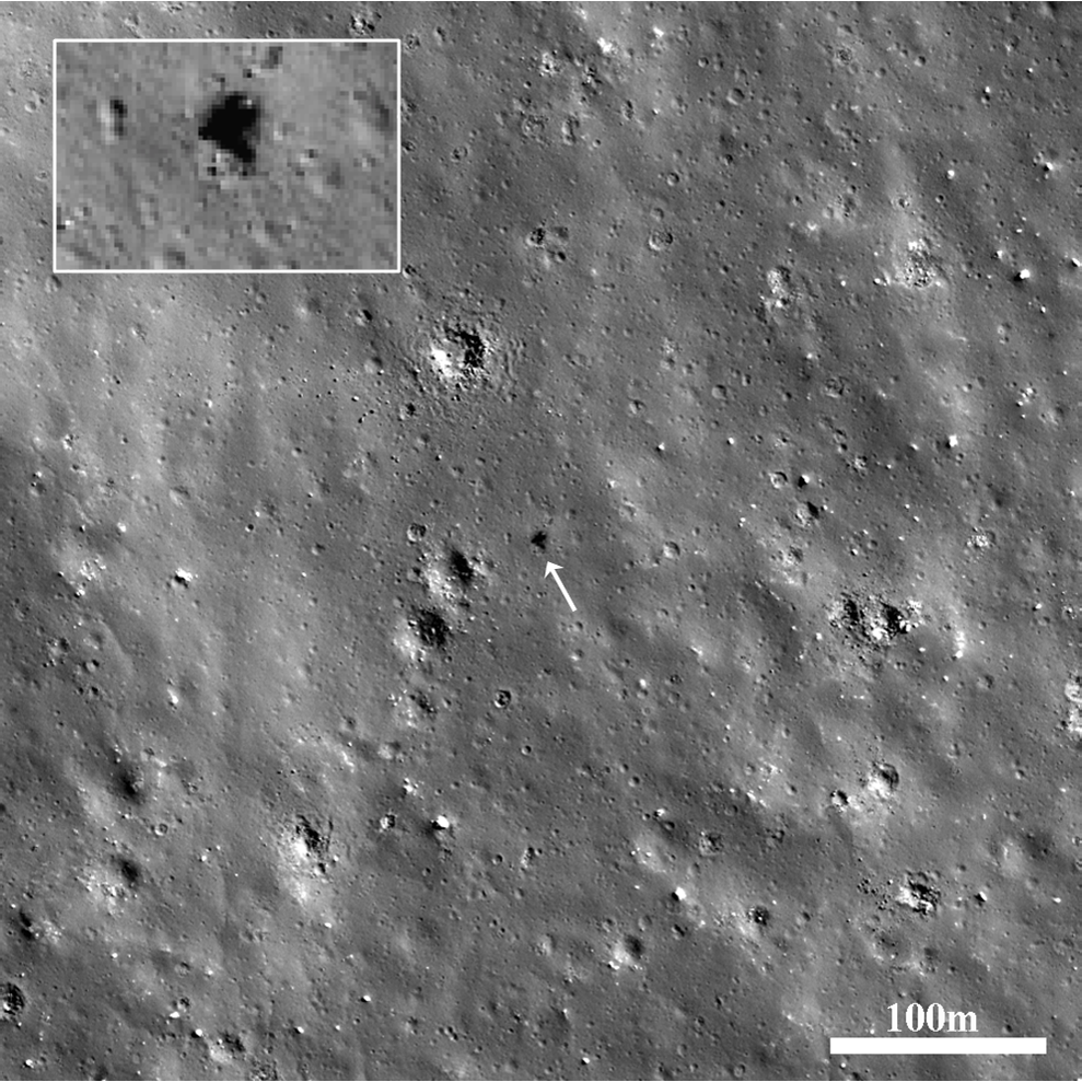
Small Step or Giant Leap?
A house-sized boulder (more than 30 m in diameter) left a clear impression (arrow) in the lunar surface. This boulder was thrown a relatively short distance (500 m) to the east of a young 1.6-km crater (rim crest to the left); LROC NAC...
Published on 21 Jul 2014
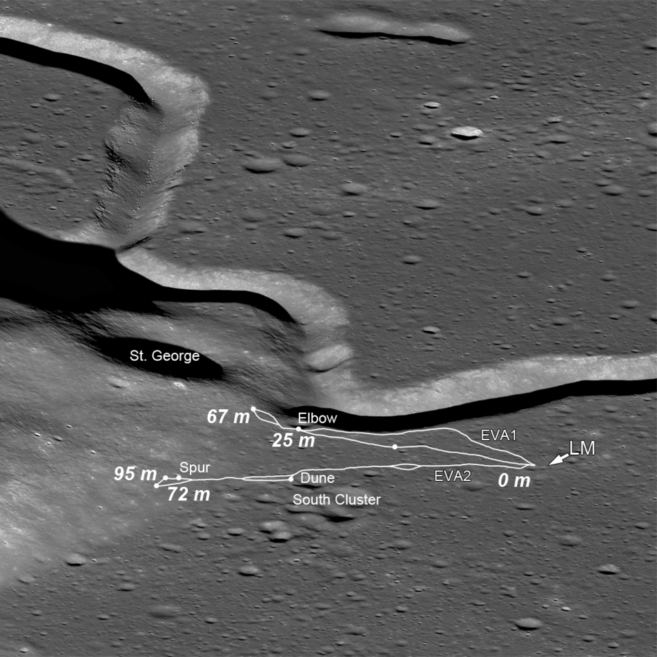
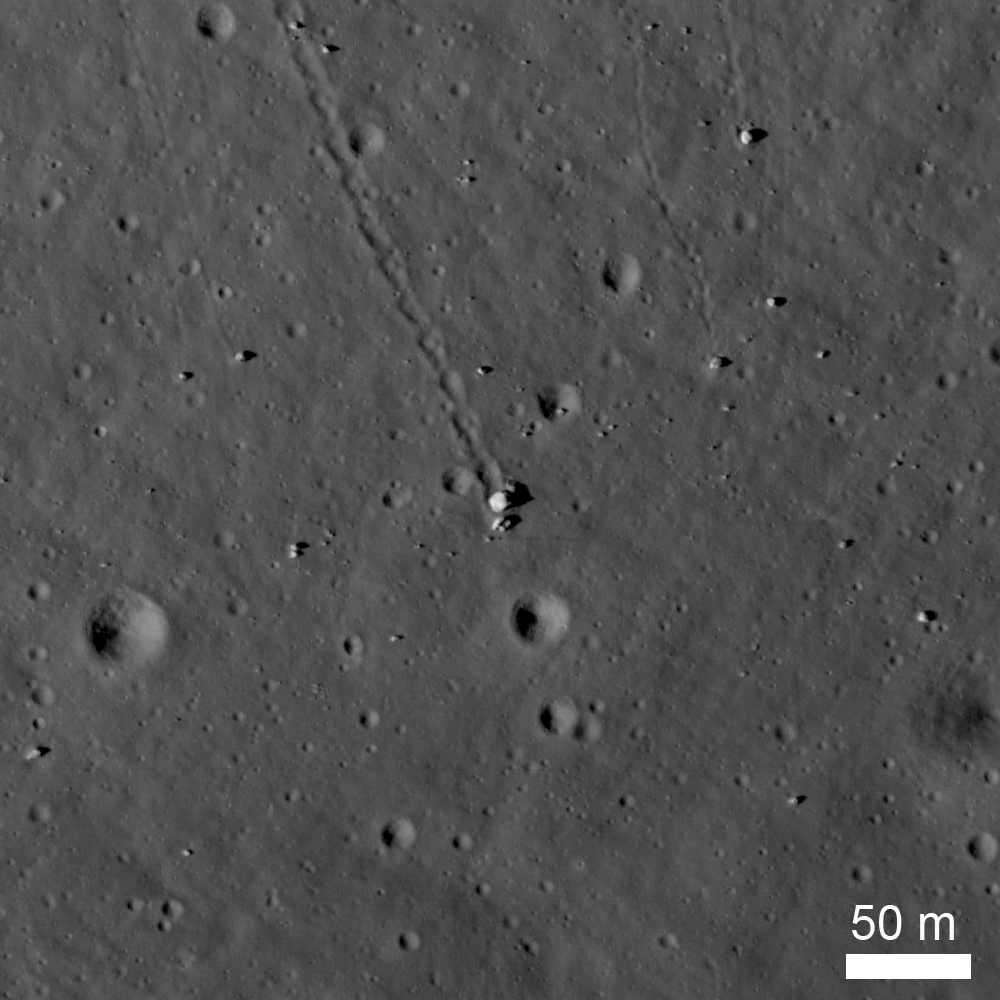
The Original Interplanetary Mountaineers
Traverse plots of the first two Apollo 15 EVAs, on which astronauts Scott and Irwin ventured to the lower slopes of Mons Hadley Delta (center left); numbers indicate elevations above the landing site (LM) (oblique LROC NAC M1123519889;...
Published on 20 Jun 2014
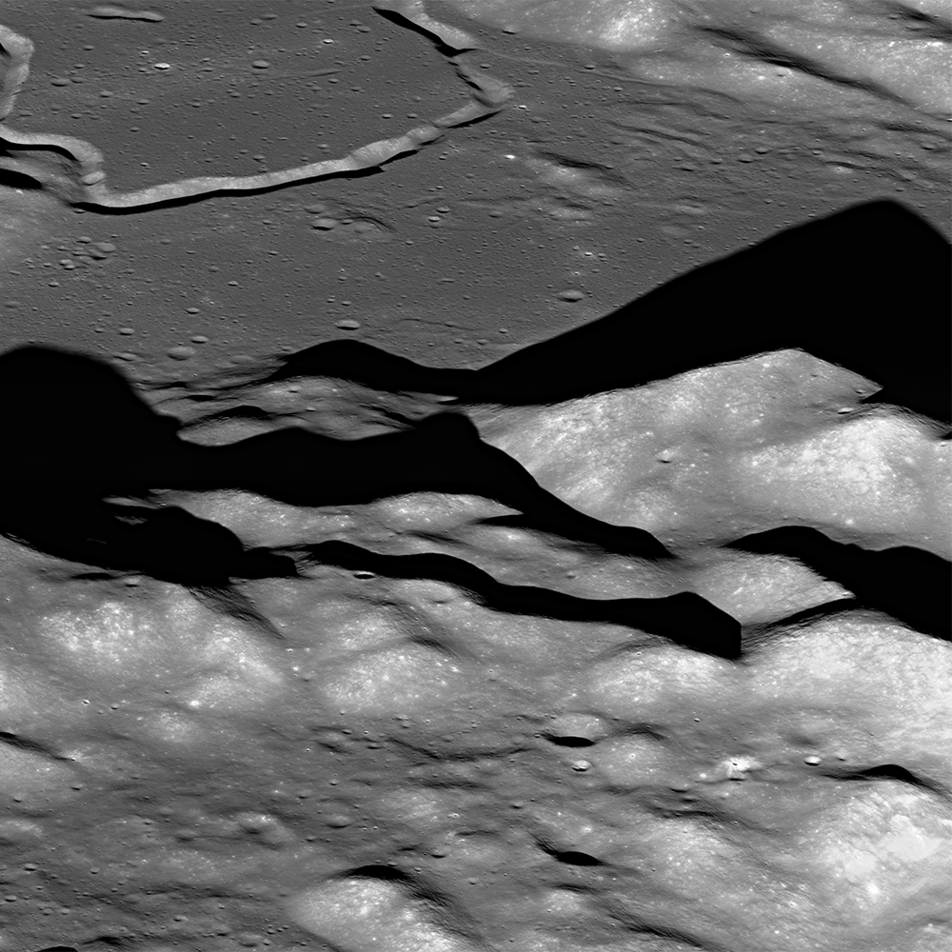
Soaring Over Mighty Mt. Hadley
An oblique view, looking east-to-west over the Apennine Mountains towards Hadley Rille (upper left) (LROC NAC M1123519889, north is to the right). A long shadow is cast by mighty Mt. Hadley (center right). Nestled between the Apennines...
Published on 18 Jun 2014
Station 6 - Apollo 17
Station 6 allowed Apollo 17 astronauts to explore a collection of boulders and regolith that represents the rocks from the mighty North Massif. Five large boulder fragments lie at the base of a long boulder trail, all from a single...
Published on 13 Dec 2013
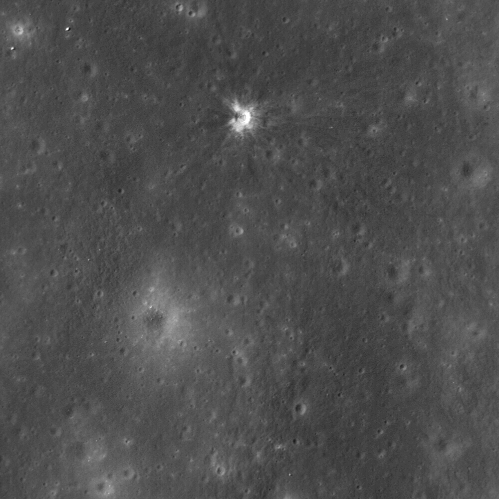
Making an Impact on History
LROC NAC image (M153014430L) of the Ranger 7 impact crater (bright crater near top center) in Mare Cognitum located at 339.323°E, 10.634°S. The crater is 14 meters in diameter; image width is 400 m. [NASA/GSFC/Arizona State University].
Published on 07 Nov 2013
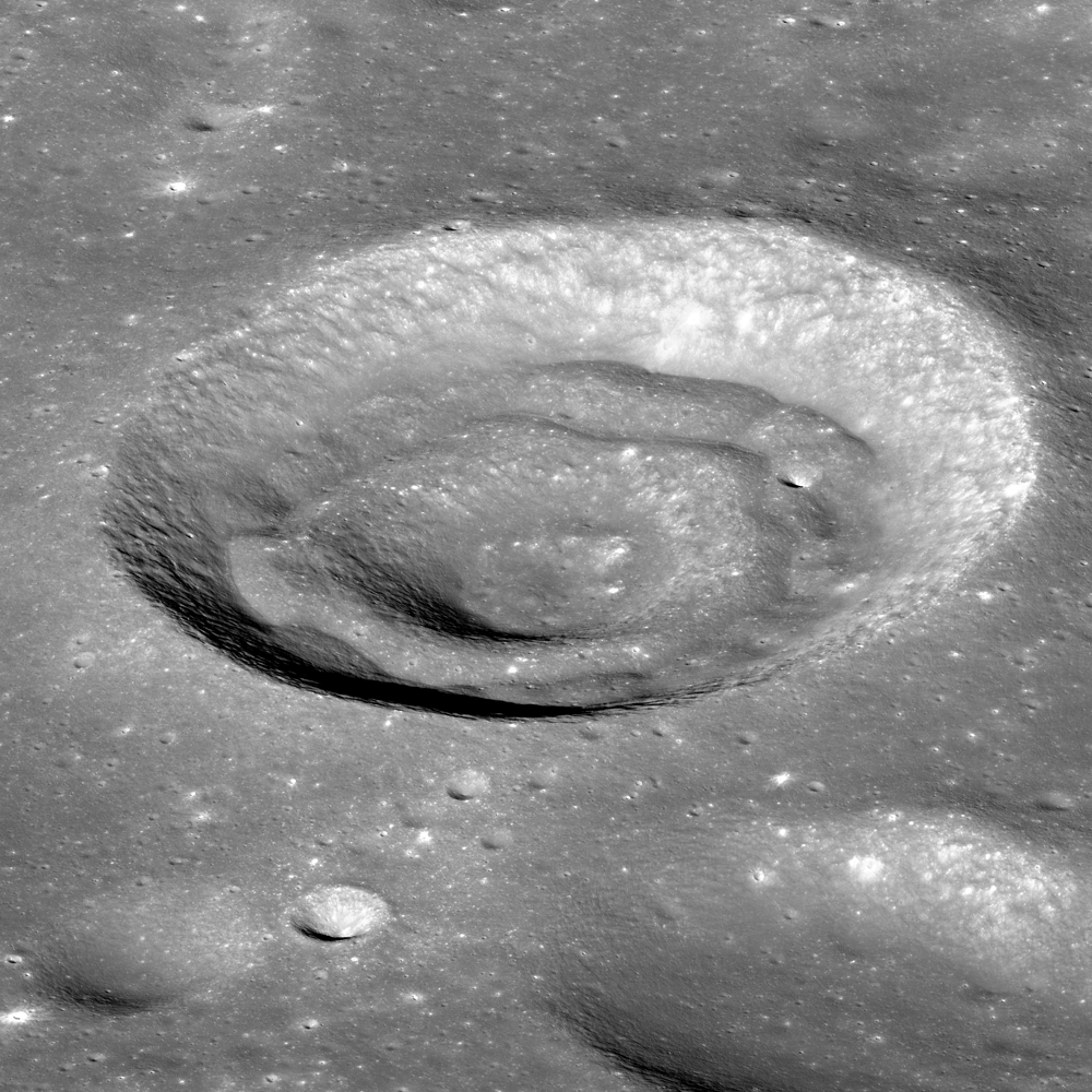
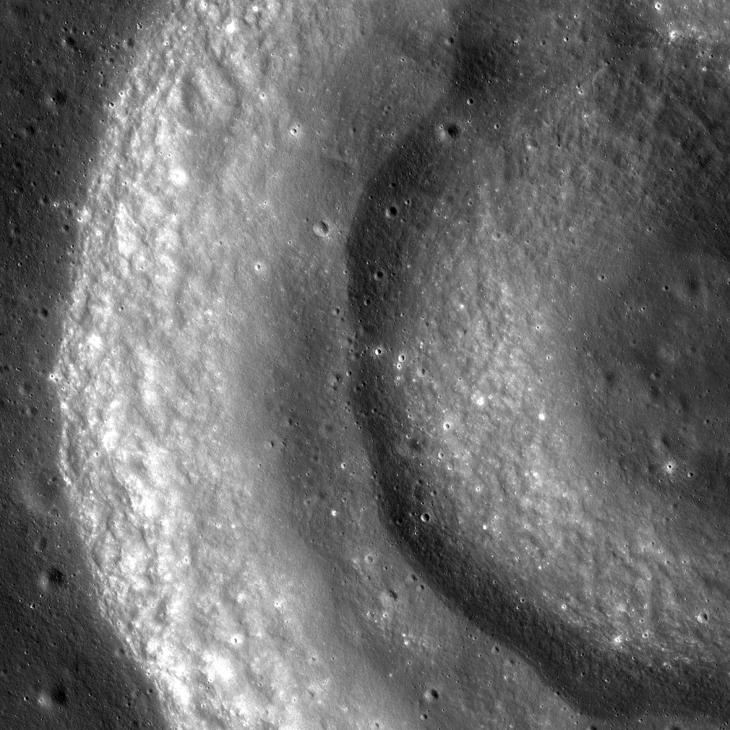
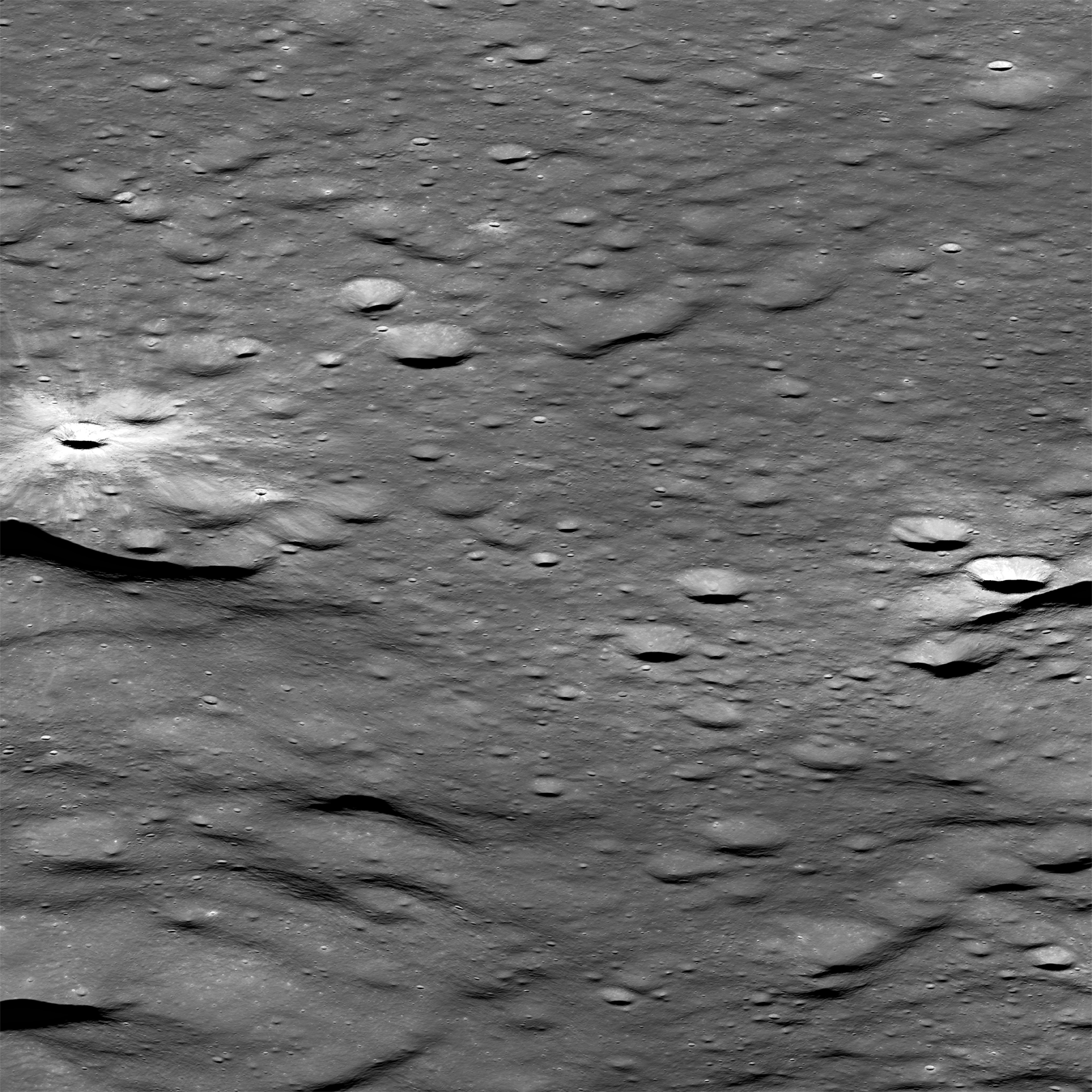
Oblique Image of Concentric Crater
Oblique view of an unnamed concentric crater located in Apollo Basin. The crater has a diameter of 11.5 km, north is to the left. LROC NAC images M1097537923L & R [NASA/GSFC/Arizona State University].
Published on 13 Aug 2013
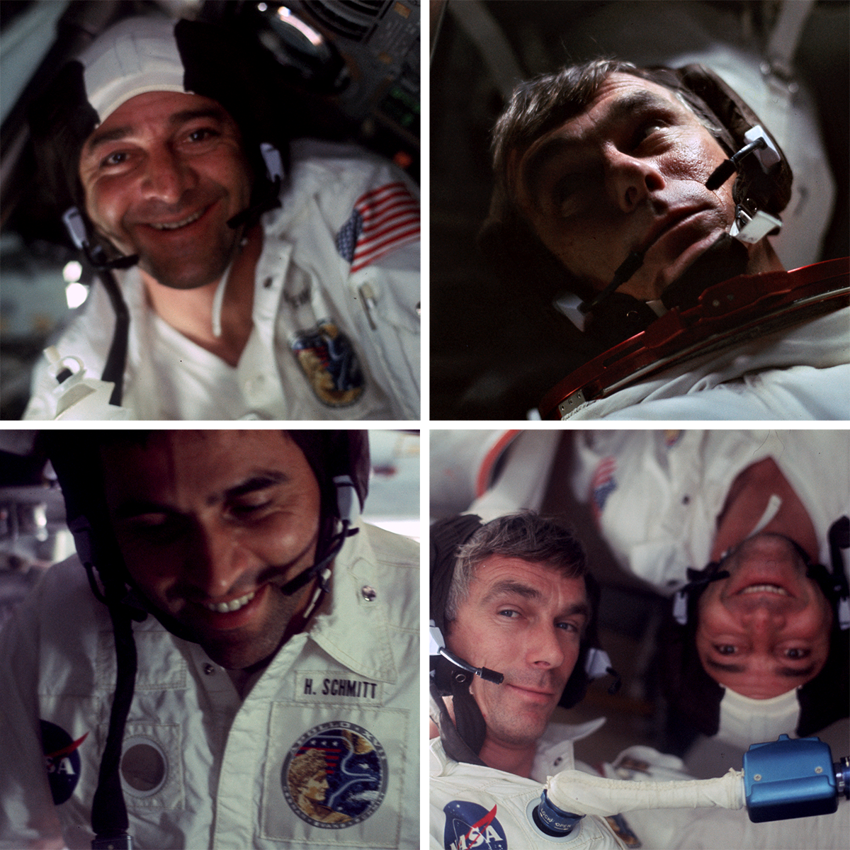
Snapshots From Space
Astronaut Cernan (UR, LR), Evans (UL, LR) and Schmitt (LL) relaxing in the Apollo 17 Command Module America after Cernan and Schmitt returned from three days of exploring the magnificent Taurus Littrow valley [NASA/ Arizona State...
Published on 25 Jul 2013
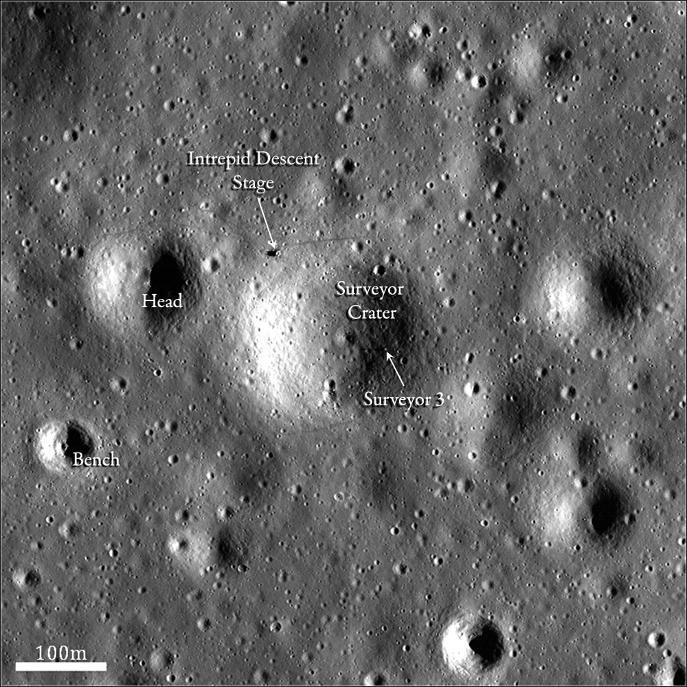
Surveyor Crater, Before and After
Another look at the Apollo 12 and Surveyor 3 landing site. See the full description for comparison with a Lunar Orbiter image of the same area taken 45 years ago! Image width is 470 meters [NASA/GSFC/Arizona State University].
Published on 09 Jul 2013
Concentricity in Apollo Basin
Portion of a concentric crater in Apollo Basin. Sun is incident from the right to the left. LROC NAC mosaic M1122245918LR, image width is 6.3 km [NASA/GSFC/Arizona State University].
Published on 22 May 2013
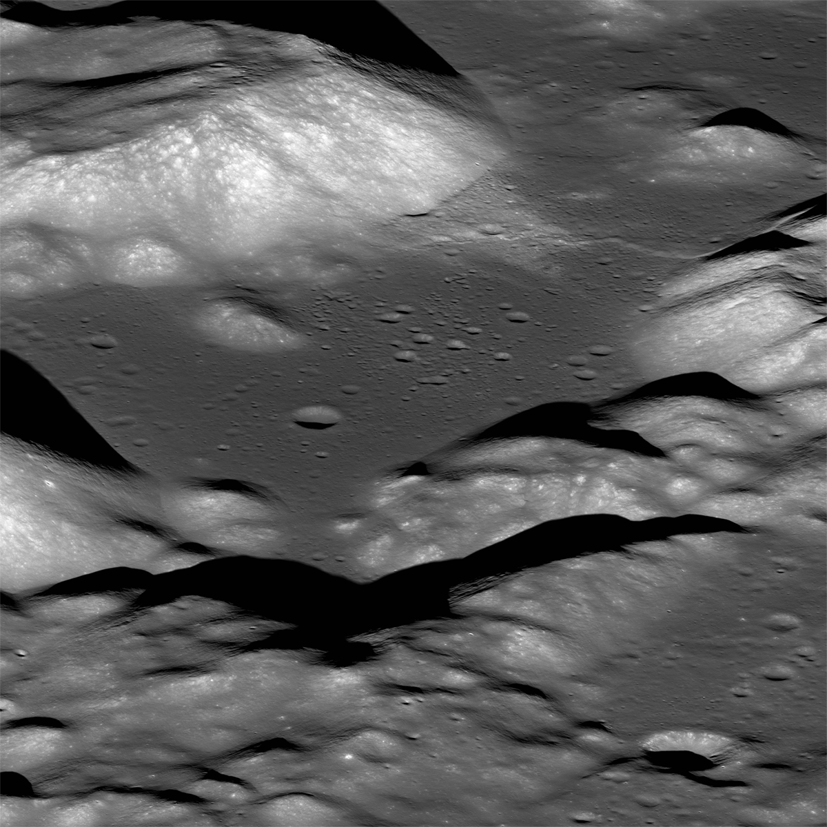
Taurus Littrow Valley, West-To-East
The magnificent Taurus Littrow valley seen obliquely from west-to-east by the LROC NAC. The Apollo 17 crew briefly explored portions of this valley 40 years ago this month. M1096343661LR, image ~10 km across the center...
Published on 19 Dec 2012
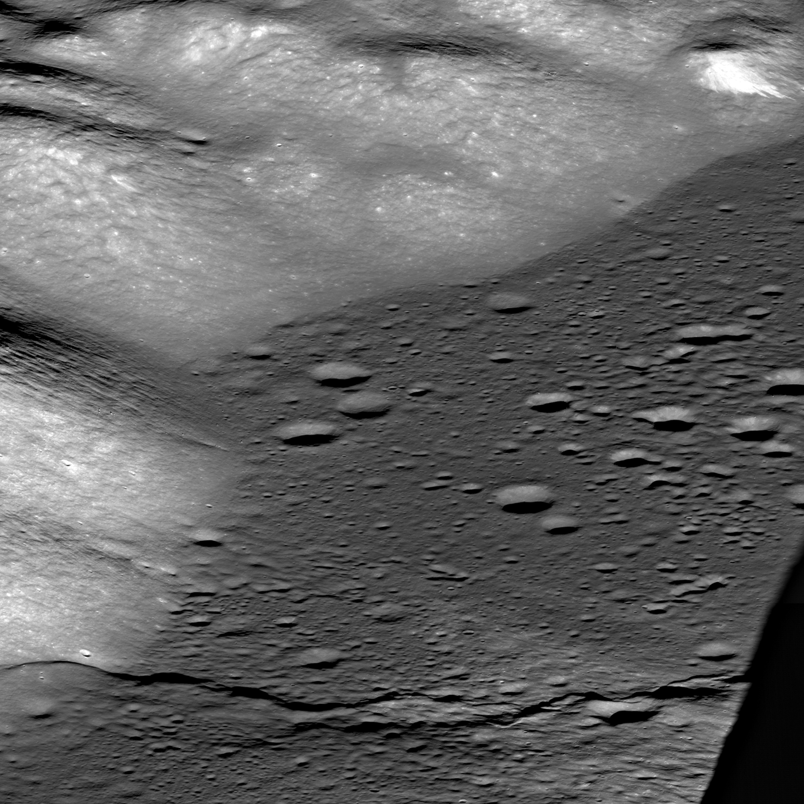
Approach to Taurus Littrow Valley
View similar to what the Apollo 17 astronauts saw as they approached their landing in the magnificent Taurus Littrow Valley. LROC NAC east-to-west oblique image pair, about 18 km wide in center, M192703697LR [NASA/GSFC/Arizona State...
Published on 12 Dec 2012
Surveyor 7 - America's Last Lunar Unmanned Lander
Surveyor 7, sitting on the ejecta blanket of Tycho Crater, was the last spacecraft of the Surveyor series, and the only to land in the lunar highlands. NAC M175355093L, image width is 500 m. Inset is zoomed 4x [NASA/GSFC/Arizona State...
Published on 07 Sep 2012
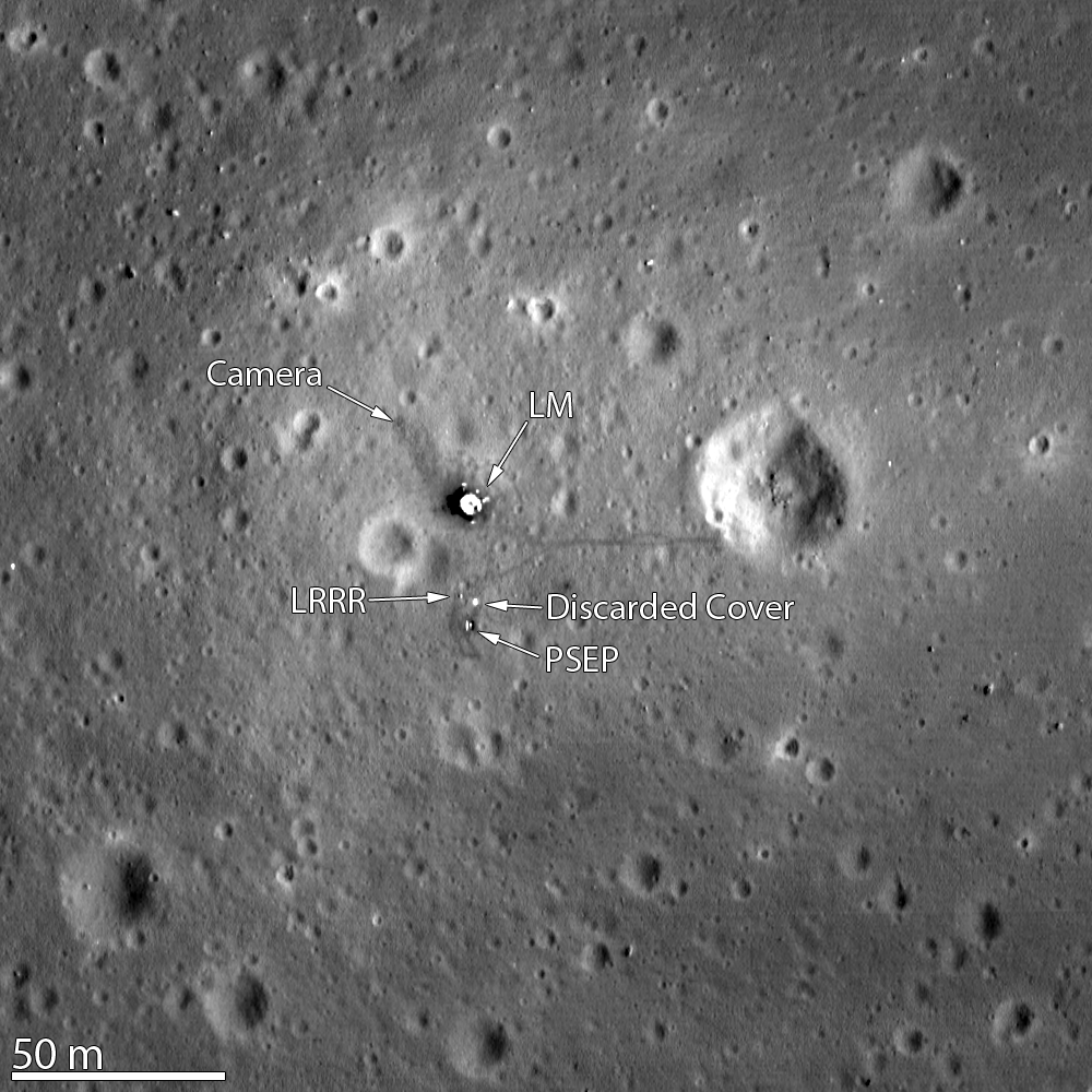
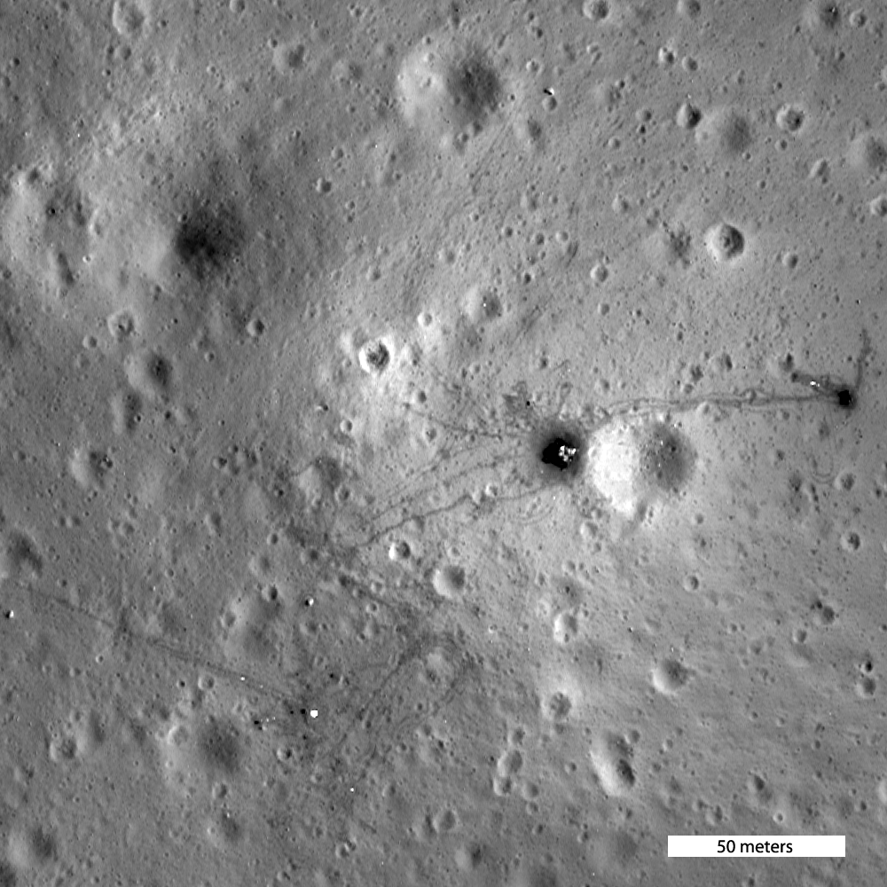
"Houston, Tranquility base here."
Apollo 11 landing site, as Armstrong and Aldrin left it some 43 years ago, LROC M175124932R [NASA/GSFC/Arizona State University].
Published on 27 Aug 2012
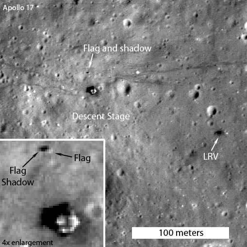
Question Answered!
LRO slewed 19° down-Sun allowing the illuminated side of the still standing American flag to be captured at the Apollo 17 landing site. M113751661L [NASA/GSFC/Arizona State University].
Published on 27 Jul 2012
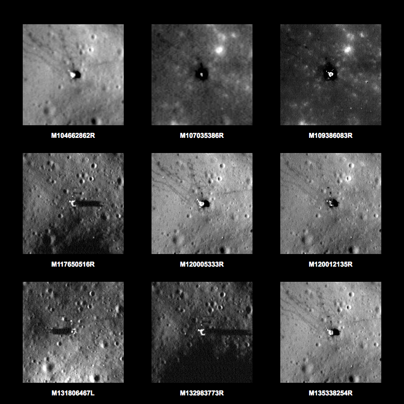
A New Tool For Exploring NAC Images!
New tool! Explore the Apollo landing sites using LROC images! Nine views of the Apollo 12 landing site [NASA/ASU/Arizona State University].
Published on 19 Jul 2012
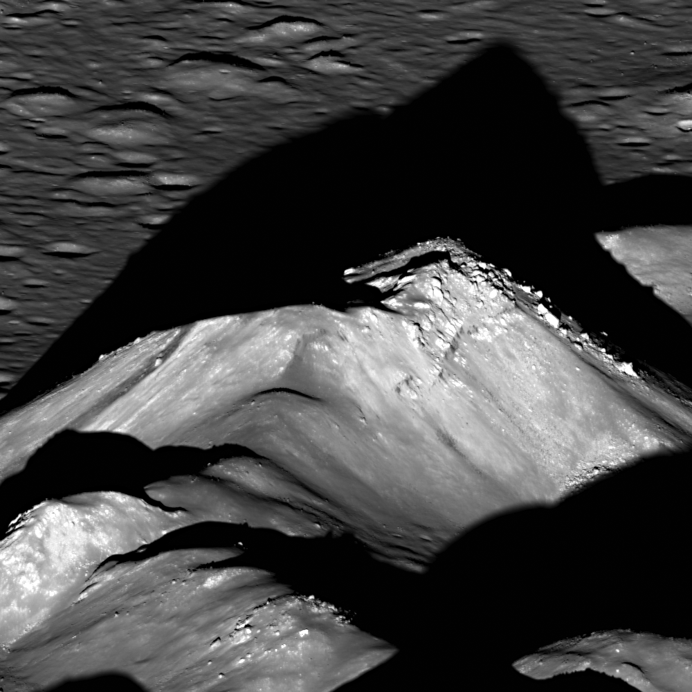
Copernicus Central Peak
Copernicus crater central peak casts a long shadow to the west over a crater floor that was flooded with impact melt that cooled and hardened to form this spectacular landscape. LROC NAC M193025138LR, image width is 1350 m...
Published on 27 Jun 2012
Astronaut's Eye View of Apollo 16 Site
Oblique LROC NAC image of the Apollo 16 landing site, viewpoint is east to west. South Ray crater is center left and North Ray crater is center right, distance between two crater centers is 10.5 km. LROC NAC M192817484LR...
Published on 19 Jun 2012
Orion, Up Close
Low orbit view of Apollo 16 landing site, image width 250 meters, M175179080 [NASA/GSFC/Arizona State University].
Published on 23 Apr 2012
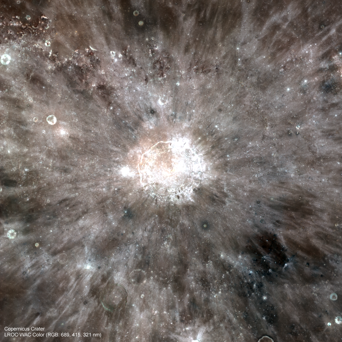
Absolute Time
LROC Wide Angle Camera (WAC) visible to ultraviolet portrait of Copernicus crater, image 458 km wide [NASA/GSFC/Arizona State University].
Published on 19 Mar 2012