Permanently lit and permanently dark places at the lunar poles are ideal places for exploration and lunar resource development. Permanently Shadowed Regions (PSRs) are the only places on the Moon that may contain water ice. Water is essential for life support. It can also be split into hydrogen and oxygen to make rocket fuel using solar power generated in nearby lit regions. Before we begin planning lunar polar exploration traverses and ice-mining bases, however, we need good maps.
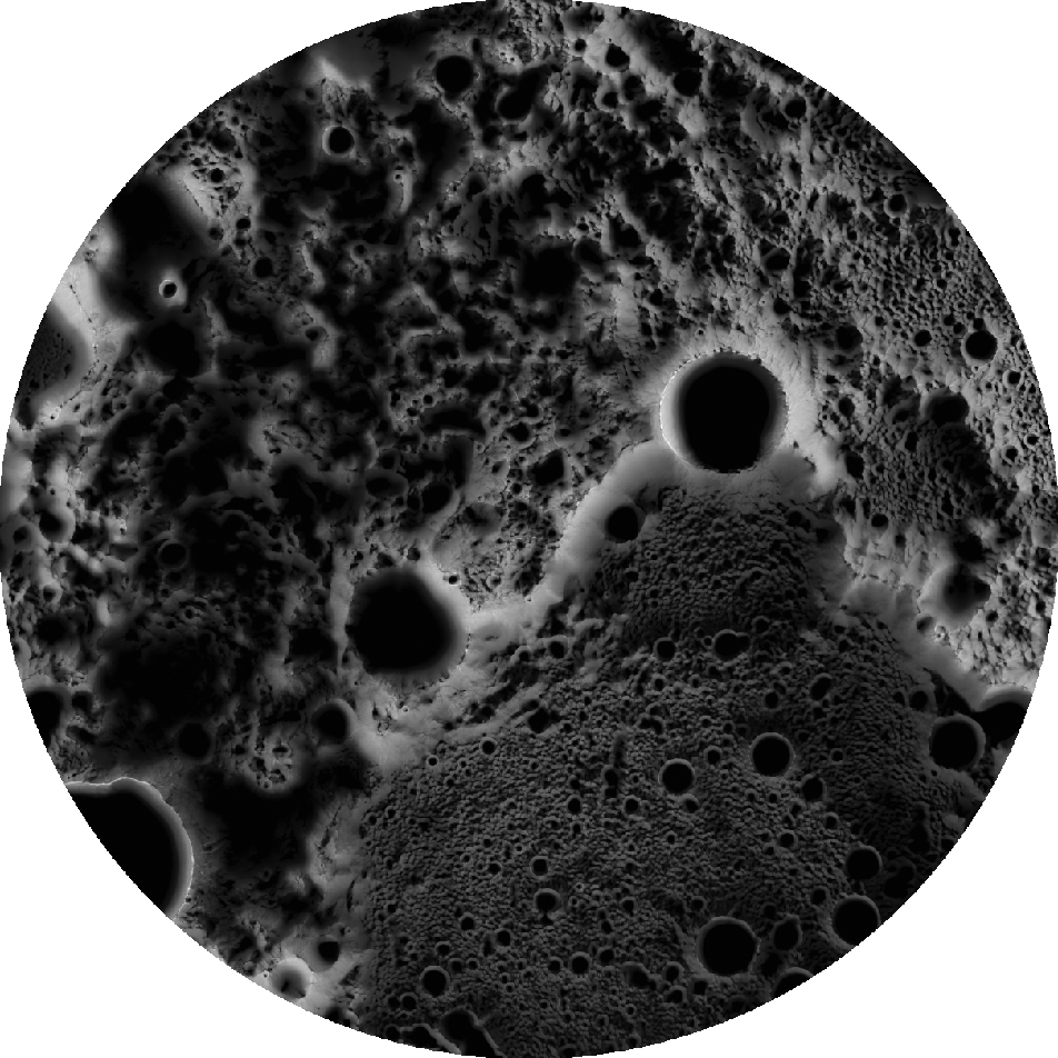
Two types of polar illumination maps are displayed here: percentage-based maps and time-weighted maps. The initial steps for making both map types are identical; first, 3548 LRO north pole images and 3807 south pole images were processed so that any pixels receiving illumination were set to one (white) and any pixels in shadow were set to zero (black). This created a set of binary images.
For the percentage-based illumination maps, the value of of each pixel was determined by stacking all the binary images and determining for what percentage of time that pixel was illuminated. Pixel stacks containing a high percentage of illuminated pixels indicated areas that were more often lit by the Sun than pixel stacks containing a high percentage of dark pixels.
The time-weighted illumination maps are more complicated. LROC Wide-Angle Camera (WAC) images used for making these maps were not taken during some orbits, resulting in unequal spacing of observations throughout the lunar year. To compensate for the missed observations, binary images acquired during periods when imaging was skipped during many orbits were more heavily weighted than those acquired when imaging occurred during many consecutive orbits. The weighted and non-weighted binary images were then stacked to calculate the percentage of time a pixel was illuminated.
Rovers and instruments that could explore these regions would normally rely on solar power and batteries for power. Even in places near the poles that receive some sunlight, it is necessary to understand how much sunlight they receive so that a rover does not accidentally become stuck in the dark long enough to run down its batteries. For more information on polar rover traverses, see Lunar Exploration: Planning the Next Steps.
Discover more about how these maps were created: Speyerer, E. J., & Robinson, M. S. (2013). Persistently illuminated regions at the lunar poles: Ideal sites for future exploration. Icarus, 222(1), 122-136. doi:j.icarus.2012.10.010
You can download and explore the new illumination maps:
- WAC Time-Weighted North Pole Illumination Map
- WAC Time-Weighted South Pole Illumination Map
- WAC Percentage-Based North Pole Illumination Map
- WAC Percentage-Based South Pole Illumination Map
Other RDRs include five new Narrow Angle Camera (NAC) Digital Terrain Models (DTMs) and one new region of interest mosaic:
- Cones North of T Mayer DTM
- Mount Marilyn DTM
- Mare Ingenii Swirls DTM
- Kepler Cones DTM
- Nubium IMP DTM
- Balmer Basin (low-Sun) ROI
Two NAC DTMs were updated to improve their accuracy:
Finally, shapefiles were updated to include new observations and data products:
- NAC Digital Terrain Model Shapefile
- Stereo Observations Shapefile
- Featured Mosaic Observation Shapefile
Explore these time-weighted illumination maps at full resolution! Which areas do you think are almost always illuminated? Permanently in shadow? Where would you choose to land in order to explore this fascinating landscape?
North Pole Time-Weighted Map
South Pole Time-Weighted Map
Related Posts:
Lunar Exploration - Planning the Next Steps
High Resolution Maps of the Moon
'Shaping' Lunar Science with Vector Data
Published by Megan Henriksen on 12 January 2018