The Apollo "J" missions were designed to allow the crews to stay and work longer on the Moon's surface and included a Lunar Rover so they could explore several kilometers away from the Lunar Module. Hadley Rille and the Apennine Mountains provided a dramatic backdrop for the first Apollo "J" mission. This landing site presented Apollo 15 Commander Dave Scott and Lunar Module Pilot Jim Irwin not only a spectacular view, but access to two key geologic features: a "young" volcanic sinuous rille and "older" highland massifs. These geologic features afforded a chance to sample different events from the Moon's geologic history: early crust formation and late stage volcanism. Over the course of 3 EVAs (Extra-vehicular Activities), Scott and Irwin covered a total distance of ~28 km (17.4 miles), collected ~77 kg (~170 lbs) of rock and soil samples, and spent 18.5 hours exploring the Moon's surface.
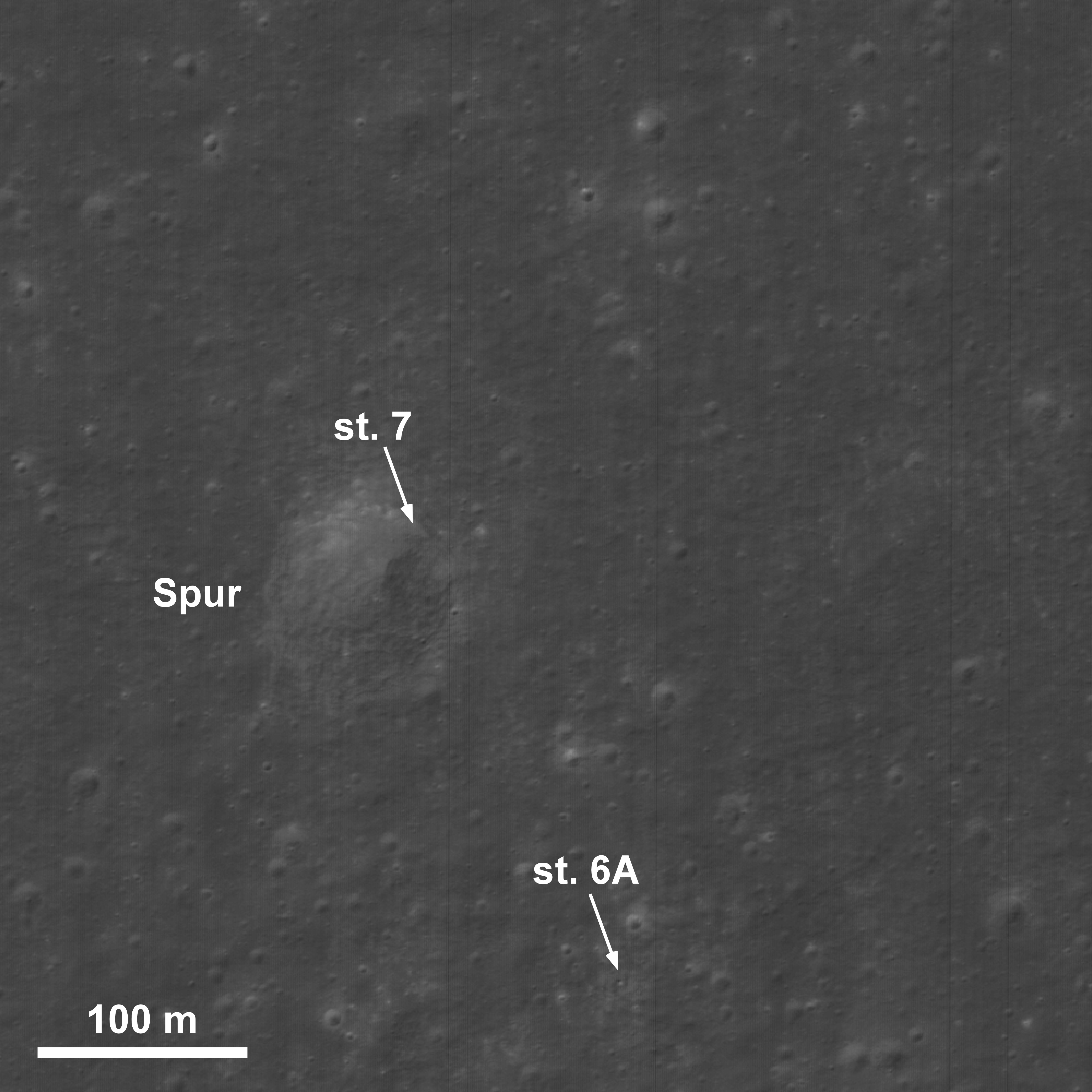
The LROC Narrow Angle Cameras (NAC) have provided 50 cm/pixel resolution images of the Apollo 15 landing site. In previous posts, we have shown the Lunar Module descent stage, Lunar Rover, ALSEP instruments, and darkened paths of regolith disturbed by the crew and the rover. Here, we focus what the crew did at two locations away from the landing site accompanied by excerpts from their voice transmission about their discoveries and observations.
EVA 2: Station 7 – Collecting the Genesis Rock
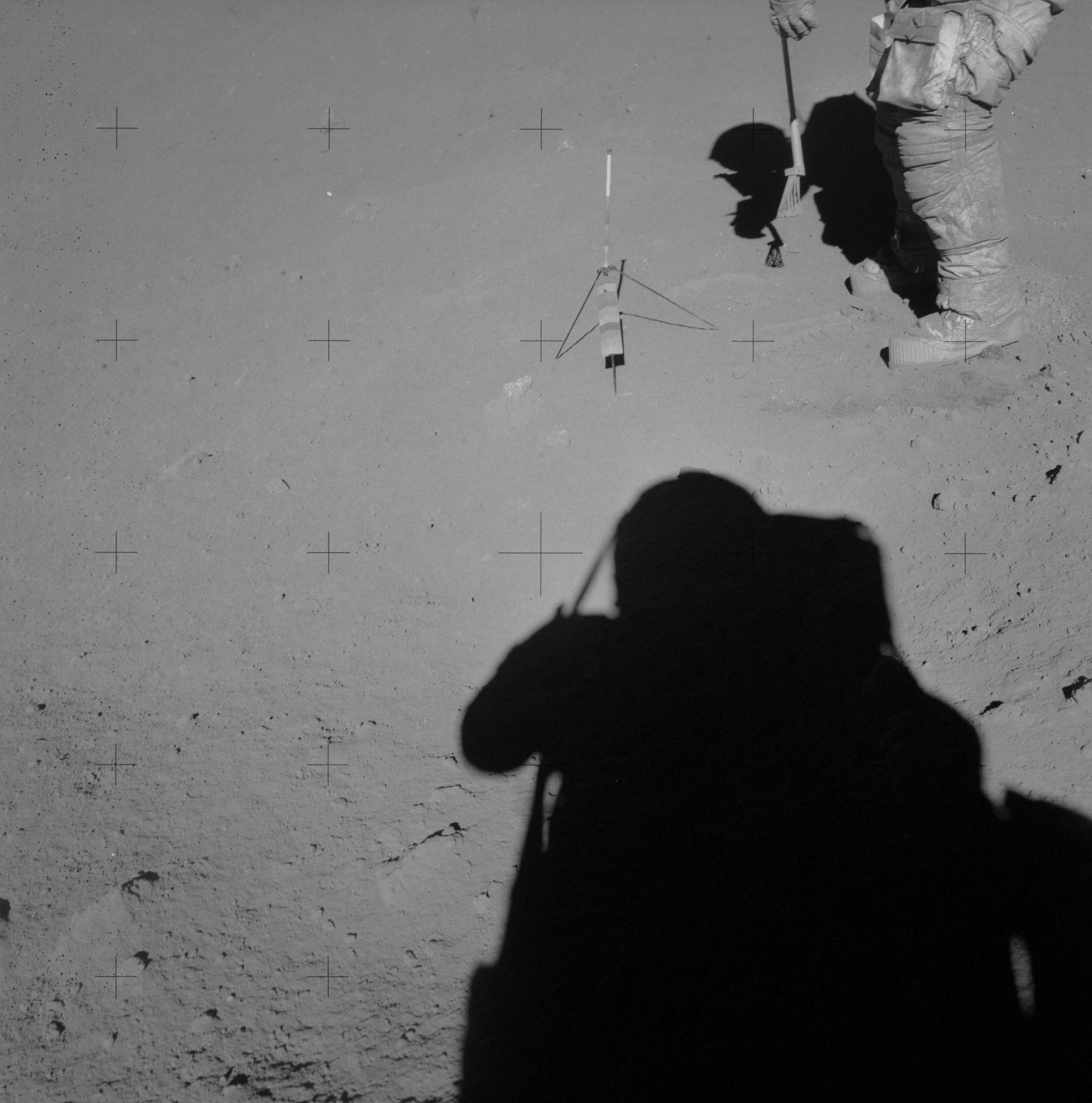
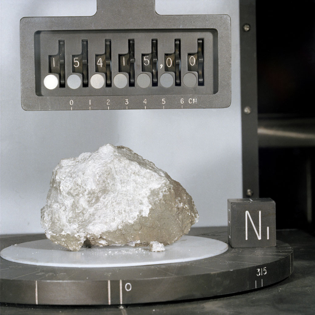
Station 7 was at Spur crater, a 90 m diameter impact crater on the slope of the massif to the south known as Mount Hadley Delta. The crew parked along the northeast part of the crater rim (on the downslope side) where they could sample the ejecta blanket. This station is famous for the collection of the Genesis Rock, a 4 billion year old sample of anorthosite representative of the original lunar crust. Their excitement of the discovery is evident in the transmission.
145:42:41 Irwin: Oh, man!
145:42:41 Scott: Oh, boy!
145:42:42 Irwin: I got...
145:42:42 Scott: Look at that.
145:42:44 Irwin: Look at the glint!
145:42:45 Scott: Aaah.
145:42:46 Irwin: Almost see twinning in there!
145:42:47 Scott: Guess what we just found. (Jim laughs with pleasure) Guess what we just found! I think we found what we came for.
145:42:53 Irwin: Crystalline rock, huh?
145:42:55 Scott: Yes, sir. You better believe it.
EVA 3: Station 9A - Observations of Hadley Rille
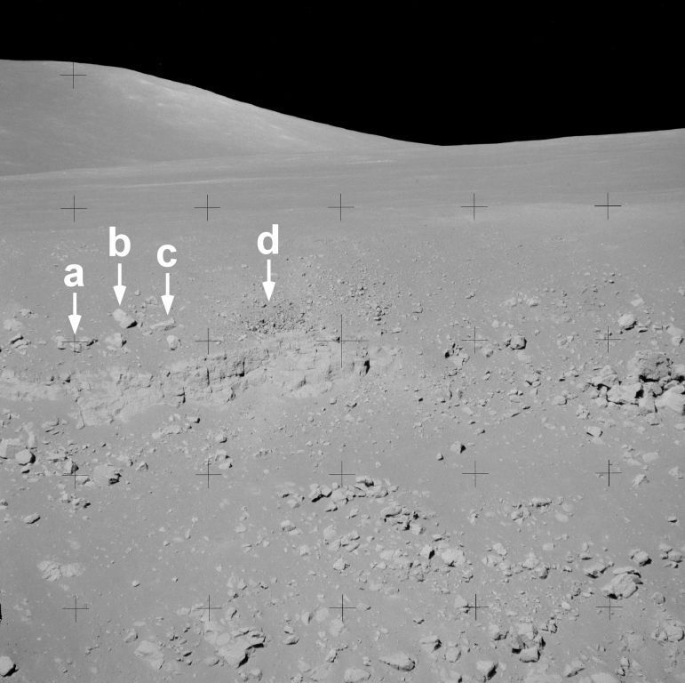
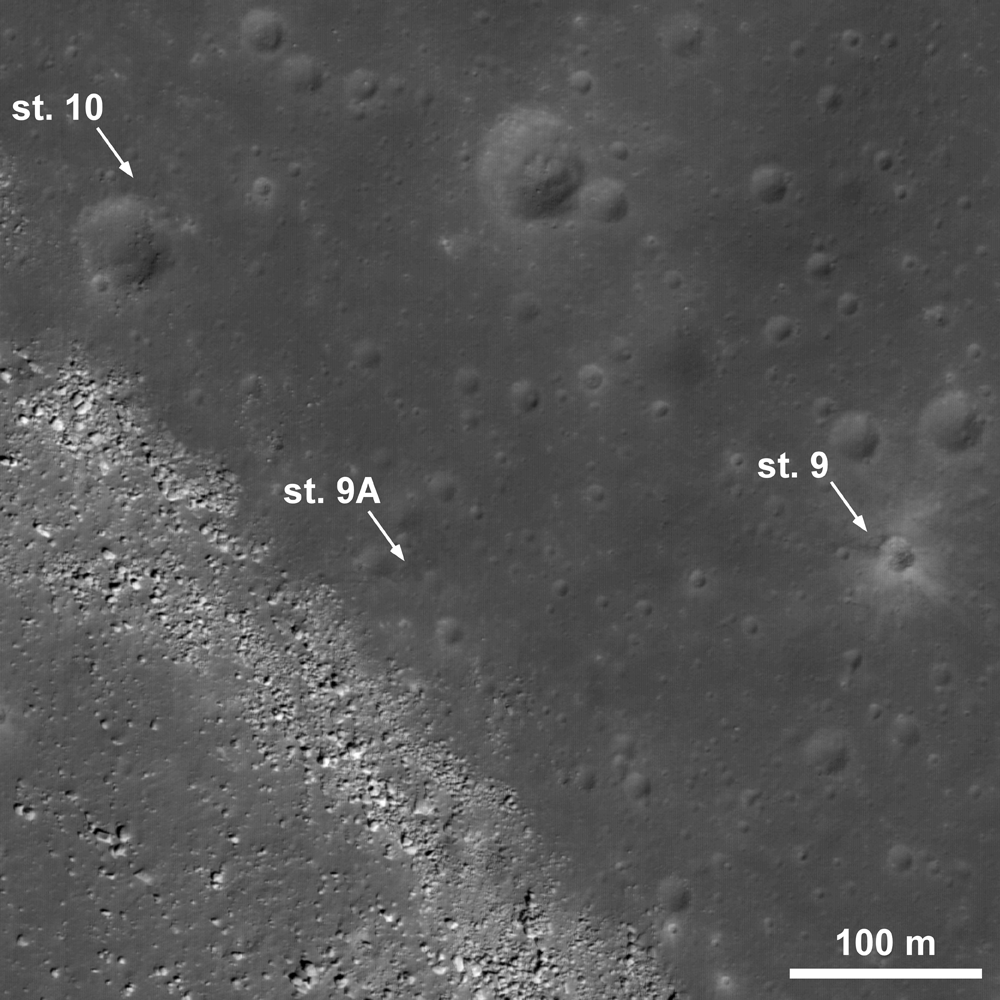
The last EVA allowed the crew to explore the edge of Hadley Rille. Pans at Stations 9 and 10 show two different craters the crew visited; one of which is a fresh crater with a blocky texture. Station 9A was a terrace that allowed Scott and Irwin a chance to peer down into the rille, which is approximately 1.3 km wide and 400 m deep along most of its length. The crew was able to observe and photograph bedrock along the upper part of the western rille wall. Test pilots by profession, the crew went through extensive geology training so that they could communicate their observations effectively and efficiently to the Science Backroom in Houston, Texas. Most of us are familiar with different historic phrases from various Apollo missions. What is sometimes forgotten is that there was also a great deal of science being accomplished and discussed. Field geologists normally have a field notebook to write down and draw their observations in, but on the Moon everything has to be described verbally. Here is an example from Commander Scott's geologic description of the rille wall at this location and one of the images that corresponds with it. Compare his description with the photograph and this panorama.
165:22:50 Scott: I can see from up at the top of the rille down, there's debris all the way. And, it looks like some outcrops directly at about 11 o'clock to the Sun line. It looks like a layer. About 5 percent of the rille wall (height), with a vertical face on it. And, within the vertical face, I can see other small lineations, horizontal about maybe 10 percent of that unit.
165:23:26 Scott: And that unit outcrops (at various places) along the rille. It's about 10 percent from the top, and it's somewhat irregular; but it looks to be a continuous layer. It may be portions of (mare basalt) flows, but they're generally at about the 10-percent level. I can see another one at about 12 o'clock to the Sun line, which is somewhat thinner, maybe 5 percent of the total depth of the rille. However, it has a more-well-defined internal layering of about 10 percent of its thickness. I can see maybe 10 very well-defined layers within that unit.
The high resolution imagery from LROC allows us to retrace the steps of previous Apollo missions. Compare the Apollo 15 surface panoramas at the different stations with the LROC images to see if you can locate some of the individual rocks and outcrops seen in both perspectives.
Future crews that explore Hadley Rille and the Apennine Mountains could continue where Apollo 15 left off. Combining our previous exploration experience at the site with new remote sensing data sets, a new mission could explore the massifs to the north, additional sites along Hadley Rille, as well as revisit any of the Apollo 15 stations.
Explore the entire LROC NAC frame here and decide the spots you would like to explore on a future mission.
Read more about the Apollo 15 landing site in previous ASU posts:
LROC's First Look at the Apollo Landing Sites (July 17, 2009)
Lunar Highs and Lows (July 22, 2008)
The Mighty Apennine Mountain Range (Sept. 30, 2008)
Hadley-Apennine: the Apollo 15 Landing Site (Nov. 14, 2007)
Text from the corrected Apollo 15 transcript and links to panoramas are from the Apollo Lunar Surface Journal. Used with permission. Copyright Eric M. Jones (1996).
Published by Brent Garry on 16 April 2010
