
The Lunar Reconnaissance Orbiter Camera (LROC) on board the Lunar Reconnaissance Orbiter (LRO) was afforded its first of many opportunities to image the six Apollo landing sites July 11 through 15 with its high resolution Narrow Angle Cameras (NACs). These early images show the Lunar Module descent stages left behind by the departing astronauts. LRO’s current elliptical orbit (40 x 199 km), with the low portion of the orbit (perilune) over the south pole, resulted in image scales near the equator ranging from 1.0 meter per pixel (Apollo 16) to 1.4 meter per pixel (Apollo 17) (3.3 feet and 4.4 feet respectively).
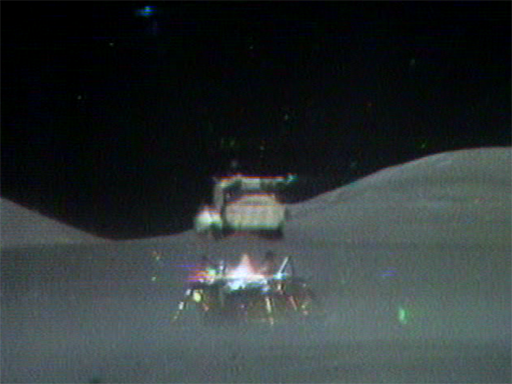
Apollo 17 ascent stage blasts off from the Moon! [NASA].
|
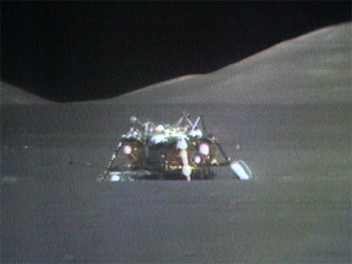 Apollo 17 descent stage patiently awaiting a return visit [NASA].
|
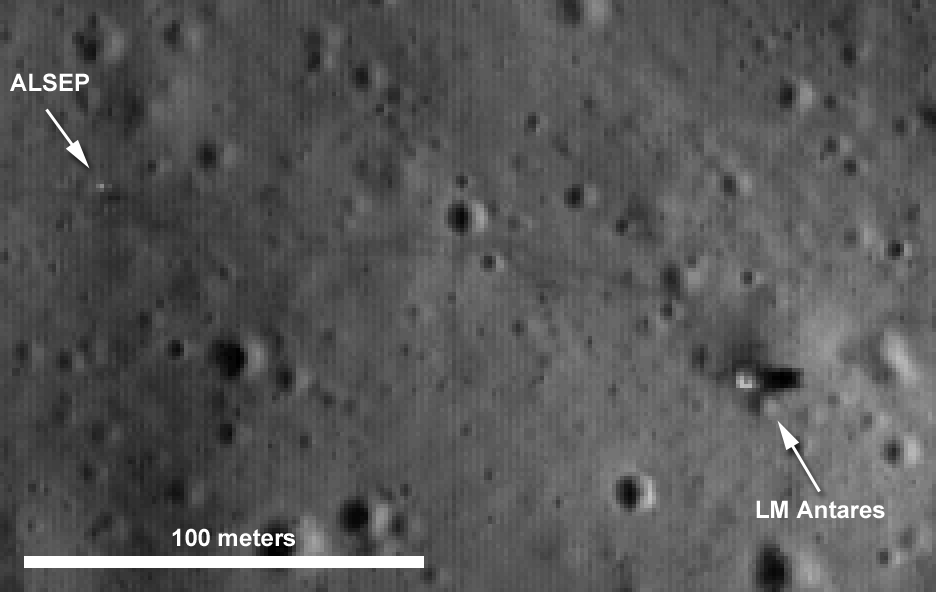
The deck of the Lunar Module descent stage is 3.7 meters on a side -- three to four pixels square. The images were taken with late "afternoon" sun creating long shadows. The top of the descent stage is 3 meters above the surface and casts a shadow roughly 18 pixels long; the bottom of the descent module is about a meter above the surface, creating a gap through which sunlight can shine, in some cases creating a thinner shadow of the front landing strut/ladder or engine bell. Guided by our precise knowledge of the locations of the Apollo landing sites, and the distinctive shadow of the Lunar Module (usually the tallest feature relative to its width), the landing sites were easily recognized. As the LRO mission progresses, its orbit will be lowered and the resolution of images of the landing sites will improve by two to three times.
Pixel scale (m/pixel) is a convenient way to describe a camera's ability to capture feature details on the lunar surface, although strictly speaking it takes 2-4 pixels to resolve an object. Perhaps the simplest value to start with when describing image resolution is the pixel scale defined as the size of a pixel projected onto the ground. In the case of the LROC Narrow Angle Cameras (NACs) the angular scale of a single pixel is only 0.000572958°, which from an altitude of 100 km provides a ground scale of 1.0 meter per pixel. However, the true resolution is always poorer than the ground scale. First, the optics and the CCD introduce scatter to some of the incoming light, which works to slightly blur the image. Next, in the case of the NACs, the pixels move across the ground as the exposure is made introducing along-orbit smear. Finally, the image quality is affected by the illumination of the scene. When the Sun is near noon and the ground is brightly illuminated, the signal received by the camera is strong. When near sunset or sunrise, the scene is poorly illuminated and signals are weak. A handheld camera can usually compensate for low light levels with a flash – if not, you will see a grainier image.
For the five Apollo landing sites imaged by LROC, the biggest variables are spacecraft altitude (ground scale) and time of day, which translates into signal strength. In the current collection of images the best feature discrimination is in the Apollo 14 scene (astronaut tracks and ALSEP) even though the highest resolution picture covers the Apollo 16 site. This counter-intuitive result clearly shows that increased illumination (high signal) is a very significant factor in the true resolution of a picture. Next month LRO will pass over all the landing sites at the same altitudes but with the Sun 15° higher above the horizon. By September LRO will be placed in a lower mapping orbit and higher resolution images will be possible.
The LROC NAC image data presented here has not been calibrated, the faint vertical stripes are a normal part of the image, and will be removed later after the full suite of calibration data is collected during the commissioning phase.
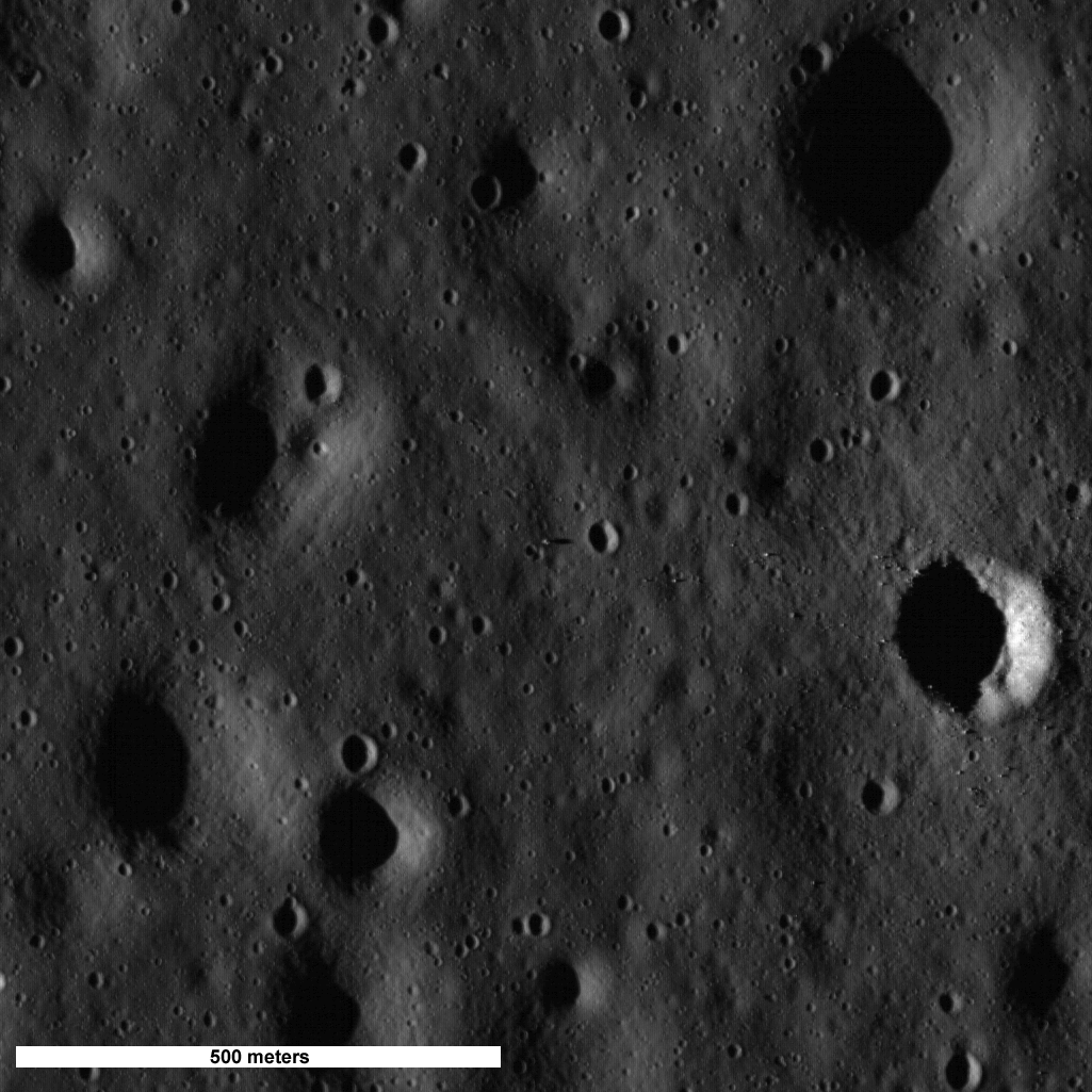 Apollo 11 Landing Site.
|
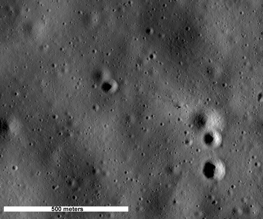 Apollo 14 Landing Site.
|
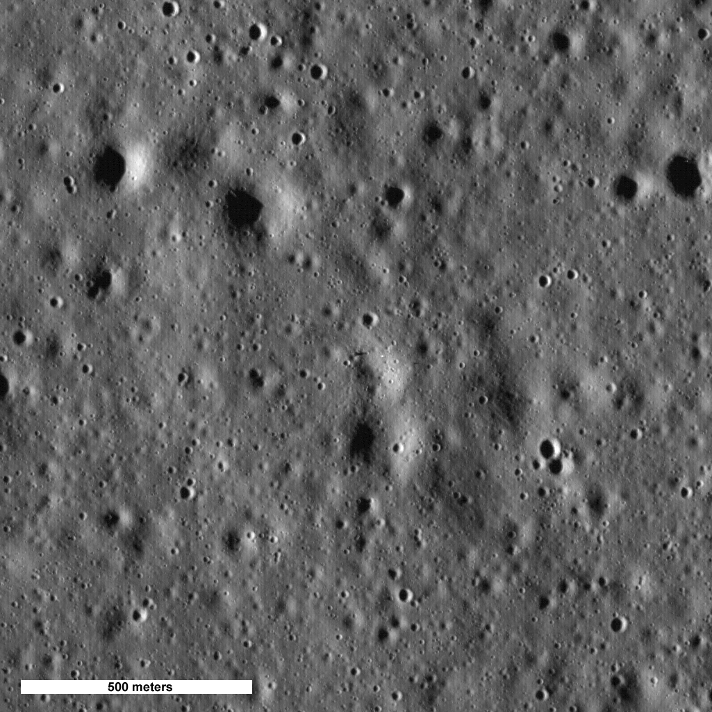 Apollo 15 Landing Site.
|
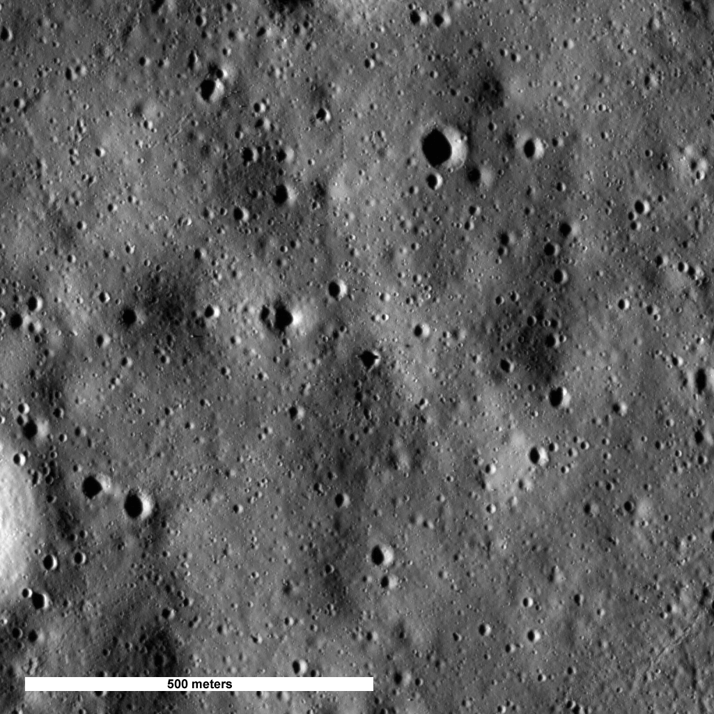 Apollo 16 Landing Site.
|
 Apollo 17 Landing Site.
|
Browse the full Apollo 11 image!
Browse the full Apollo 14 image!
Browse the full Apollo 15 image!
Browse the full Apollo 16 image!
Browse the full Apollo 17 image!
Published by Mark Robinson on 16 July 2009