The LROC team has recently developed and released two new activities designed to help introduce curious minds of all ages to robotic rovers around the solar system, ongoing research at the lunar south pole, and the Moon using interactive activity guides full of illustrations, images, instructions, real instrument data, and techniques.
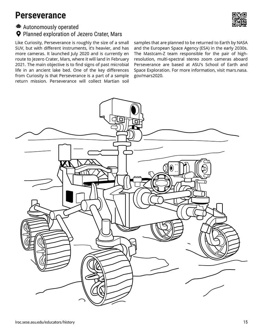
Rovers are amazing additions to space science that roll, crawl, and hop their way across divers worlds, collecting data and helping humans explore and learn more about solid surface bodies like the Moon, Mars, and asteroid Ryugu than ever before. In Rovers of the Solar System, informational coloring pages and interactive activities take learners on a chronologic journey of rovers used for space science, from Grover, the astronaut training rover used in the 1960s, to rovers currently spread across the solar system and in development today — even here at Arizona State University.
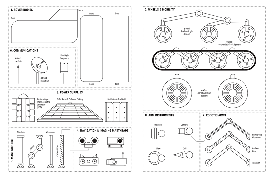
Whether you're young or young-at-heart, creative minds will enjoy the Build-A-Rover activity that guides crafters at home or in class through developing their own custom rover using pre-supplied parts, but feel free to get inspired and create your own — the final design is in your hands!
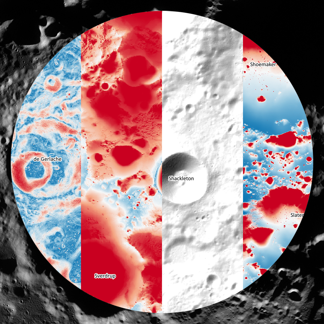
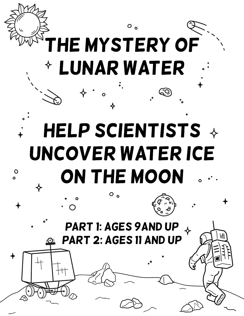
In addition to Rovers of the Solar System, the LROC team is also releasing The Mystery of Lunar Water, a robust activity guide for ages 9 and up that parallels the work lunar scientists are doing right now! Lunar scientists are working to identify areas near the poles that are most likely to have water in the form of ice and to plan future missions to access this valuable resource. These activities use maps created with data from the instruments on-board the Lunar Reconnaissance Orbiter (LRO) that scientists are using today, including data from LROC, making this a great introduction to remote sensing and planetary science.
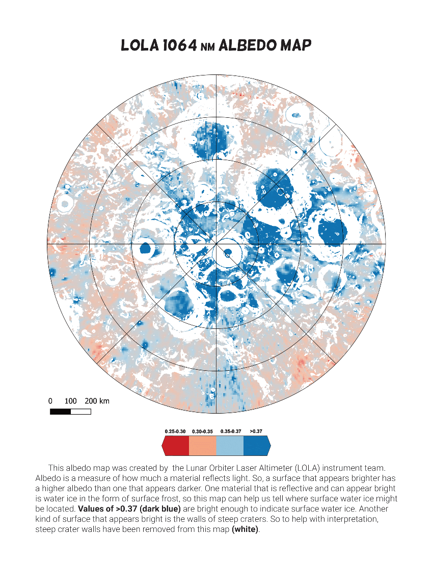
In Part 1, students locate water on the Moon in the form of surface frost, a resource that could be easily accessible in future missions. By comparing datasets that show environments suitable for water ice and consistent with frost, such as albedo maps, students will identify areas most likely to have water in the form of surface frost.
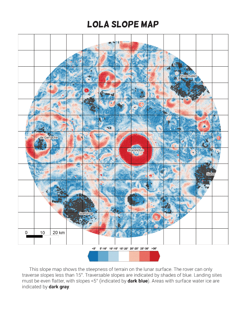
In Part 2, students use more datasets from LRO to plan a rover mission to collect the surface water identified in Part 1. They must consider the availability of solar power, communication with earth, and the slope of the surface to navigate their mission through the Moon's hazardous environment. Students will also identify a safe landing site and determine the safest traverse that takes them to a surface water frost location.
Teacher's guides are provided for Part 1 and Part 2 of this activity booklet, containing background information for the activity, additional information about each of the maps, and answer keys for each of the sections. A glossary, located at the end of the activity, helps with any new terminology related to LRO, the Moon, and the search for water. Visit the educator section of the website for more activities and guides.
We hope everyone enjoys these new activities and learns a bit about lunar exploration along the way!
Published by Megan Henriksen on 3 June 2021