Determining how much water ice is present at the lunar poles has been a focus of a substantial amount of research, particularly in the last decade. This is because water could provide a key resource for future lunar explorers, serving as drinking water for astronauts, or rocket fuel if broken apart. And determining where the water came from could provide wonderful new information about the early Solar System – comets that impacted the Earth–Moon system and delivered their icy materials from the outer reaches of the Solar System, or perhaps hydrogen carried along in the solar wind from an early, more active, Sun, or maybe even water that came from deep within the Moon, erupted along with magmas during past volcanic activity.
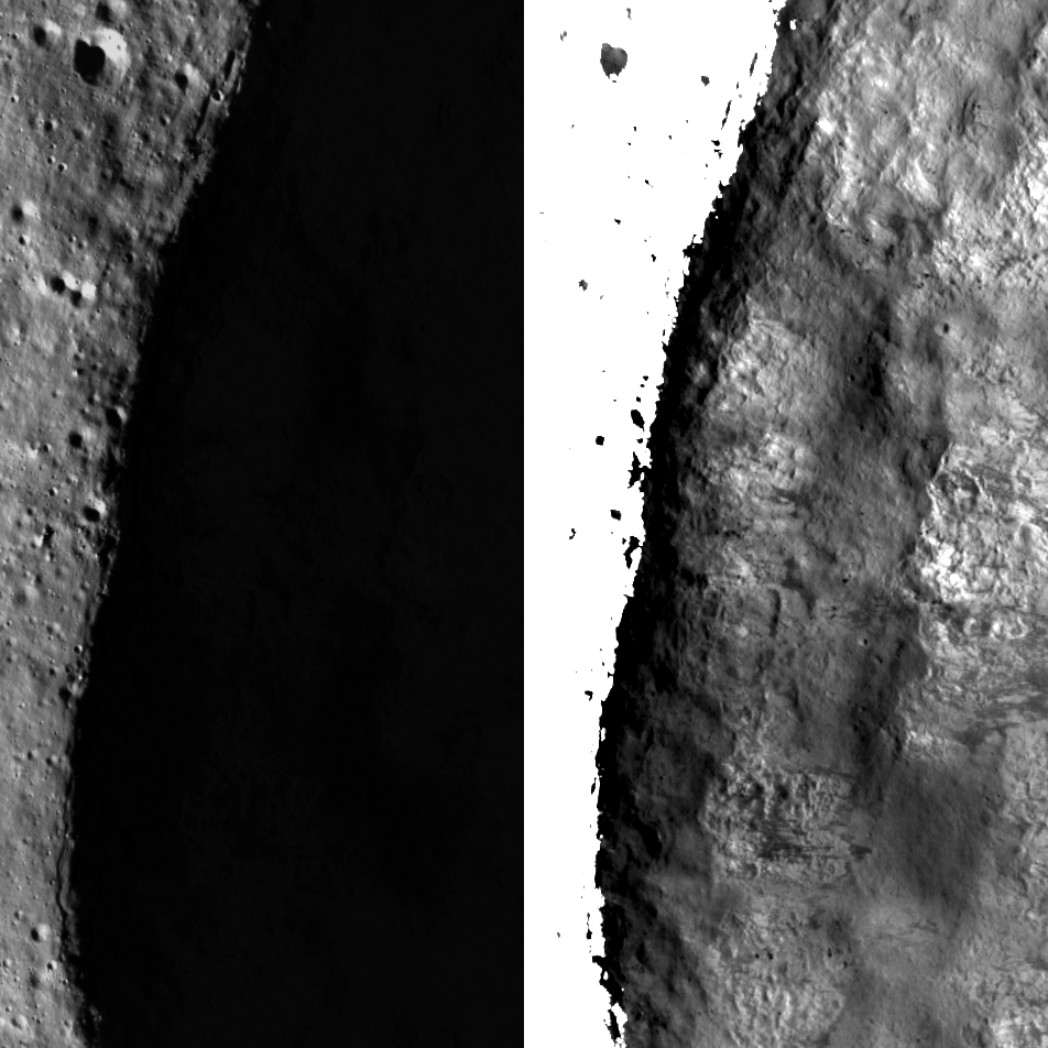
Water ice is able to persist on the Moon, despite the lack of an atmosphere, because there are regions near the poles that never see direct light from the Sun. This is not the case near the Earth’s poles: the tilt of the Earth on its axis of rotation is 23.5°, which gives us our seasons and means that each pole experiences six months of daylight during its summer, and six months of darkness during its winter. The Moon’s axial tilt is just 1.5°, meaning it experiences very little seasonal change and permanent shadows extend across the floors of polar craters, such as Sylvester N crater seen above. Because these permanently shadowed regions (PSRs) never see the Sun, they are extremely cold, and any water (or other volatile) that finds its way into a PSR becomes trapped, possibly for billions of years.
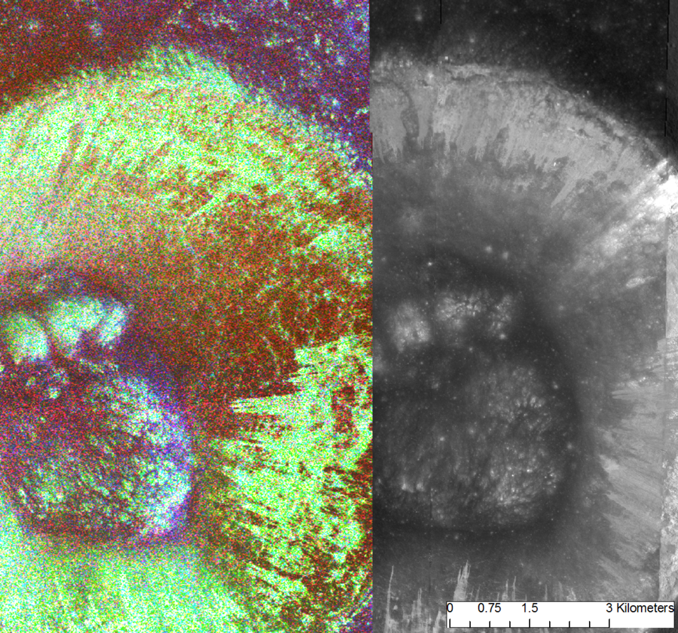
Numerous remote sensing techniques have been used to search for water ice at the lunar poles, including neutron spectroscopy, radar, and reflectance measurements at a variety of wavelengths, and yet we still don’t have a clear understanding of how much water there is, how its distribution varies, and at what depth(s) it is located. Radar measurements are particularly interesting because they are sensitive to large, pure deposits of water ice. Unfortunately, they have an inherent ambiguity because while ice is highly reflective at radar wavelengths (that is, it has enhanced radar backscatter), rocks in the centimeter- to meter-size range yield similar radar backscatter signatures.

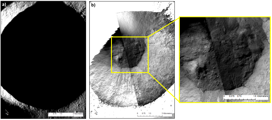
New work from the LROC team used long-exposure NAC images to examine areas that the Mini-RF instrument on LRO determined had high radar backscatter, in order to determine whether it was more likely that ice or blocks were present in the crater. Even though PSRs receive no direct illumination, a very small amount of sunlight is reflected off of nearby crater walls. The NAC can detect this light if the exposure time of the images is many times longer than usual, and in this way, can “see” inside PSRs. Thus these long-exposure images can be used to look for rocks in PSRs, with the idea being that if many rocks are present, it is likely these that are responsible for the radar backscatter, rather than ice.
LROC images were compared with radar data for craters at the poles, but also at the equator. The equatorial craters provided a dataset for which we already knew the answer: no ice could be present due to the high temperatures they experience. The NAC images of equatorial craters were also higher in resolution, with pixel scales of <1 m/pixel rather than 10–40 m/pixel. The lower resolution for images of polar craters is a result of the long exposure times needed for the low-light conditions – while the pixels are being exposed, the spacecraft is moving rapidly over the surface and each pixel sees a larger area. The higher-resolution equatorial data thus also provided a calibration, of sorts, to understand what population of rocks we may be missing in the lower-resolution PSR images.

The NAC study shows that craters with high radar backscatter have higher numbers of resolvable rocks in their interiors, whether they are at the equator or at the poles. Therefore, radar signatures that were previously thought to indicate large deposits of pure ice were present may in fact be the result of rocks instead. From other investigations we know that ice is present in PSRs – these new results suggest that it may not be present in large, pure deposits, but instead is mixed into the local soil. However, Further investigations of PSRs, including high-resolution images that will be acquired by the ShadowCam instrument, will be required to fully characterize the distribution and abundance of water ice at the lunar poles.
For the full, story see the newly published paper from the LROC team:
Mitchell, J., S. Lawrence, M. Robinson, E. Speyerer, B. Denevi (2017), Using complementary remote sensing techniques to assess the presence of volatiles at the lunar north pole, Planetary and Space Science, doi: 10.1016/j.pss.2017.07.015.
Related Featured Images:
Eternal Darkness Near the North Pole
Five Years Later: Revisiting an Old Friend
Lunar Exploration: Planning the Next Steps
Published by Brett Denevi on 20 December 2017