Lunar Reconnaissance Orbiter Camera
  • Home
    • News & Announcements
    • Featured Images
    • Operations Journal
    • Targeting Tool
    • Ask a Question!
    • LRO Live! (videos)
    • Where is LRO?
    • Site Map
    • RSS Feed
  • What is LROC
    • What is LROC?
    • Mission Overview
    • LROC Summary
    • Objectives
    • Specifications
  • Images
  • Downloads
  • Outreach
    • Operations Journal
    • Ask a Question!
    • LRO Live! (videos)
    • Where is LRO?
    • Calendar
    • History
    • Explore the Moon
    • Educators
    • Students
    • Our Team
    • Press Kit
    • Press Archive
  • Tours
    • Tour Information
    • Arrange Tour
:: Homepage ::
:: "Surveyor 1 - America’s first soft lunar landing" by Jeff Plescia « Featured Image « LROC News System ::

Surveyor 1 - America’s first soft lunar landing

LROC News System

Wednesday, September 30. 2009

30Sep

Surveyor 1 - America’s first soft lunar landing

Featured Image

Surveyor 1 spacecraft sitting silently on Oceanus Procellarum, the first US spacecraft to land on another planet (June 2, 1966). The image was taken in the lunar afternoon such that the sun in low on the western horizon and the 3.3 meter tall spacecraft casts a long shadow (almost 15 m long) to the east [NASA/GSFC/Arizona State University].


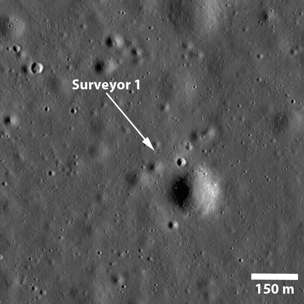
Surveyor 1 was the first in a series of seven US missions to the Moon that preceded Apollo; five of the seven missions were successful. Surveyor 1 was launched on May 30, 1966 and landed on June 2, 1966. The mission's objectives were to soft land on the Moon and to collect information on the lunar regolith. This first Surveyor spacecraft carried only a television camera system (later missions carried additional instruments). The spacecraft landed on a relatively smooth mare surface in Oceanus Procellarum (the Ocean of Storms).  The Surveyor 1 landing site is also one of the areas identified by Project Constellation as a high-priority target for future human lunar exploration.

Enlarged view showing Surveyor 1 sitting in the Ocean of Storms, waiting for a return visit by human explorers [NASA/GSFC/Arizona State University].


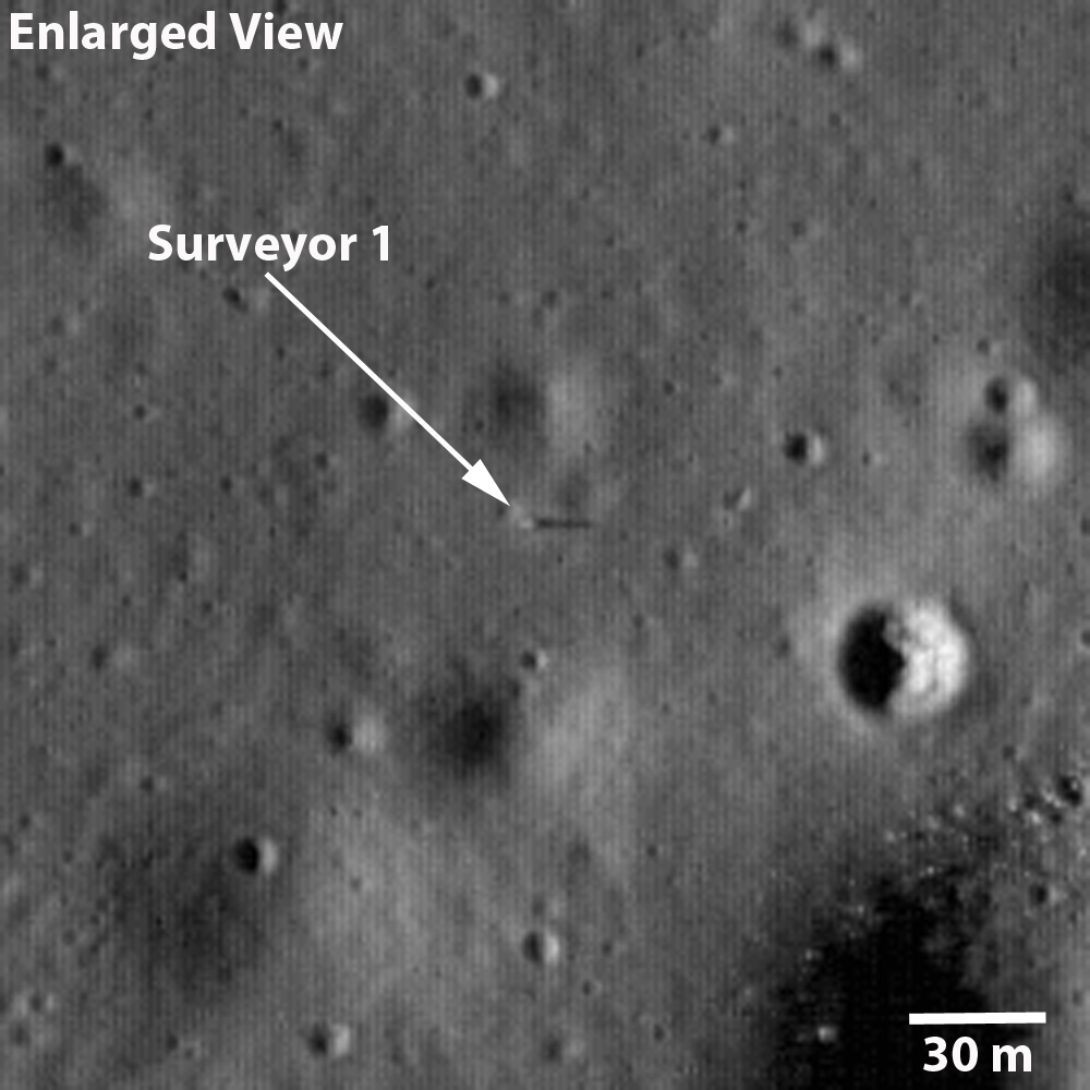
The scene shows the spacecraft (annotated with an arrow) just south of a subdued 40 m diameter crater and about 110 m northwest of a 190 m diameter crater lined with boulders.  The landing site is in the northeast corner of the Flamsteed Ring, a 100 km diameter impact crater almost completely buried by mare lavas such that all that remains exposed is the upper part of the original crater rim. 


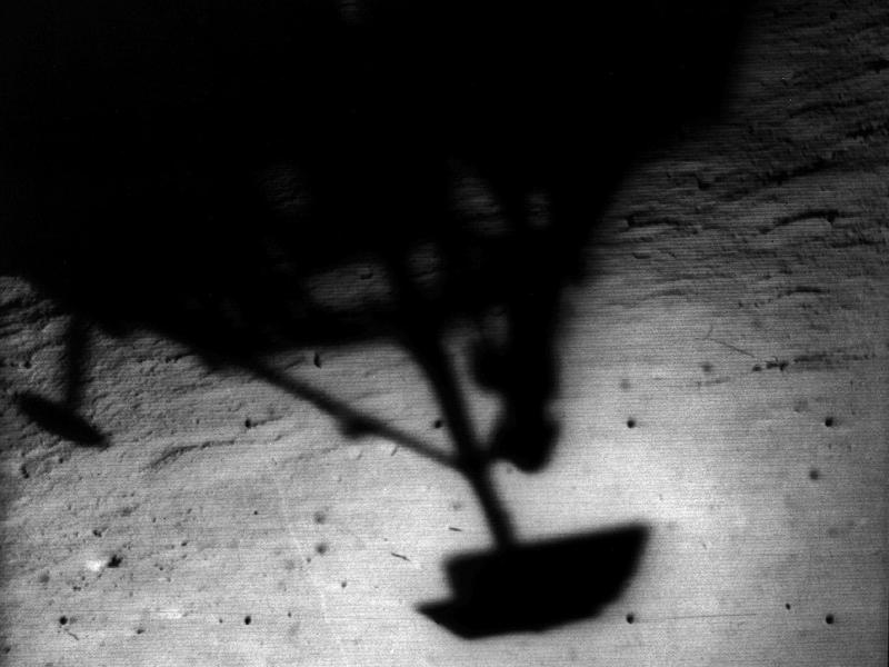
Surveyor 1 collected over 11,000 images, most during the first lunar day between landing and July 7, 1966. The spacecraft continued to operate until January 7, 1967. The Surveyor images demonstrated that the lunar surface was strong enough to support a landed vehicle or a human. The detailed images also indicated that the surface was composed of a granular material interpreted to be produced by the impact of various size meteors over billions of years. 

Image of Surveyor 1's shadow against the lunar surface, collected by the on-board imaging system [NASA].


Explore the full-resolution NAC image of the Surveyor 1 site.

Posted by Jeff Plescia in Featured Image at 13:34
New System Links
  • News System Home «
  • Announcements «
  • Featured Image «
  • Operations Journal «
  • RSS Feed «

Quicksearch

Calendar

Back February '10 Forward
Mon Tue Wed Thu Fri Sat Sun
1 2 3 4 5 6 7
8 9 10 11 12 13 14
15 16 17 18 19 20 21
22 23 24 25 26 27 28

Categories

  • XML LROC
  • XML Announcements
  • XML Featured Image
  • XML Operations Journal


All categories
Goddard Space Flight Center Space Exploration Resources Adler Planetarium Arizona State University, School of Earth and Space Exploration
Comments and suggestions can be emailed to: lroc_webmaster@asu.edu