Featured Images

Longjiang-2 Impact Site Found!
The Longjiang-2 spacecraft (also known as DSLWP-B) crashed onto the lunar farside on 31 July 2019 after completing its orbital mission. This new crater was most likely the result of that impact. Image width 330 meters, north is up,...
Published on 14 Nov 2019
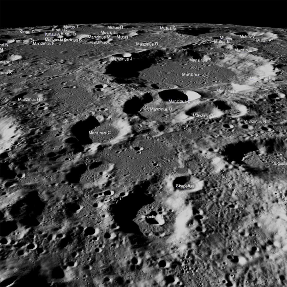
Obscured in the Lunar Highlands?
The Chandrayaan-2 lander, Vikram, attempted a landing September 7th Indian time (Friday the 6th in the United States), on a small patch of lunar highland smooth plains between Simpelius N and Manzinus C craters. Unfortunately the...
Published on 26 Sep 2019
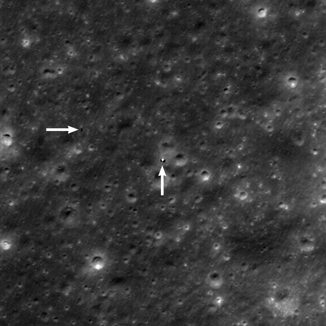
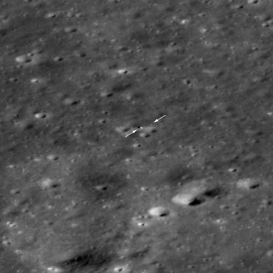
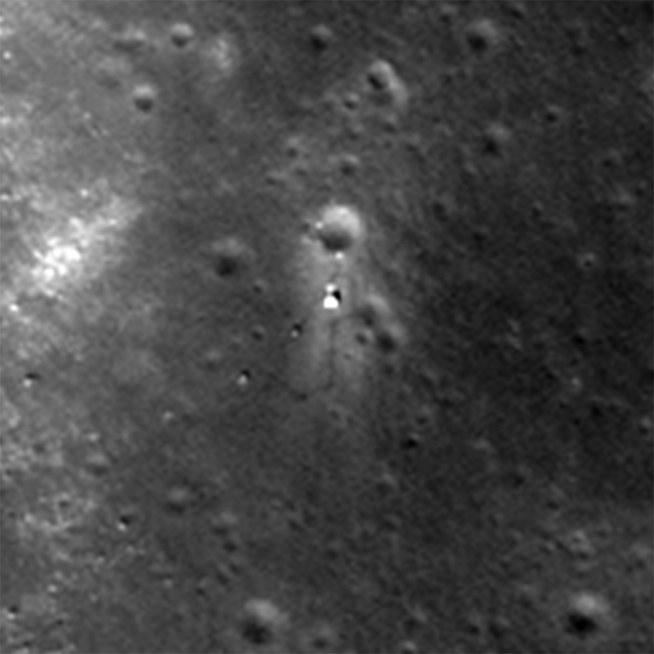
Yutu-2 Still on the Move!
Yutu-2 (horizontal arrow) was about 130 meters west of the Chang'e 4 lander (vertical arrow) on 3 June 2019. North is up, image is 495 meters wide and enlarged two times, M1314237625L [NASA/GSFC/Arizona State University].
Published on 27 Jun 2019

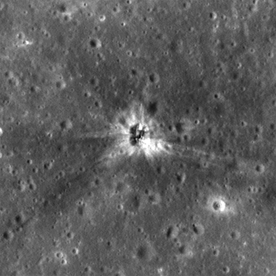
Beresheet Crash Site Spotted!
SpaceIL Beresheet crash site as seen by LROC eleven days after the attempted landing. Date in lower left indicates when the NAC image was acquired, M1310536929R [NASA/GSFC/Arizona State University].
Published on 15 May 2019
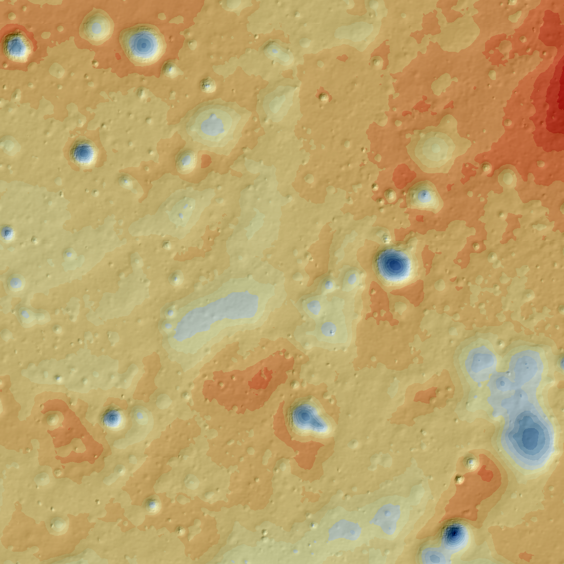
Topographic Map of the Chang'e 4 Site
Topographic map of the Chang'e 4 landing site derived from LROC NAC stereo pair (M1303619844LR, M1303640934LR obtained on 1 February 2019). North is up, map is 5500 meters wide [NASA/GSFC/Arizona State University].
Published on 30 Apr 2019
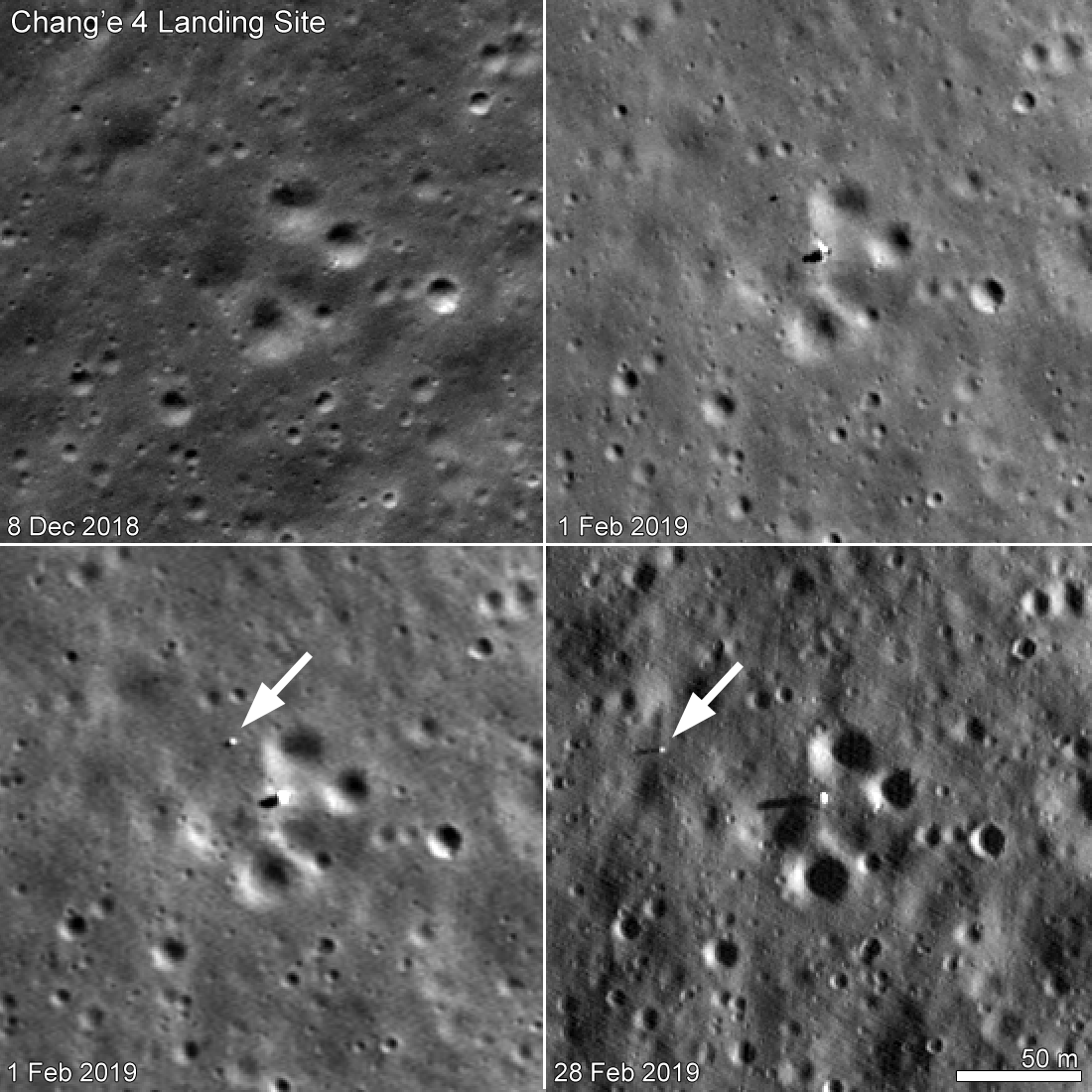
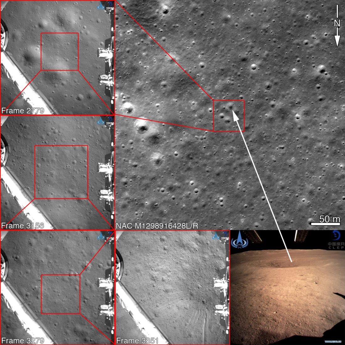
Chang'e 4 Rover on the Move
The Chang'e 4 rover, Yutu-2, moved between 1 February 2019 and 28 February 2019. The upper left panel (M1298916428L) shows the landing site before Chang'e 4 set down and the image in upper right panel (M1303619844L) has the best...
Published on 20 Mar 2019
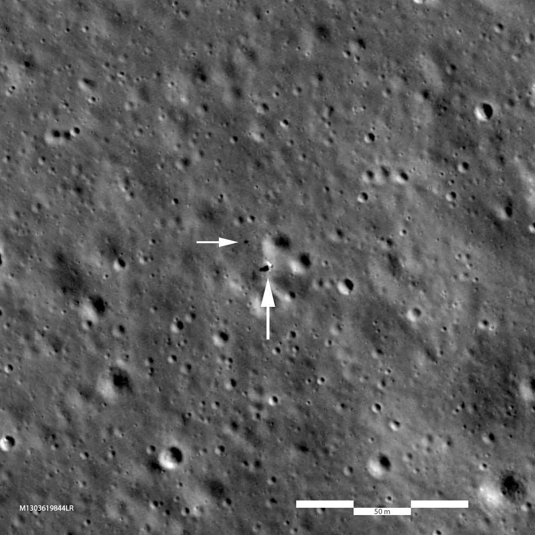
Above the Landing Site
Looking down on the Chang'e 4 landing site; lander is just beyond tip of large arrow, rover at tip of small arrow. Image is 468 meters (1535 feet) across, 2x enlargement, LROC M1303619844LR [NASA/GSFC/Arizona State University].
Published on 15 Feb 2019
Chang'e 4 Rover Comes into View
The Chang'e 4 rover is now visible to LROC! Just beyond the tip of the right arrow is the rover and the lander is to the right of the tip of the left arrow. The image appears blocky because it is enlarged 4x to make it easier to see the...
Published on 08 Feb 2019
First Look: Chang'e 4
Arrows indicate position of Chang'e 4 lander on the floor of Von Kármán crater. The sharp crater behind and to the left of the landing site is 3900 meters across (12,800 feet) and 600 meters (1970 feet) deep. Image was shrunk by more...
Published on 06 Feb 2019
Chang'e 4 Lander Coordinates
Following the Chang'e 4 descent frames (CNSA/CLEP) to the surface makes it easy to find the exact landing spot in a NAC image, which was taken before the landing. Note that the NAC image is rotated so north is down to match the Chang'e...
Published on 11 Jan 2019
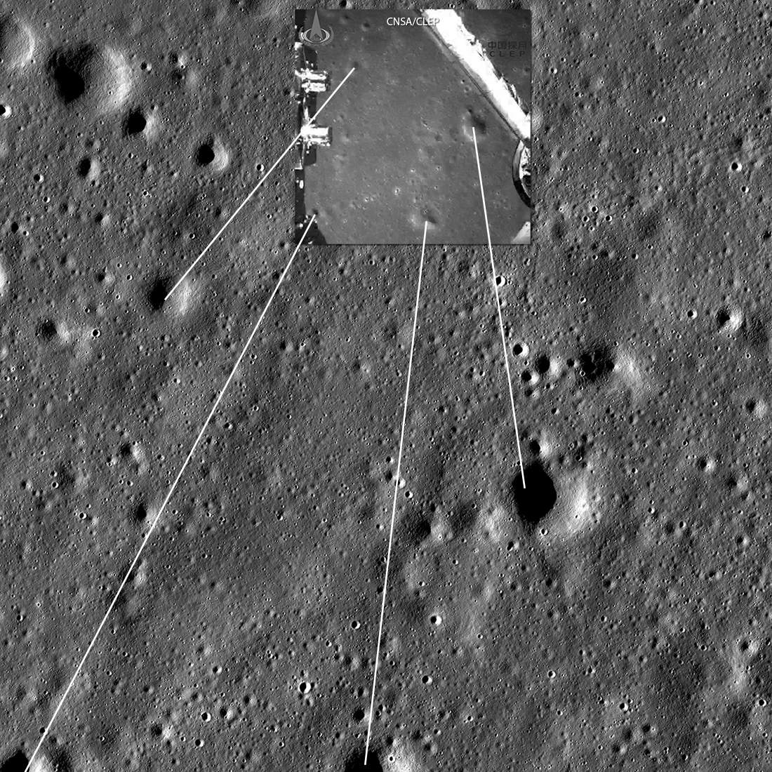
On the Farside!
Safe on the farside, Chang'e 4 set down somewhere in this LROC image obtained 17 July 2010. The lines connect craters seen in the Chang'e 4 descent image (CNSA/CLEP) with the same craters seen in the LROC image. Image width 2700 meters,...
Published on 03 Jan 2019
Von Kármán Crater: Awaiting A Visitor
Von Kármán crater (186 kilometer diameter), a treasure house of geologic landforms! LROC Wide Angle Camera mosaic, five degree latitude and longitude grid [NASA/GSFC/Arizona State University].
Published on 02 Jan 2019
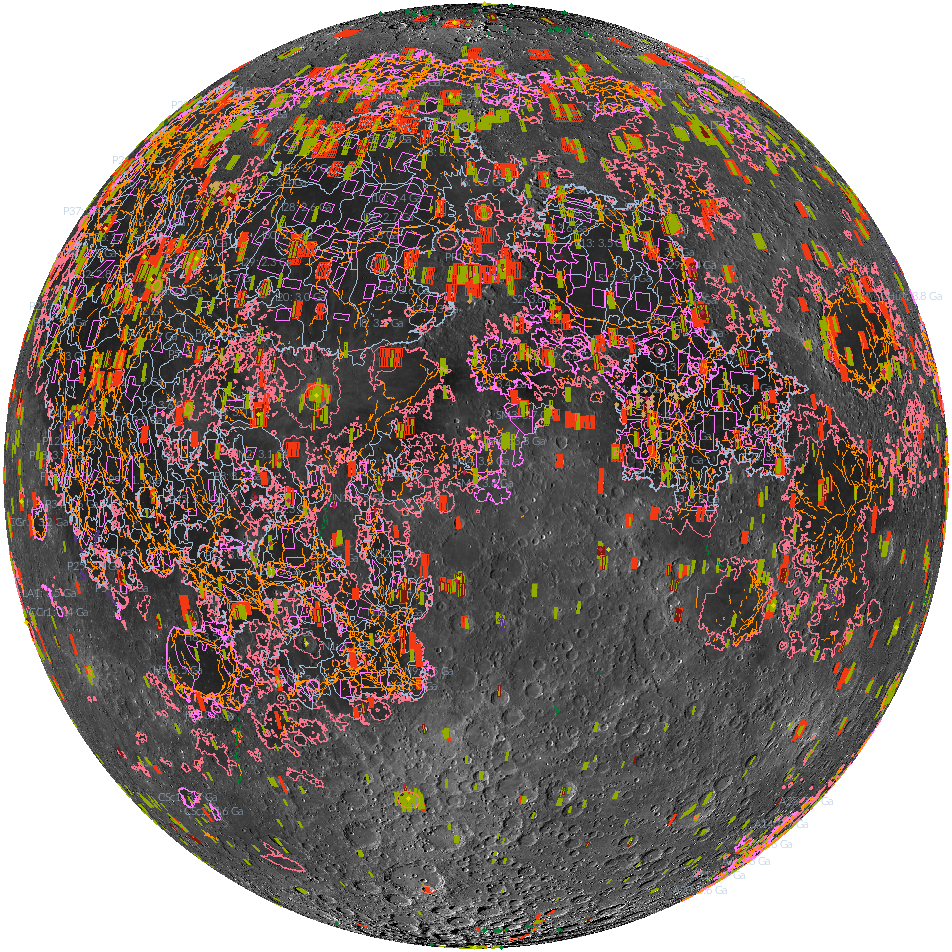
'Shaping' Lunar Science with Vector Data
Twenty new shapefiles created by the LROC Team are now available! A few of the shapefiles shown here include mare age units, footprints of digital terrain models (DTMs), and the locations of small geologic features such as...
Published on 18 Jul 2017
Struck by a Meteoroid!
The first wild back-and-forth line (line # 22,616) records the moment (October 13, 2014 at 21:18:48.404 UTC) the left NAC radiator was struck by a meteoroid (image M1167874395L). [NASA/GSFC/Arizona State University]
Published on 26 May 2017
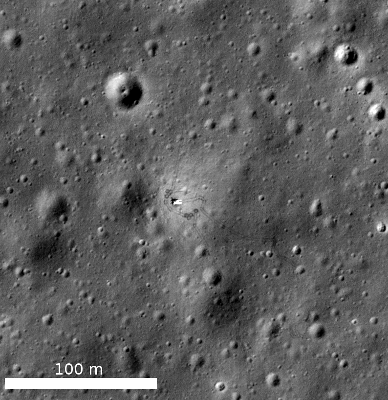
Spacecraft Related Coordinates - 2016 Update
Luna 17, the intrepid lander that carried the Lunokhod 1 rover to the surface. You can make out the rover's tracks around the lander, the tight circles were formed as the Earth-bound drivers tested out the maneuverability of their just...
Published on 25 Nov 2016
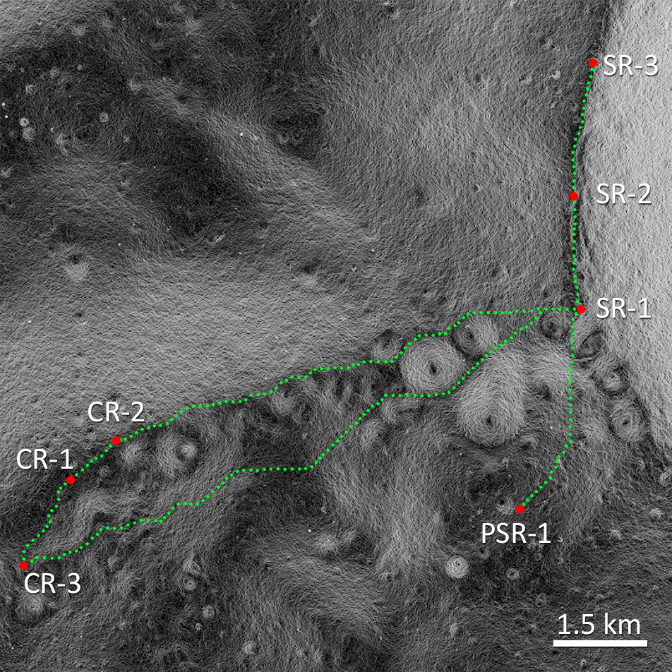
Lunar Exploration: Planning The Next Steps
Optimal traverse located around persistently illuminated points on the rim of Shackleton crater (SR-1, SR-2, and SR-3) and the connecting ridge between Shackleton and de Gerlache crater (CR-1, CR-2, and CR-3) as well as a permanently...
Published on 13 Jul 2016
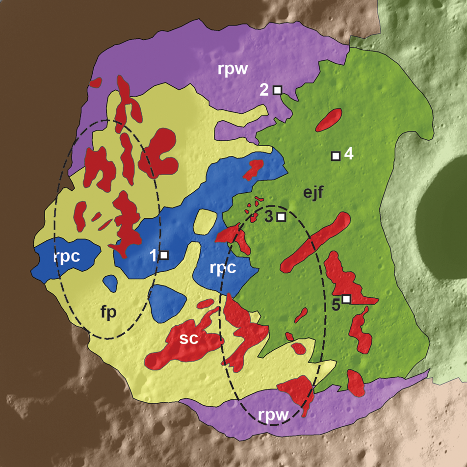
A Landing Site for Russia's Luna-Glob
A portion of a new geologic map of the interior of Boguslawsky crater, proposed site of the next Russian mission to the lunar surface [Ivanov et al., 2015].
Published on 22 Jun 2016
What a Blast! – Revisiting the Chang'e 3 Landing Site
View of the Chang'e-3 landing site from the LROC NAC. The region around the lander was brightened from the interaction of rocket exhaust with the regolith. Scene is approximately 240 m across, located at 44.121°N, 340.488°E. NAC image...
Published on 13 May 2016
Found! Apollo 16 S-IVB Impact Crater
Newly discovered Apollo 16 S-IVB stage impact crater, image is 400 m wide, north is up (M183689432L)
Published on 02 Dec 2015
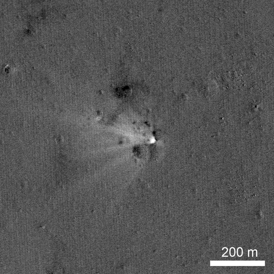
LADEE Impact Crater Found!
LADEE impact site on the eastern rim of Sundman V crater, the spacecraft was heading west when it impacted the surface. The image was created by ratioing two images, one taken before the impact and another after the impact. The bright...
Published on 28 Oct 2014