Featured Images
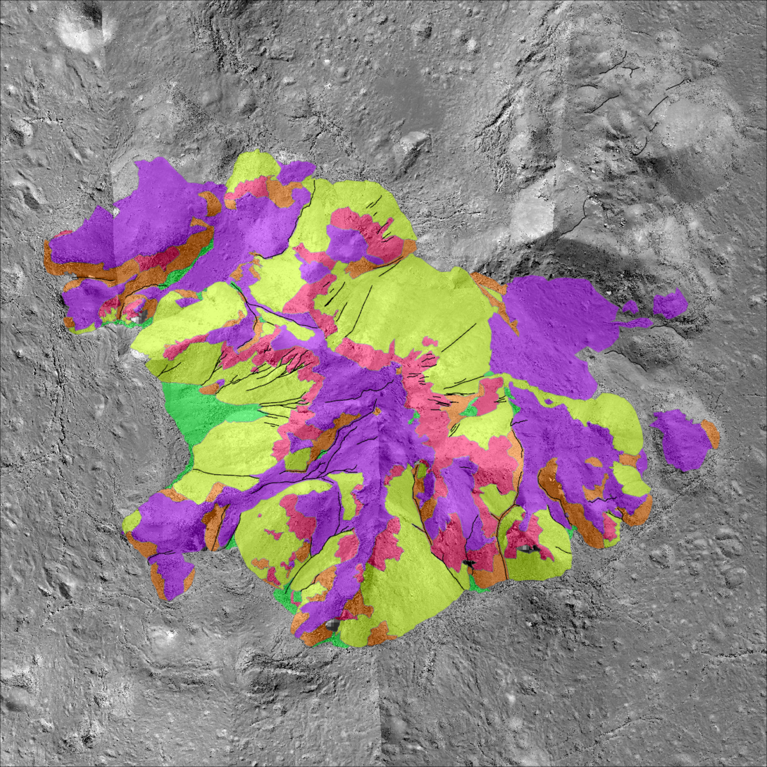
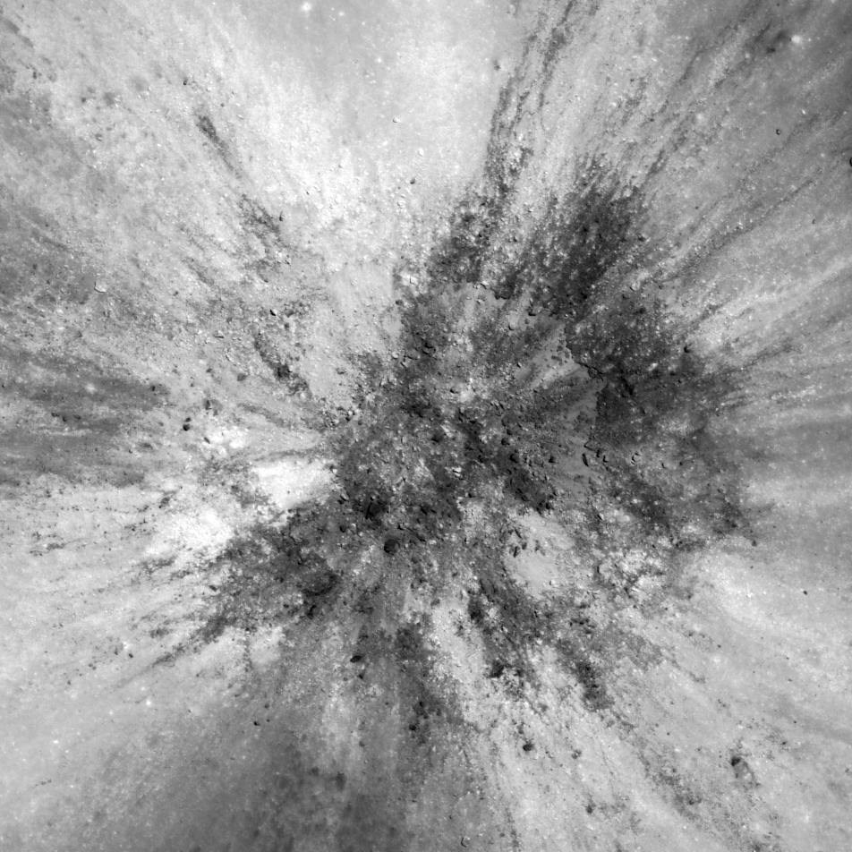
Tycho Central Peak: A Deeper Look!
A morphologic map highlighting the variety of landforms that make up the central peak of Tycho crater, a young ~70 kilometer diameter crater on the southern nearside (-43.48, 348.67) {NASA/ASU/Arizona State University].
Published on 03 May 2025
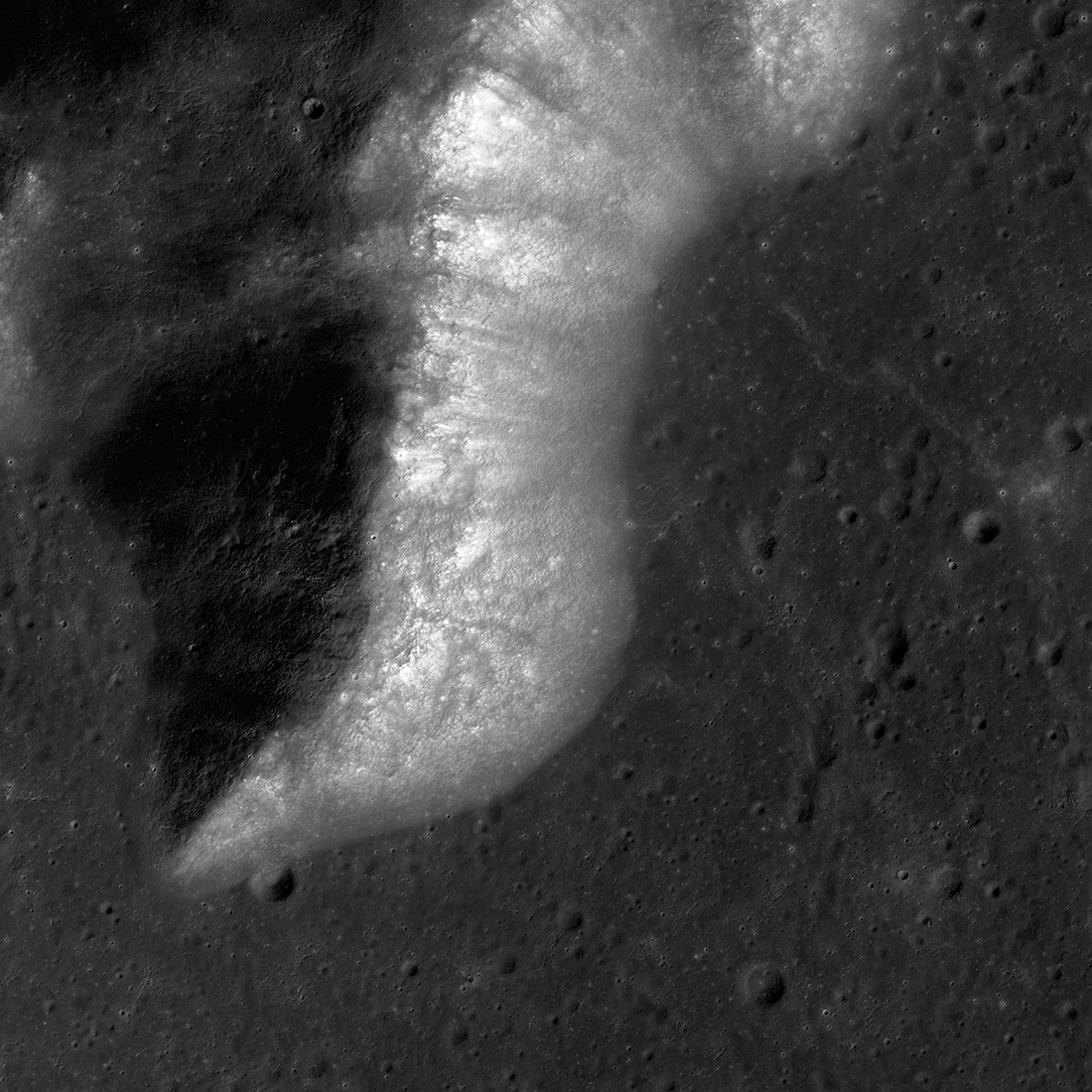
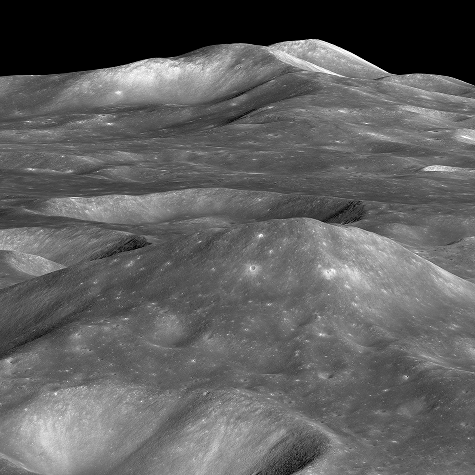
Malapert Massif
Malapert massif (informal name) is thought to be a remnant of the South Pole - Aitken basin rim, which formed more than 4 billion years ago. More recently, this magnificent peak (lower left) was selected as an Artemis 3 candidate...
Published on 14 Mar 2023
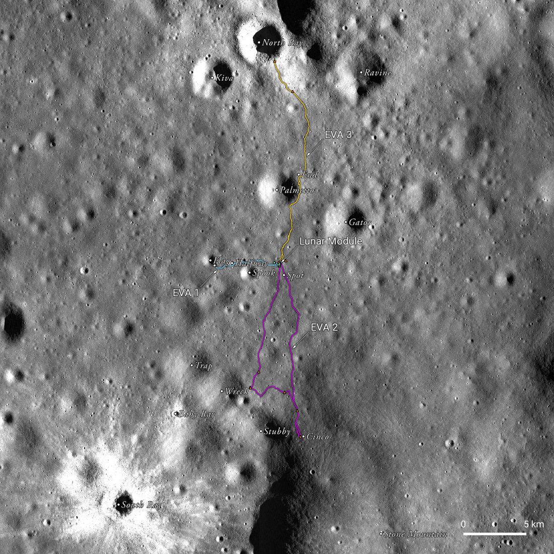
Apollo 16 50th Anniversary: A New Landscape
A spectacular, labeled view of the Apollo 16 landing site between North Ray and South Ray craters in the Descartes Highlands, a new landscape for the crew and an exciting set of LROC team products to help celebrate the 50th anniversary...
Published on 20 Apr 2022
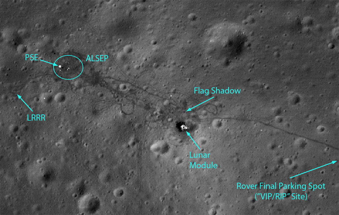
Apollo 15: A Mission of Many Firsts
Highlights of the Apollo 15 landing site, as seen in LROC NAC image M175252641R. This image has a resolution of 27 cm/px, and shows an area of 262 m by 186 m. The Lunar Module is clearly visible, as are many tracks from the Lunar Roving...
Published on 30 Jul 2021

A Lunar Donut: Bell E Crater
Bell E Crater (22.06° N , 264.06° E; ~16 km diameter) controlled feature mosaic made from images M1139534784L/R & M1139527672L/R [NASA/GSFC/Arizona State University].
Published on 02 Oct 2020
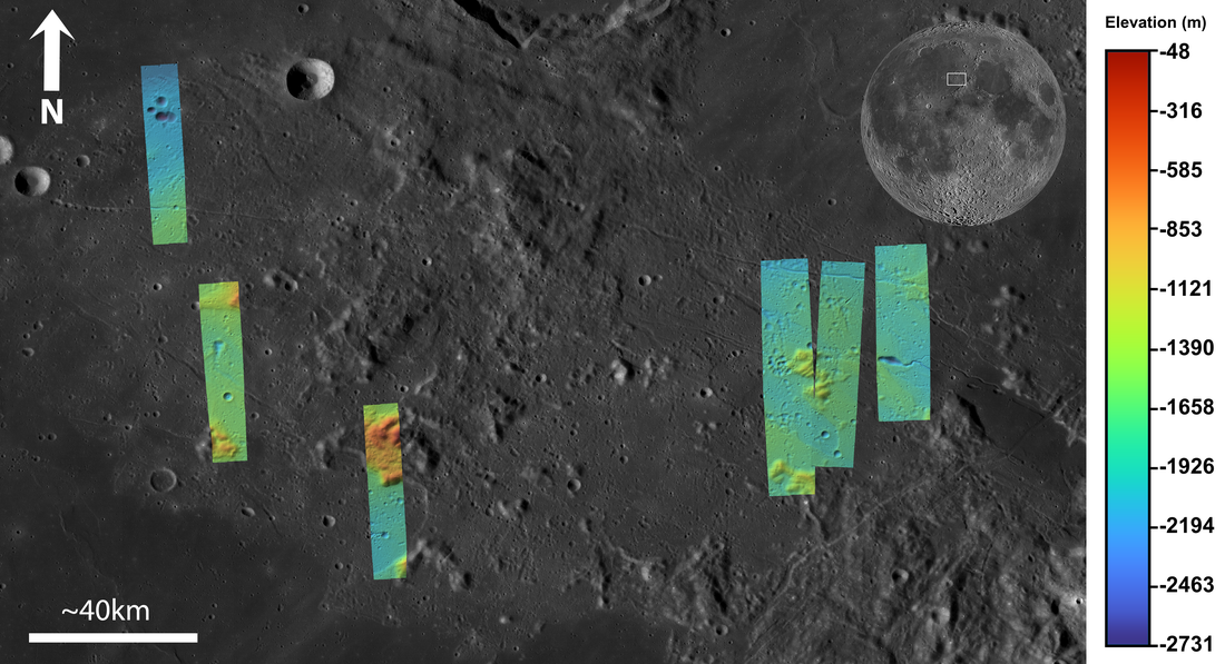
Apennine Bench Formation: A Window into Ancient Volcanism
LROC Wide Angle Camera (WAC) 100 m/px mosaic with 6 colorized Digital Terrain Models (DTMs) of the Apennine Bench Formation (centered near 26° N, 356° E - here in Quickmap), an enigmatic light plains unit located on the central lunar...
Published on 29 Jun 2020
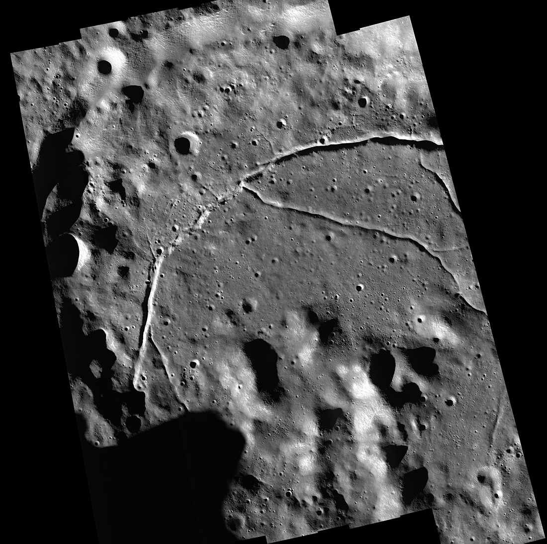
Feature Mosaics: Behind the Seams
A seamless mosaic of a portion of Karpinsky crater (91 km diameter, 72.61° N, 166.80°E) seamless mosaic. Scene is 55 km across, NAC images M1309496597L/R, M1309503618L/R, M1309510644L/R, M1309517669L/R, and M1309524696L/R...
Published on 16 Mar 2020
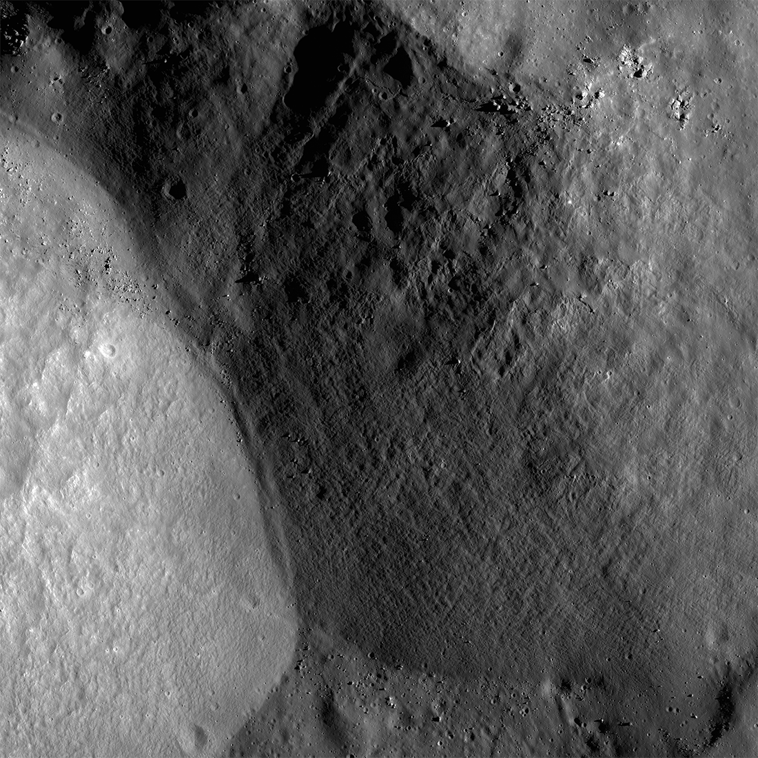
Plumbing the Depths by Scaling the Heights
The central mountainous peaks of Maunder crater are thought to be made of rock that was melted by the impact event that resulted in the Orientale basin. This impact melt rock deposit was then lifted up from below the surface during the...
Published on 19 Feb 2020
"Oceanus Procellarum Base Here - The Eagle Has Landed"
In 1969, NASA published a map showing candidate Apollo 11 and Apollo 12 landing sites. The map was based on photographs taken using large Earth-based telescopes. The map above, based on an LROC global image mosaic, is a near-copy of...
Published on 09 Aug 2019
On and Around Mons Piton
Mons Piton rises 2300 meters above the dark volcanic rocks of Mare Imbrium. The image covers an area 15.5 kilometers wide, north is up, and the Sun shines from the east (right). LROC NAC image pair M190609650LR [NASA/GSFC/Arizona State...
Published on 09 May 2019
First Look: Chang'e 4
Arrows indicate position of Chang'e 4 lander on the floor of Von Kármán crater. The sharp crater behind and to the left of the landing site is 3900 meters across (12,800 feet) and 600 meters (1970 feet) deep. Image was shrunk by more...
Published on 06 Feb 2019
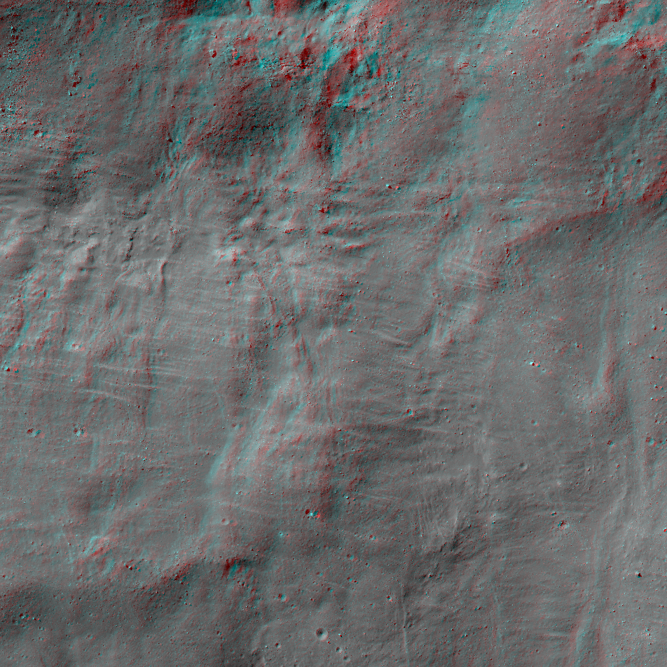
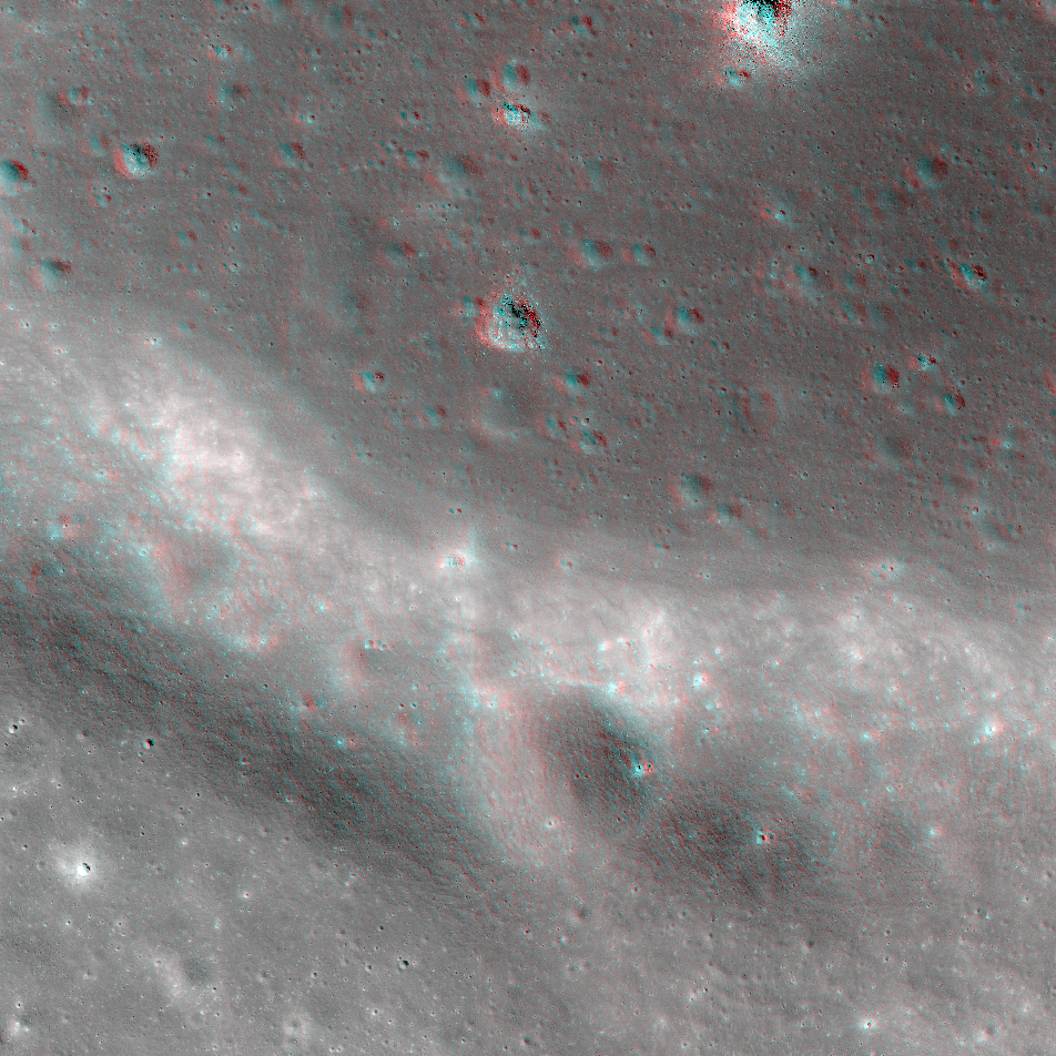
The South Side of Tycho Crater
Get out your red/blue anaglyph glasses for a three-dimensional treat! This extreme closeup of the south side of 86-kilometer-diameter Tycho Crater shows melt flows and pools, small craters, sagging slopes that look like ripples,...
Published on 08 Oct 2018
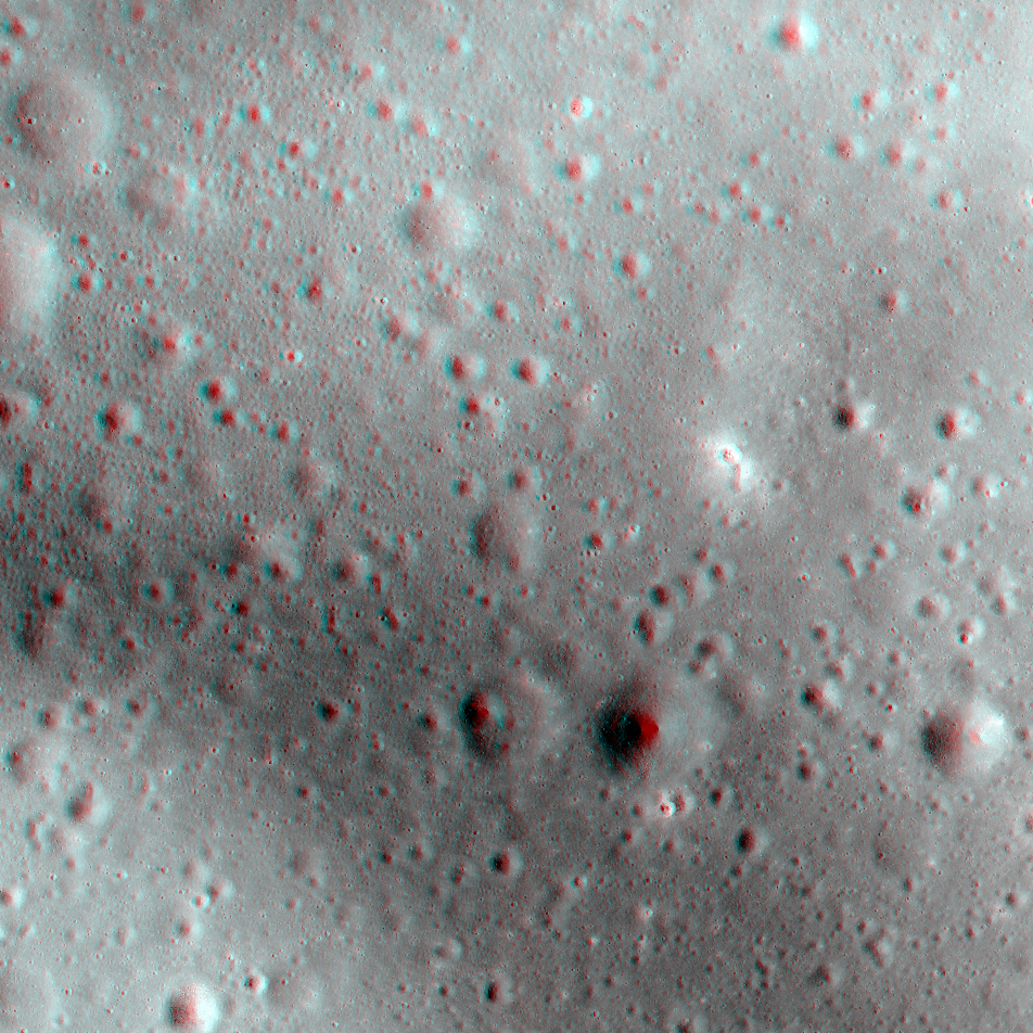
Deflector Shields Up!
Part of the westernmost swirl feature in Mare Marginis. This closeup of the center of the anaglyph strip below highlights an area little more than five kilometers wide. Bright swirl areas appeared "painted on" the landscape. Part of NAC...
Published on 06 Sep 2018
John Young at South Ray Crater
Overhead view of South Ray crater, the most prominent feature at the Apollo 16 Descartes landing site in the central lunar highlands. Astronaut John Young landed Lunar Module Orion north of the crater on 21 April 1972 (UTC)....
Published on 05 Jul 2018
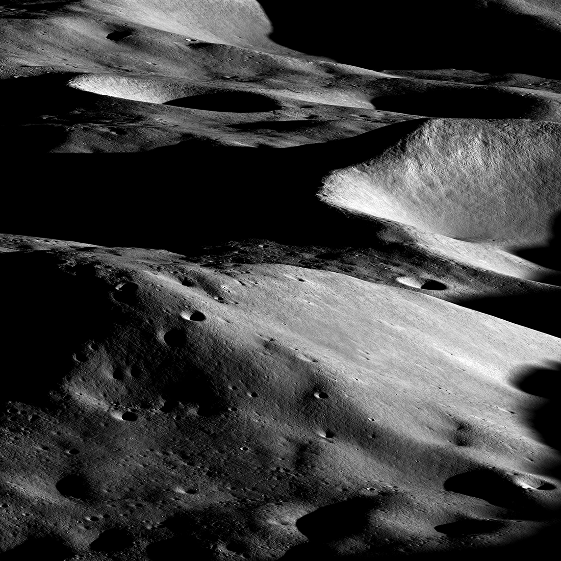
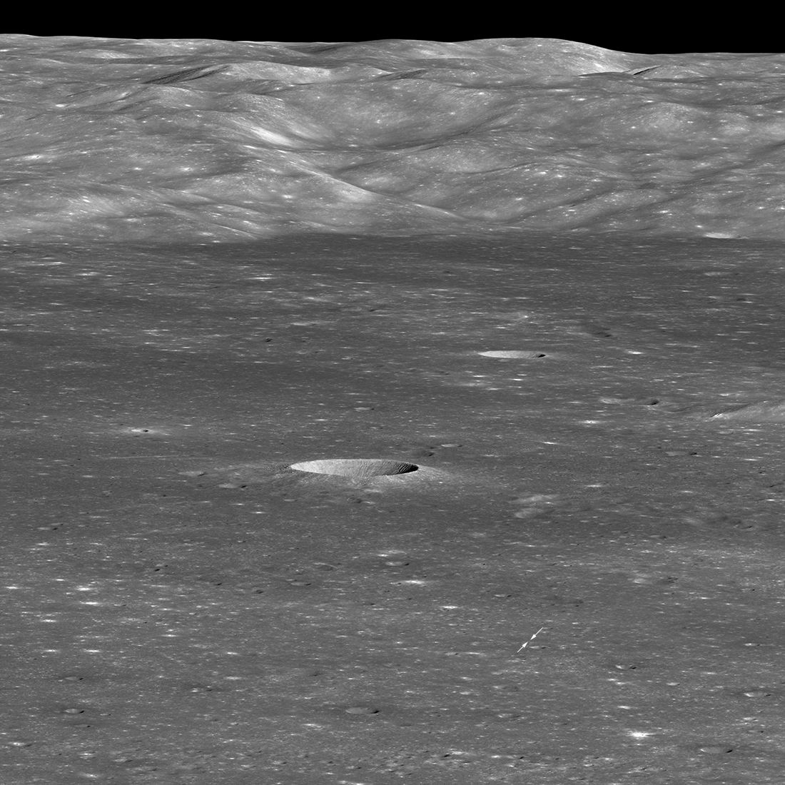
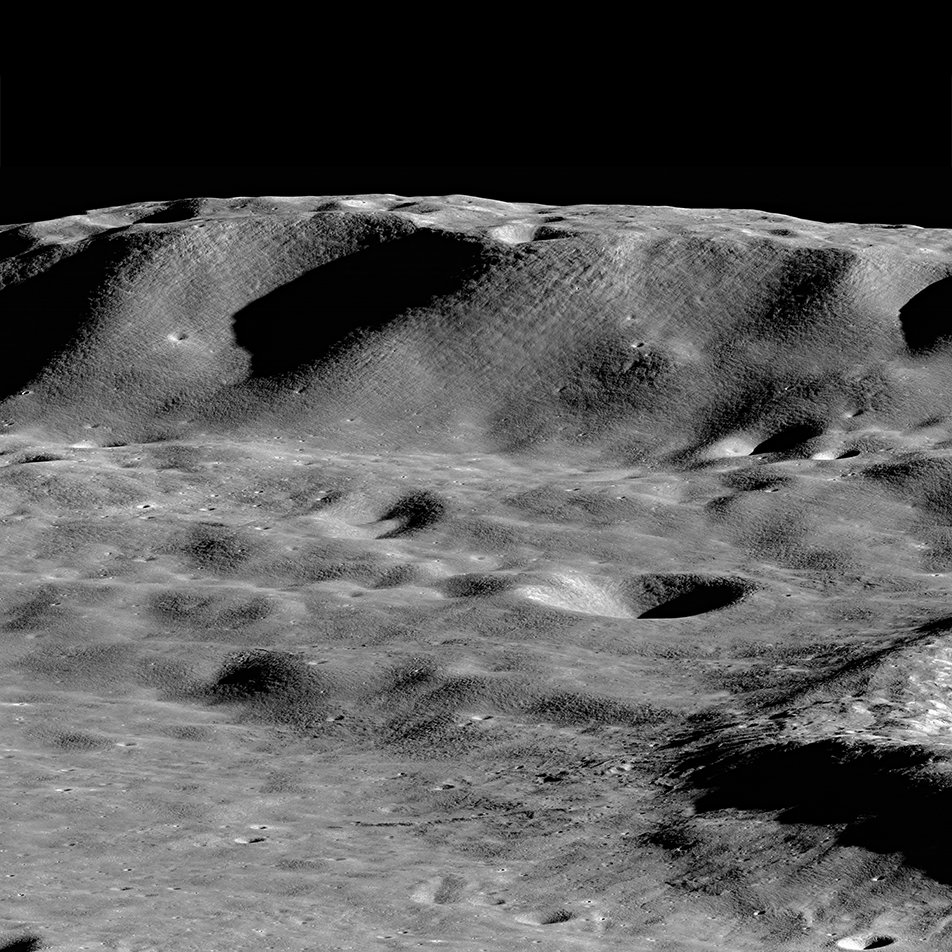
Towering Peak
The summit of the unnamed peak in the foreground (50.2° S, 236.6° E) has an elevation of 6710 meters, about 7000 meters of relief relative to the low point at the bottom of the image. The two peaks on the horizon, 200 kilometers in the...
Published on 15 Jun 2018
South Massif Landslide
By lunar standards South Massif is a relatively modest mountain, but with a rich history (geologic and exploration). The massif is about 7000 meters across at the base and 2300 meters tall; M1266925685LR, incidence angle 33°, slew angle...
Published on 09 Jun 2018
Montes Carpatus
The Montes Carpatus region (16.67°N, 332.93°E) contains numerous examples of volcanic materials. The low albedo (dark) patterns may indicate pyroclastic (explosive) material that erupted over 3 billion years ago. Tobias Mayer G crater...
Published on 08 Mar 2018
Mountains of the Moon: Zeeman Mons
The largest mountains on the Moon rival those of the Earth. Here Zeeman mons (informal name) rises more than 7,570 m (24,500 ft, 73.39°S, 213.31°E) above the floor of Zeeman crater, and the flank of Zeeman Y is just visible on the right...
Published on 20 Nov 2017
NAC Anaglyph: Mare Shoreline in Apollo Basin
A portion of the southwestern mare "shoreline" in the Apollo basin on the farside. This contact between ancient lava plains and a remnant crater rim shows the lunar surface as a land of contrasts -- of expansive plains and jutting...
Published on 30 Jun 2017
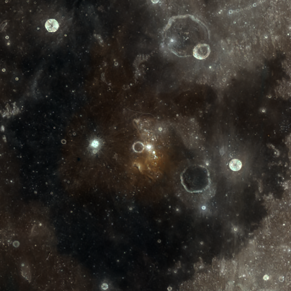
Color of the Lassell Massif
A shock of color on the Moon! The Lassell Massif (a so-called "red spot") in Mare Nubium appears orange in the center of this WAC color composite image. The image was derived by assigning red to 689 nm, green to 415 nm, and blue to 321...
Published on 12 Sep 2016