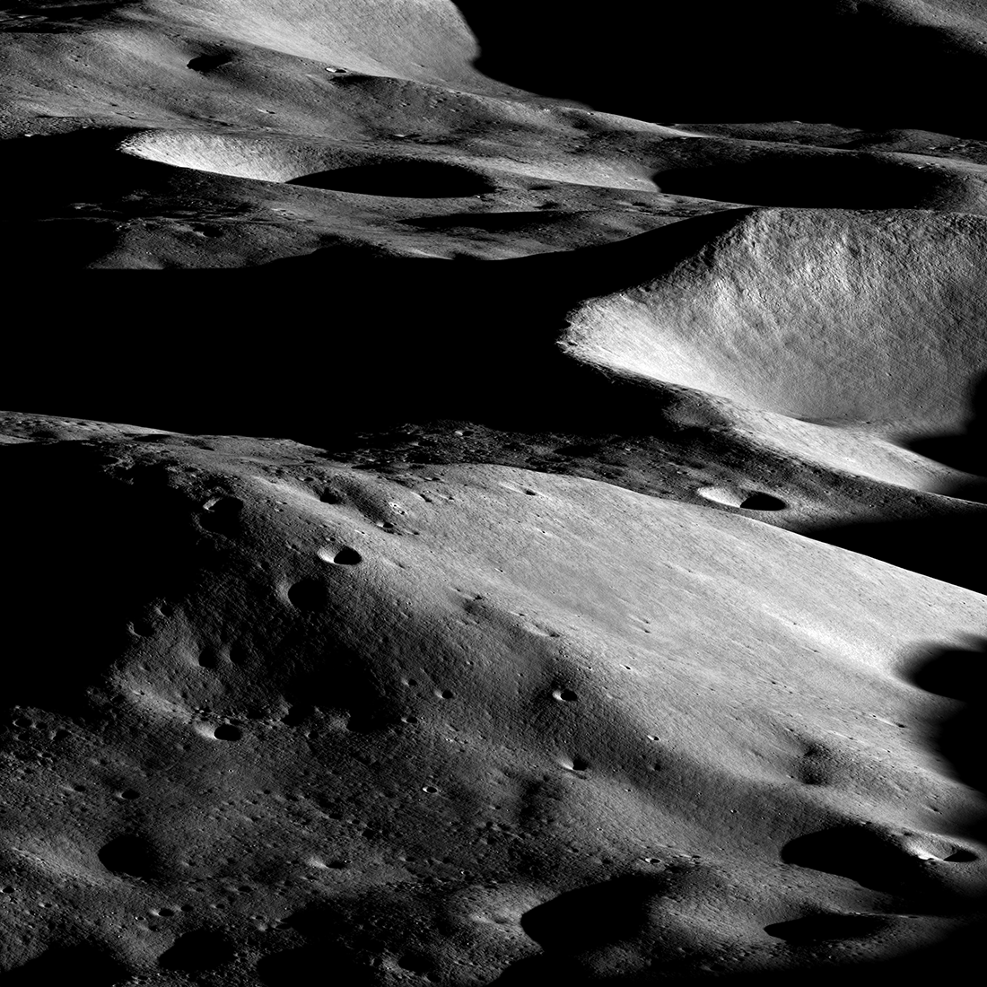
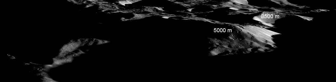
LROC shuttered this view on 03 March 2023 when the spacecraft was about 170 kilometers beyond Shackleton crater (sub-spacecraft point was 84.10°S, 129.1°E) looking towards the nearside. From this viewpoint, we see the back side of Malapert massif assuming an Earth-centric reference. The Artemis 3 candidate landing region is partially visible from this viewpoint. The relatively flat area (86°S, 0°E) above the "5000" in the image below is the heart of the Artemis 3 landing region, which continues down the slope toward the Earth, as seen here.
Imagine the view from the summit; it rises more than 5000 meters (16,400 feet) above its base. Off in the distance, you could see a 3500 meter (11,480 feet) tall cliff. One could argue that the sheer grandeur of this region makes it a prime candidate. But then again, a landing here might be too exciting?
Related Featured Images
Mountains of the Moon
Mountains of the Moon: Zeeman Mons
Towering Peak
Traversing the Shackleton de Gerlache Ridge
Published by Mark Robinson on 14 March 2023