About 3.86 billion years ago, a large asteroid smashed into the Moon, excavating the 1150-kilometer-wide Imbrium basin. Early in its history, the Imbrium basin resembled the Moon's Orientale basin, a spectacular bullseye formed of concentric mountain rings. The Orientale basin experienced only minor mare lava flooding, so its original mountain ring structure is still exposed. The Imbrium basin had a very different fate.
Mons Piton was one of many peaks in the inner mountain ring of the Imbrium basin. It likely stood as high as five kilometers above the basin floor. Between about 3.7 and 2.5 billion years ago, however, volcanic eruptions gradually filled in the Imbrium basin. Lava submerged most of the mountain ring of which Mons Piton was a part. Mons Piton now stands up to 2.3 kilometers above Mare Imbrium. Other fragments of that lost mountain ring survive: they include Mons Pico, Montes Teneriffe, and Montes Recti, all located west of Mons Piton.
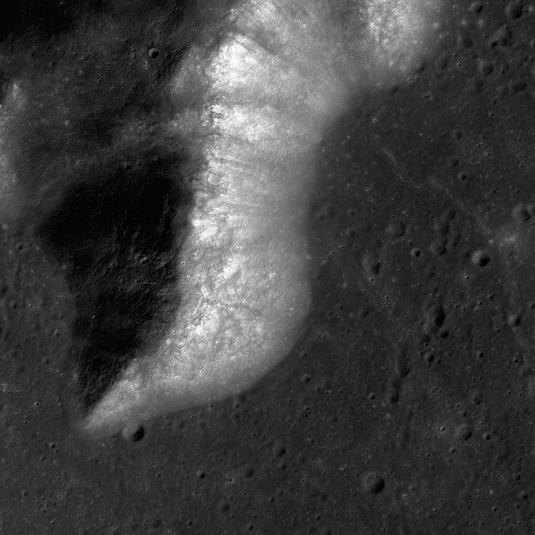
In our Featured Image, we see the southern part of Mons Piton and the surrounding Mare Imbrium plain. As in most images of the lunar surface, impact craters large and small pock the landscape. Many are degraded. A steady rain of micrometeoroids chips away at boulders and crater rims, gradually turning fresh craters into nondescript depressions. In addition, shaking caused by impacts and moonquakes gradually fills in craters.
Mons Piton has fewer obvious craters than the surrounding plain because mountain slopes tend to be less stable than flat terrain. This means that some crater-erasing degradation processes — specifically, gradual slumping and sudden landslides — are more efficient and thus occur more often than on the plains.
An unnamed crater touching the south edge of Mons Piton just east (right) of its tip is 770 meters wide. The small asteroid which excavated the crater apparently struck Mare Imbrium close enough to Mons Piton's slopes to trigger a landslide that covered the crater's northwest (upper left) rim and floor.

Related Featured Images:
Orientale Basin
Curiously Fast Degradation of Small Lunar Craters
Dynamic Moon!
Boulder Clusters on a Ridge Crest
South Massif Landslide
Published by David Portree on 9 May 2019