Featured Images
 New!
New!
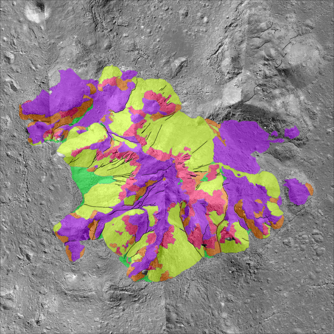
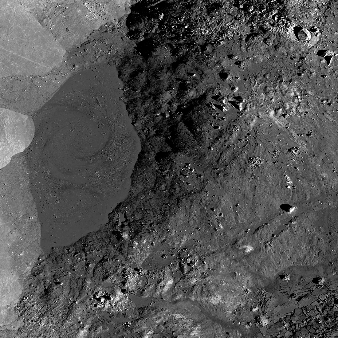
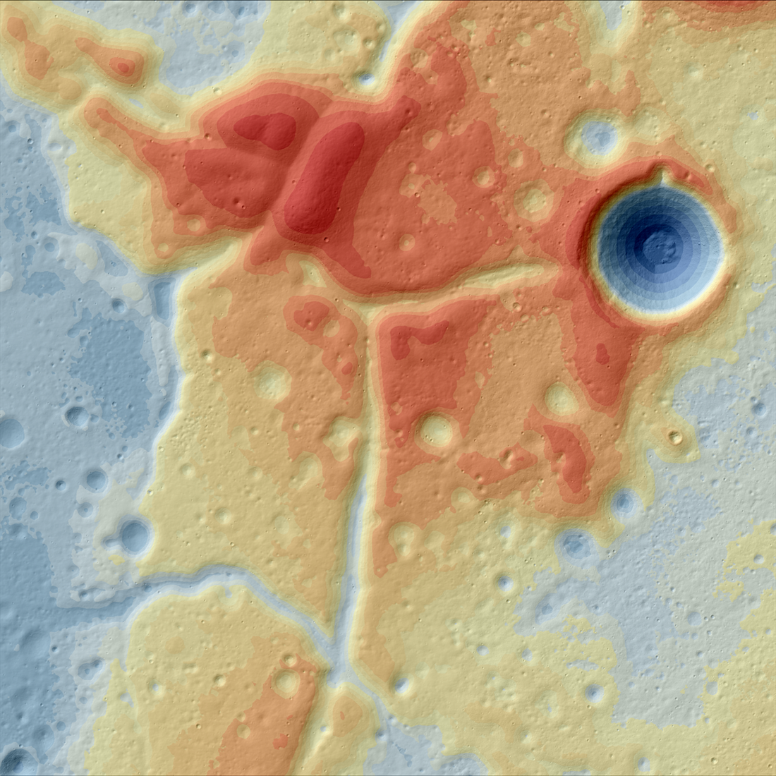
Tycho Central Peak: A Deeper Look!
A morphologic map highlighting the variety of landforms that make up the central peak of Tycho crater, a young ~70 kilometer diameter crater on the southern nearside (-43.48, 348.67) {NASA/ASU/Arizona State University].
Published on 03 May 2025

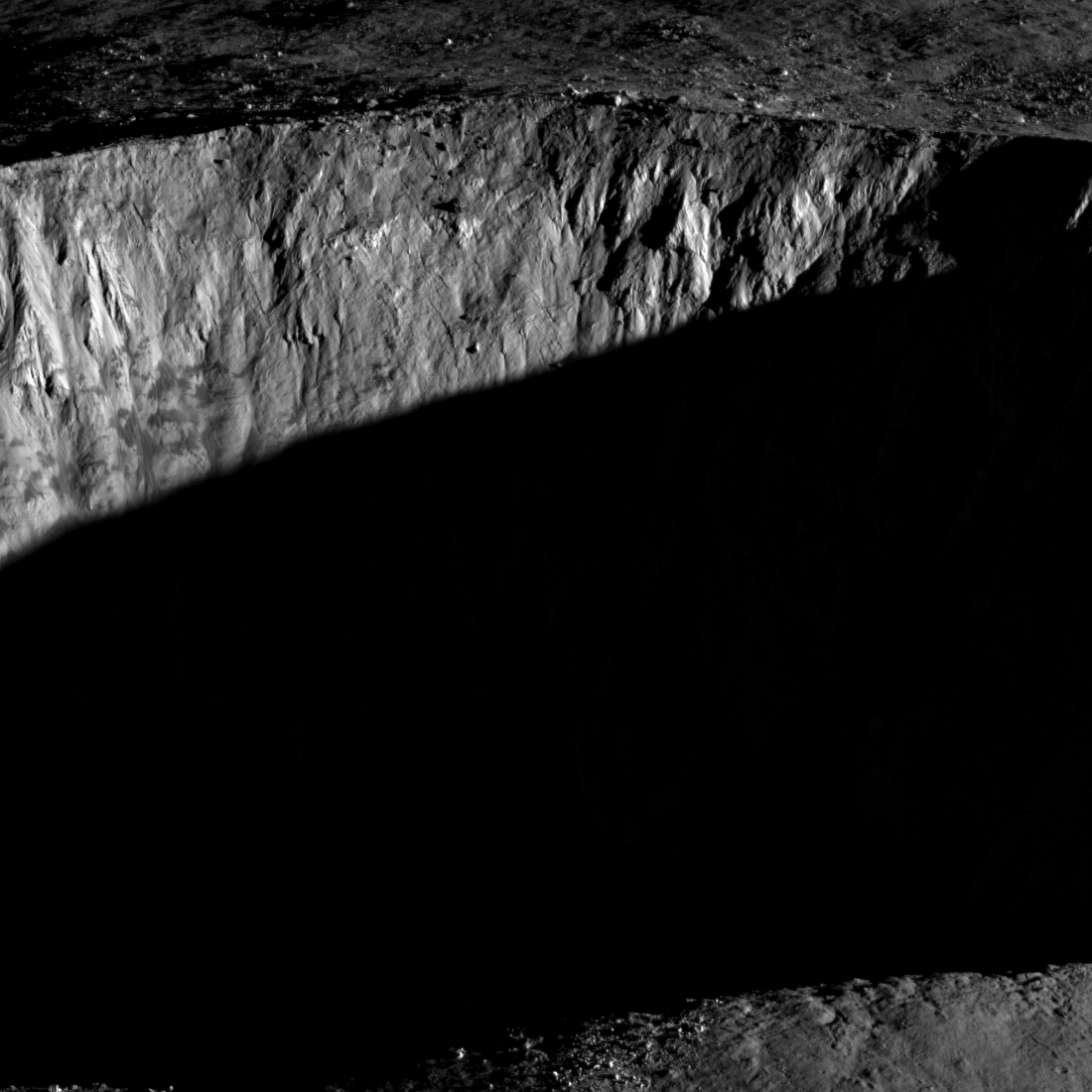
Fences on the Moon?
Mysterious farside impact melt deposits, image width 12 kilometers at center, looking west-to-east, north is to the left, M1451669615LR [NASA/GSFC/Arizona State University].
Published on 25 Apr 2025

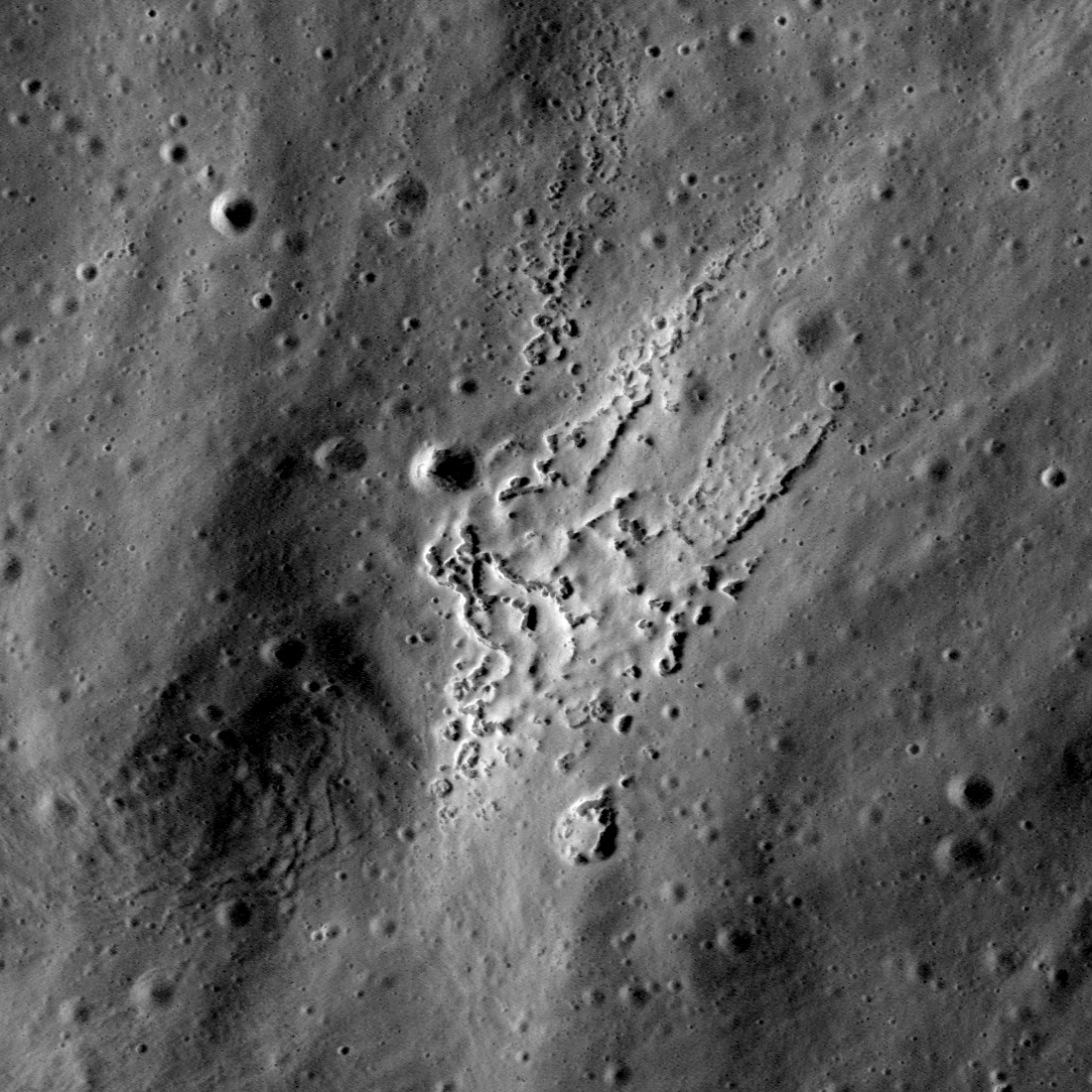
Mons Rümker and the Moon's Volcanic Past
NAC regional mosaic composed of 10 images showing Mons Rümker and the surrounding mare surface. Images acquired between 2012-06-03 to 2016-04-21. Image width is 299 kilometers, centered at 40.80°N, 301.43°E [NASA/GSFC/Arizona State...
Published on 12 Apr 2025
Blue Ghost Site: Looking Back Towards The Sun
Large phase angle NAC image of the Firefly Aerospace Blue Ghost lunar lander. Image is 1300 meters wide, north is up, NAC M1495633125LR (NASA/GSFC/Arizona State University).
Published on 21 Mar 2025
IM-2 Athena: A Closer View
LROC acquired a subsequent oblique on 10 March at 14:52 UTC, bringing the IM-2 Athena lander into sharper focus. North and nearside to the right, image width 1175 meters M1496181900LR [NASA/GSFC/Arizona State University].
Published on 11 Mar 2025
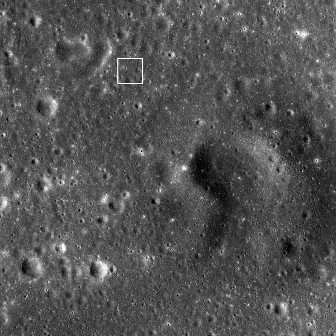
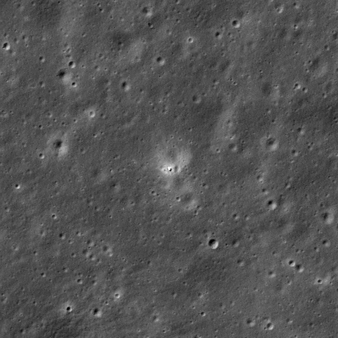
IM-2 Athena Seen Obliquely
The Intuitive Machines IM-2 Athena lander reached the surface of the Moon on 06 March 2025, near the center of Mons Mouton. The Earth and north are towards the right, image width 3.9 kilometers, image resolution reduced 3x, NAC...
Published on 10 Mar 2025

Blue Ghost Lunar Lander Seen From Above
The Firefly Aerospace Blue Ghost lunar lander touched down in the volcanic terrain known as Mare Crisium. Visible in the upper left is a portion of a volcanic depression and to the bottom right is a volcanic cone, known as Mons...
Published on 07 Mar 2025
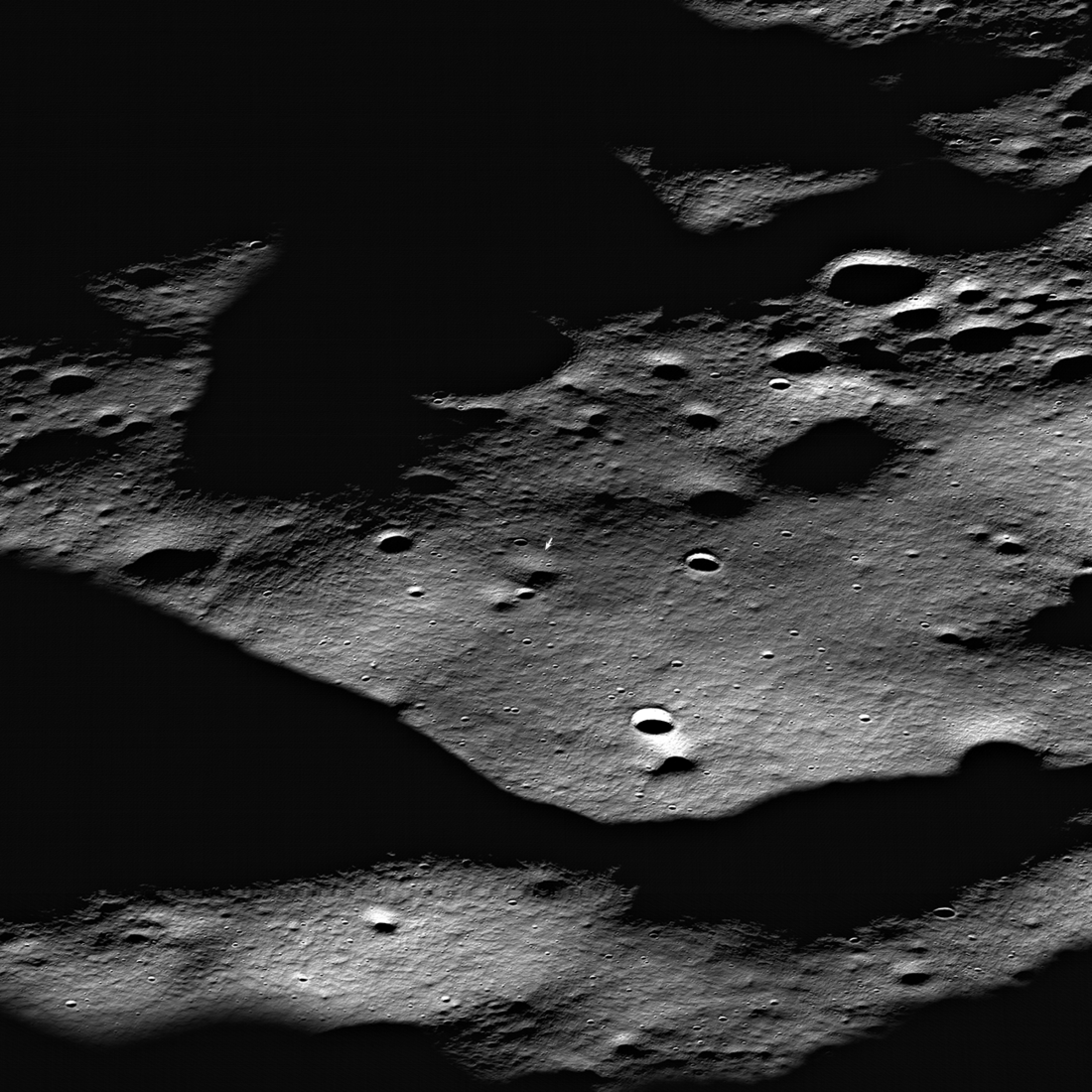
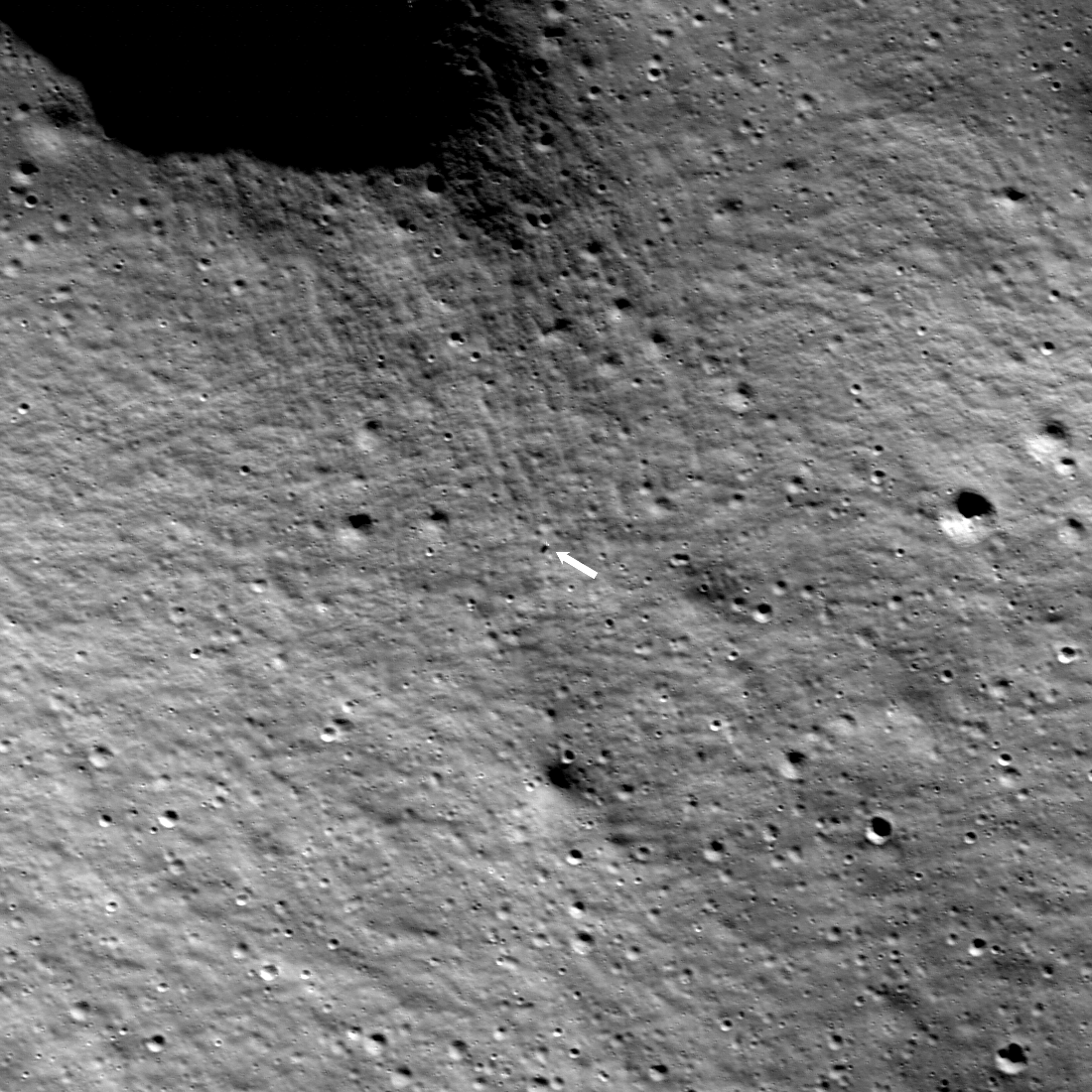
Blue Ghost Seen Obliquely
The Firefly Blue Ghost lunar lander set down on 2nd March 2025. The landing site (arrow) is about 4000 meters from the center of Mons Latreille, a large volcanic cone. NAC M1495577008LR [NASA/GSFC/Arizona State University].
Published on 04 Mar 2025
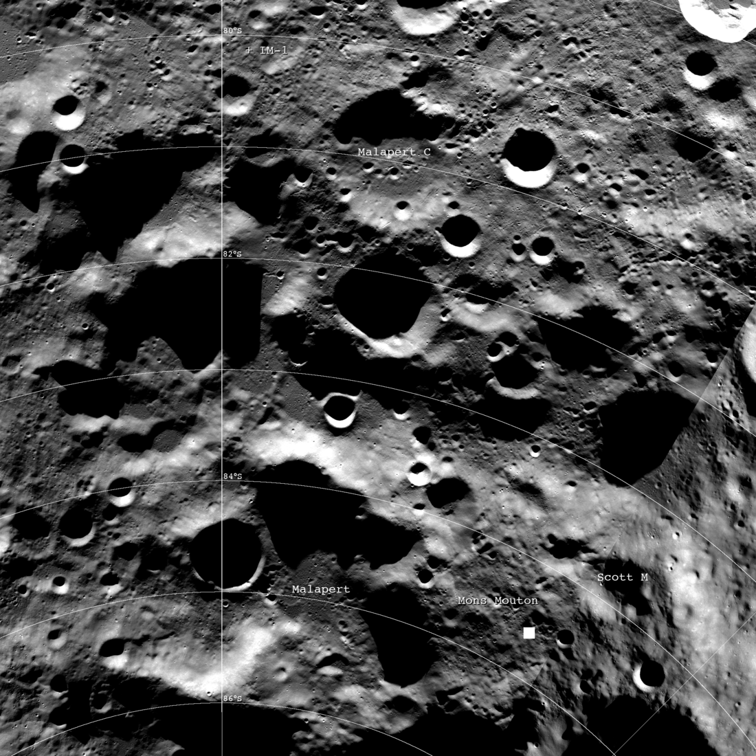
IM-2 Landing Region
The Intuitive Machines IM-2 Nova-C lander (Athena) is currently scheduled to land on Mons Mouton on 6 March 2025 (predicated upon a launch before the 2nd of March). The IM-1 Odysseus landing site is indicated at the center top, and the...
Published on 26 Feb 2025
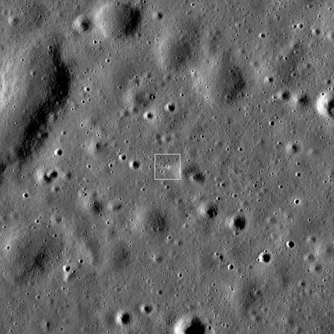
Firefly Blue Ghost Landing Region
The Firefly Aerospace Blue Ghost Mission 1 spacecraft was launched toward the Moon on January 15th 2025 and is slated to land on March 2nd. The landing region is located in eastern Mare Crisium (white box; 18.56°N, 61.81°E); NAC...
Published on 21 Feb 2025
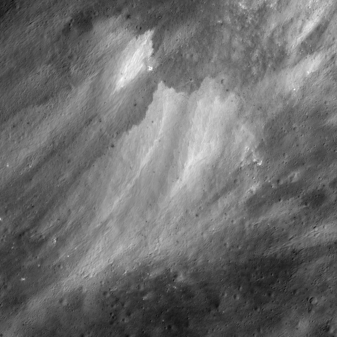
Mesmerizing Patterns
Mesmerizing abstract pattern (17.45°S, 144.75°E) formed as low-angle ejecta from a 2.4-kilometer diameter crater was emplaced from the lower left towards the upper right. The curve indicates the underlying steep slope (20°)....
Published on 28 Jan 2025
Amazing Giordano Bruno
Beautiful complex floor of Giordano Bruno crater. M1452055478LR, acquired 2023-10-16, incidence angle 65°, slew angle 0°, phase angle 64°, spacecraft altitude 96 kilometers, image width 3750 meters, pixel scale reduced...
Published on 20 Jan 2025
First to See the Farside
First photograph (BW) taken of the famous Apollo 8 Earthrise sequence, the following images were acquired with color film [AS08-13-2329, NASA].
Published on 24 Dec 2024
Dramatic Sunrise
Early morning Sun illuminates the steep western wall of an unnamed 10-kilometer diameter crater. North is to the right, image 3.5 kilometers across in the center [NASA/GSFC/Intuitive Machines].
Published on 22 Oct 2024
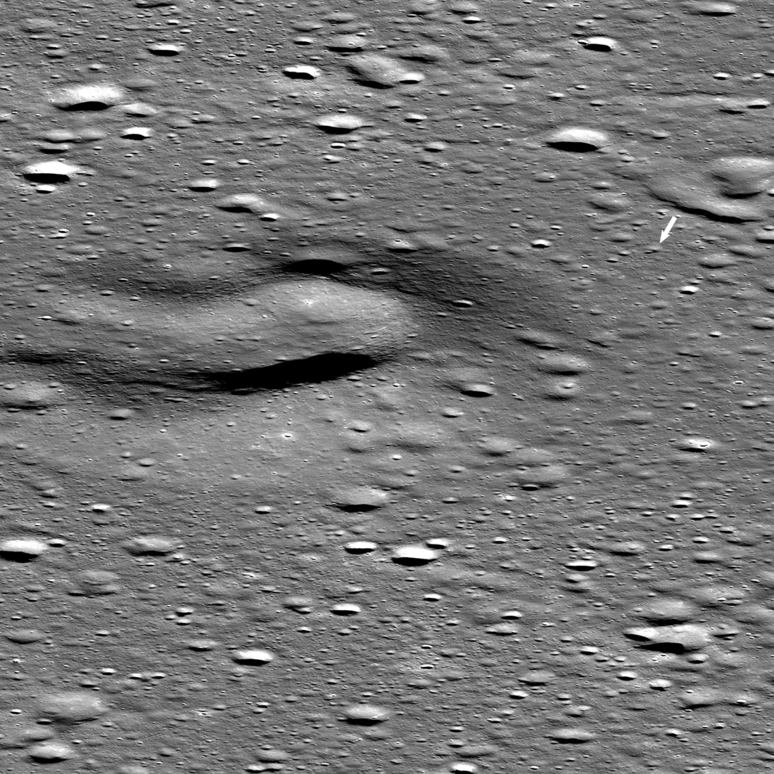
Young Volcanism?
Enigmatic landform proposed to have formed from relatively young volcanic activity. NAC M1453037761LR, acquired 2023-11-27, incidence angle 71°, slew angle 43°, phase angle 116°, spacecraft altitude 89 km, north is up, image width...
Published on 18 Oct 2024
First Look: Chang'e 6
This image from NASA's Lunar Reconnaissance Orbiter Camera shows Chang'e 6 in the Apollo basin on the lunar farside on 07 June 2024. The lander is seen as the small cluster of bright pixels in the center of the image. Image is 552...
Published on 14 Jun 2024
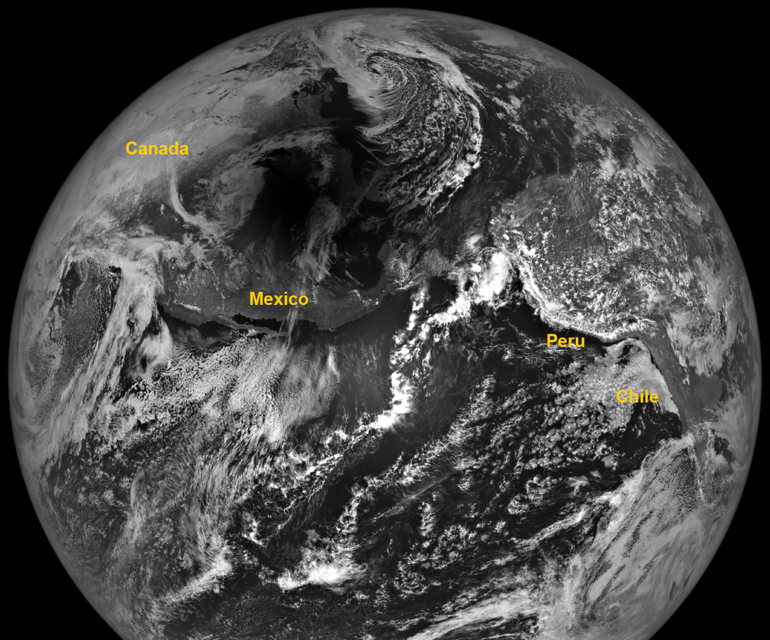
2024 Eclipse as Seen From The Moon
When LROC acquired this image on 8 April 2024, the shadow of the Moon was centered near Cape Girardeau, Missouri. LROC E1467242026L [NASA/GSFC/Arizona State University].
Published on 15 Apr 2024

Another Close Encounter!
Hard to find, but centered here, you can see a fuzzy view of the Korea Aerospace Research Institute (KARI) lunar orbiter, Danuri, as it flew just 8 kilometers below LRO. Image width about 3000 meters, NAC M1464323568...
Published on 05 Apr 2024
A Lunar Island Surrounded by Lava
Color-shaded relief map showing the elevations of the Western Crisium Kipuka (WCK) located on the western edge of Mare Crisium. The elevation ranges from -4,218 m (blue) to -3,195 m (red) [NASA/GSFC/Arizona State University].
Published on 01 Apr 2024
Intuitive Machines IM-1 On The Moon!
The Intuitive Machines IM-1 Nova-C, known as Odysseus, touched down on the Moon Thursday, 22 February, at 23:23:53 UTC (17:23 CST). The arrow indicates the Nova-C lander; the image width is 973 meters, NAC M1463440322L...
Published on 26 Feb 2024