Featured Images
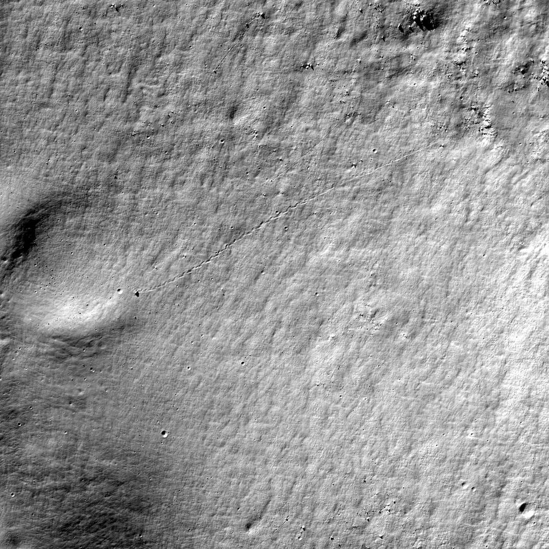
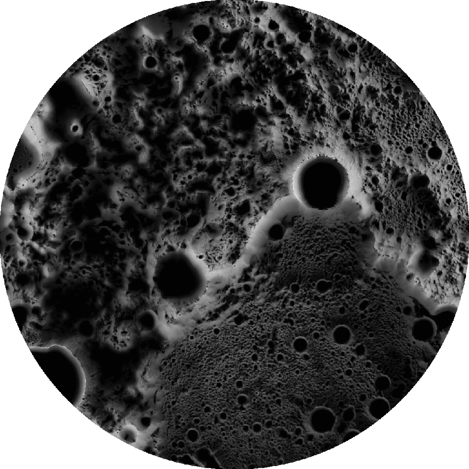
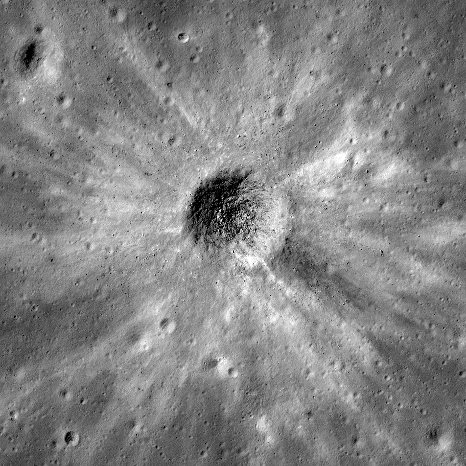
Almost a Hole-in-One
A geologic story in Antoniadi crater on the Moon's far side. North is toward the top. Image width 1.54 kilometers, NAC M1311837924LR [NASA/GSFC/Arizona State University].
Published on 26 Jul 2019
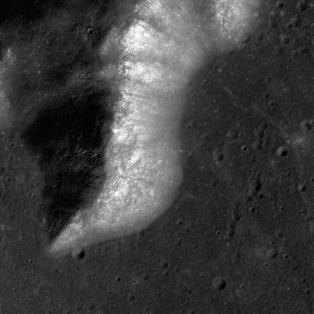
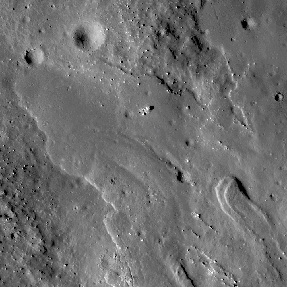
On and Around Mons Piton
Mons Piton rises 2300 meters above the dark volcanic rocks of Mare Imbrium. The image covers an area 15.5 kilometers wide, north is up, and the Sun shines from the east (right). LROC NAC image pair M190609650LR [NASA/GSFC/Arizona State...
Published on 09 May 2019

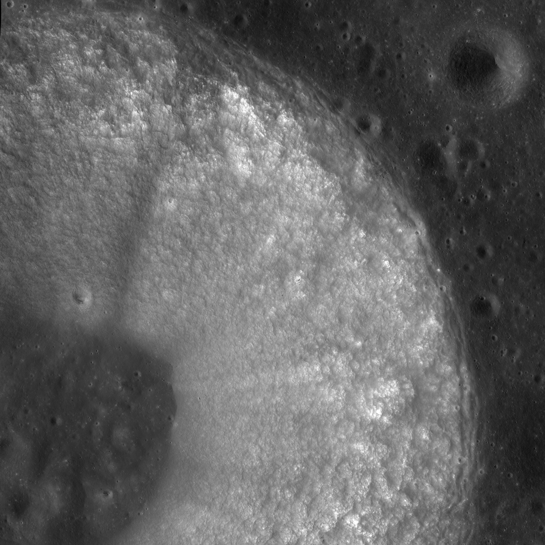
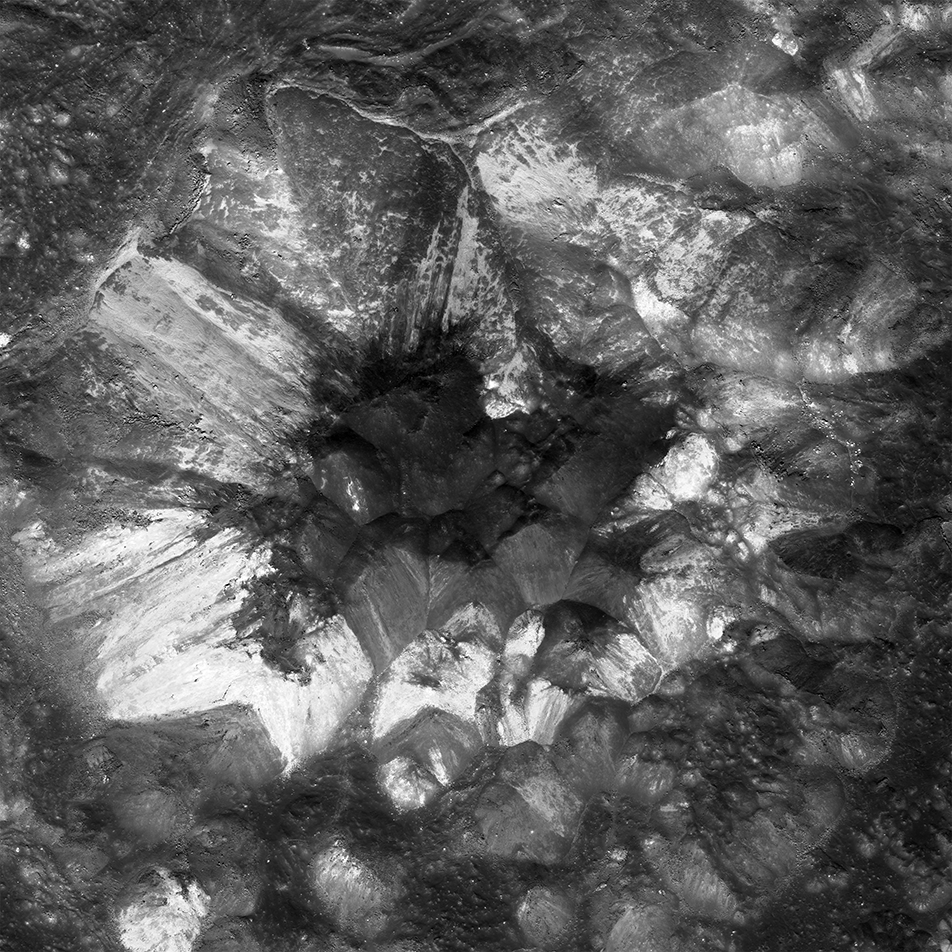
Mysteries of Compton Crater
The oblique view of part of the north-central floor of Compton crater (center lat 55.9°, center lon 104.1°) shows floor fractures, the north slopes of its central peaks (center right), thousands of impact craters (some less than a meter...
Published on 10 Apr 2019
Chladni 225
Chladni crater (center lat 3.96°N, center lon 1.11°E) is a classic bowl-shaped "simple" lunar crater located in Sinus Medii ("central bay"). The image displays the north and east parts of the 13.1-kilometer-wide crater, including part...
Published on 21 Feb 2019
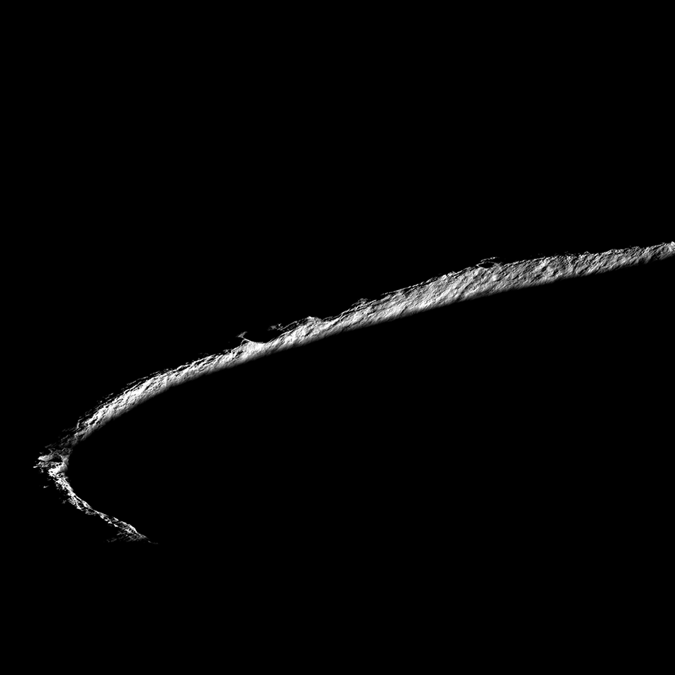
Lobate Scarps: The Movie
Lobate scarps - like those shown here on the floor of the farside crater d'Alembert - are not large, but they tell us much about how hot the Moon was when it was born and its ongoing thermal evolution. Image width is about four...
Published on 31 Oct 2018
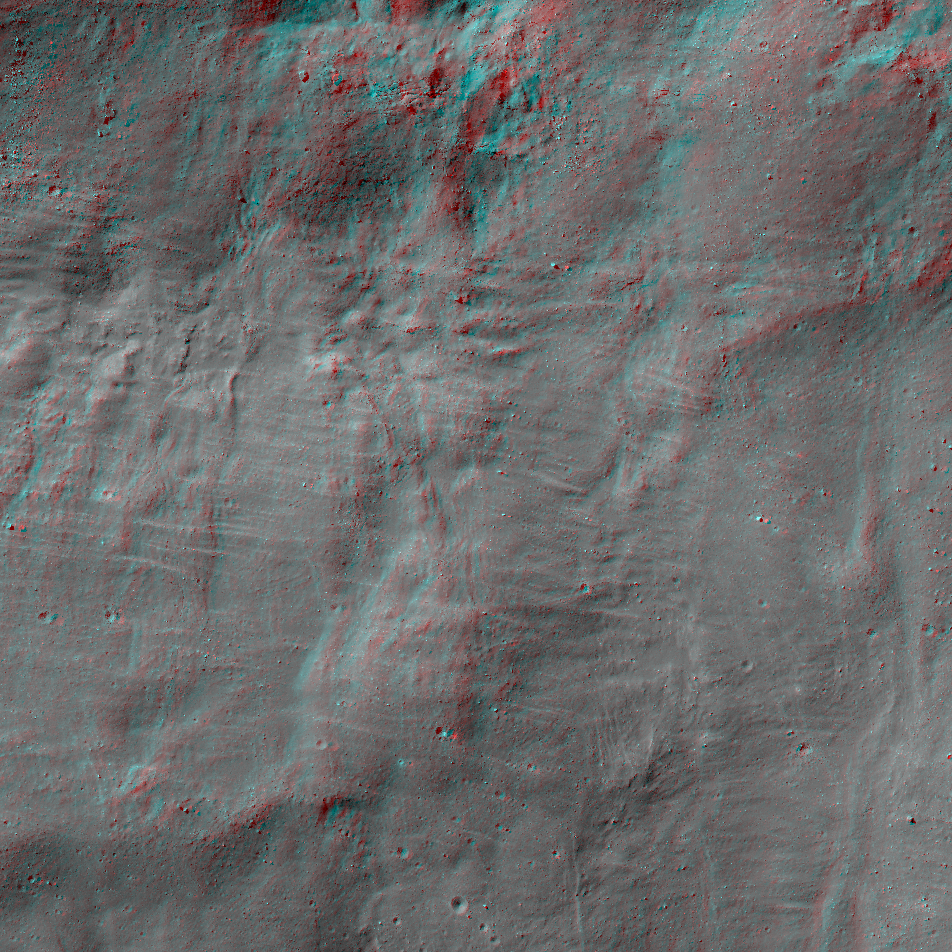
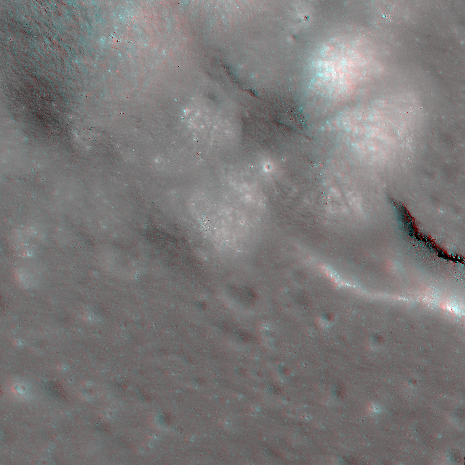
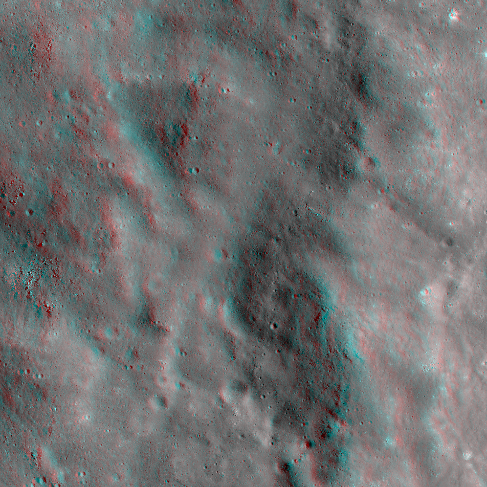
The South Side of Tycho Crater
Get out your red/blue anaglyph glasses for a three-dimensional treat! This extreme closeup of the south side of 86-kilometer-diameter Tycho Crater shows melt flows and pools, small craters, sagging slopes that look like ripples,...
Published on 08 Oct 2018
Self-Inflicted Secondaries?
This portion of an impact melt flow at Aristarchus Crater, centered at 24.6°N, 321.1°E, includes modified small craters and overlapping melt flows. What do the shapes of craters on impact melt and the statistics derived through careful...
Published on 30 Jun 2018
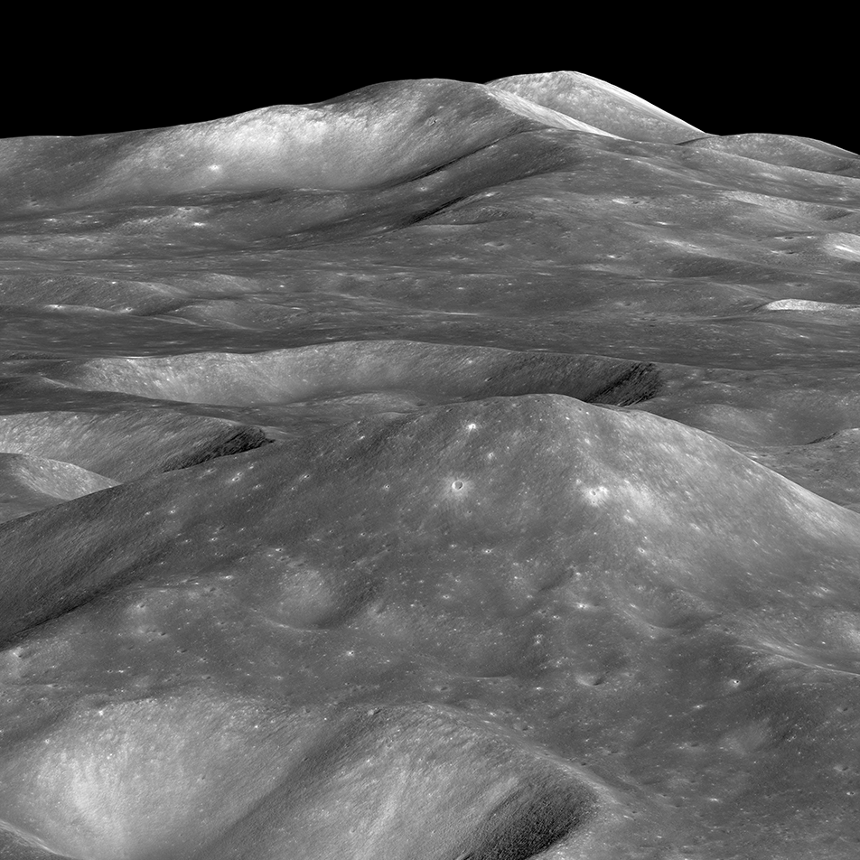
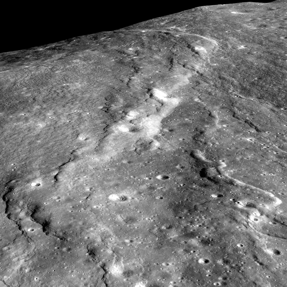
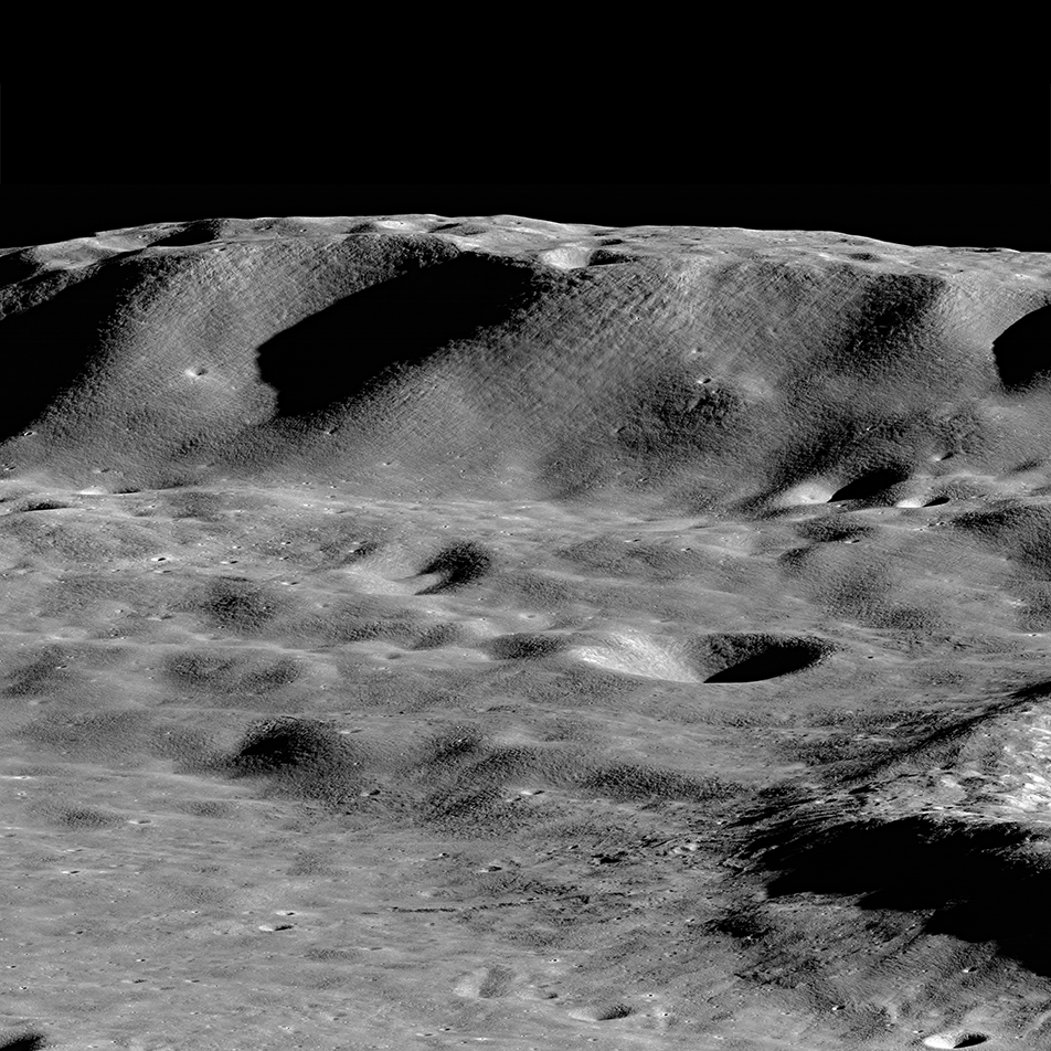
Towering Peak
The summit of the unnamed peak in the foreground (50.2° S, 236.6° E) has an elevation of 6710 meters, about 7000 meters of relief relative to the low point at the bottom of the image. The two peaks on the horizon, 200 kilometers in the...
Published on 15 Jun 2018
Curiously Fast Degradation of Small Lunar Craters
Taurus-Littrow valley, geologic exploration target for Apollo 17 and the Lunar Reconnaissance Orbiter Camera study team led by Dr. Prasun Mahanti. Center latitude 20.15°N, center longitude 30.98°E, image 18 km wide, image...
Published on 24 Apr 2018
Lunar Light Plains: The Movie
The Orientale Basin, about 950 kilometers wide, is the striking multi-ringed impact feature at lower right. New research suggests that the impact event that formed Orientale may have emplaced light plains deposits - visible here...
Published on 20 Apr 2018
NAC Anaglyph: Humboldt Crater Floor
A floor fracture and central peak structure on the floor of Humboldt Crater (207 km diameter) that formed directly after impact. Intrusive volcanic activity likely caused the floor of the crater to lift up and then fracture ...
Published on 06 Apr 2018
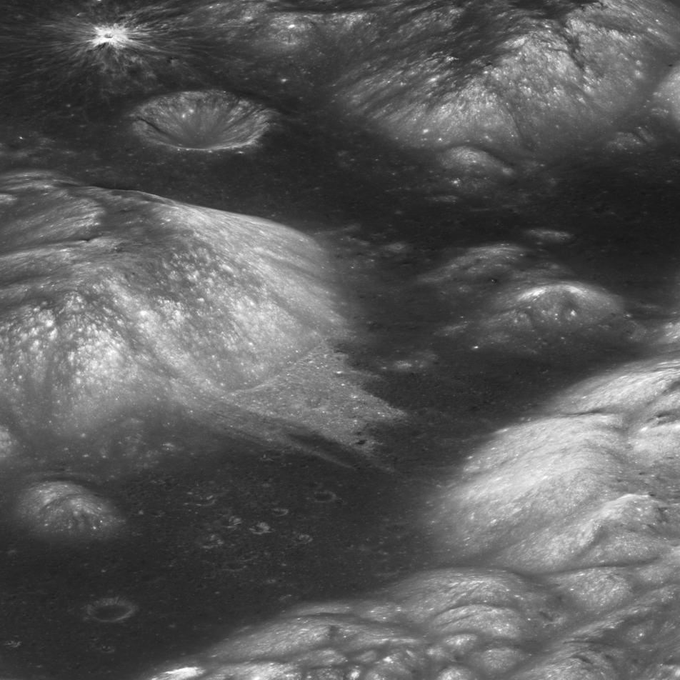
On the Rim!
Spectacular oblique view of the rim of Shackleton crater (21 km diameter, 89.66°S, 129.20°E). While no location on the Moon stays continuously illuminated, three points on the rim remain collectively sunlit for more than 90% of the...
Published on 01 Feb 2018
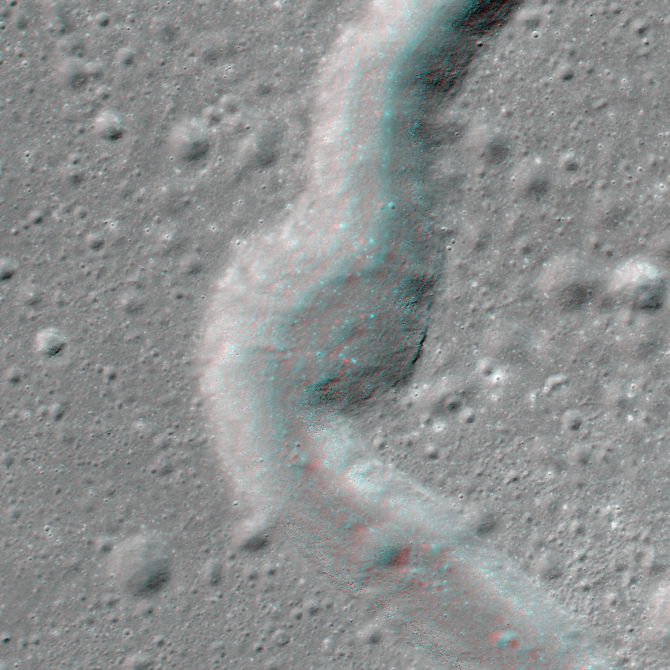
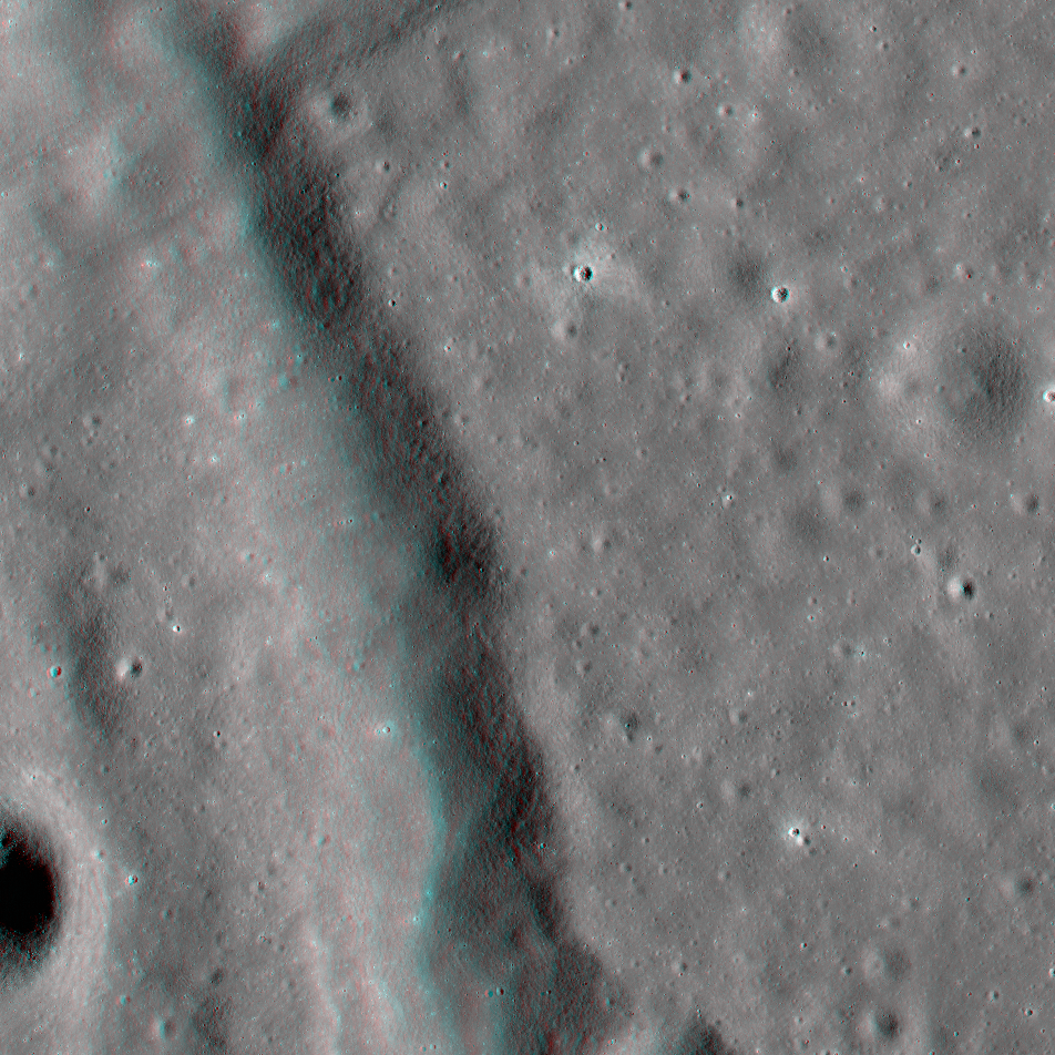
NAC Anaglyph: Rima Sharp
A bend in Rima Sharp, a sinuous rille that can be traced more than 250 km and spans the boundary between mare-filled Sinus Roris (to the north) and Oceanus Procellarum (to the south) [NASA/GSFC/Arizona State University].
Published on 26 Jan 2018
Polar Illumination Maps and More!
New Reduced Data Records (RDRs) available as part of the 32nd Planetary Data System (PDS) release include two versions of the polar illumination maps for each pole. They include this time-weighted north pole illumination...
Published on 12 Jan 2018
Zowie!
Looking down on the amazing central peak of Jackson crater, which rises 2000 meters above the crater floor. North is to the left; the area imaged measures 10 kilometers from left to right. NAC M1117602006LR [NASA/GSFC/Arizona State...
Published on 09 Jan 2018
Mountains of the Moon: Zeeman Mons
The largest mountains on the Moon rival those of the Earth. Here Zeeman mons (informal name) rises more than 7,570 m (24,500 ft, 73.39°S, 213.31°E) above the floor of Zeeman crater, and the flank of Zeeman Y is just visible on the right...
Published on 20 Nov 2017
High Resolution Maps of the Moon
A section of Narrow Angle Camera (NAC) Region of Interest (ROI) mosaic of Catena Littrow (22.23°N, 29.61°E) represents one of 12 new Reduced Data Records (RDRs) recently released as part of Volume 31 of the LROC Planetary Data System...
Published on 31 Oct 2017
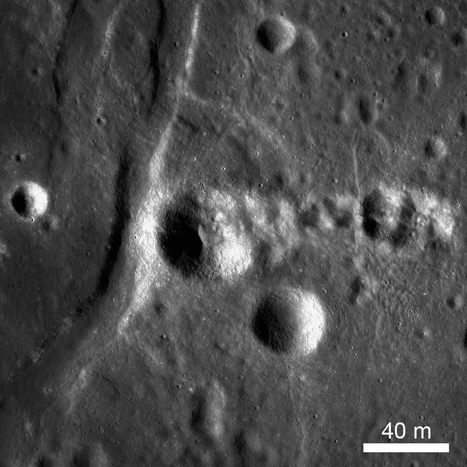
Probing the Lunar Surface Using Small Impact Craters
A fresh impact crater with finely detailed ejecta patterns. How has this crater changed since it was formed? Can the shape of this crater tell us anything about the surface in which it formed? The crater cavity (centered at 20.870°S,...
Published on 20 Oct 2017
NAC Anaglyph: Triesnecker Fractures
A graben (a negative relief feature) in Sinus Medii that is part of a complex fracture system named Rimae Triesnecker, which represents deep tectonic deformatoin of the crust [NASA/GSFC/Arizona State University].
Published on 22 Sep 2017
NAC Anaglyph: Tsiolkovskiy Crater Terrace
A portion of the terraces that make up the southeastern wall of Tsiolkovskiy Crater. The "rough and tumble-down" appearance of the wall conveys the dynamic processes involved in impact cratering events of this magnitude...
Published on 11 Aug 2017