Featured Images
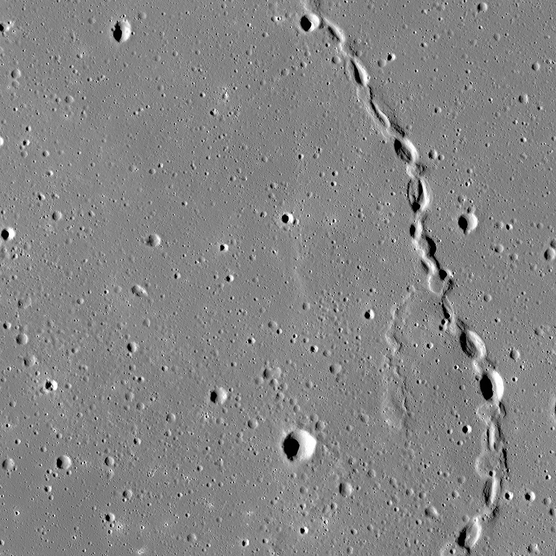
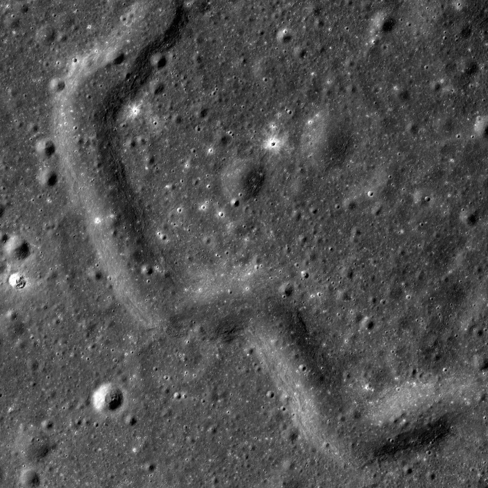
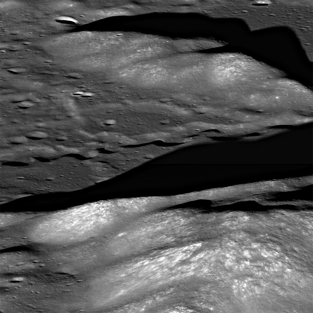
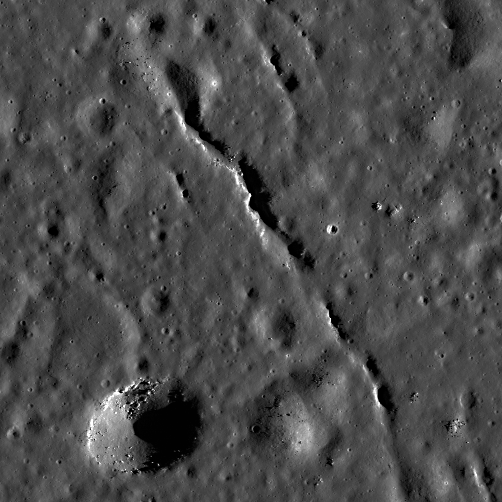
Gruithuisen: Collapsed Lava Tube?
The spectacular sinuous landform shown above is thought to be a collapsed lava tube (34.7°N, 316.6°E), located near Gruithuisen K crater. NAC controlled mosaic containing images M1173350480L/R, M1173357586L/R [NASA/GSFC/Arizona...
Published on 06 Oct 2023
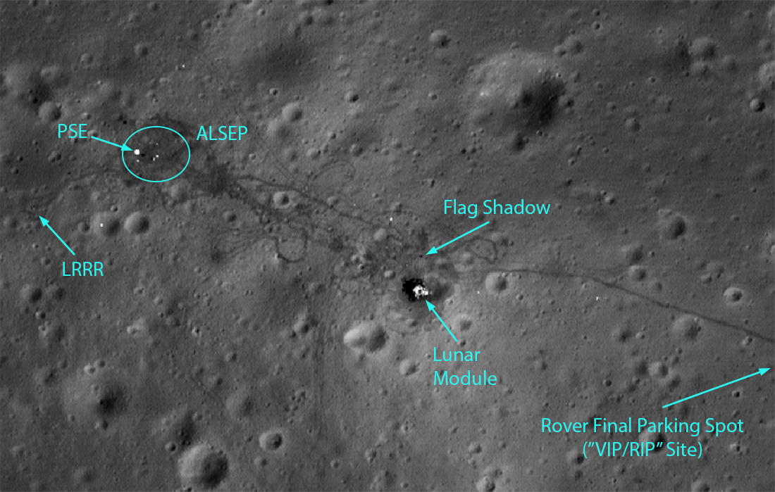
Apollo 15: A Mission of Many Firsts
Highlights of the Apollo 15 landing site, as seen in LROC NAC image M175252641R. This image has a resolution of 27 cm/px, and shows an area of 262 m by 186 m. The Lunar Module is clearly visible, as are many tracks from the Lunar Roving...
Published on 30 Jul 2021
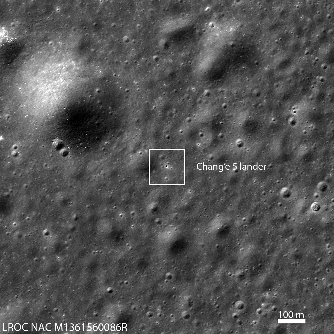
First Look: Chang'e 5
Box indicates Chang'e 5 lander on the basaltic plains of Oceanus Procellarum ("Ocean of Storms") on 02 December 2020 09:54 EST (14:53:55 UTC). The lander is the bright spot in the center of the outline. Image is 1210 meters wide; north...
Published on 04 Dec 2020
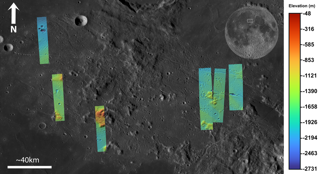
Apennine Bench Formation: A Window into Ancient Volcanism
LROC Wide Angle Camera (WAC) 100 m/px mosaic with 6 colorized Digital Terrain Models (DTMs) of the Apennine Bench Formation (centered near 26° N, 356° E - here in Quickmap), an enigmatic light plains unit located on the central lunar...
Published on 29 Jun 2020
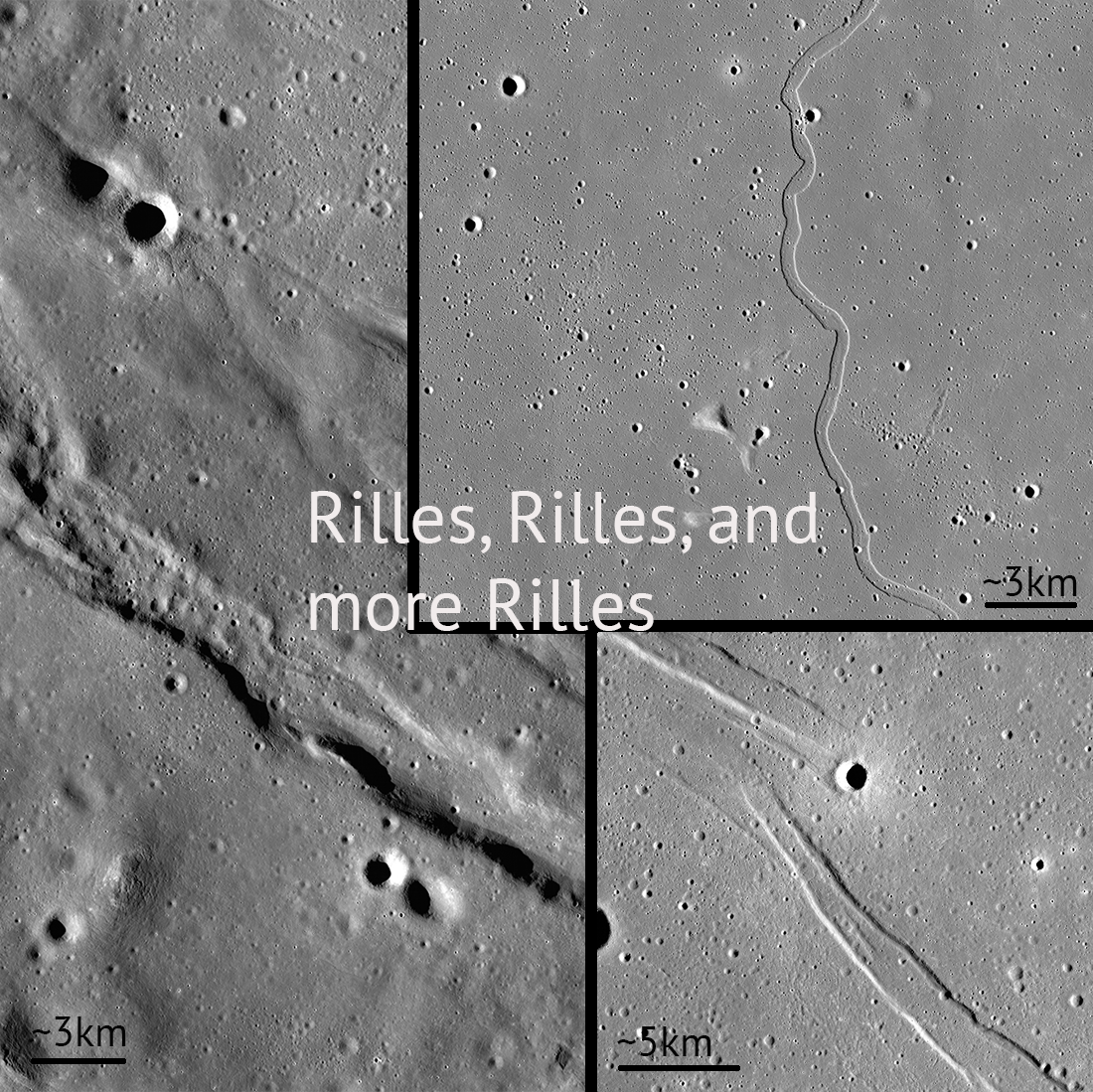
Rilles and Rilles: Sinuous, Straight, and Arcuate
Rilles are all over the Moon! Controlled feature mosaics help us see these features with great detail. Pictured: Rimae Sulpicious Gallus (20°N Lat, 10°E Lon), Rima Sharp (46°N Lat, 309°E Lon), Rima Cauchy (10°N Lat, 38°E Lon)...
Published on 30 Apr 2020
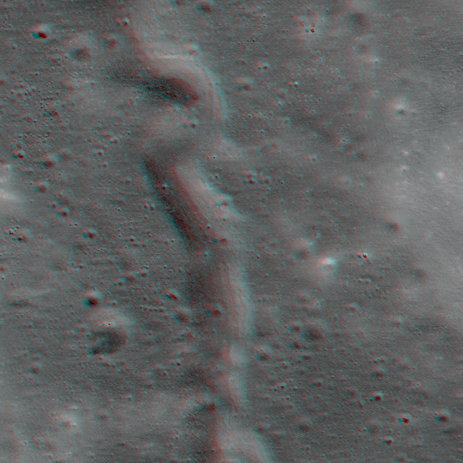
NAC Anaglyph: Alpes Rille
Sinuous rille -- check out this lunar lava channel [NASA/GSFC/Arizona State University].
Published on 09 Oct 2015
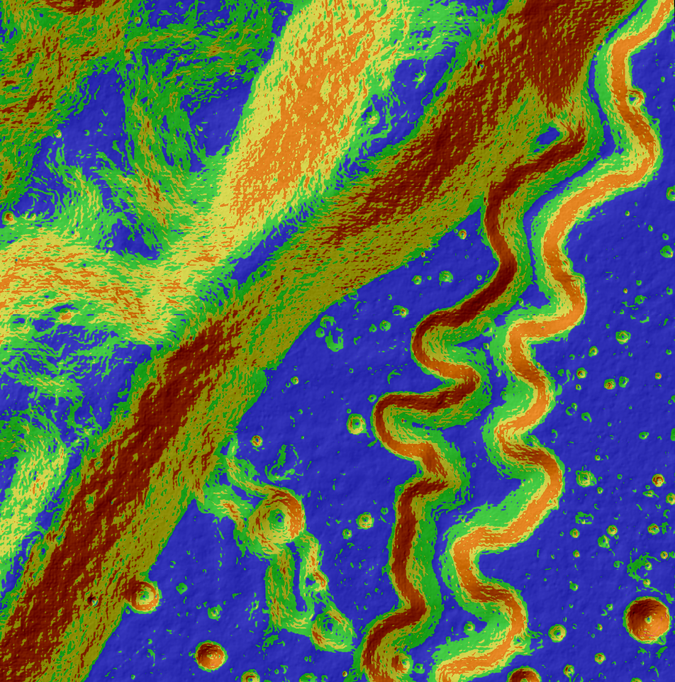
A Tortuous Path in Posidonius
This may look like a work of abstract art, but in reality, it's for science! This colorful image is an LROC slope map of the northwestern portion of the floor of Posidonius crater. Warmer colors indicate steeper slopes, whereas cooler...
Published on 31 Jul 2014
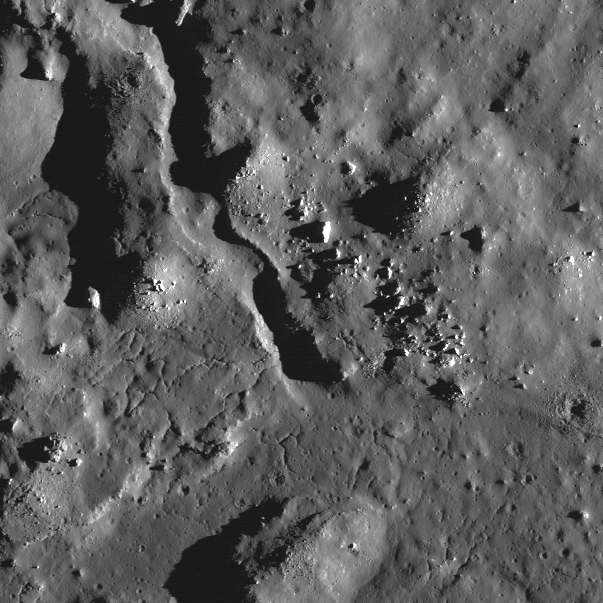
Rough Around the Edges
With peppered flanks, Rima Suess wanders over 150 km through Oceanus Procellarum. The rocks that rest on the walls of this lunar rille are perhaps remnants of much larger boulders that have eroded down to meter sized rocks due to micro...
Published on 05 Jun 2014
A Kink in Rima Krieger
Rima Krieger winds its way through Oceanus Procellarum. Image width is ~ 3.5 km. Taken from LROC NAC image M1152172510R [NASA/GSFC/Arizona State University].
Published on 20 May 2014
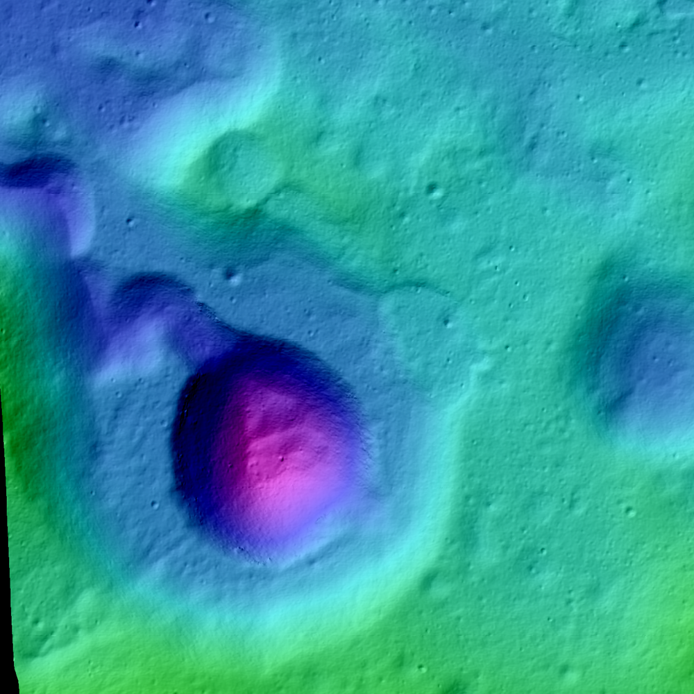
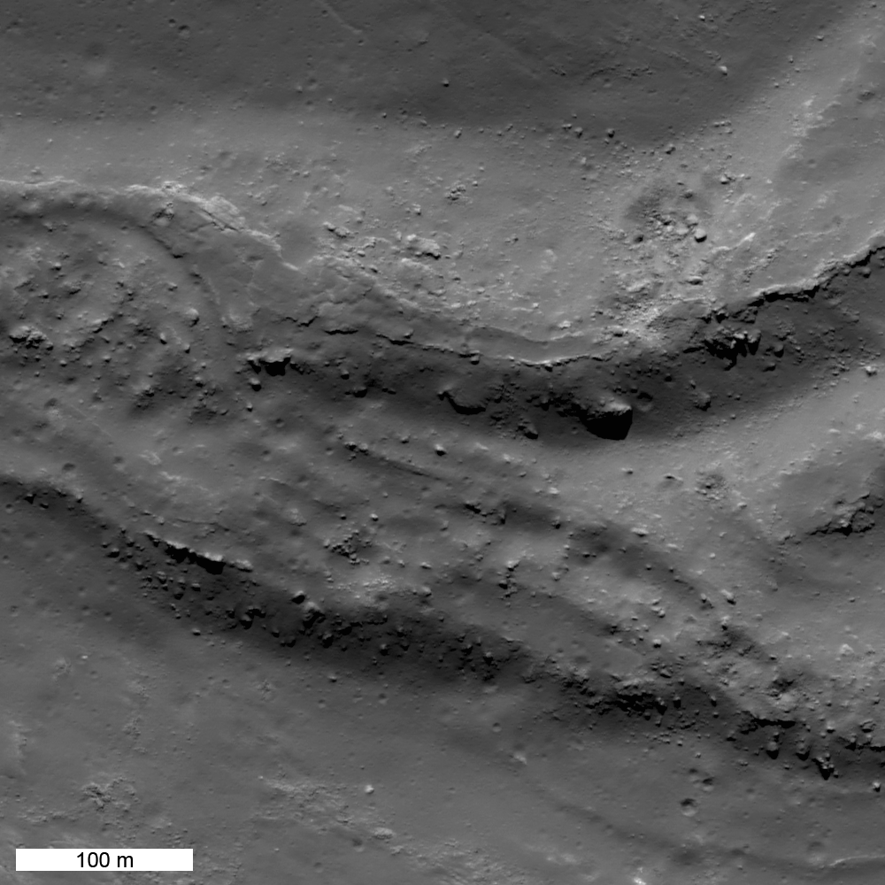
Collapsing Tube
Uneven depression near the north end of Rima Suess. Image center 9.109°N, 311.396°E; image width is 1.38 km; illumination from left; incidence angle is 67°; north is up; NAC M1112132406L [NASA/GSFC/Arizona State University].
Published on 30 Jan 2014
X Marks the Spot
Fractured mound (~3 km) on the floor of Stevinus crater. LROC NAC image M1131495601R, north is up [NASA/GSFC/Arizona State University].
Published on 07 Jan 2014
Source Vent for Rima Prinz I
Newly released LROC NAC Digital Terrain Model (DTM) of Rima Prinz I where it meets the source crater Vera (~2 km in diamter). Image is approximately 7 km across [NASA/GSFC/Arizona State University].
Published on 19 Dec 2013
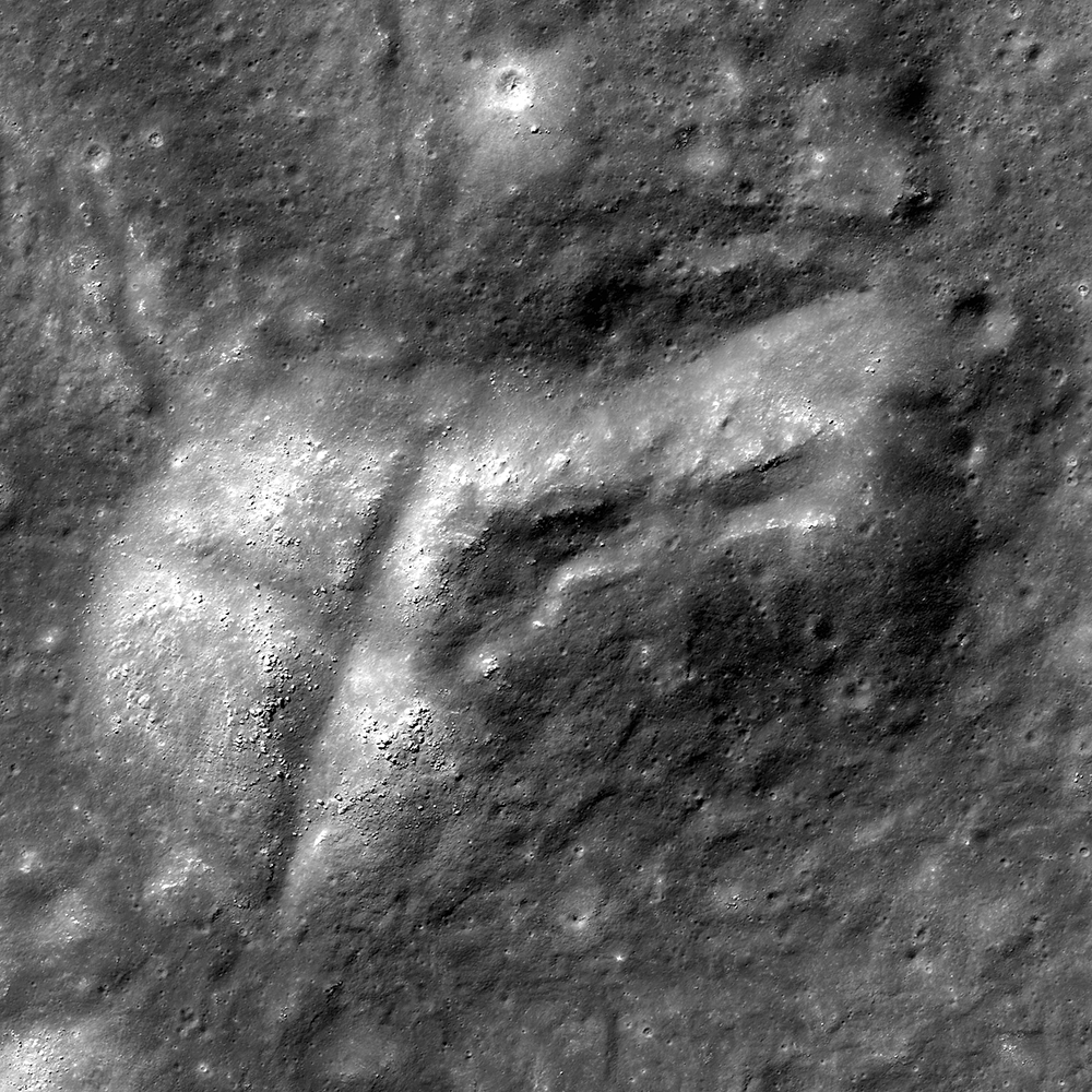
The Lunar Alps
A portion of an LROC NAC oblique image (M177602135LR) of a rille, seen in the center of this image running northwest to southeast through the Montes Alpes region. Image width is approximately 15 km. North is to the right...
Published on 15 Nov 2013
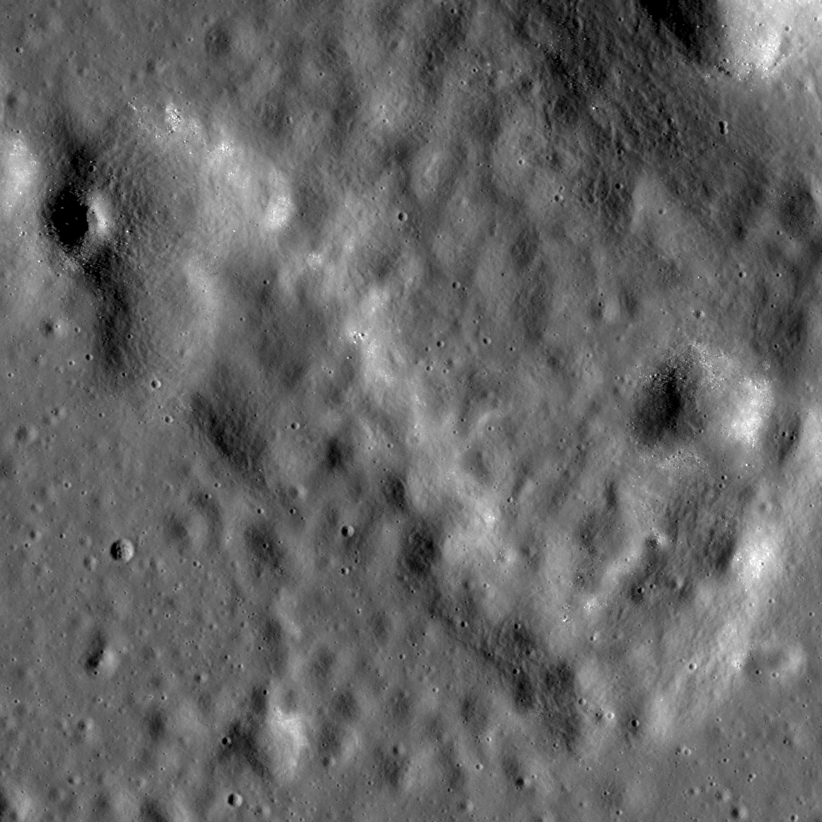
Volcanic Vent
This unassuming textured surface surrounding a smooth tongue of material is likely a volcanic vent. LROC NAC M181495512L, image width is 1500 m [NASA/GSFC/Arizona State University].
Published on 01 Apr 2013
Channels And Fractures
Stratigraphic relationships within impact melt deposits may be discovered with diligent observation! NAC M185971152L, image width ~1.8 km [NASA/GSFC/Arizona State University].
Published on 17 Jan 2013
Egede A crater channelized melt
Impact melt from nearby Egede A crater formed channels as it flowed one kilometer down slope. Cracks in the melt probably formed as a result of cooling and inflation. LROC NAC M175204950LE, image width is 500 m [NASA/GSFC/Arizona State...
Published on 06 Nov 2012
Copernicus Seen Looking Straight Down
Fractures and a collapse crater within impact melt rock on the floor of Copernicus crater. Image width is 1800 m [NASA/GSFC/Arizona State University].
Published on 28 Jun 2012
River of Rock
A small section of an enormous, now frozen, river of impact melt that flowed down the southeastern flank of Tycho crater some 108 million years ago. NAC image M185940195RE [NASA/GSFC/Arizona State University].
Published on 20 Jun 2012

Impact Melt Lobes
Impact melt flowed down the wall of Lowell crater forming two lobes when it solidified. The first lobe was breached or overtopped by a second flow in a manner probably similar to lava flows on Earth. LROC NAC M184196652RE, sun is from...
Published on 12 Apr 2012
Impact melt channel
Impact melt channel 2.5 km from the rim of Petavius B crater. Down-slope is to the bottom, image width is 1.02 km, Sun is from right, M115937523R, image center latitude 20.350°S, longitude 57.371°E [NASA/GSFC/Arizona State University].
Published on 14 Feb 2012