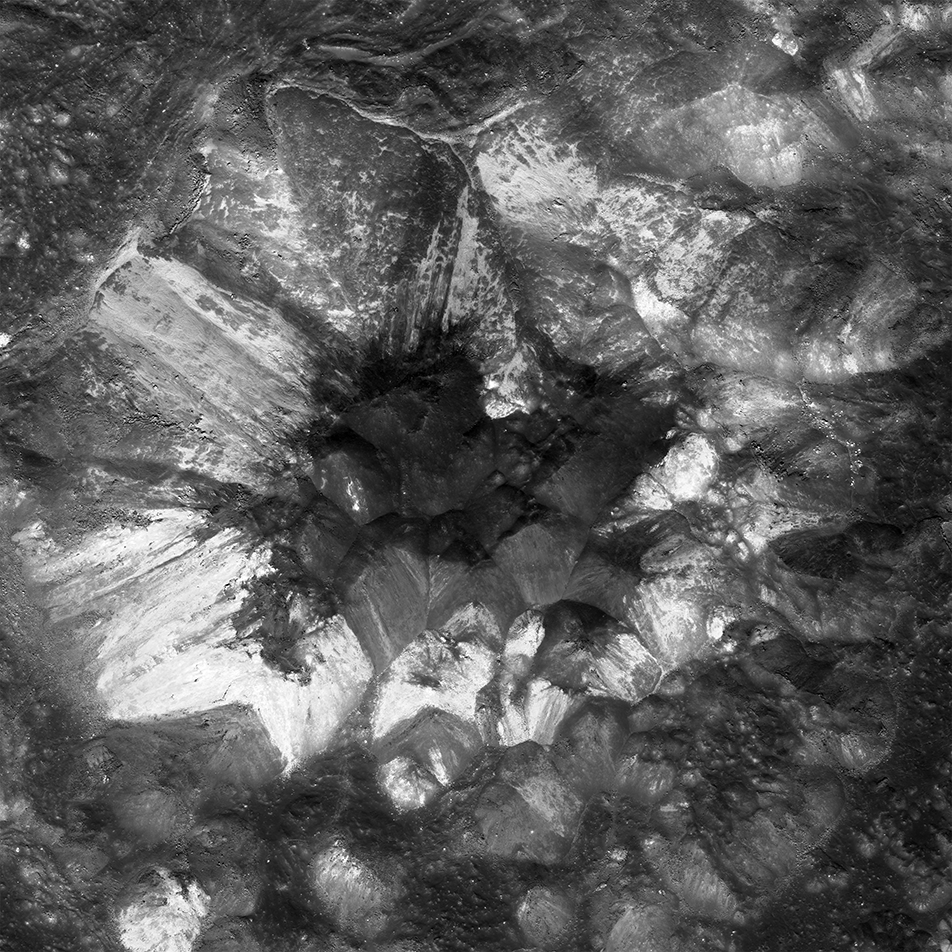
LROC captured Jackson crater (latitude 22.05°N, longitude 196.68°E, on the Moon's farside) when the Sun was high overhead at an incidence angle of 21°. This viewing geometry enhanced differences in albedo (brightness).
The variegated hues of the peak are largely the result of significant compositional differences. Central peaks expose the deepest material in the crater - the wild variety evident in Jackson's central peak thus hints at a complex geologic history for the central farside. Imagine future explorers traversing this rugged terrain - how many rock types would an astronaut encounter? What would samples of these rocks tell us about the Moon's hard-knock history?
Explore the central peak and much of Jackson's complex floor in the full-resolution view below. Note the spectacular impact melt rock formations: can you find where melt spashed up steep slopes and froze? This amazing landscape all formed in a matter of minutes after a large asteroid or comet slammed into the Moon about 100 million years ago, during the Cretaceous period, when dinosaurs dominated Earth.
Related Featured Images
Melt Fractures in Jackson Crater
Published by Mark Robinson on 9 January 2018