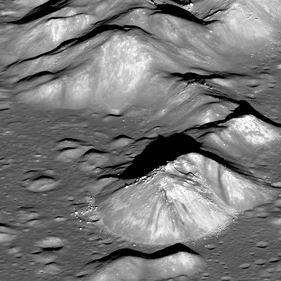
LROC captured this spectacular view of the heart of Copernicus crater (9.62°N, 339.92°E, 93 km diameter) just before sunset, on 11 July 2012. Compare it to the reverse view point snapped from the East near local sunrise, on 5 May 2012! LROC can only be slewed large angles while looking away from the Sun, otherwise its radiators are exposed to the hot Moon and the LROC WAC optics are exposed to the Sun. So back-to-back obliques are not possible on the same day. Between May and July LRO passed over the terminator (boundary between night and day) and thus the direction to the Sun reversed, in terms of LRO. On that orbit the daylight side switched from one side of the Moon to the other, at least from the perspective of the spacecraft. For example if LROC had just completed mapping the nearside, as it crossed the terminator we skip the farside and start remapping the nearside!

Back to Copernicus, what are those dark streaks we see on the peak? In the comparison image above, and if you skip back to the earlier post that shows the other side, that dark streak is seen on both sides of the central peak, showing that it is three dimensional within the peak. Might it be a dark rock intruded as a dike into the light colored crystalline bedrock that was brought up from beneath the deepest part of the transient cavity in the Copernicus target? Or is it simply a dark rock that is eroding and slumping down the sides of the peak?
When and how will we first visit this fascinating and geologically rich area? Imagine the view astronauts will have as they descend to the floor and then step out at the base of this peak!
Previous LROC Featured Images Highlighting Copernicus Crater
Copernicus Seen Looking Straight Down
Copernicus Crater and the Lunar Timescale
Published by Mark Robinson on 18 July 2012