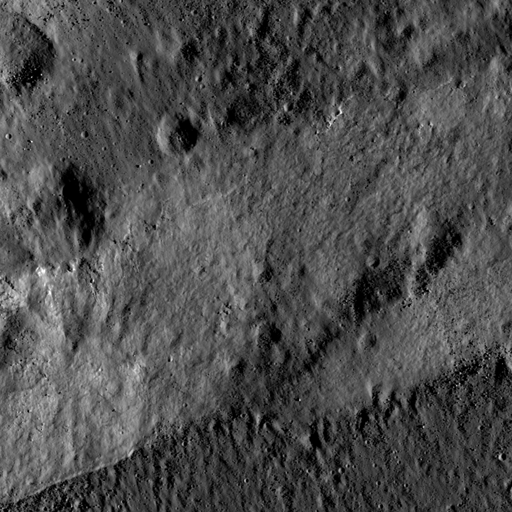
Impact melt deposits ponded at two elevations (top and bottom darker grey zones) separated by a fault scarp (middle grey zone) on the WNW rim of King crater (76 km diameter). Here is a great example of a 'cross-cutting relationship.' Cross-cutting relationships provide a relative (which came first) timing of events. Knowing the order in which things happened is as important to reconstructing geologic history as knowing what happened. Accurate absolute dating of impact melt is also possible, but only with laboratory analysis of rock samples collected in the field!
See if you can tell what happened first here. Was it the faulting of the crater rim or the deposition of impact melt? Here's a clue: notice how cleanly the edge of the ponded melt material contacts the fault scarp at the bottom left of the Featured Image. Would you expect such a clean margin if 1) hard rock had been ripped apart by a faulting crust, or if 2) the fault happened first and the melt flowed in afterward? Also, notice the 'herringbone' pattern in the melt itself, showing the direction of a flow that started high and cascaded like a waterfall over the fault scarp. Based on this, the faulting may seem to have come first! These massive blocks of lunar crust were in motion minutes after the blast that excavated King crater, and the melt remained molten and mobile long afterward. Or did they happen at the same time? First, what caused the fault? The impact event that created King crater resulted in concentric faults along which large blocks of crust slid, and in some cases collapsed. The melt formed from energy released in the impact. The environment was very dynamic, impact melt was flowing while the crater interior was rebounding and adjusting to the sudden event. So the impact melt likely came to its final form as we see it today some time after most of the major faulting had ceased. However, we cannot be certain that there wasn't some major movement along this fault even after the melt had ponded, and was still molten. What a great puzzle for a future lunar geologist to unravel!
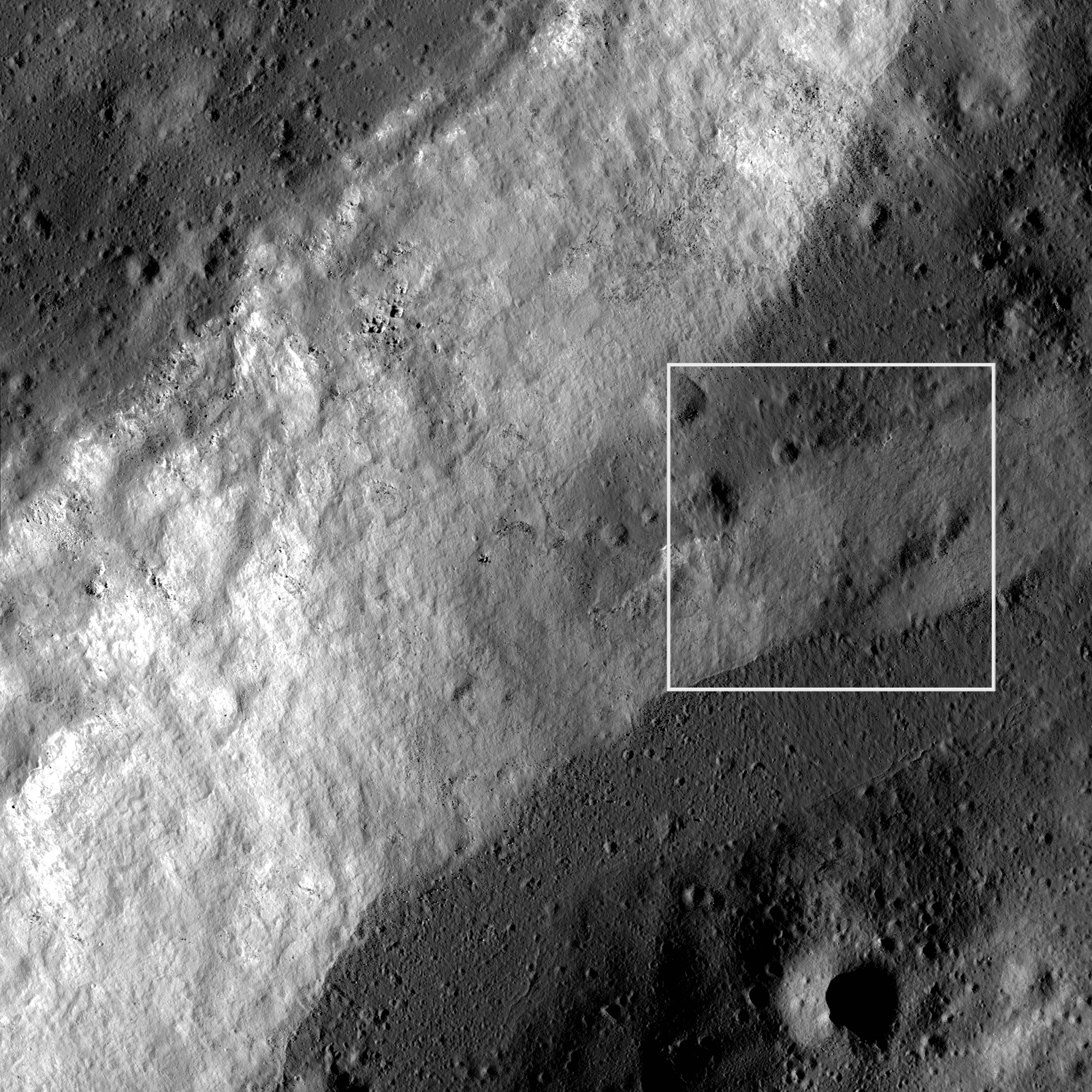
The image below is a slight "zoom-out" to provide a bit more context, and to show how the Featured Image fault scarp is only a small part of another, branching fault scarp. Note also the third, higher level of impact melt deposits in this image (upper left corner).
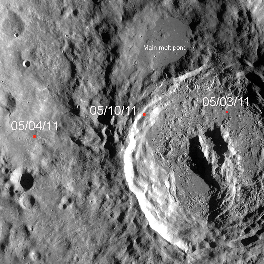
Zooming out still further gives us the full picture: The image below shows most of the 77-kilometer diameter King crater, together with areas beyond the crater rim that were effected by King's formation, and the locations of Featured Images posted on May 3rd, 4th and today (small red squares, which are drawn to scale). Clearly visible is King crater's large impact melt pond to the NNW. If you look closely, you will notice smaller pools of melt just south of this main pond. Notice their relationship to King crater. The crater walls have faulted and slumped into a 'stair step' arrangement of large blocks, and melt flowed in and ponded (afterward or perhaps during). Compare the last three Featured Image posts and note the diversity in terrain represented by one region on the Moon! Explore the full NAC image below.
Related Featured Image posts:
Natural bridge in King crater main melt pond
Published by James Ashley on 10 May 2011

