The lunar highlands are thought to have formed as a result of a global melting event early in the Moon’s history, during which plagioclase floated to the top of the ocean and solidified as an upper layer of anorthosite. The study of anorthosite occurrence is thus important for investigating the global magma ocean concept and the evolution/development of the lunar crust. Anaxagoras is a 50 km diameter Copernican impact crater at 73.4°N, 10.1°W, with an extensive ray system (reaching over 900 km from the crater rim in some directions), and a central peak of pure anorthosite. The central peak and the material ejected and deposited onto the floor of Goldschmidt crater to the east, indicates that the Anaxagoras crater-forming impact excavated pure anorthosite. Consequently it is one of the NASA Constellation Program regions of interest targeted by LROC to provide data that supports future human and robotic exploration of the Moon.

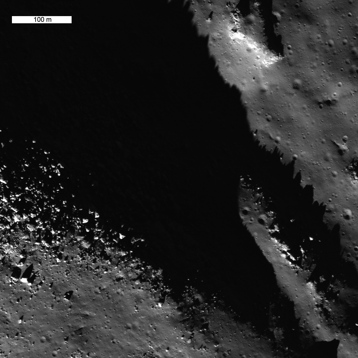
Figure 3 shows a section of the Anaxagoras crater floor, including a section of the anorthositic central peak complex. The crater floor is covered in relatively smooth impact melt; the melt in this image has degraded over time and is now covered by an upper regolith layer and displays numerous younger small impact craters. Sections of the central uplift protrude above the crater floor melt and are covered with large boulders.
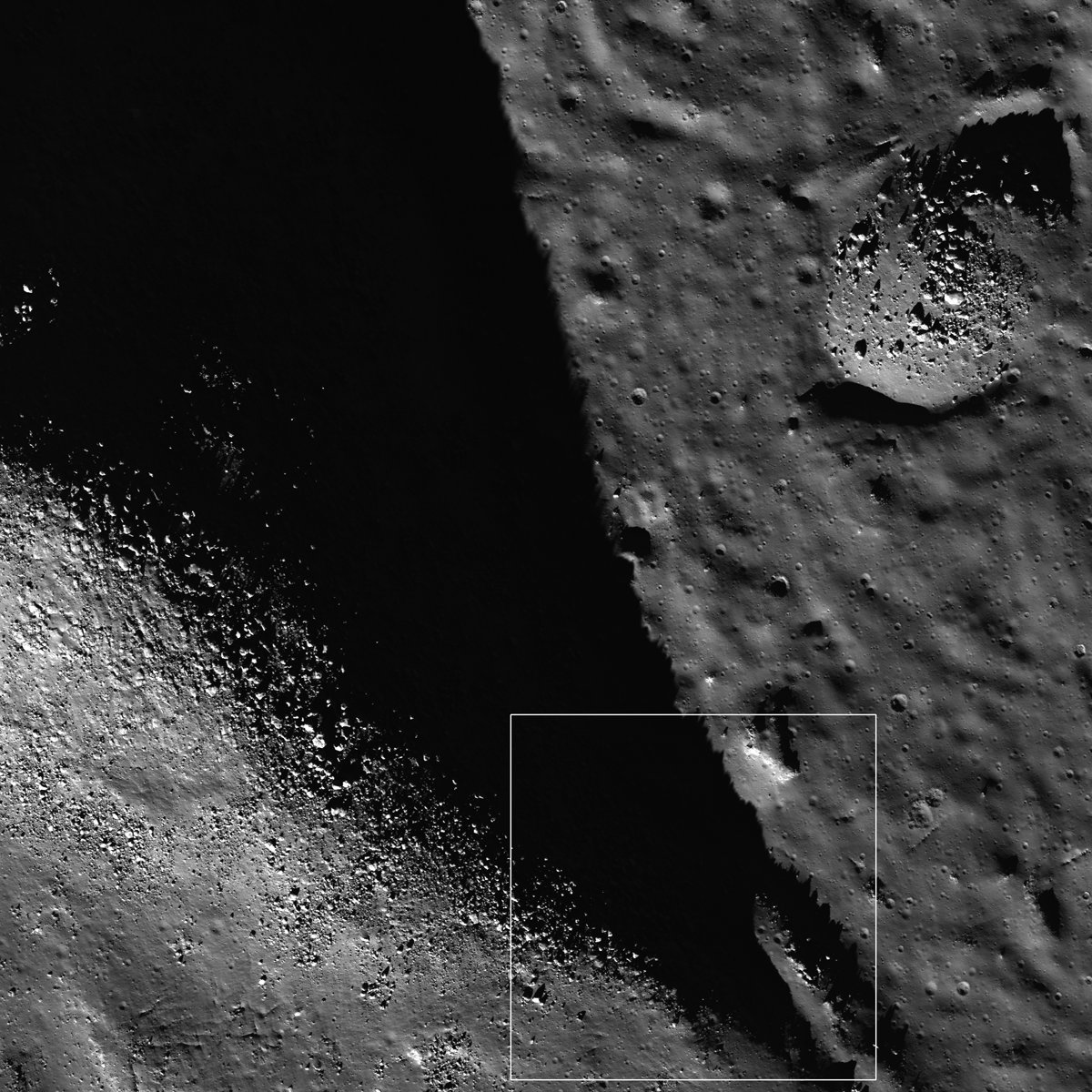
The smaller mound, in the right of Figure 2, is covered with large boulders, up to 30 meters (90 feet) across. Since the boulders cluster on top of topographic highs and are rare on the surrounding flat surfaces, they most likely were not thrown in from afar but rather are eroding out of the substrate.

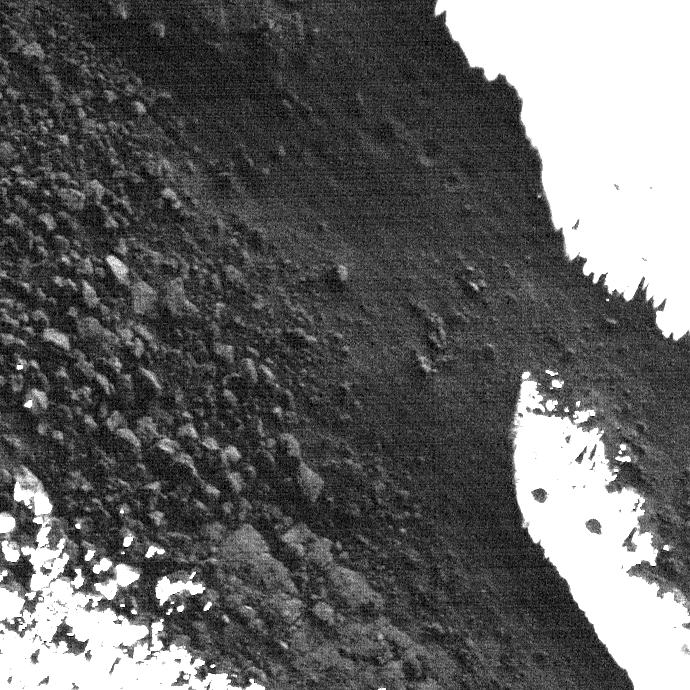
Figure 4 shows a close up of the ridge (Figure 2), revealing a great spot for future explorers to sample. The best samples for most scientific studies come from outcrops or rubble that can be traced back to their original position. Understanding the geologic context of a sample allows scientists to place a rock in its stratigraphic position and better trace back to the processes and forces that formed the original rock and later altered it. Sampling the central peak is scientifically important because it represents anorthositic rock formed as part of the original lunar crust. Lunar geologists would like to sample a variety of these ancient rocks spread across the whole Moon to understand variations in lunar chemistry which would help to bring together the story of the Moon's formation. The impact melts on the floor of the crater also represent a valuable sample -- by age dating their time of formation we would know exactly when the crater was formed.
Explore the floor of Anaxagoras!
Published by Veronica Bray on 14 April 2010