
One of the many surprises made possible by the Lunar Reconnaissance Orbiter Camera (LROC) is the discovery of thousands of small, young lobate thrust fault scarps, cliff-like landforms that result when crustal materials are pushed together, break, and are pushed upward. These fault scarps are easily detected in high-resolution Narrow Angle Camera (NAC) images. Essential to the study of these features are NAC stereo-derived Digital Terrain Models (DTMs) that provide highly accurate details about the shape and relief of the young fault scarps.
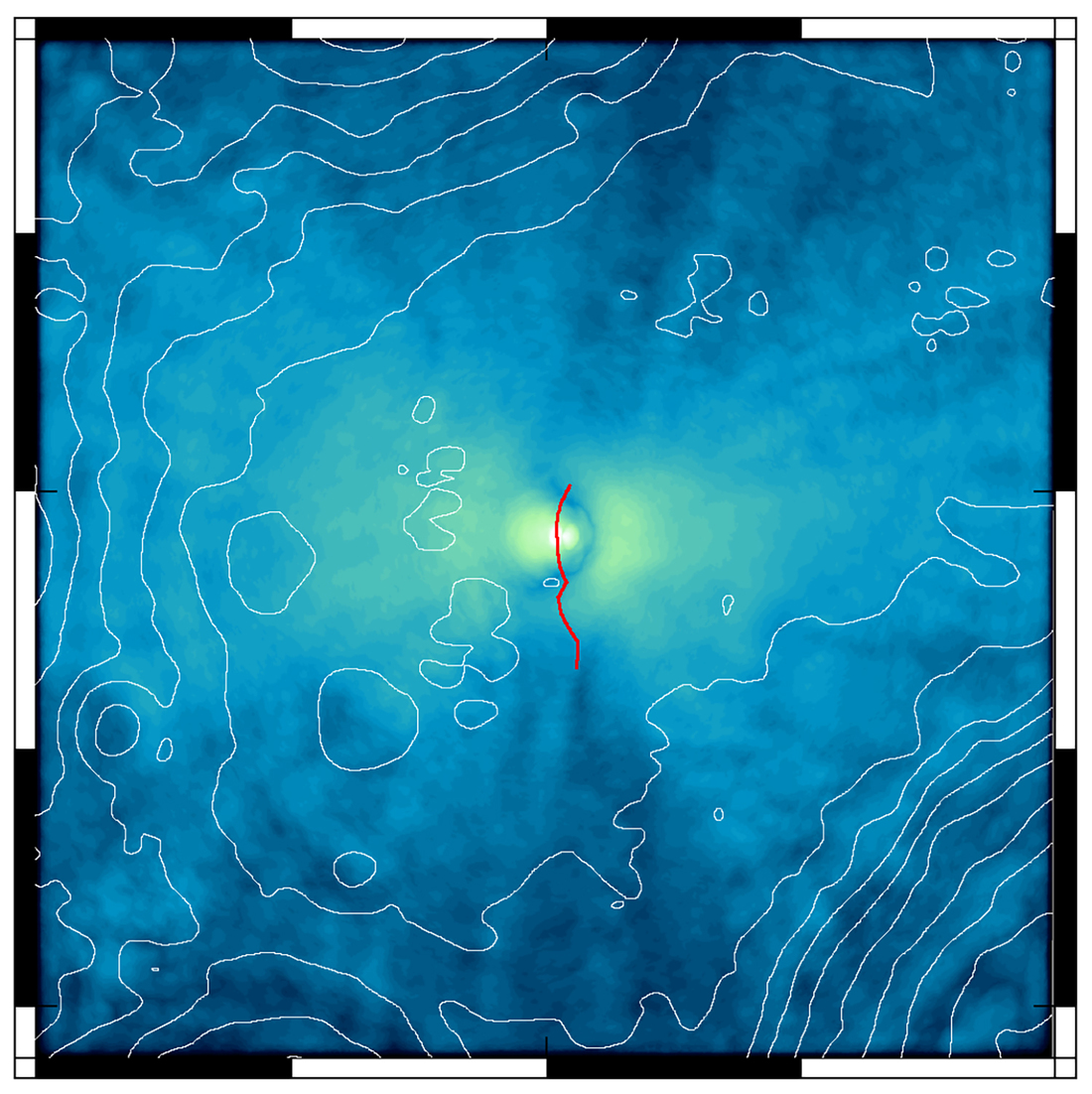
Digital Terrain Models (DTM) of lobate scarps have made it possible to model the characteristics of the underlying thrust faults, such as the geometry of the fault and the depth to which it extends into the lunar crust. An example is the fault scarp near the Mandel’shtam impact crater. The NAC stereo-derived DTM indicates the scarp has about 70 m of relief relative to the surrounding terrain. Modeling the fault using the DTM allows an estimate of the seismic moment, a measure of the size of the moonquake generated by the slip on the fault needed to make the scarp.
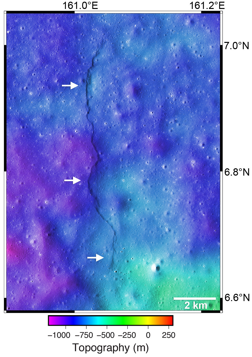
An estimate of the seismic moment, a shake map, or a map of the expected ground motion can be made from a fault-related shallow-depth moonquake. The shake map gives a sense of the area affected by significant seismic shaking and its distance from the Mandel’shtam scarp. The strength of the shaking depends on the size or magnitude of the moonquake. What would a strong, shallow moonquake feel like if you were standing on the Moon near one of the fault scarps? The Moon’s lower gravity means it takes less ground motion to exceed the pull of gravity and so you might get knocked off your feet. The lower gravity also means weaker moonquakes have stronger ground motion than earthquakes.
Read more about lobate scarps and their connection to moonquakes in a published paper from the LROC team:
Watters, T. R., Weber, R. C., Collins, G. C., Howley, I. J., Schmerr, N. C., and Johnson, C. L. (2019) Shallow seismic activity and young thrust faults on the Moon. Nature Geoscience. 12 (6):411. https://doi.org/10.1038/s41561-019-0362-2
Related Featured Images
Slipher Crater: Fractured Moon in 3-D
Taurus Littrow Valley: West-to-East
Published by Mark Robinson on 14 February 2023