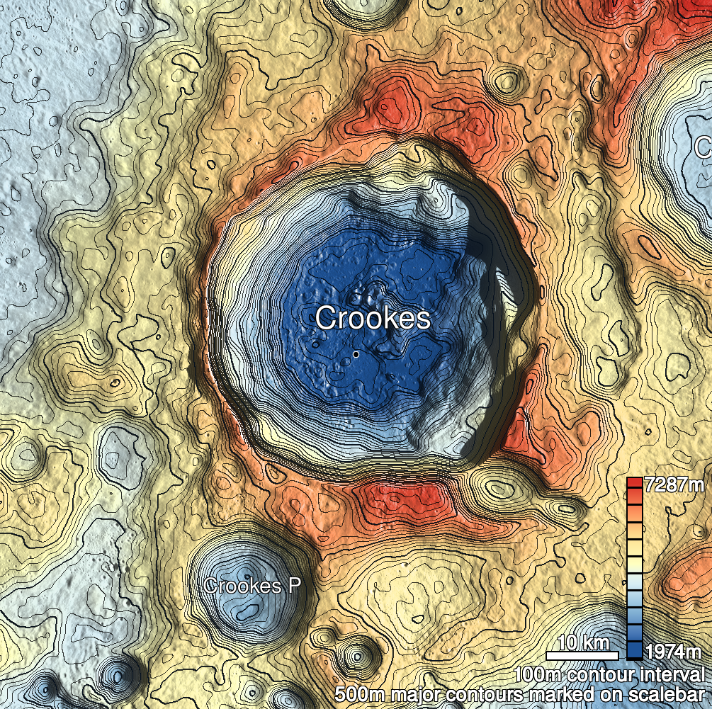
Pits Atlas: Crookes 7
| Impact Melt pit: Crookes | |
|---|---|
| Name | Crookes 7 |
| Lat. | -10.5592 |
| Long. | 194.823 |
| Desc. | Round pit in the SW flank of a blocky rise. Appears to have somewhat rounded floor, with only one or two ~1m boulders. Pit is in shadow in full stereo pair, but higher-Sun slewed image shows no overhang on W wall. E wall (under the rise) is never seen. E rim is ~12m higher than W rim above floor. No other collapses in the area. |
| Types | |
| Terrain | Impact Melt |
| Host Feature | Crookes |
| Funnel Min. Diam. | 23 |
| Funnel Max. Diam. | 23 |
| Inner Min. Diam. | 19 |
| Inner Max. Diam. | 20 |
| Azimuth | 55 |
| Depth | 8.0 |
| Depth 1 | 8.6 |
| Depth 2 | 6.6 |
| Depth 3 | 8.2 |
| Best Stereo Left | M176359843R |
| Best Stereo Right | M176359843R |
| DTMs | |
| Clipping Width | 200 |
| Other IMGs | |
| Data Warning | All measurements are from W rim. Depth from E wall measure in M1119966613L is ~23m. |
| Entrance Ramp | N |
| Overhang | ? |
| Nearby Pits? | N |
| Nearby Fractures? | N |
| Nearby Depressions? | N |
| In Dome | Y |
| Beside Dome | N |
| In Depression | N |
| Colinear Pits | N |
| Colinear Depressions | N |
| Colinear Fractures | N |
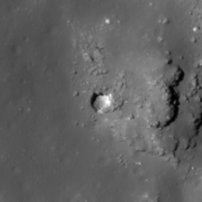
| Crookes 7 Shaded Relief | |
|---|---|
 |
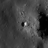
| M1099931168R | |
|---|---|
 |
|
| Line | 33900 |
| Sample | 4382 |
| Inc. Angle | -31.18 |
| Emission Angle | -2.31 |
| Time | 14.0 |
| Resolution | 1.0 |
| M1097573241R | |
|---|---|
 |
|
| Inc. Angle | -57.04 |
| Emission Angle | -0.24 |
| Time | 15.78 |
| Resolution | 1.0 |
| M184611296L | |
|---|---|
 |
|
| Inc. Angle | -28.31 |
| Emission Angle | 2.78 |
| Time | 13.71 |
| Resolution | 1.0 |
| Crookes 7 Stereo |
|---|
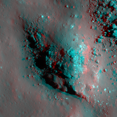 |