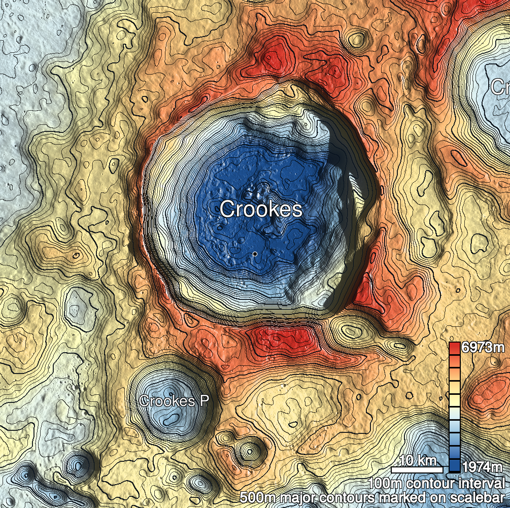
Pits Atlas: Crookes 5c
| Impact Melt pit: Crookes | |
|---|---|
| Name | Crookes 5c |
| Lat. | -10.6824 |
| Long. | 194.8646 |
| Desc. | Wide collapse in the E side of a PRF, mostly filled with the semi-coherent remains of the former roof (shattered into 1-2m boulders, but there are still sections that look like they fell together). The E side is a smooth slope to the surrounding surface- no rim. ~10m to the W, across a strip of untouched ground, is another collapse. The arrangement is similar to the various not-bridges in King crater, and I cannot rule out the uncollapsed section being hollow (stereo image hints at a 1-2m overhang), but the rock pile on the W side of the "bridge-like" section appears solid. |
| Types | |
| Terrain | Impact Melt |
| Host Feature | Crookes |
| Funnel Min. Diam. | 38 |
| Funnel Max. Diam. | 46 |
| Inner Min. Diam. | 34 |
| Inner Max. Diam. | 45 |
| Azimuth | 25 |
| Depth | 9.0 |
| Depth 1 | 8.9 |
| Depth 2 | 8.8 |
| Depth 3 | 10.0 |
| Best Stereo Left | M176359843L |
| Best Stereo Right | M176359843L |
| DTMs | |
| Clipping Width | 200 |
| Other IMGs | |
| Data Warning | |
| Entrance Ramp | Y |
| Overhang | Y? |
| Nearby Pits? | Y |
| Nearby Fractures? | N |
| Nearby Depressions? | Y |
| In Dome | N |
| Beside Dome | Y |
| In Depression | N |
| Colinear Pits | Y |
| Colinear Depressions | N |
| Colinear Fractures | N |
| Crookes 5c Shaded Relief | |
|---|---|
 |
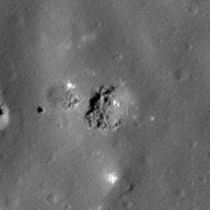
| M1191791679L | |
|---|---|
 |
|
| Line | 40920 |
| Sample | 2793 |
| Inc. Angle | -31.57 |
| Emission Angle | 1.58 |
| Time | 14.03 |
| Resolution | 0.87 |
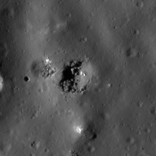
| M105593830R | |
|---|---|
 |
|
| Inc. Angle | -40.51 |
| Emission Angle | -0.16 |
| Time | 14.64 |
| Resolution | 1.03 |
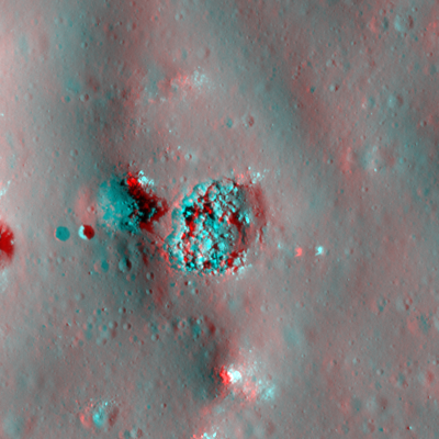
| M1189437272L | |
|---|---|
 |
|
| Inc. Angle | -57.72 |
| Emission Angle | 2.3 |
| Time | 15.83 |
| Resolution | 0.87 |
| Crookes 5c Stereo |
|---|
 |