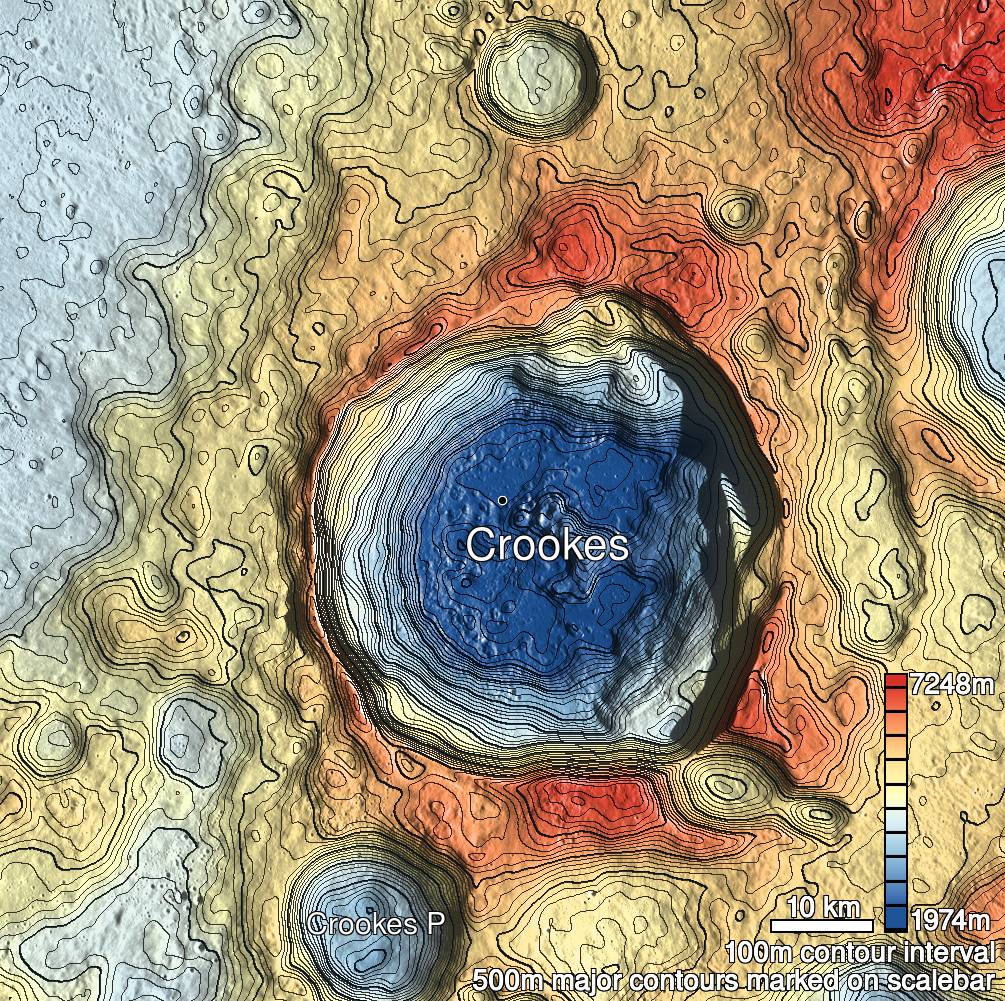
Pits Atlas: Crookes 1
| Impact Melt pit: Crookes | |
|---|---|
| Name | Crookes 1 |
| Lat. | -10.2424 |
| Long. | 194.7536 |
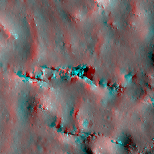
| Desc. | A complicated and very large pit. There are three main sections: The east end is the deepest part, and does not have any slopes leading into it. It is separated from the central section by a jumble of 10-15m boulders. The central section is wide (70m across) and round-bottomed, and the south wall is a smooth slope to the floor. The western section is a narrow (50x17m) canyon, barely opening into the central section, and with a smooth slope from the west end down to the floor. There are deep fracture systems to the north and south, and some depressions/collapses past the east end. |
| Types | |
| Terrain | Impact Melt |
| Host Feature | Crookes |
| Funnel Min. Diam. | 77 |
| Funnel Max. Diam. | 259 |
| Inner Min. Diam. | 67 |
| Inner Max. Diam. | 213 |
| Azimuth | 70 |
| Depth | 17.0 |
| Depth 1 | 20.5 |
| Depth 2 | 14.7 |
| Depth 3 | 15.8 |
| Best Stereo Left | M1214163158R |
| Best Stereo Right | M1214163158R |
| DTMs | |
| Clipping Width | 500 |
| Other IMGs | M176353098R |
| Data Warning | All depths are of eastern section. Central section is >10m deep (M1097573241L), and western section is ~18m deep (M110316458R) |
| Entrance Ramp | Y? |
| Overhang | ? |
| Nearby Pits? | N |
| Nearby Fractures? | Y |
| Nearby Depressions? | Y |
| In Dome | N |
| Beside Dome | N |
| In Depression | N |
| Colinear Pits | Y |
| Colinear Depressions | Y |
| Colinear Fractures | N? |
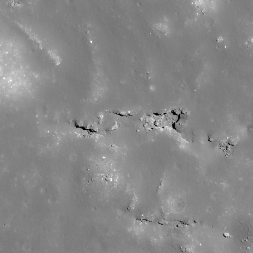
| Crookes 1 Shaded Relief | |
|---|---|
 |
| M110316458R | |
|---|---|
 |
|
| Line | 12322 |
| Sample | 1076 |
| Inc. Angle | 16.33 |
| Emission Angle | -8.52 |
| Time | 11.07 |
| Resolution | 0.59 |
| M1119966613L | |
|---|---|
 |
|
| Inc. Angle | 28.48 |
| Emission Angle | -0.53 |
| Time | 10.24 |
| Resolution | 0.93 |
| M1099931168R | |
|---|---|
 |
|
| Inc. Angle | -31.04 |
| Emission Angle | -1.14 |
| Time | 14.0 |
| Resolution | 1.0 |
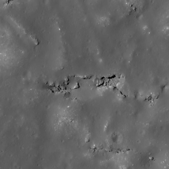
| Crookes 1 Stereo |
|---|
 |