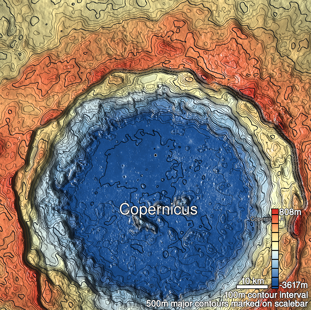
Pits Atlas: Copernicus 23
| Impact Melt pit: Copernicus | |
|---|---|
| Name | Copernicus 23 |
| Lat. | 10.2067 |
| Long. | 339.8978 |
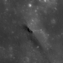
| Desc. | Small linear pit at the NW end of a larger elliptical depression. Exact bounds are hard to determine, as the south end is a very dark material (possibly a slope to inner floor?), and there are some small, very deep depressions just north of the inner pit. On the S end of a ~100m wide mound. Copernicus 14 is ~400m N, Copernicus 13 is ~1km SW, Copernicus X in ~300m W. Roughly in line with a large linear depression that starts ~1km SE. |
| Types | |
| Terrain | Impact Melt |
| Host Feature | Copernicus |
| Funnel Min. Diam. | 45 |
| Funnel Max. Diam. | 118 |
| Inner Min. Diam. | 6 |
| Inner Max. Diam. | 9 |
| Azimuth | 125 |
| Depth | 9.0 |
| Depth 1 | 8.2 |
| Depth 2 | 8.0 |
| Depth 3 | 9.4 |
| Best Stereo Left | M165978380L |
| Best Stereo Right | M165978380L |
| DTMs | |
| Clipping Width | 200 |
| Other IMGs | M124701702L, M124708491R, M153008029R |
| Data Warning | All images are VERY high Sun. |
| Entrance Ramp | Y |
| Overhang | ? |
| Nearby Pits? | N? |
| Nearby Fractures? | N |
| Nearby Depressions? | Y |
| In Dome | Y |
| Beside Dome | Y |
| In Depression | Y |
| Colinear Pits | N? |
| Colinear Depressions | N |
| Colinear Fractures | N |
| Copernicus 23 Shaded Relief | |
|---|---|
 |
| M155369774R | |
|---|---|
 |
|
| Line | 39305 |
| Sample | 3365 |
| Inc. Angle | -9.74 |
| Emission Angle | -1.65 |
| Time | 12.29 |
| Resolution | 0.43 |
| M1177898186L | |
|---|---|
 |
|
| Inc. Angle | -16.14 |
| Emission Angle | 1.85 |
| Time | 12.9 |
| Resolution | 1.18 |
| M109365462R | |
|---|---|
 |
|
| Inc. Angle | 12.06 |
| Emission Angle | 2.48 |
| Time | 11.81 |
| Resolution | 0.52 |
| Copernicus 23 Stereo |
|---|
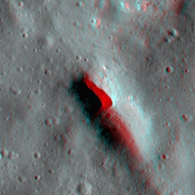 |