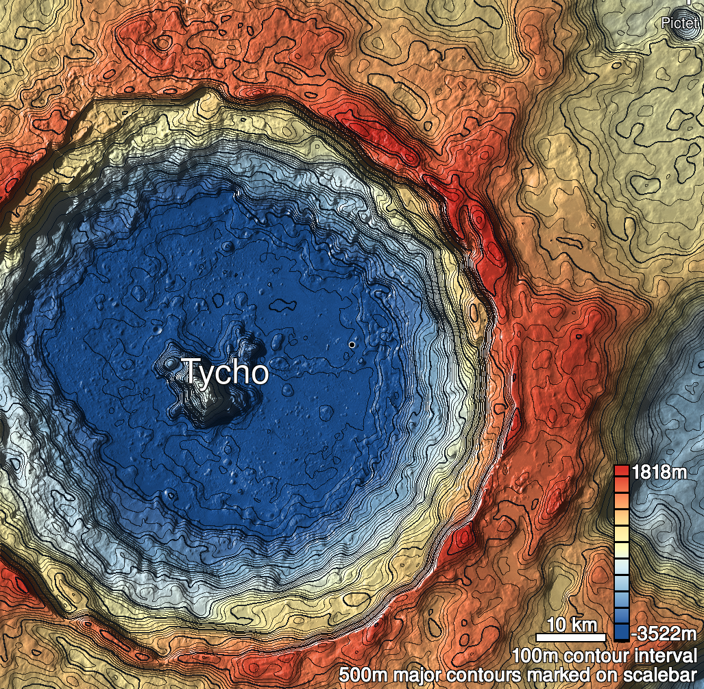
Pits Atlas: Tycho 15a
| Impact Melt pit: Tycho | |
|---|---|
| Name | Tycho 15a |
| Lat. | -43.1445 |
| Long. | 349.6332 |
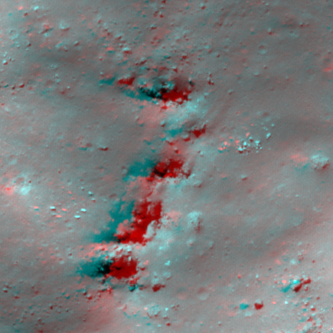
| Desc. | Triangular pit at northern end of a 100m chain of collapses at the edge of a hill. Floor is sloped from N to S, and shadow measures are to N end of floor. Tycho 15b is the center pit, and the southernmost collapse is more an alcove in the hillside level with the surrounding terrain (with an ~8m high N wall). The ground appears slightly sagged between the pits in the chain. There are several other linear depressions running in the same direction in the area. |
| Types | |
| Terrain | Impact Melt |
| Host Feature | Tycho |
| Funnel Min. Diam. | 16 |
| Funnel Max. Diam. | 27 |
| Inner Min. Diam. | 9 |
| Inner Max. Diam. | 18 |
| Azimuth | 95 |
| Depth | 4.0 |
| Depth 1 | 3.9 |
| Depth 2 | 3.9 |
| Depth 3 | 4.7 |
| Best Stereo Left | M1177818994L |
| Best Stereo Right | M1177818994L |
| DTMs | |
| Clipping Width | 200 |
| Other IMGs | |
| Data Warning | There are several other linear depressions running in the same direction in the area. |
| Entrance Ramp | N |
| Overhang | ? |
| Nearby Pits? | Y |
| Nearby Fractures? | N |
| Nearby Depressions? | Y |
| In Dome | N |
| Beside Dome | Y |
| In Depression | N |
| Colinear Pits | Y |
| Colinear Depressions | Y |
| Colinear Fractures | N |
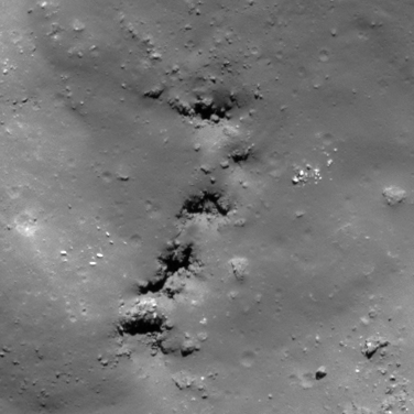
| Tycho 15a Shaded Relief | |
|---|---|
 |
| M109298521R | |
|---|---|
 |
|
| Line | 24962 |
| Sample | 4474 |
| Inc. Angle | 41.7 |
| Emission Angle | 2.3 |
| Time | 11.83 |
| Resolution | 0.52 |
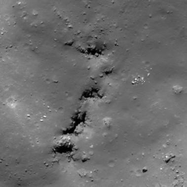
| M139973084L | |
|---|---|
 |
|
| Inc. Angle | -41.85 |
| Emission Angle | 1.57 |
| Time | 12.36 |
| Resolution | 0.51 |
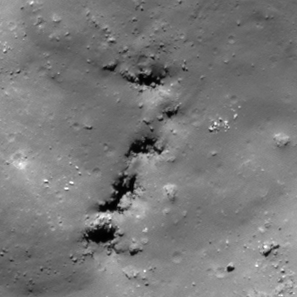
| M185947368R | |
|---|---|
 |
|
| Inc. Angle | -45.33 |
| Emission Angle | -1.26 |
| Time | 12.58 |
| Resolution | 0.66 |
| Tycho 15a Stereo |
|---|
 |