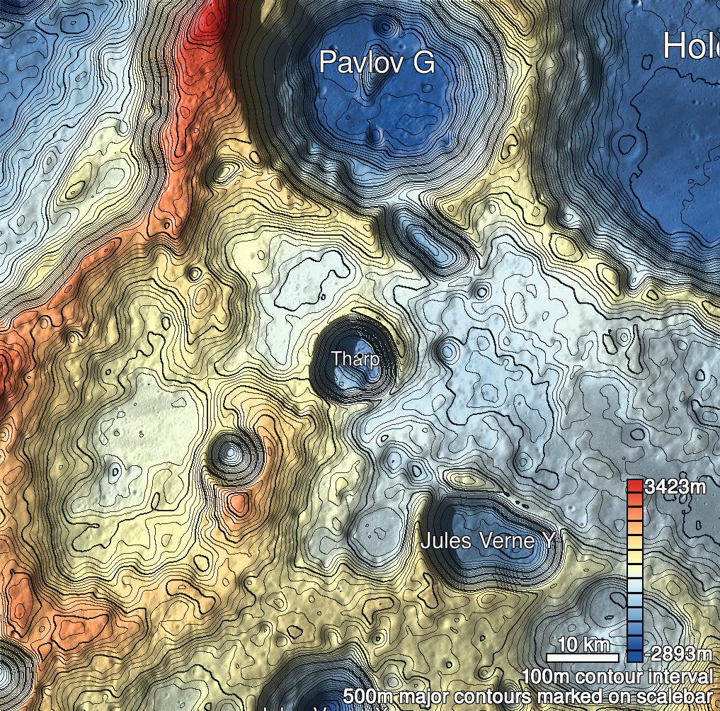
Pits Atlas: Tharp 3
| Impact Melt pit: Tharp | |
|---|---|
| Name | Tharp 3 |
| Lat. | -30.5713 |
| Long. | 145.6634 |
| Desc. | Collapse near the base of a PRF (floor is lower than non-PRF terrain). The south (upslope) wall seems to be a smooth (rocky?) slope to the bottom, N and W walls appear vertical. No other obvious collapses in the area. |
| Types | |
| Terrain | Impact Melt |
| Host Feature | Tharp |
| Funnel Min. Diam. | 37 |
| Funnel Max. Diam. | 40 |
| Inner Min. Diam. | N/A |
| Inner Max. Diam. | 31 |
| Azimuth | 60 |
| Depth | 16.0 |
| Depth 1 | 18.6 |
| Depth 2 | 17.0 |
| Depth 3 | 13.1 |
| Best Stereo Left | M1181514179R |
| Best Stereo Right | M1181514179R |
| DTMs | |
| Clipping Width | 200 |
| Other IMGs | |
| Data Warning | |
| Entrance Ramp | Y |
| Overhang | ? |
| Nearby Pits? | N |
| Nearby Fractures? | N |
| Nearby Depressions? | N |
| In Dome | Y |
| Beside Dome | Y |
| In Depression | N |
| Colinear Pits | N |
| Colinear Depressions | N |
| Colinear Fractures | N |
| Tharp 3 Shaded Relief | |
|---|---|
 |
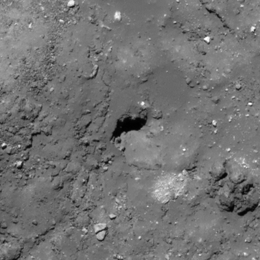
| M108278624R | |
|---|---|
 |
|
| Line | 5473 |
| Sample | 1060 |
| Inc. Angle | -30.6 |
| Emission Angle | -0.31 |
| Time | 12.64 |
| Resolution | 0.51 |
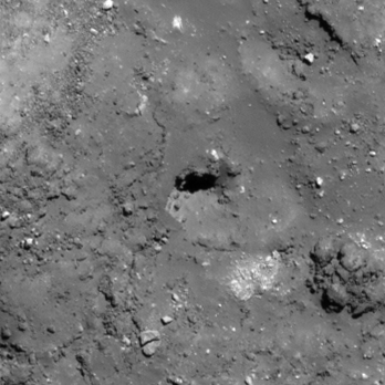
| M1148548012R | |
|---|---|
 |
|
| Inc. Angle | 31.75 |
| Emission Angle | 0.09 |
| Time | 11.85 |
| Resolution | 0.79 |
| M125977218R | |
|---|---|
 |
|
| Inc. Angle | 35.91 |
| Emission Angle | 1.05 |
| Time | 10.87 |
| Resolution | 0.57 |
| Tharp 3 Stereo |
|---|
 |