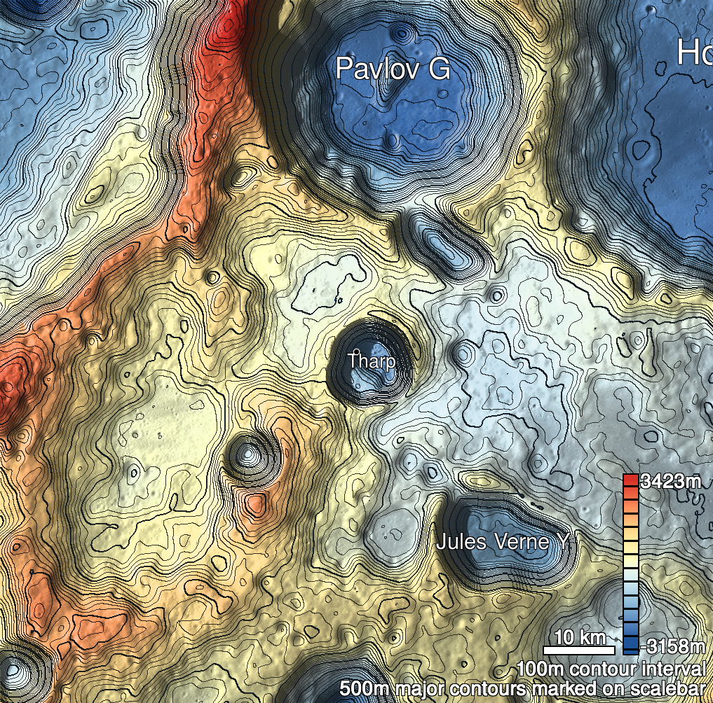
Pits Atlas: Tharp 2
| Impact Melt pit: Tharp | |
|---|---|
| Name | Tharp 2 |
| Lat. | -30.5395 |
| Long. | 145.5548 |
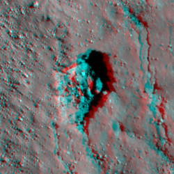
| Desc. | A rectangular pit ~150m E of the crater wall. The floor is covered in 1-18m boulders, and there are no collapsed walls. There is a very thin fracture running 50m S from the S corner of the pit, and several more thin fractures running N-S to the east of the pit. There are a couple of large (~100m diameter) fracture-associated collapses ~120m and ~260m SE. |
| Types | |
| Terrain | Impact Melt |
| Host Feature | Tharp |
| Funnel Min. Diam. | 70 |
| Funnel Max. Diam. | 91 |
| Inner Min. Diam. | 56 |
| Inner Max. Diam. | 88 |
| Azimuth | 20 |
| Depth | 24.0 |
| Depth 1 | 24.0 |
| Depth 2 | 27.5 |
| Depth 3 | 20.3 |
| Best Stereo Left | M1168585439L |
| Best Stereo Right | M1168585439L |
| DTMs | |
| Clipping Width | 200 |
| Other IMGs | M108278624L |
| Data Warning | |
| Entrance Ramp | N |
| Overhang | ? |
| Nearby Pits? | Y |
| Nearby Fractures? | Y |
| Nearby Depressions? | N |
| In Dome | N |
| Beside Dome | N |
| In Depression | N |
| Colinear Pits | Y |
| Colinear Depressions | N |
| Colinear Fractures | Y |
| Tharp 2 Shaded Relief | |
|---|---|
 |
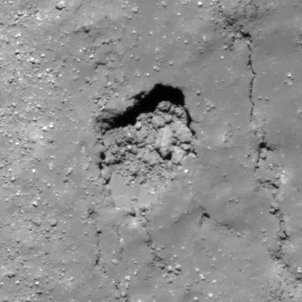
| M1133251236L | |
|---|---|
 |
|
| Line | 16075 |
| Sample | 3249 |
| Inc. Angle | -29.37 |
| Emission Angle | 1.31 |
| Time | 12.17 |
| Resolution | 0.79 |
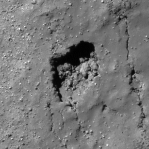
| M1146193359L | |
|---|---|
 |
|
| Inc. Angle | -40.47 |
| Emission Angle | 0.73 |
| Time | 13.73 |
| Resolution | 0.77 |
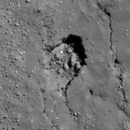
| M1150904064L | |
|---|---|
 |
|
| Inc. Angle | 42.32 |
| Emission Angle | -0.39 |
| Time | 9.98 |
| Resolution | 0.8 |
| Tharp 2 Stereo |
|---|
 |