Pits Atlas: Tharp 1a
| Impact Melt pit: Tharp | |
|---|---|
| Name | Tharp 1a |
| Lat. | -30.6002 |
| Long. | 145.6809 |
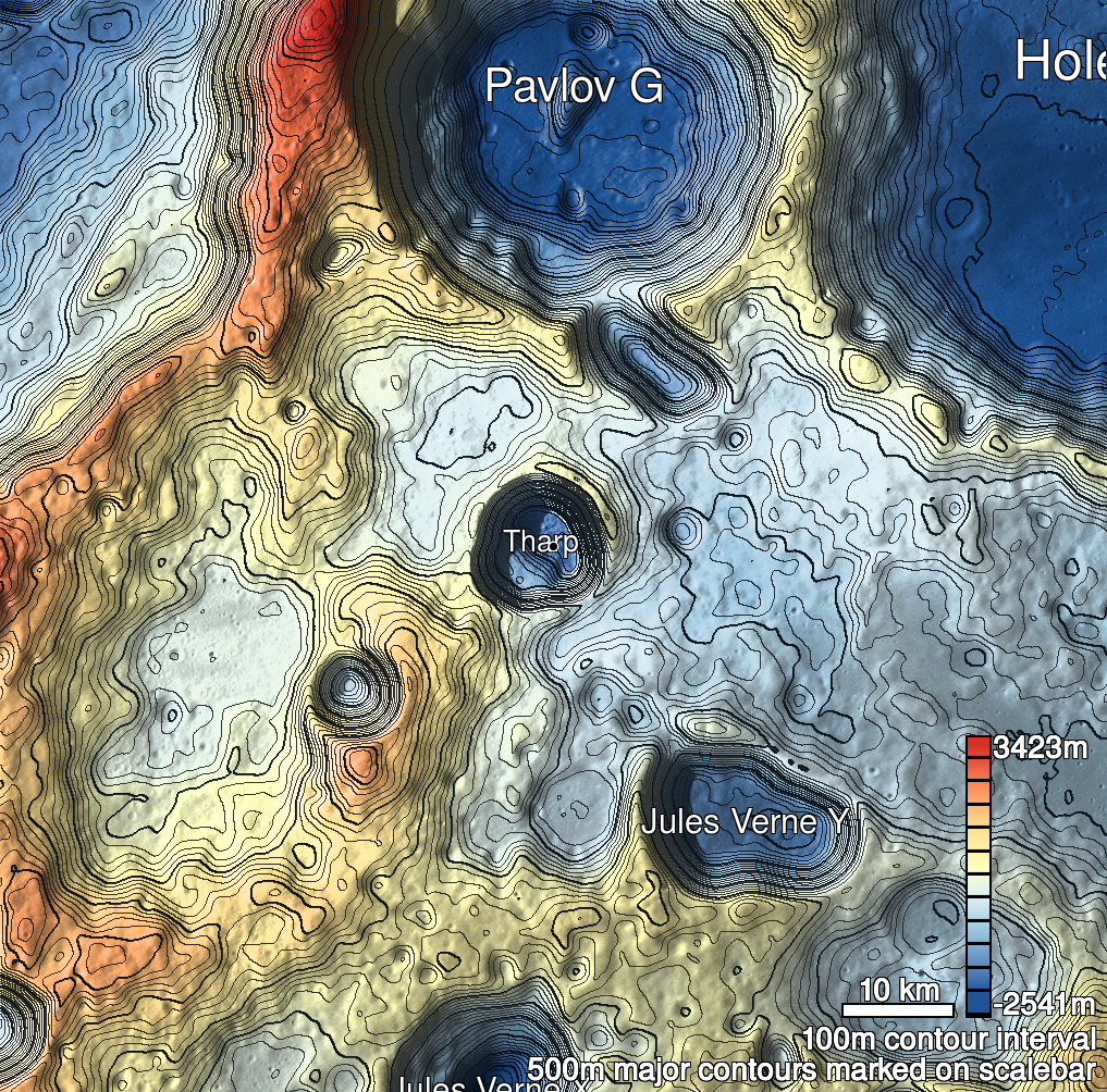
| Desc. | Large, shallow, roughly triangular pit at the base of a PRF. S wall is mostly a slope down from rim (in places near the top of the PRF) to the floor, but there is usually a bit of a vertical wall at the top. There is a small pit (Near Pavlov G 1b) adjacent on the E side, close enough that there may be a bridge. No available Sun angle confirms a connection, though. There is another pair of much smaller and shallower collapses ~280m north. |
| Types | |
| Terrain | Impact Melt |
| Host Feature | Tharp |
| Funnel Min. Diam. | 121 |
| Funnel Max. Diam. | 140 |
| Inner Min. Diam. | 88 |
| Inner Max. Diam. | 116 |
| Azimuth | 10 |
| Depth | 23.0 |
| Depth 1 | 24.5 |
| Depth 2 | 20.0 |
| Depth 3 | 23.5 |
| Best Stereo Left | M1181514179R |
| Best Stereo Right | M1181514179R |
| DTMs | |
| Clipping Width | 300 |
| Other IMGs | |
| Data Warning | |
| Entrance Ramp | N? |
| Overhang | ? |
| Nearby Pits? | Y |
| Nearby Fractures? | N |
| Nearby Depressions? | Y |
| In Dome | Y |
| Beside Dome | Y |
| In Depression | N |
| Colinear Pits | Y |
| Colinear Depressions | N |
| Colinear Fractures | N |
| Tharp 1a Shaded Relief | |
|---|---|
 |
| M108278624R | |
|---|---|
 |
|
| Line | 7072 |
| Sample | 1996 |
| Inc. Angle | -30.63 |
| Emission Angle | -0.85 |
| Time | 12.64 |
| Resolution | 0.51 |
| M125977218R | |
|---|---|
 |
|
| Inc. Angle | 35.93 |
| Emission Angle | 0.59 |
| Time | 10.87 |
| Resolution | 0.57 |
| M1148548012L | |
|---|---|
 |
|
| Inc. Angle | 31.78 |
| Emission Angle | -0.33 |
| Time | 11.85 |
| Resolution | 0.79 |
| Tharp 1a Stereo |
|---|
 |