Pits Atlas: Rutherfurd 2
| Impact Melt pit: Rutherfurd | |
|---|---|
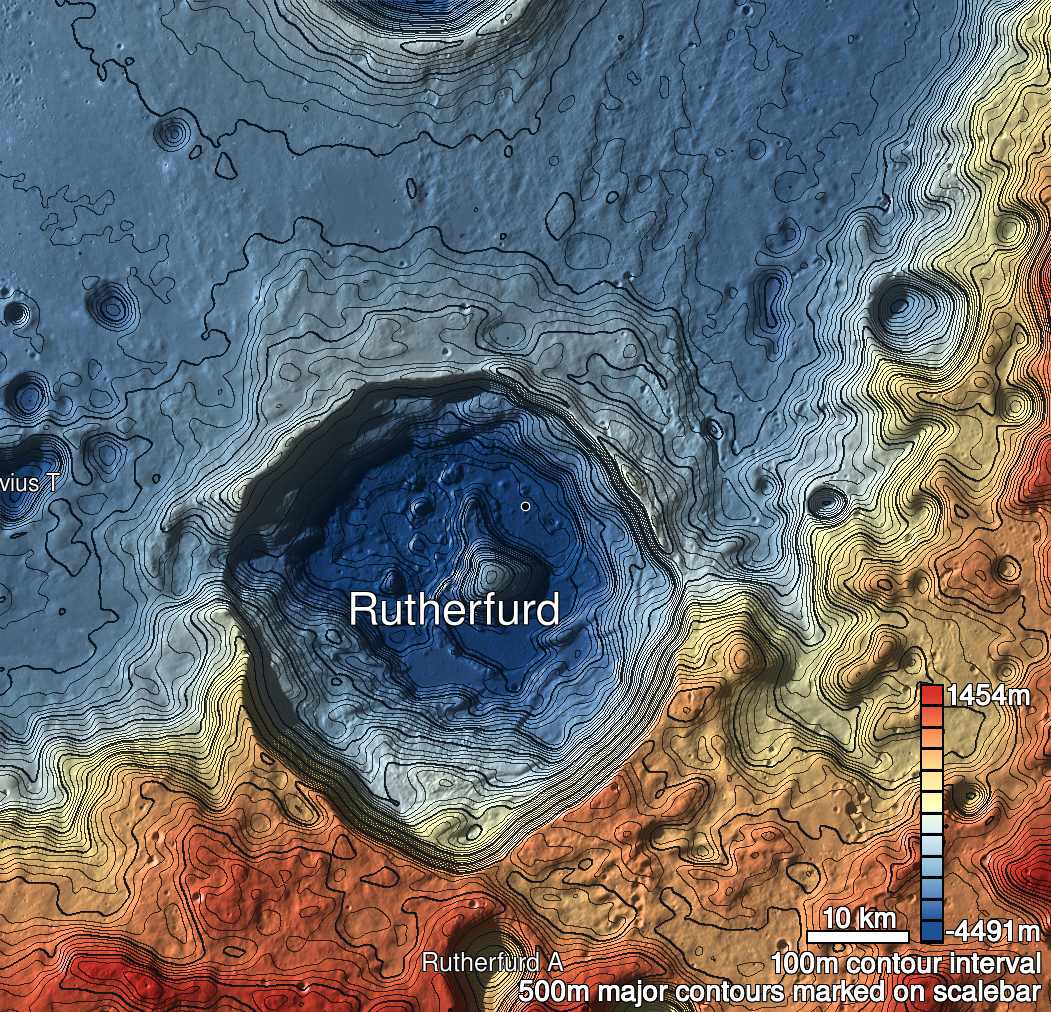
| Name | Rutherfurd 2 |
| Lat. | -60.7757 |
| Long. | 348.253 |
| Desc. | Round pit, east wall slopes down to floor There's a ~200m long, 35m wide, ~7m deep linear depression running NW/SE starting ~60m to the NW, and a few more round to elliptical depressions with some degree of vertical wall/rim outcropping running in a chain ~50m south of that. |
| Types | |
| Terrain | Impact Melt |
| Host Feature | Rutherfurd |
| Funnel Min. Diam. | 30 |
| Funnel Max. Diam. | 36 |
| Inner Min. Diam. | 19 |
| Inner Max. Diam. | 24 |
| Azimuth | 10 |
| Depth | 9.0 |
| Depth 1 | 8.9 |
| Depth 2 | >9.0 |
| Depth 3 | N/A |
| Best Stereo Left | |
| Best Stereo Right | |
| DTMs | |
| Clipping Width | 200 |
| Other IMGs | |
| Data Warning | M1361100396L, M13202480613R |
| Entrance Ramp | Y |
| Overhang | ? |
| Nearby Pits? | N? |
| Nearby Fractures? | N |
| Nearby Depressions? | Y |
| In Dome | N |
| Beside Dome | Y |
| In Depression | N |
| Colinear Pits | N |
| Colinear Depressions | Y |
| Colinear Fractures | N |
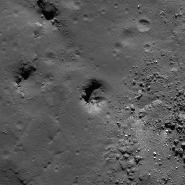
| Rutherfurd 2 Shaded Relief | |
|---|---|
 |
| M109305653L | |
|---|---|
 |
|
| Line | 4795 |
| Sample | 2305 |
| Inc. Angle | 59.31 |
| Emission Angle | -1.84 |
| Time | 11.81 |
| Resolution | 0.53 |
| M114024557R | |
|---|---|
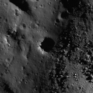 |
|
| Inc. Angle | 73.84 |
| Emission Angle | 1.38 |
| Time | 8.15 |
| Resolution | 0.79 |