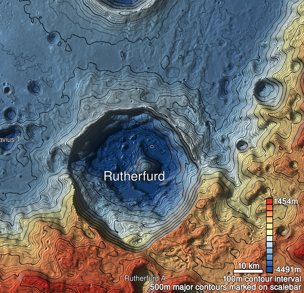
Pits Atlas: Rutherfurd 1b
| Impact Melt pit: Rutherfurd | |
|---|---|
| Name | Rutherfurd 1b |
| Lat. | -60.7789 |
| Long. | 348.1862 |
| Desc. | Smaller of the Rutherfurd 1 pair, may just be a cliff, not a pit- data is ambiguous. The pair is probably not a bridge, as I think that some light would pass under it visibly in M114024557R, but nothing is visible. |
| Types | |
| Terrain | Impact Melt |
| Host Feature | Rutherfurd |
| Funnel Min. Diam. | 14 |
| Funnel Max. Diam. | 15 |
| Inner Min. Diam. | N/A |
| Inner Max. Diam. | 9 |
| Azimuth | 65 |
| Depth | >3.0 |
| Depth 1 | >2.0 |
| Depth 2 | >3.0 |
| Depth 3 | >1.0 |
| Best Stereo Left | |
| Best Stereo Right | |
| DTMs | |
| Clipping Width | 200 |
| Other IMGs | |
| Data Warning | M1361100396L, M13202480613R |
| Entrance Ramp | Y |
| Overhang | ? |
| Nearby Pits? | Y |
| Nearby Fractures? | N |
| Nearby Depressions? | Y |
| In Dome | N |
| Beside Dome | N? |
| In Depression | N |
| Colinear Pits | Y |
| Colinear Depressions | Y |
| Colinear Fractures | N |
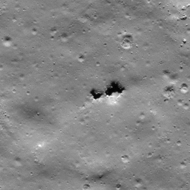
| Rutherfurd 1b Shaded Relief | |
|---|---|
 |
| M109305653L | |
|---|---|
 |
|
| Line | 5008 |
| Sample | 4184 |
| Inc. Angle | 59.32 |
| Emission Angle | -0.73 |
| Time | 11.8 |
| Resolution | 0.53 |
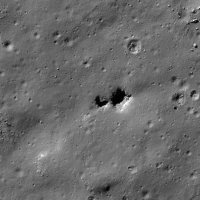
| M168287020R | |
|---|---|
 |
|
| Inc. Angle | -66.14 |
| Emission Angle | -1.7 |
| Time | 14.56 |
| Resolution | 0.44 |
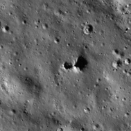
| M114024557R | |
|---|---|
 |
|
| Inc. Angle | 73.87 |
| Emission Angle | 2.48 |
| Time | 8.15 |
| Resolution | 0.79 |