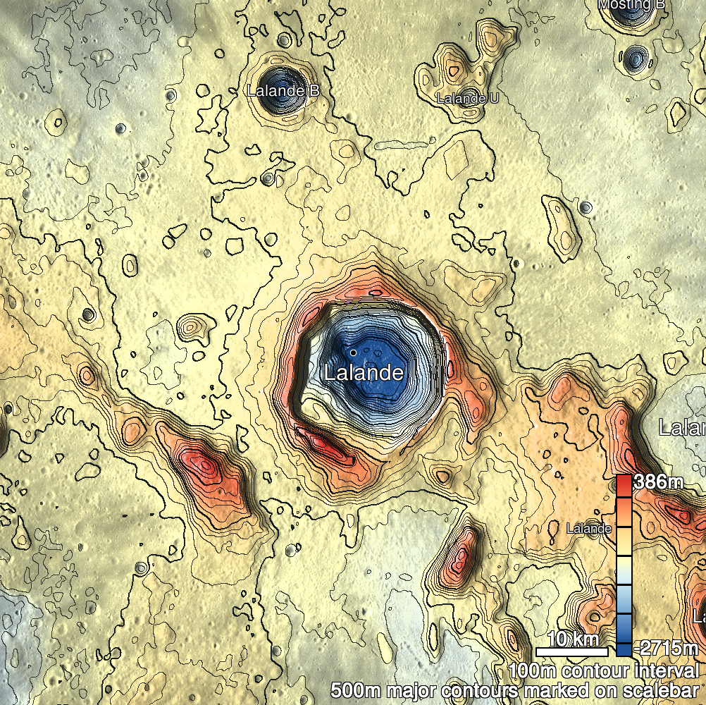
Pits Atlas: Lalande 13
| Impact Melt pit: Lalande | |
|---|---|
| Name | Lalande 13 |
| Lat. | -4.3571 |
| Long. | 351.3054 |
| Desc. | Pit at the end of a ~100m long linear depression in a set of similar parallel depressions. Looks like a set of fractures, but I don't see any actual fracturing. Flat floor, no entrance slopes. |
| Types | |
| Terrain | Impact Melt |
| Host Feature | Lalande |
| Funnel Min. Diam. | 16 |
| Funnel Max. Diam. | NA |
| Inner Min. Diam. | 10 |
| Inner Max. Diam. | 13 |
| Azimuth | 25 |
| Depth | 8.0 |
| Depth 1 | 7.0 |
| Depth 2 | 9.0 |
| Depth 3 | 9.3 |
| Best Stereo Left | M1103624254L |
| Best Stereo Right | M1103624254L |
| DTMs | |
| Clipping Width | 200 |
| Other IMGs | |
| Data Warning | Depths 2 and 3 are very low incidence angles (15 and 12 degrees, respectively). Stereo is accidental and probably only works for manual viewing. |
| Entrance Ramp | N |
| Overhang | ? |
| Nearby Pits? | N |
| Nearby Fractures? | Y |
| Nearby Depressions? | Y |
| In Dome | N |
| Beside Dome | N |
| In Depression | Y |
| Colinear Pits | N |
| Colinear Depressions | Y |
| Colinear Fractures | Y |
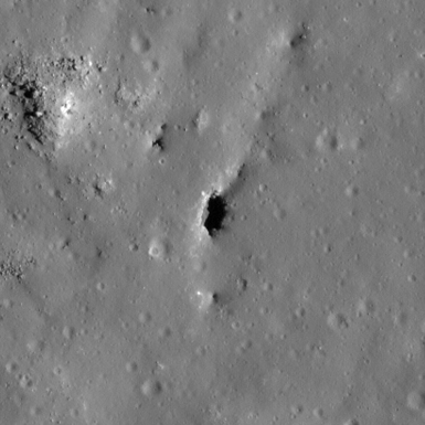
| Lalande 13 Shaded Relief | |
|---|---|
 |
| M144680975L | |
|---|---|
 |
|
| Line | 22205 |
| Sample | 261 |
| Inc. Angle | 48.99 |
| Emission Angle | -3.04 |
| Time | 8.74 |
| Resolution | 0.49 |
| M1101267085R | |
|---|---|
 |
|
| Inc. Angle | -15.46 |
| Emission Angle | -0.24 |
| Time | 13.01 |
| Resolution | 1.03 |
| M1103624254L | |
|---|---|
 |
|
| Inc. Angle | 12.25 |
| Emission Angle | -0.6 |
| Time | 11.21 |
| Resolution | 1.02 |
| Lalande 13 Stereo |
|---|
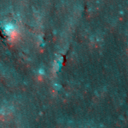 |