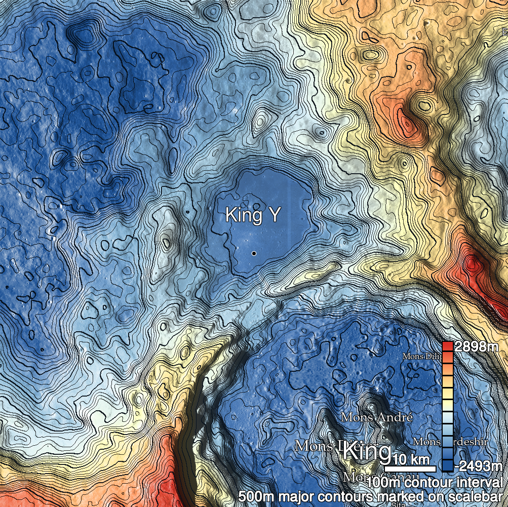
Pits Atlas: King 13b
| Impact Melt pit: King | |
|---|---|
| Name | King 13b |
| Lat. | 6.2551 |
| Long. | 119.7615 |
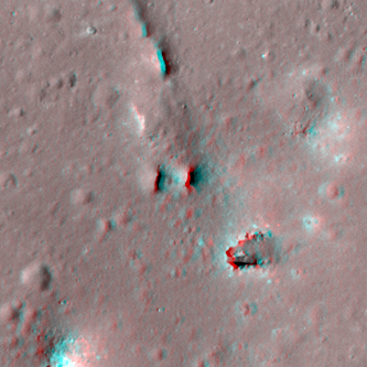
| Desc. | Northern pit of the King 13 pair, on the NW side of the PRF. Does not have an unambiguously-visible floor in any image, even the noontime M172133732L, although there may be a ledge on the W wall ~5m down, leaving a ~6x2m inner pit. There is a similar-diameter depression 14m W at the base of the PRF, although its only vertical wall is the PRF-ward one. |
| Types | |
| Terrain | Impact Melt |
| Host Feature | King |
| Funnel Min. Diam. | 8 |
| Funnel Max. Diam. | 10 |
| Inner Min. Diam. | 5 |
| Inner Max. Diam. | 7 |
| Azimuth | 165 |
| Depth | 7.0 |
| Depth 1 | >5.0 |
| Depth 2 | 6.8 |
| Depth 3 | 7.4 |
| Best Stereo Left | M143839277L |
| Best Stereo Right | M143839277L |
| DTMs | NAC_DTM_KINGCRATER3 |
| Clipping Width | 200 |
| Other IMGs | |
| Data Warning | All depths are very high-Sun, especially depth 3. Depth 1 is from shelf on W wall, depths 2 and 3 may be to shelf on W wall, or may be minimums. |
| Entrance Ramp | N |
| Overhang | ? |
| Nearby Pits? | Y |
| Nearby Fractures? | Y? |
| Nearby Depressions? | Y |
| In Dome | Y |
| Beside Dome | N |
| In Depression | N |
| Colinear Pits | Y |
| Colinear Depressions | Y |
| Colinear Fractures | Y? |
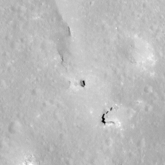
| King 13b Shaded Relief | |
|---|---|
 |
| M154453455L | |
|---|---|
 |
|
| Line | 9021 |
| Sample | 4640 |
| Inc. Angle | -15.99 |
| Emission Angle | 0.46 |
| Time | 13.02 |
| Resolution | 0.6 |
| M141478563R | |
|---|---|
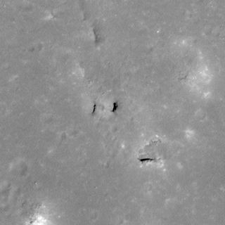 |
|
| Inc. Angle | 14.12 |
| Emission Angle | 2.4 |
| Time | 11.21 |
| Resolution | 0.61 |
| M172133732L | |
|---|---|
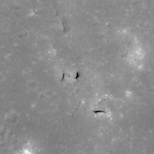 |
|
| Inc. Angle | 10.03 |
| Emission Angle | -1.02 |
| Time | 11.57 |
| Resolution | 0.62 |
| King 13b Stereo |
|---|
 |