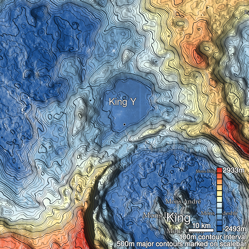
Pits Atlas: King 4a
| Impact Melt pit: King | |
|---|---|
| Name | King 4a |
| Lat. | 6.2066 |
| Long. | 119.7815 |
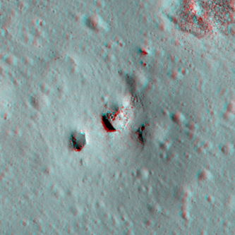
| Desc. | Elliptical pit, northeastern and larger of a pair of pits in a PRF. N wall has a collapse that has a chance of being traversable, especially if bouldering is acceptable. King 4b is 20m west, and there is a 45m long linear depression with a pair of <5m pits in it ~200m to the SW. There is a very fresh crater with bright ejecta ~120m west. No obvious proof that King 4a and 4b connect underground. There is probably another collapse in the east side of this PRF, ~20m SE of King 4a, only expressed as curved cliff on the west side of a circular depression. While no images exist with the correct lighting and slew to verify an overhang under the highest part of the PRF, a couple meters of overhang exist on the east (shallower) side. |
| Types | |
| Terrain | Impact Melt |
| Host Feature | King |
| Funnel Min. Diam. | 22 |
| Funnel Max. Diam. | 28 |
| Inner Min. Diam. | 16 |
| Inner Max. Diam. | 20 |
| Azimuth | 55 |
| Depth | 6.0 |
| Depth 1 | 7.2 |
| Depth 2 | 5.5 |
| Depth 3 | 5.8 |
| Best Stereo Left | M136762839L |
| Best Stereo Right | M136762839L |
| DTMs | NAC_DTM_KINGCRATER3 |
| Clipping Width | 200 |
| Other IMGs | |
| Data Warning | Depth 1 is extremely high-Sun |
| Entrance Ramp | N? |
| Overhang | Y |
| Nearby Pits? | Y |
| Nearby Fractures? | N |
| Nearby Depressions? | Y |
| In Dome | Y |
| Beside Dome | N |
| In Depression | N |
| Colinear Pits | N |
| Colinear Depressions | N |
| Colinear Fractures | N |
| King 4a Shaded Relief | |
|---|---|
 |
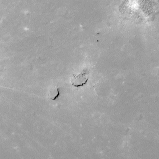
| M141478563R | |
|---|---|
 |
|
| Line | 29532 |
| Sample | 3667 |
| Inc. Angle | 14.08 |
| Emission Angle | 1.83 |
| Time | 11.21 |
| Resolution | 0.61 |
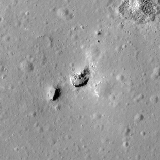
| M113168034R | |
|---|---|
 |
|
| Inc. Angle | 47.43 |
| Emission Angle | -0.21 |
| Time | 8.87 |
| Resolution | 0.62 |
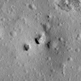
| M182745931L | |
|---|---|
 |
|
| Inc. Angle | -48.27 |
| Emission Angle | 1.82 |
| Time | 15.21 |
| Resolution | 1.27 |
| King 4a Stereo |
|---|
 |