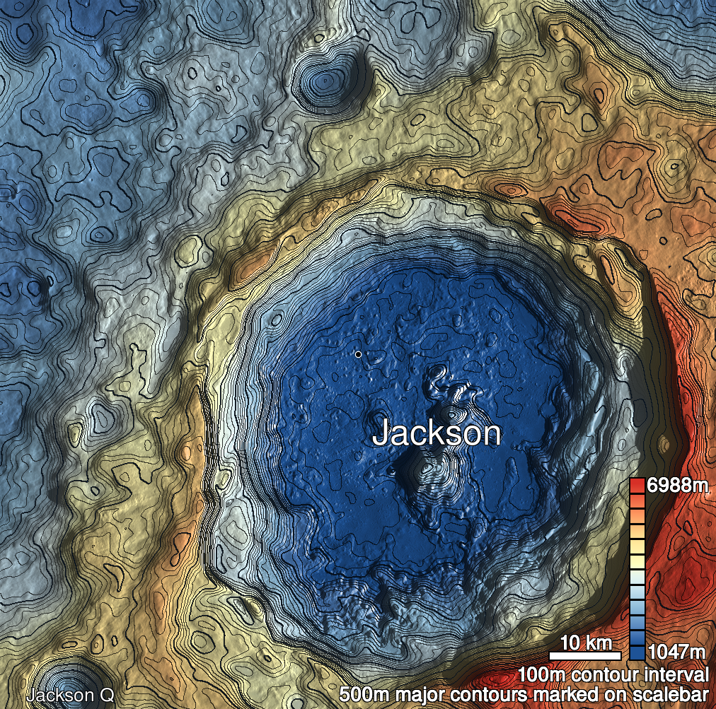
Pits Atlas: Jackson 1a
| Impact Melt pit: Jackson | |
|---|---|
| Name | Jackson 1a |
| Lat. | 22.4208 |
| Long. | 196.2868 |
| Desc. | Central of three pits in a rough line (~10m north of the ~150m direct line between the end pits). North wall may be a slope down to the floor, although there seems to be a bit of a rim. Significant funnel, especially on SE side. No depression visible in ground between the end pits of the chain. |
| Types | |
| Terrain | Impact Melt |
| Host Feature | Jackson |
| Funnel Min. Diam. | 20 |
| Funnel Max. Diam. | 31 |
| Inner Min. Diam. | 8 |
| Inner Max. Diam. | 13 |
| Azimuth | 160 |
| Depth | 19.0 |
| Depth 1 | 15.0 |
| Depth 2 | 22.7 |
| Depth 3 | >13.0 |
| Best Stereo Left | M105593167L |
| Best Stereo Right | M105593167L |
| DTMs | |
| Clipping Width | 200 |
| Other IMGs | M1122318040R |
| Data Warning | Depth 2 is from west rim, which may be higher than south. Depth 3 is from top of funnel, and no floor is visible. |
| Entrance Ramp | N? |
| Overhang | ? |
| Nearby Pits? | Y |
| Nearby Fractures? | N |
| Nearby Depressions? | Y |
| In Dome | N |
| Beside Dome | N |
| In Depression | N |
| Colinear Pits | Y |
| Colinear Depressions | N |
| Colinear Fractures | N |
| Jackson 1a Shaded Relief | |
|---|---|
 |
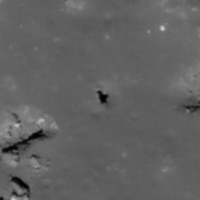
| M125645661L | |
|---|---|
 |
|
| Line | 39421 |
| Sample | 4531 |
| Inc. Angle | 24.5 |
| Emission Angle | -0.52 |
| Time | 11.12 |
| Resolution | 0.53 |
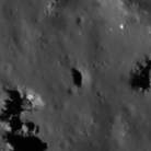
| M1178843656L | |
|---|---|
 |
|
| Inc. Angle | -21.59 |
| Emission Angle | 0.36 |
| Time | 12.21 |
| Resolution | 1.35 |
| M1097558297L | |
|---|---|
 |
|
| Inc. Angle | -59.46 |
| Emission Angle | 2.35 |
| Time | 15.73 |
| Resolution | 1.44 |
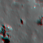
| Jackson 1a Stereo |
|---|
 |