Pits Atlas: Dollond E 1b
| Impact Melt pit: Dollond E | |
|---|---|
| Name | Dollond E 1b |
| Lat. | -10.275 |
| Long. | 15.7004 |
| Desc. | Eastern of a pair of adjacent (joined?) circular pits ~30m SW of Dollond E 1a. S wall might be an off-vertical slope, and may have a protruding lump. There is a tiny (~5m) dark spot ~10m south that might be another collapse. |
| Types | |
| Terrain | Impact Melt |
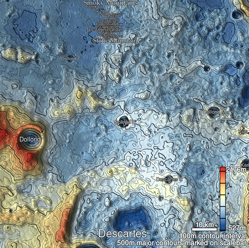
| Host Feature | Dollond E |
| Funnel Min. Diam. | 12 |
| Funnel Max. Diam. | 17 |
| Inner Min. Diam. | N/A |
| Inner Max. Diam. | 17 |
| Azimuth | 70 |
| Depth | 28.0 |
| Depth 1 | 25.3 |
| Depth 2 | 32.2 |
| Depth 3 | 27.9 |
| Best Stereo Left | M1121138205R |
| Best Stereo Right | M1121138205R |
| DTMs | |
| Clipping Width | 200 |
| Other IMGs | M1208262541L |
| Data Warning | |
| Entrance Ramp | N |
| Overhang | ? |
| Nearby Pits? | Y |
| Nearby Fractures? | Y |
| Nearby Depressions? | N |
| In Dome | N |
| Beside Dome | Y |
| In Depression | Y? |
| Colinear Pits | Y? |
| Colinear Depressions | N |
| Colinear Fractures | N |
| Dollond E 1b Shaded Relief | |
|---|---|
 |
| M1177656184R | |
|---|---|
 |
|
| Line | 6641 |
| Sample | 1474 |
| Inc. Angle | -19.18 |
| Emission Angle | -0.56 |
| Time | 13.02 |
| Resolution | 0.87 |
| M1101110051L | |
|---|---|
 |
|
| Inc. Angle | -19.45 |
| Emission Angle | 0.33 |
| Time | 13.17 |
| Resolution | 0.92 |
| M1103467217R | |
|---|---|
 |
|
| Inc. Angle | 13.12 |
| Emission Angle | 0.08 |
| Time | 11.36 |
| Resolution | 0.92 |
| Dollond E 1b Stereo |
|---|
 |