Featured Images
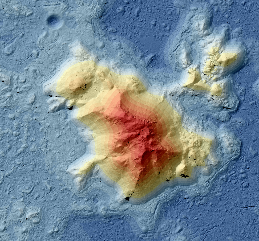
Tycho: A Model Central Peak
Color-shaded relief map showing elevations for the central peak of Tycho crater. Black areas indicate shadows in the stereo images, where no topography could be extracted [NASA/GSFC/Arizona State University].
Published on 29 Mar 2023
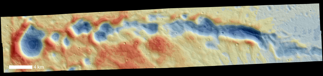
A “Secondary” View of Copernicus
NAC DTM showing a chain of Copernicus secondaries (15.5°N, 343.4°E). North is pointing right [NASA/GSFC/Arizona State University].
Published on 04 Feb 2022