Featured Images
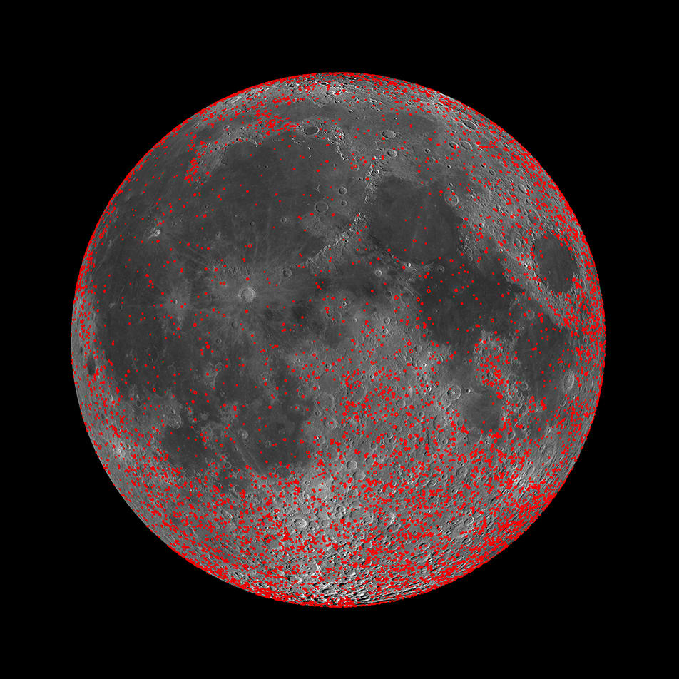
Every Crater on the Moon (Larger than 5 km)
New work from the LROC team resulted in a map of all detectable craters on the Moon between 5 and 20 km in diameter (red circles). When combined with an existing map of craters larger than 20 km in diameter, the differences in the...
Published on 13 Nov 2017
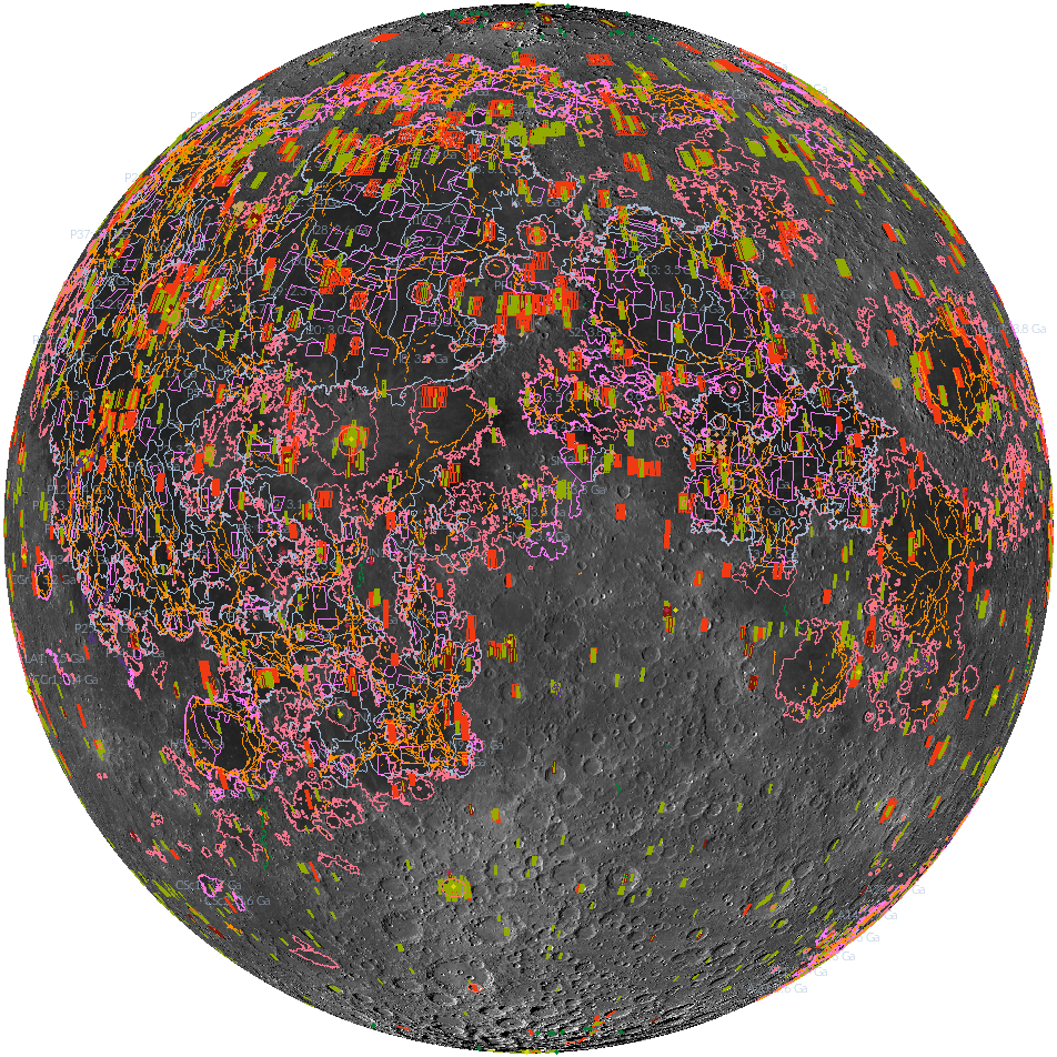
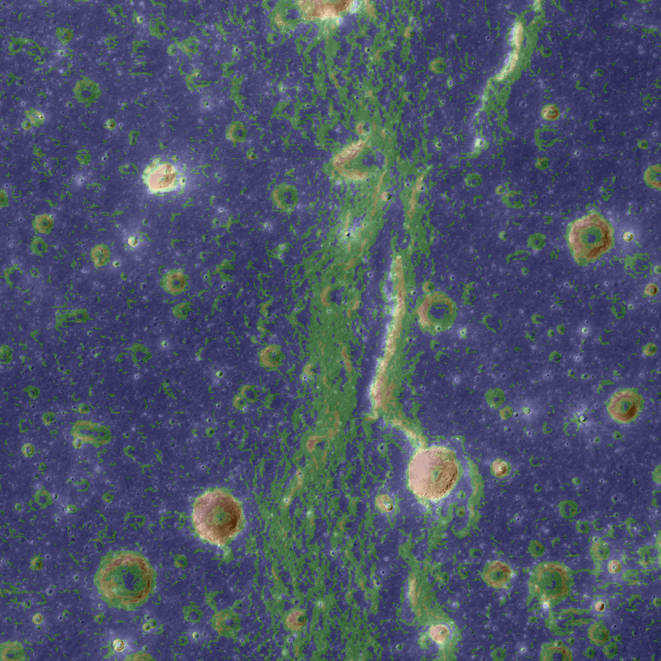
'Shaping' Lunar Science with Vector Data
Twenty new shapefiles created by the LROC Team are now available! A few of the shapefiles shown here include mare age units, footprints of digital terrain models (DTMs), and the locations of small geologic features such as...
Published on 18 Jul 2017
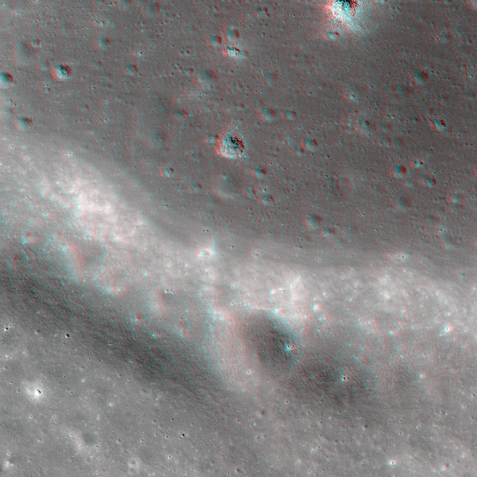
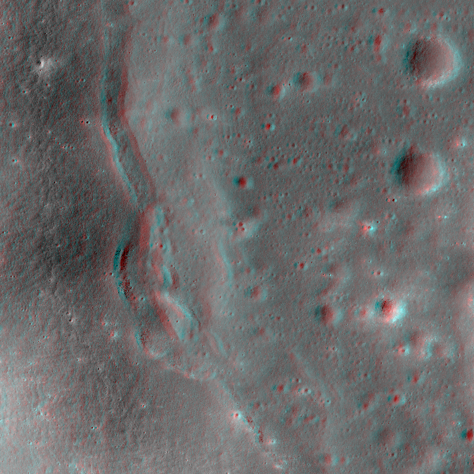
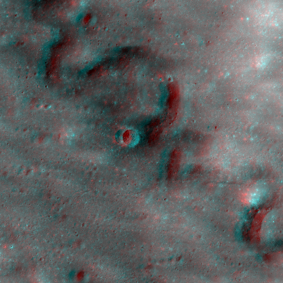
NAC Anaglyph: Mare Shoreline in Apollo Basin
A portion of the southwestern mare "shoreline" in the Apollo basin on the farside. This contact between ancient lava plains and a remnant crater rim shows the lunar surface as a land of contrasts -- of expansive plains and jutting...
Published on 30 Jun 2017
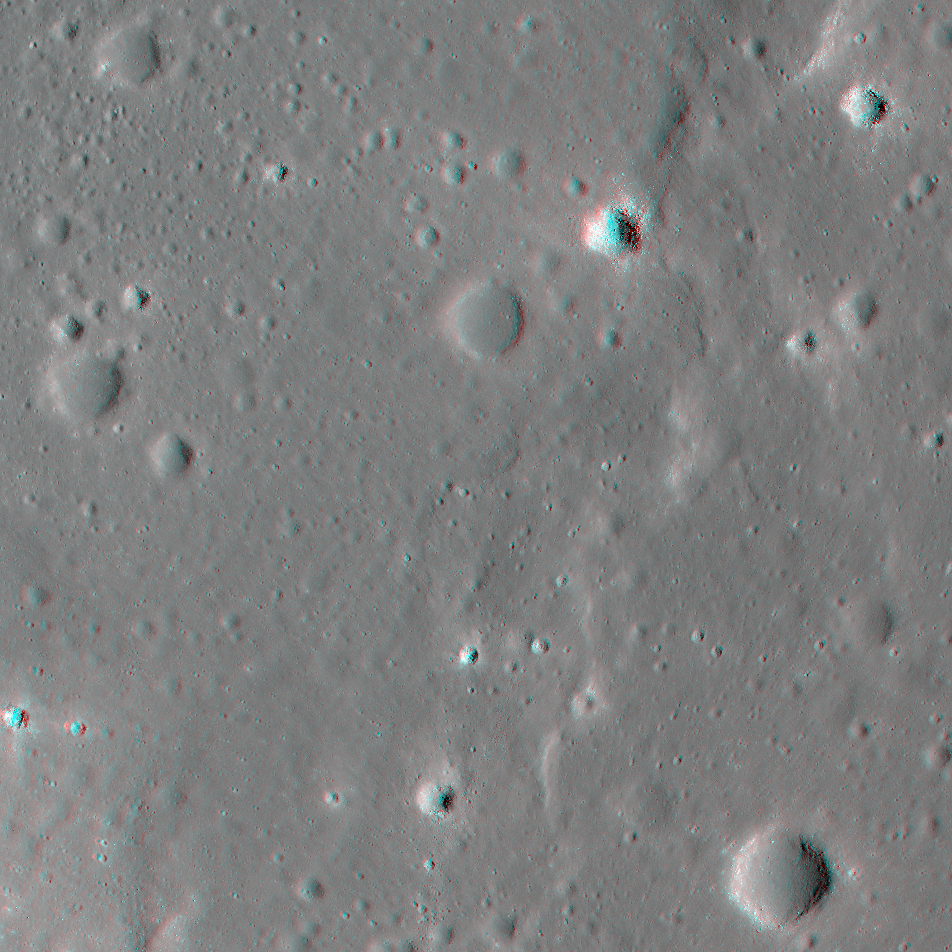
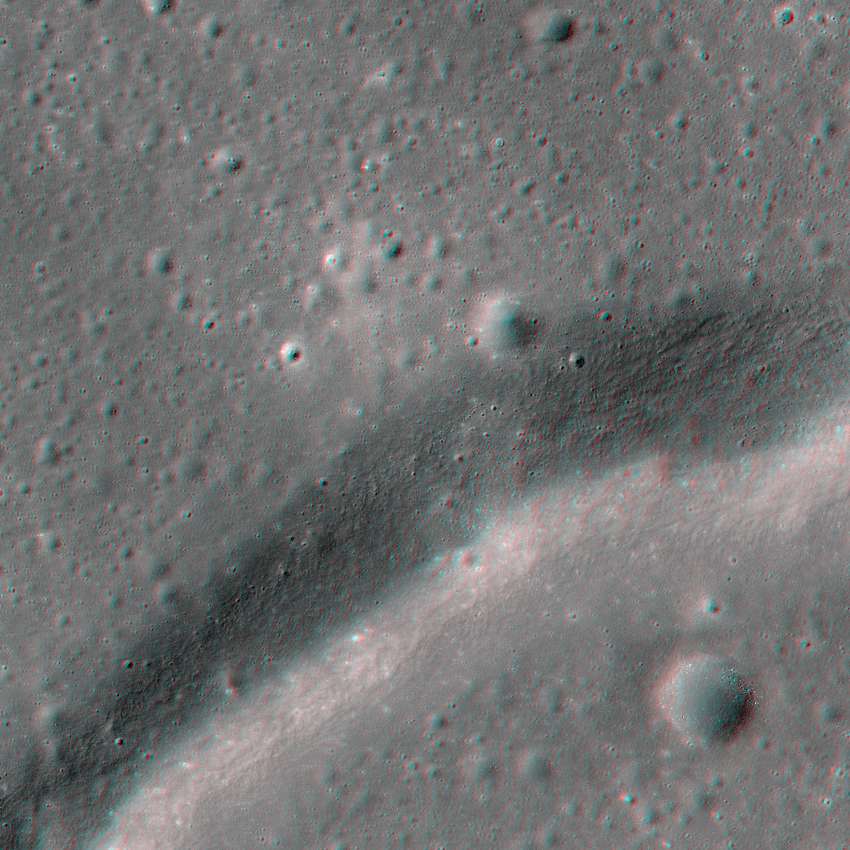
NAC Anaglyph: Dorsa Whiston
A distinctive wrinkle ridge in Oceanus Procellarum named Dorsa Whiston. Ridges like this one result from substantial compression within portions of the lunar maria [NASA/GSFC/Arizona State University].
Published on 12 May 2017
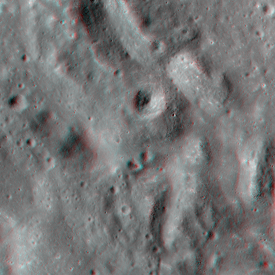
NAC Anaglyph: "Bathtub Ring" of Lava
The pit-like Bawa crater (off-center left) is located on the edge of Lacus Solitudinus. The pit is congested with old lava and spiny, razerback ridges. The ridges are composed of debris that slumped from the upslope (western) wall above...
Published on 17 Mar 2017
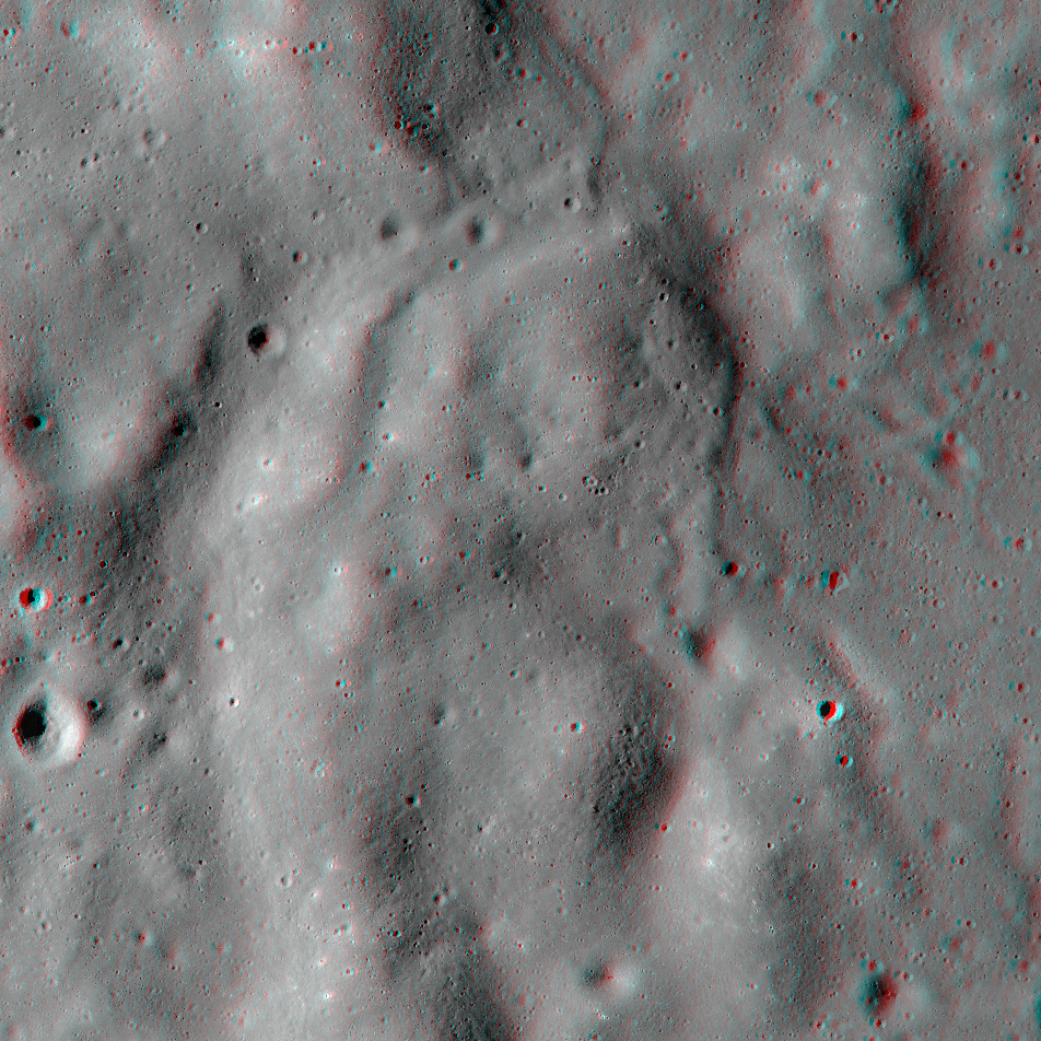
NAC Anaglyph: Dorsum Cloos
Dorsum Cloos -- a wrinkle ridge signifying that substantial forces within the rocks have led to folding and faulting in eastern Mare Smythii [NASA/GSFC/Arizona State University].
Published on 10 Mar 2017
NAC Anaglyph: Fissures in Bowditch Crater
A complex grouping of fissures in the mare-flooded Bowditch crater that were once likely sites of volcanic eruptions in this area. Bowditch crater is part of the lava-flooded region named Lacus Solitudinus [NASA/GSFC/Arizona State...
Published on 24 Feb 2017
NAC Anaglyph: Orientale Mare and Melt
Fractured impact melt from the Orientale basin-forming impact stands out from the mare lavas that later embayed it [NASA/GSFC/Arizona State University].
Published on 23 Dec 2016
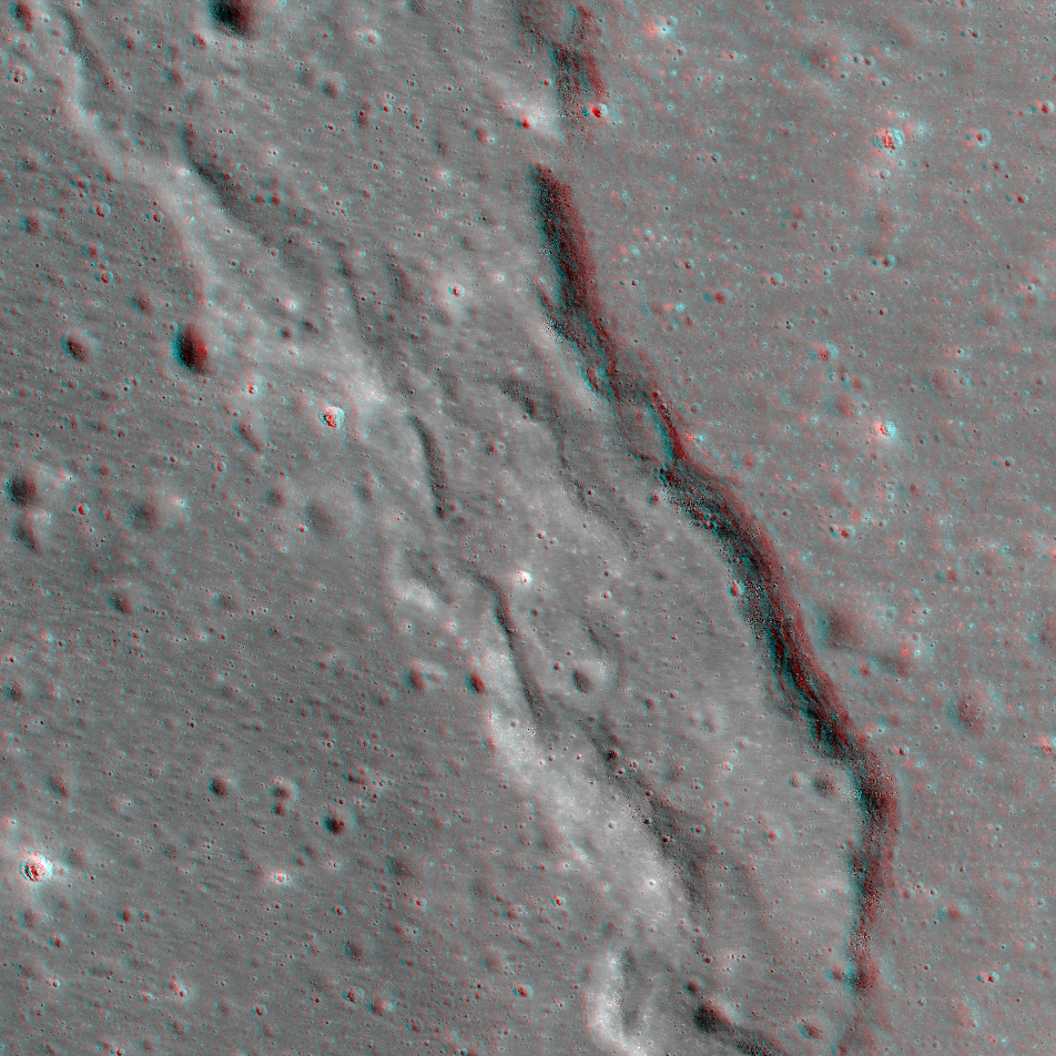
NAC Anaglyph: Orientale Basin Rille
The sinuous valleys of a rille wind their way through part of Orientale basin [NASA/GSFC/Arizona State University].
Published on 26 Jun 2015
NAC Anaglyph: Lichtenberg Ghost Crater
Portion of a crater rim -- only the highest parts of an old crater are visible after being inundated by mare flows long ago [NASA/GSFC/Arizona State University].
Published on 27 Mar 2015
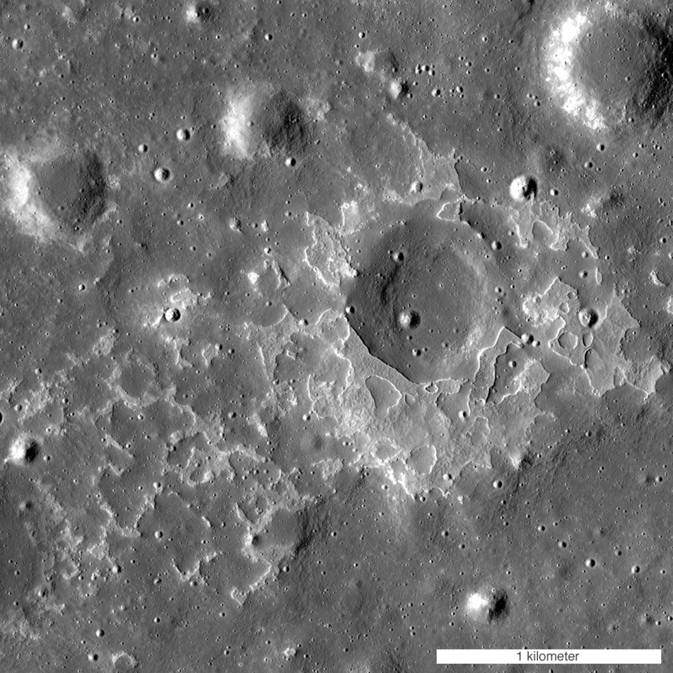
Exploring the Lunar Subsurface
What a great place to explore! Two collapsed segments of a lava tube run from the southwest to the northeast. These collapsed segments may provide access to the subsurface, which has never been directly sampled. The average width of the...
Published on 05 Nov 2014
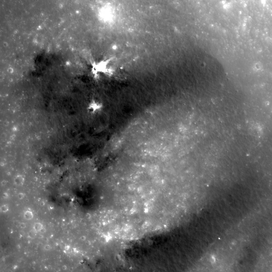
New Evidence For Young Lunar Volcanism!
One of many newly-discovered young volcanic deposits on the Moon (4.330°N, 33.750°E), this example is near the crater Maskelyne. The direction of sunlight is from the right and north is up, NAC M1123370138R [NASA/GSFC/Arizona State...
Published on 12 Oct 2014
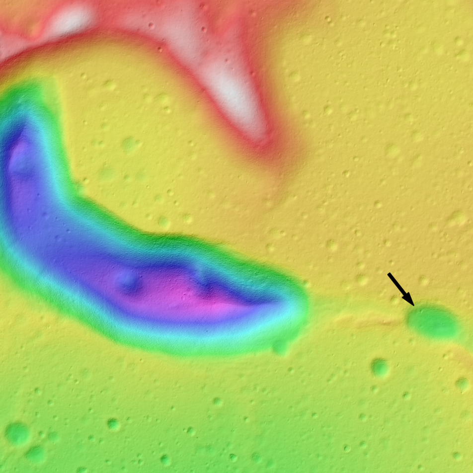
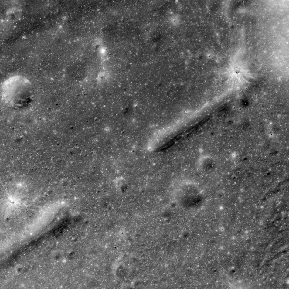
Tadpole and Lava Tube
An irregularly shaped depression, resembling a tadpole (center left), which is part of a sinuous chain of pits. The black arrow indicates the beginning of the pit chain that trends to the southeast. This feature is about 8 km long and...
Published on 29 Aug 2014
Striped Crater
Dark mantle deposits decorate a crater wall. Slowly pulled downhill by gravity, the volcanic glasses that compose these stripes where formed during explosive volcanic eruptions on the Moon. The scene is 952m wide from NAC image...
Published on 25 Aug 2014

Littered Wrinkles
LROC NAC image M1144863959L of portion of a wrinkle ridge found in Mare Nubium. The crest and side of the ridge is lined with high reflectance boulders, likely eroded from the fractured basalts that make up the ridge. Image width...
Published on 14 Aug 2014
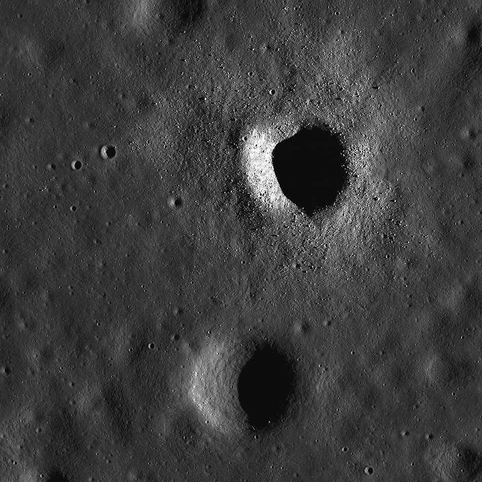
Fresh, But Not So Clean
LROC NAC image M131515002R showing two similarly sized craters, ~500 m in diameter, but one is littered with boulders and the other is not. This boulder discrepency is most likely due to age differences between the two craters....
Published on 12 Aug 2014
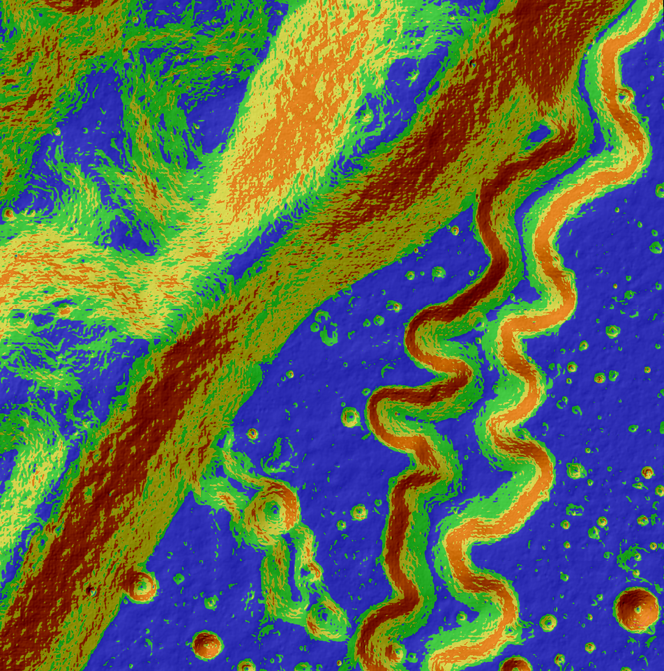
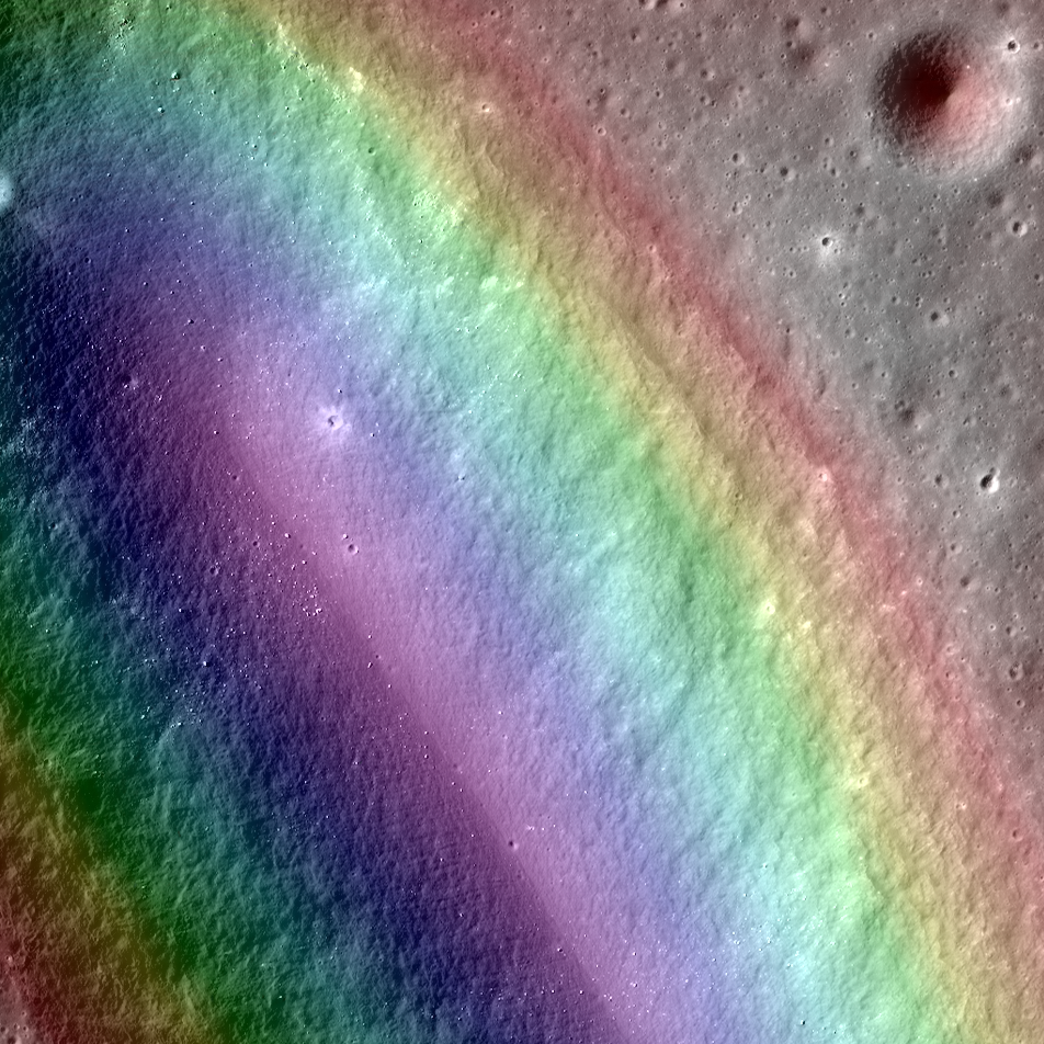
A Tortuous Path in Posidonius
This may look like a work of abstract art, but in reality, it's for science! This colorful image is an LROC slope map of the northwestern portion of the floor of Posidonius crater. Warmer colors indicate steeper slopes, whereas cooler...
Published on 31 Jul 2014
Dorsum Nicol
This tectonic feature was formed as stresses built up in the lunar crust until the rock gave way. The energy released was immense, and the displaced rock is the north-south trending wrinkle ridge that we see today. This is LROC NAC...
Published on 17 Jul 2014
Birt E
Birt E crater is thought to be the source region for lava that carved out Rima Birt, a rille in Mare Nubium. This mare is older than 3.4 billion years, and so is this vent! LROC NAC M1144849711LR with the a color DTM overlaid; North is...
Published on 15 Jul 2014
A Rille to Rover Over
LROC NAC image M1145219838 of a rille found on the Southwestern edge of Oceanus Procellarum. This rille most likely formed from the stress added to the crust as the mare deposits were emplaced and cooled [NASA/GSFC/Arizona State...
Published on 08 Jul 2014