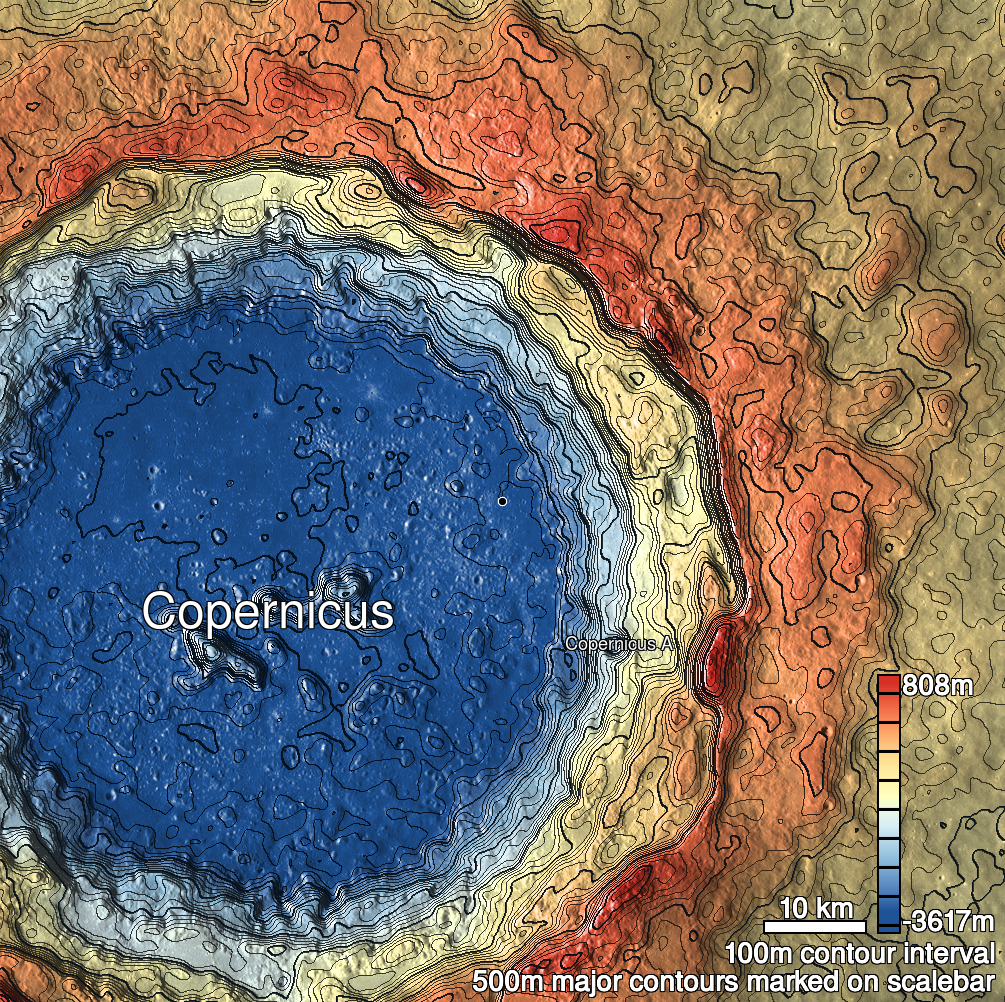
Pits Atlas: Copernicus 3
| Impact Melt pit: Copernicus | |
|---|---|
| Name | Copernicus 3 |
| Lat. | 9.9929 |
| Long. | 340.7149 |
| Desc. | Irregular pit. NE wall/corner appears to be a ramp from rim to SW wall. There are a couple ~120m circular depressions in a line to the NW, but they could easily be very degraded impact craters. |
| Types | |
| Terrain | Impact Melt |
| Host Feature | Copernicus |
| Funnel Min. Diam. | 36 |
| Funnel Max. Diam. | 36 |
| Inner Min. Diam. | 10 |
| Inner Max. Diam. | 13 |
| Azimuth | 60 |
| Depth | 7.0 |
| Depth 1 | 5.1 |
| Depth 2 | 9.1 |
| Depth 3 | 6.4 |
| Best Stereo Left | |
| Best Stereo Right | |
| DTMs | |
| Clipping Width | 200 |
| Other IMGs | M1111940683L |
| Data Warning | Depth 2 is from a very high-Sun, low-res image. Nearby high-albedo terrain makes it hard to get a good stretch that reveals the shadow length- a naïve stretch gives a depth of ~23m, and a larger shadow that lower-Sun images show. The stretch used only measures the very darkest pixels of the shadow. |
| Entrance Ramp | Y |
| Overhang | ? |
| Nearby Pits? | N |
| Nearby Fractures? | N |
| Nearby Depressions? | N? |
| In Dome | N |
| Beside Dome | N |
| In Depression | N |
| Colinear Pits | N |
| Colinear Depressions | N? |
| Colinear Fractures | N |
| Copernicus 3 Shaded Relief | |
|---|---|
 |
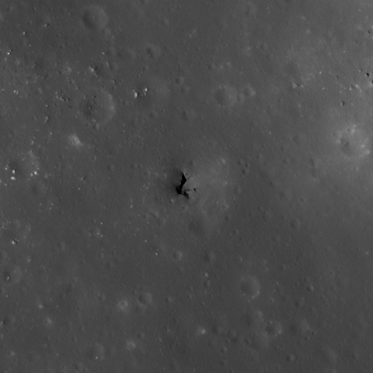
| M122339925L | |
|---|---|
 |
|
| Line | 22295 |
| Sample | 3089 |
| Inc. Angle | -26.34 |
| Emission Angle | 1.38 |
| Time | 13.67 |
| Resolution | 0.43 |
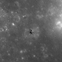
| M186012733L | |
|---|---|
 |
|
| Inc. Angle | -12.31 |
| Emission Angle | 1.53 |
| Time | 12.6 |
| Resolution | 1.26 |
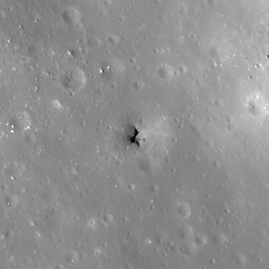
| M137672132L | |
|---|---|
 |
|
| Inc. Angle | -33.31 |
| Emission Angle | 2.79 |
| Time | 14.1 |
| Resolution | 0.49 |