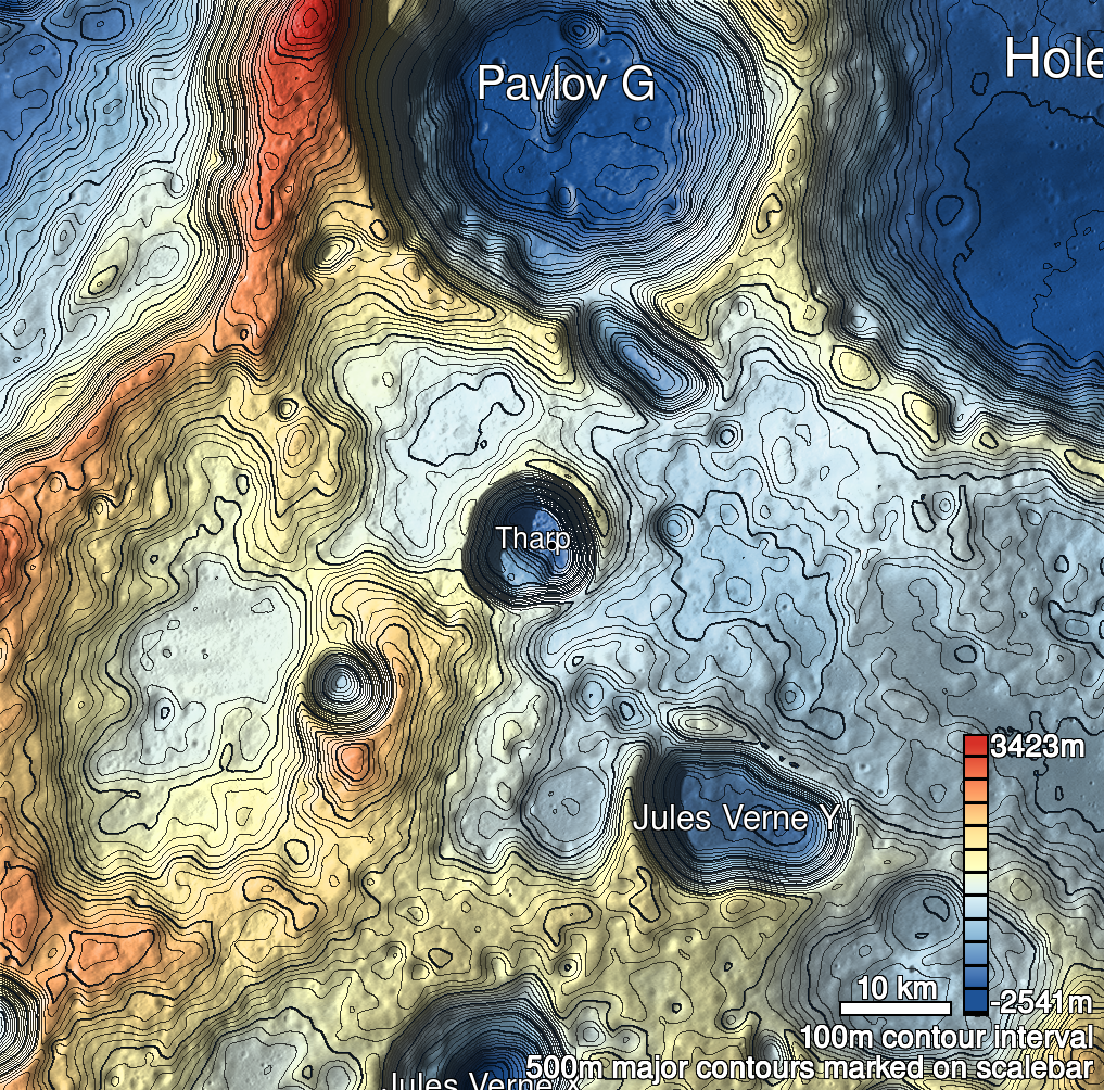
Pits Atlas: Tharp 4
| Impact Melt pit: Tharp | |
|---|---|
| Name | Tharp 4 |
| Lat. | -30.6063 |
| Long. | 145.7057 |
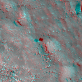
| Desc. | Circular pit at the base of a large (~1km diameter?) PRF. Walls appear vertical, although E side may be protruding slightly. Several smaller (~100m diameter) mounds in the area that look like they were oozed-out piles of melt. There is a 100-150m diameter bowl-shaped collapse ~275m to the NW. |
| Types | |
| Terrain | Impact Melt |
| Host Feature | Tharp |
| Funnel Min. Diam. | 12 |
| Funnel Max. Diam. | 12 |
| Inner Min. Diam. | 8 |
| Inner Max. Diam. | 10 |
| Azimuth | 60 |
| Depth | 9.0 |
| Depth 1 | 8.6 |
| Depth 2 | 9.3 |
| Depth 3 | 7.9 |
| Best Stereo Left | M1181514179R |
| Best Stereo Right | M1181514179R |
| DTMs | |
| Clipping Width | 200 |
| Other IMGs | |
| Data Warning | |
| Entrance Ramp | N |
| Overhang | ? |
| Nearby Pits? | Y |
| Nearby Fractures? | N |
| Nearby Depressions? | Y |
| In Dome | N |
| Beside Dome | Y |
| In Depression | N |
| Colinear Pits | N |
| Colinear Depressions | N |
| Colinear Fractures | N |
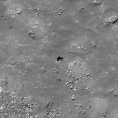
| Tharp 4 Shaded Relief | |
|---|---|
 |
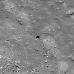
| M108278624R | |
|---|---|
 |
|
| Line | 7405 |
| Sample | 3269 |
| Inc. Angle | -30.65 |
| Emission Angle | -1.59 |
| Time | 12.65 |
| Resolution | 0.51 |
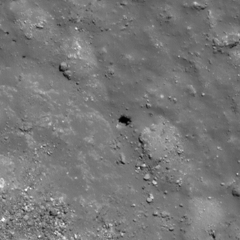
| M1148548012L | |
|---|---|
 |
|
| Inc. Angle | 31.79 |
| Emission Angle | -0.83 |
| Time | 11.85 |
| Resolution | 0.79 |
| M125977218R | |
|---|---|
 |
|
| Inc. Angle | 35.93 |
| Emission Angle | -0.11 |
| Time | 10.88 |
| Resolution | 0.57 |
| Tharp 4 Stereo |
|---|
 |