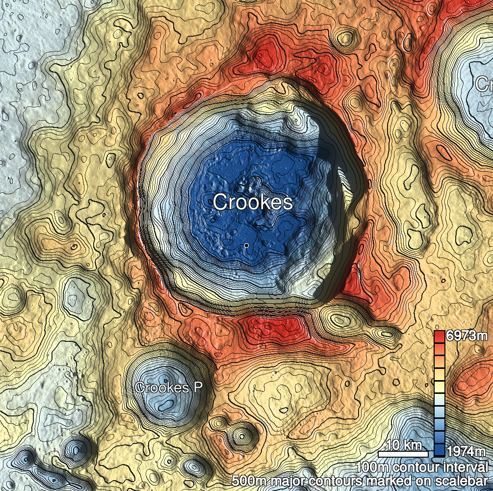
Pits Atlas: Crookes 5b
| Impact Melt pit: Crookes | |
|---|---|
| Name | Crookes 5b |
| Lat. | -10.6825 |
| Long. | 194.8612 |
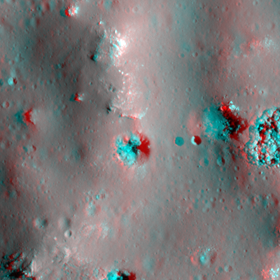
| Desc. | Collapse in the E flank of a PRF. Mostly funnel/steep walls- I'm not entirely certain it has a "floor" as such. The E wall seems to be a slope from rim to W walls. |
| Types | |
| Terrain | Impact Melt |
| Host Feature | Crookes |
| Funnel Min. Diam. | 23 |
| Funnel Max. Diam. | 25 |
| Inner Min. Diam. | 5 |
| Inner Max. Diam. | N/A |
| Azimuth | 15 |
| Depth | 12.0 |
| Depth 1 | 11.4 |
| Depth 2 | 11.7 |
| Depth 3 | 11.8 |
| Best Stereo Left | M176359843L |
| Best Stereo Right | M176359843L |
| DTMs | |
| Clipping Width | 200 |
| Other IMGs | |
| Data Warning | All depths are from W rim. Depth from E rim is ~6m (M1183552745R) |
| Entrance Ramp | Y? |
| Overhang | ? |
| Nearby Pits? | Y |
| Nearby Fractures? | N |
| Nearby Depressions? | Y |
| In Dome | Y |
| Beside Dome | N |
| In Depression | N |
| Colinear Pits | Y |
| Colinear Depressions | N |
| Colinear Fractures | N |
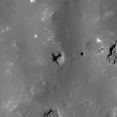
| Crookes 5b Shaded Relief | |
|---|---|
 |
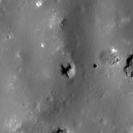
| M1191791679L | |
|---|---|
 |
|
| Line | 40925 |
| Sample | 2669 |
| Inc. Angle | -31.57 |
| Emission Angle | 1.65 |
| Time | 14.03 |
| Resolution | 0.87 |
| M105593830R | |
|---|---|
 |
|
| Inc. Angle | -40.51 |
| Emission Angle | -0.11 |
| Time | 14.64 |
| Resolution | 1.03 |
| M1117608455L | |
|---|---|
 |
|
| Inc. Angle | -12.03 |
| Emission Angle | 2.57 |
| Time | 12.08 |
| Resolution | 0.94 |
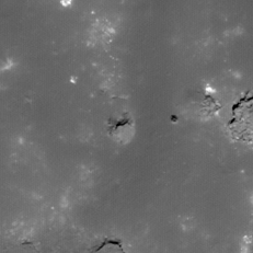
| Crookes 5b Stereo |
|---|
 |