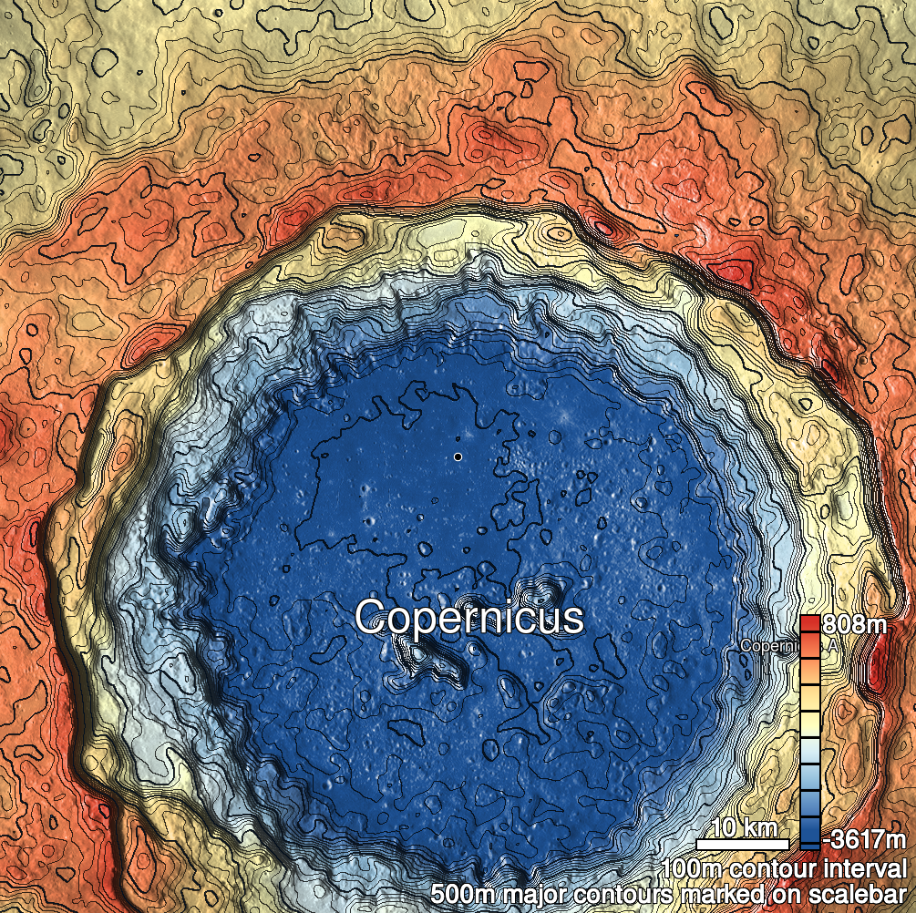
Pits Atlas: Copernicus 22
| Impact Melt pit: Copernicus | |
|---|---|
| Name | Copernicus 22 |
| Lat. | 10.2095 |
| Long. | 339.8873 |
| Desc. | Linear/irregular pit at the E end of a set of broad shallow circular depressions. Extremely narrow- no clear view of the floor, although it might be visible in the M16597… stereo pair, and possibly M1188488085R. Hints of a linear depression running E of the pit, passing just south of a mound. Copernicus 23 is ~300m E. |
| Types | |
| Terrain | Impact Melt |
| Host Feature | Copernicus |
| Funnel Min. Diam. | 11 |
| Funnel Max. Diam. | 29 |
| Inner Min. Diam. | 3 |
| Inner Max. Diam. | 17 |
| Azimuth | 75 |
| Depth | >11.0 |
| Depth 1 | >11.0 |
| Depth 2 | >3.0 |
| Depth 3 | >10.0 |
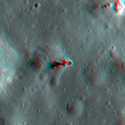
| Best Stereo Left | M165978380L |
| Best Stereo Right | M165978380L |
| DTMs | |
| Clipping Width | 200 |
| Other IMGs | |
| Data Warning | Funnel only includes the immediately adjacent slopes in, not the broader shallow depression this pit is in. |
| Entrance Ramp | N |
| Overhang | ? |
| Nearby Pits? | N? |
| Nearby Fractures? | N |
| Nearby Depressions? | Y |
| In Dome | N |
| Beside Dome | N |
| In Depression | Y |
| Colinear Pits | N? |
| Colinear Depressions | Y |
| Colinear Fractures | N |
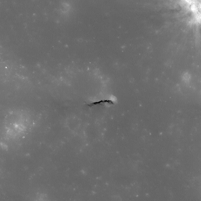
| Copernicus 22 Shaded Relief | |
|---|---|
 |
| M155369774R | |
|---|---|
 |
|
| Line | 39471 |
| Sample | 2631 |
| Inc. Angle | -9.73 |
| Emission Angle | -1.22 |
| Time | 12.29 |
| Resolution | 0.43 |
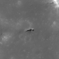
| M1188488085R | |
|---|---|
 |
|
| Inc. Angle | -68.59 |
| Emission Angle | -1.03 |
| Time | 16.53 |
| Resolution | 0.95 |
| M1103695396R | |
|---|---|
 |
|
| Inc. Angle | 17.44 |
| Emission Angle | 0.69 |
| Time | 11.12 |
| Resolution | 1.21 |
| Copernicus 22 Stereo |
|---|
 |