Pits Atlas: Copernicus 18
| Impact Melt pit: Copernicus | |
|---|---|
| Name | Copernicus 18 |
| Lat. | 10.2933 |
| Long. | 339.5981 |
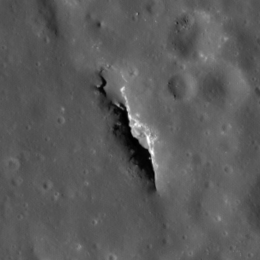
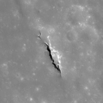
| Desc. | Linear pit running NNW-SSE. There are two wide sections: a shallow one in the north that may be drivable, and a deep one in the south, with a narrow (5m wide) section joining them. Depths are for the southern opening. There's a line of shallow depressions starting ~75m NW and trending away to the NW, and a <5m pit-like dark spot ~150m SW. |
| Types | |
| Terrain | Impact Melt |
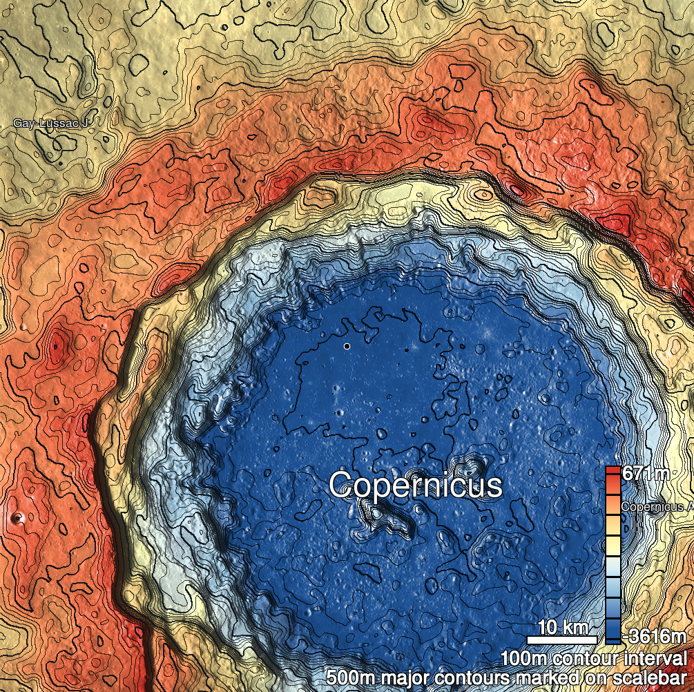
| Host Feature | Copernicus |
| Funnel Min. Diam. | 48 |
| Funnel Max. Diam. | 165 |
| Inner Min. Diam. | 26 |
| Inner Max. Diam. | 137 |
| Azimuth | 155 |
| Depth | 15.0 |
| Depth 1 | 14.1 |
| Depth 2 | 15.1 |
| Depth 3 | 16.1 |
| Best Stereo Left | M135324446L |
| Best Stereo Right | M135324446L |
| DTMs | |
| Clipping Width | 300 |
| Other IMGs | M157730473R |
| Data Warning | |
| Entrance Ramp | Y? |
| Overhang | ? |
| Nearby Pits? | N? |
| Nearby Fractures? | N |
| Nearby Depressions? | Y |
| In Dome | N |
| Beside Dome | N |
| In Depression | N |
| Colinear Pits | N |
| Colinear Depressions | Y |
| Colinear Fractures | N |
| Copernicus 18 Shaded Relief | |
|---|---|
 |
| M1175545925L | |
|---|---|
 |
|
| Line | 39101 |
| Sample | 2593 |
| Inc. Angle | -42.76 |
| Emission Angle | 1.73 |
| Time | 14.81 |
| Resolution | 1.18 |
| M1147289388R | |
|---|---|
 |
|
| Inc. Angle | -16.65 |
| Emission Angle | -1.23 |
| Time | 12.94 |
| Resolution | 1.2 |
| M188378781L | |
|---|---|
 |
|
| Inc. Angle | 20.43 |
| Emission Angle | -0.91 |
| Time | 10.77 |
| Resolution | 1.27 |
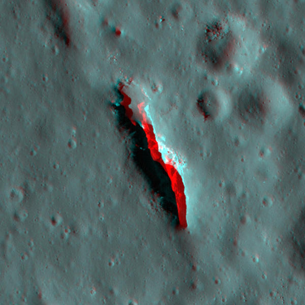
| Copernicus 18 Stereo |
|---|
 |