Pits Atlas: Copernicus 9
| Impact Melt pit: Copernicus | |
|---|---|
| Name | Copernicus 9 |
| Lat. | 10.1385 |
| Long. | 339.9387 |
| Desc. | Round pit in a deep local depression in a NNW-SSE trending linear depression. ~200m S of Copernicus 8, which is in an adjacent depression. NW wall seems to be a slope to floor level. Floor appears fairly clear, but is usually in shadow from deep outer depression/funnel. |
| Types | |
| Terrain | Impact Melt |
| Host Feature | Copernicus |
| Funnel Min. Diam. | 22 |
| Funnel Max. Diam. | 31 |
| Inner Min. Diam. | 7 |
| Inner Max. Diam. | 10 |
| Azimuth | 140 |
| Depth | 12.0 |
| Depth 1 | 12.5 |
| Depth 2 | 12.4 |
| Depth 3 | 10.5 |
| Best Stereo Left | M144755352R |
| Best Stereo Right | M144755352R |
| DTMs | |
| Clipping Width | 200 |
| Other IMGs | |
| Data Warning | All depths are from very high Sun |
| Entrance Ramp | Y |
| Overhang | ? |
| Nearby Pits? | Y |
| Nearby Fractures? | N |
| Nearby Depressions? | Y |
| In Dome | N |
| Beside Dome | N |
| In Depression | Y |
| Colinear Pits | N |
| Colinear Depressions | N |
| Colinear Fractures | N |
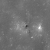
| Copernicus 9 Shaded Relief | |
|---|---|
 |
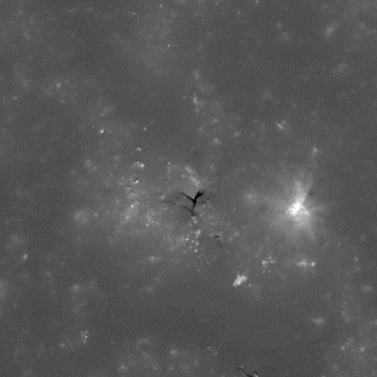
| M109365462R | |
|---|---|
 |
|
| Line | 8310 |
| Sample | 2346 |
| Inc. Angle | 11.98 |
| Emission Angle | 1.06 |
| Time | 11.81 |
| Resolution | 0.52 |
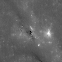
| M1103695396R | |
|---|---|
 |
|
| Inc. Angle | 17.36 |
| Emission Angle | -0.11 |
| Time | 11.12 |
| Resolution | 1.21 |
| M1101338216L | |
|---|---|
 |
|
| Inc. Angle | -18.09 |
| Emission Angle | 0.37 |
| Time | 12.93 |
| Resolution | 1.22 |
| Copernicus 9 Stereo |
|---|
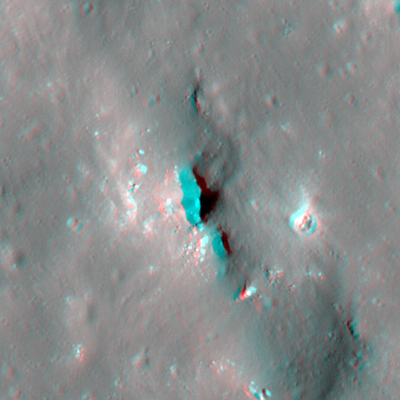 |